October 11, 2024

The best places in Central Park to see fall foliage

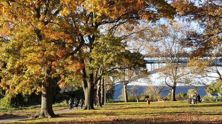
Some of the most breathtaking fall foliage can be found outside of NYC, but when it comes to autumnal bliss within the boroughs, not many places can compare to Central Park. The park experiences a different fall foliage season than other parts of the city because of the tall buildings that surround it and cast shadows on its trees. According to the Central Park Conservancy, the trees have a "distorted sense of the seasons," creating a later foliage season for Central Park. To make the most of this beautiful season, the Conservancy released its annual fall guide, complete with ideas for exploring the park, and their handy fall foliage map, which lets you know the best spots to see the park's 18,000 trees in all their yellow, orange, and red glory. Ahead, find eight spots that take the lead for leaf-peeping.
Get the guide to the best foliage spots
September 6, 2024

Explore the Queens homes of over 100 famous Jazz musicians

Explore the vibrant history of jazz in Queens with a new interactive digital map. Flushing Town Hall on Thursday released the Digital Queens Jazz Trail Map, putting 125 jazz legends who once called Queens home on the map. The digital map is the first phase of a larger database that will include more figures, locations, and details, allowing users to contribute comments and additional content to be approved by Flushing Town Hall.
LEARN MORE
August 16, 2023

Avoid rodent run-ins–or rat out your landlord–with NYC’s newest interactive rat map

The mayor's notorious war on rats is heating up. Along with the recent appointment of Kathleen Corradi as the city's $155K/year rat czar, New Yorkers have some new tools in our digital rat-fighting arsenal in the form of an updated interactive map and a revamped rat information portal. Adding firepower to the battle are a handful of super-military-sounding RMZs (Rat Mitigation Zones), complete with training academies to help neighborhood combatants put up their best fight. And Harlem recently hosted an Anti-Rat Day of Action.
New rat map, this way
December 21, 2022

Will New York City see a White Christmas this year?

New Yorkers who fantasize about opening their blinds on Christmas morning to a sprawling landscape of snow will likely be disappointed this year. According to the "White Christmas Calculator," a tool created by the Omni Calculator Project that gives the likelihood of snowfall in major cities, the probability that New York City sees at least one inch of snow on December 25 is approximately 13.2 percent. However, there are a few other cities located nearby with a near or over 50 percent chance of seeing flurries.
Dreaming of a White Christmas?
December 12, 2022

Interact with nearly 1M NYC trees through a new digital map

New Yorkers will now be able to interact with nearly one million of New York City's trees through a new first-of-its-kind digital map. The NYC Parks Department last week released the NYC Tree Map, an interactive map that allows New Yorkers to see the unique IDs, species information, and maintenance status of more than 800,000 of the city's street and park trees.
See more here
December 5, 2022

Explore NYC from Edward Hopper’s perspective with this new digital map

On Monday, the Whitney Museum launched an interactive digital map marking 20 locations across New York City that legendary artist Edward Hopper painted during his career. The map provides a side-by-side comparison of Hopper's portrayal and a photo of the location as it looks today taken from the same perspective, including places like the Manhattan Bridge, Washington Square Park, and Roosevelt Island. All of the paintings featured on the map are currently on display at the museum as part of the new exhibition, Edward Hopper's New York, which explores the life and work of the artist through his relationship with the city.
See the map
October 21, 2022

This map of Central Park tracks fall foliage in real time

The Central Park Conservancy has launched a new, interactive Peak Fall Foliage map to let parkgoers know the best times and locations to take in autumn's most vibrant colors. In the coming weeks, approximately 18,000 trees across Central Park's 843 acres will reach their peak color. The map's real-time information is provided by Central Park's arborists who take care of more than 170 species of trees on a daily basis.
See more here
September 15, 2022

New York’s 2022 fall foliage map has arrived

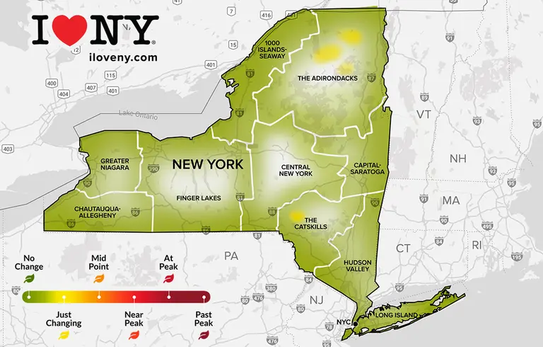
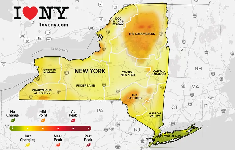
New York State has begun its colorful transformation into fall. The first signs of autumn can already be seen in the Adirondacks, with the rest of the state to soon follow suit. To help New Yorkers follow the cycle of foliage, the state released this week its annual Fall Foliage Report. The interactive map is updated weekly using observations and reports from a state-wide group of volunteers known as "leaf peepers," as 6sqft previously reported.
Get ready to leaf-peep
June 20, 2022

New map highlights NYC landmarks related to LGBTQ+ history

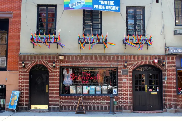
In celebration of Pride Month, the Landmarks Preservation Commission last week released an interactive story map that highlights important landmarks in New York City known for their significance within the LGBTQ+ community's cultural and civil rights movement. The project highlights seven individual landmarks throughout the city, including James Baldwin's Upper West Side apartment and the Stonewall Inn, one of the most important sites associated with LGBTQ+ history in the United States. The story map focuses solely on individual landmarks designated primarily for their LGBTQ+ significance, not just sites that have ties to individuals and groups.
See more here
February 17, 2022

New interactive map highlights 400+ arts organizations led by people of color in NYC

HueArts NYC, a coalition of over 400 New York City arts groups founded, led, and serving Black, Latinx, Indigenous, Asian, Pacific Islander, Middle Eastern, and all People of Color (POC), launched an interactive digital map and directory of the city's POC-led arts and culture landscape. The map accompanies a report with key findings and recommendations for the city's policymakers and arts donors to address the city's cultural equity gap, including a call to create a $100 million fund to support POC-led arts groups.
Find out more
November 24, 2021

The best spots to watch the 2021 Macy’s Thanksgiving Day Parade

The 95th annual Macy's Thanksgiving Day Parade returns on Thursday, welcoming the public back following a spectator-free event last year. The parade kicks off at 9 a.m. from 77th Street and Central Park West and moves down its traditional route, ending in front of Macy's Herald Square. For those hoping to enjoy the parade in person, Macy's released a helpful interactive map highlighting the 2.5 miles of public viewing. The map also notes where parade-goers can find coffee, food, and restrooms.
Learn more
September 9, 2021

New York’s official fall foliage map is here!

Have you been dreaming of pumpkin spice and chunky sweaters all summer long? Well, autumnal bliss is upon us, with the first signs of colorful fall foliage already appearing in upstate New York. To help you keep tabs on peak foliage in your area, the state has released its annual Fall Foliage Report, an interactive map that is updated weekly using on-the-ground observations and reports from a state-wide network of volunteers.
READ MORE
April 28, 2021

Share historic photos of your mom in New York City as part of a new crowdsourced map

A card and flowers are nice, but what about making your mom a documented piece of New York City's history? Tech nonprofit Urban Archive this week launched "NY <3 Moms," a new crowdsourced campaign in celebration of Mother's Day. The group is asking New Yorkers to submit photos of their moms or caregivers taken across the five boroughs that will then be added to their extensive digital map of historic images.
Get the details
March 9, 2021

NYC’s live subway map now includes COVID-19 vaccination sites

Coronavirus vaccination sites located across New York City have been added to the Metropolitan Transportation Authority's digital subway map, helping straphangers find the easiest route to their appointments. The map, which launched last October and provides real-time service updates, now features a syringe icon that marks the location of vaccine hubs in every borough.
Details here
February 10, 2021

Mapping the NYC landmarks and historic districts related to Black history

The Landmarks Preservation Commission on Tuesday released an interactive story map that explores significant buildings, districts, and sites in New York City that are related to Black history and culture. The project highlights 75 individual landmarks and 33 historic districts associated with African American figures and historical events across the five boroughs dating to before the Civil War up to today, from the African Burial Ground in Lower Manhattan to the East 25th Street Historic District in Flatbush.
Find out more
February 1, 2021

Track the progress of NYC snow plows with this interactive map

Gov. Andrew Cuomo declared on Monday a state of emergency for New York City and much of the state as Winter Storm Orlena continues to hit the area with heavy snowfall, over 50 mph winds, and white-out conditions. While many New Yorkers are already working from home, essential workers still have to get to work. With the city expected to get 16-22 inches of snow, the Department of Sanitation has updated its interactive PlowNYC map to see if and when your street has been plowed and salted.
See when your street was plowed last
October 22, 2020

New ‘Virtual Village’ platform offers 36 free history tours of Union Square South

Non-profit Village Preservation has launched a new online platform called Virtual Village, which is part of their larger efforts seeking landmarks protections for the "South of Union Square" area, where Greenwich Village meets the East Village. The interactive online tool offers 36 free, guided walking tours of the neighborhood, ranging from architectural topics like the Cast Iron Tour to cultural topics like the German History Tour to social topics like the Women's History and LGBTQ Tours.
READ MORE
October 20, 2020

MTA launches first real-time digital subway map

The Metropolitan Transportation Authority on Tuesday released a new digital map of the New York City subway system that provides service updates to riders in real-time. As first reported by Curbed, this map uses data from the MTA to update as service changes are happening, allowing users to click on stations and individual train lines to see the actual wait time for the next train. When zoomed in on the map, little gray blocks move along the colored lines, depicting the train's actual movement from station to station. Created by design and technology firm Work & Co., the map modernizes both Massimo Vignelli's iconic 1972 map and the current map designed by Michael Hertz, combining the geometric and graphic design-friendly Vignelli map with the geographical elements of Hertz. The new live map is the first major redesign of the NYC subway map in 40 years.
More here
Pitch a story icon Know of something cool happening in New York? Let us know:
September 21, 2020

MAP: Predict when fall foliage will peak in your area

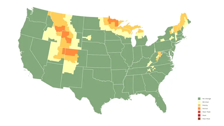
It officially feels like Fall, and whether you're good and ready for sweater weather or you're sorry to see summer go, there's no avoiding the fact that cooler temps and shorter days are on the way. One way to savor the changing seasons is to enjoy the majestic hues of autumn foliage. If you're hoping to catch the changing season at its peak, there's no better tool to plan your leaf-peeping strategy than SmokyMountains.com's Fall Foliage Prediction Map. This interactive infographic will tell you when and where foliage is expected to appear, and when it will reach its peak, in your area. Here in NYC, expect peak foliage to hit around mid-October.
See the full map
September 11, 2020

Manhattan’s 13th Avenue takes claim as the shortest avenue in the entire city

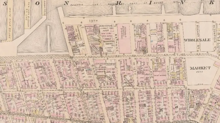
You may be scratching your head at the mention of the 13th Avenue in Manhattan, but it does exist--and it's the shortest avenue in the whole city with a fascinating history behind it. The minuscule stretch covers prime Meatpacking District real estate, just west of 11th Avenue and between Little West 12th Street and Gansevoort Street. The single block across the West Side Highway is unmarked, but officially known as Gansevoort Peninsula. The avenue was created by the city in 1837, and in no way was intended to be so short. In fact, by the mid-1800s 13th Avenue encompassed nearly 15 blocks and was planned to stretch all the way up to 135th Street. But the block never left Chelsea and was mostly destroyed by the city at the turn of the century.
Read all about the life and death of the Avenue
August 12, 2020

New interactive map tells the story of women’s suffrage in Greenwich Village

Next week, on August 18th, we celebrate the 100th anniversary of the 19th Amendment. Though the fight to give women the right to vote was a national effort, much of the movement had roots in New York City. And like most 20th-century advocacy efforts, a lot of that action was centered downtown. To mark this momentous occasion, Village Preservation has created an interactive 19th Amendment Centennial StoryMap that showcases the remarkable number of people and places in Greenwich Village, the East Village, and Noho that played a key role in the women’s suffrage movement.
READ MORE
July 29, 2020

This map explores NYC’s 19,000 acres of natural park land

Contradictory to its "concrete jungle" nickname, New York City is home to over 19,000 acres of natural areas, consisting of forest, salt marsh, freshwater wetland, and streams. A new map from the Natural Areas Conservancy (NAC) highlights the location, size, and condition of natural resources throughout the five boroughs, while comparing the percentage of green space among neighborhoods, parks, and City Council districts. When the coronavirus pandemic hit the city, New Yorkers explored more wild parts of city parks as a way to get fresh air and maintain a safe distance from others. But according to the Conservancy, the increase in visitors is putting additional strain on park management, at a time when budgets across the country are being slashed because of COVID-19.
More here
July 17, 2020

1,500 maps showing 450 years of development in Brooklyn now available online

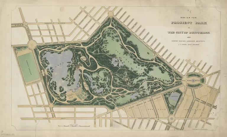
The Center for Brooklyn History, a collaboration between the Brooklyn Historical Society and the Brooklyn Public Library, launched a user-friendly online portal that contains the institution's collection of nearly 1,500 maps of Brooklyn dating back to 1562. While researchers will no doubt appreciate the new accessibility to the unique maps, the tool is also a fun way for all residents of the borough to explore the evolution of their neighborhood over the last four centuries. From rare Revolutionary War maps and original plans for Prospect Park to a subway map detailing how to get to Ebbets Field, the maps span more than 450 years and include transit maps, cultural maps, survey charts, and more.
More this way
June 26, 2020

See the 5,650+ restaurants open for outdoor dining in NYC

Restaurants and bars officially reopened for outdoor dining this week as part of New York City's phase two of reopening. Since Monday, more than 5,650 restaurants have applied, self-certified, and opened their sidewalk, patios, and adjacent parking spots to diners. To make it easier to find which establishments are open for al fresco dining in your neighborhood, the Department of Transportation on Friday released a dashboard and an interactive map that let New Yorkers search for open restaurants by borough and ZIP code.
More here
May 17, 2020

New York launches interactive map to find COVID testing sites near you

New York now has 700+ COVID testing sites across the state and is doing twice the amount of testing of the entire rest of the country. To make it easier for residents to get themselves tested, Governor Cuomo announced on Sunday the launch of a new interactive map that will show the testing sites closest to you. He also announced that the criteria to get tested has expanded to include those who would return to work in phase one.
READ MORE

Our Mission

More than just current events, here you'll learn about the places, people, and ideas that are shaping your city.