This map of Central Park tracks fall foliage in real time

The Reservoir; Photo courtesy of the Central Park Conservancy
The Central Park Conservancy has launched a new, interactive Peak Fall Foliage map to let parkgoers know the best times and locations to take in autumn’s most vibrant colors. In the coming weeks, approximately 18,000 trees across Central Park’s 843 acres will reach their peak color. The map’s real-time information is provided by Central Park’s arborists who take care of more than 170 species of trees on a daily basis.
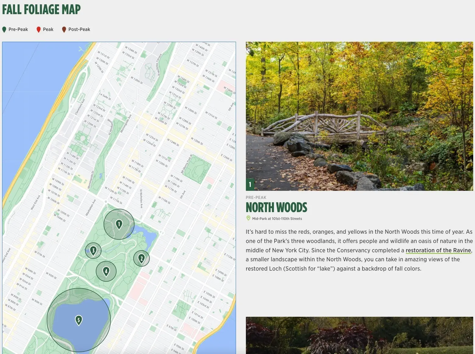
The map will show you where to go and is based on eight key locations around the park. The designated spots include the North Woods, the Conservatory Garden, the Pool, the North Meadow, the Reservoir, the Ramble, the Mall, and the Hallett Nature Sanctuary.
The map explains when to visit, using a color-coded system to identify which areas of the park are in pre-peak, peak, and post-peak phases. It also gives viewers an idea of what trees to see, whether it be red maples, sweetgums, or black cherries.
Central Park’s trees are unique in that they experience an altered fall foliage season due to the large buildings that surround them. The Conservancy says that the park’s trees have a “distorted sense of the seasons,” causing them to have a later foliage season.
Peak foliage in New York City and on Long Island takes place in mid-November, with peak brilliance typically lasting three to four days in any given spot, as 6sqft previously reported.
To make sure you don’t miss out on any leaf-peeping this year, the city’s Parks Department launched a “fall foliage tracker,” which shows when peak hues are reached for several tree species.
RELATED:


