City’s Gowanus rezoning draft calls for more public space, residential development

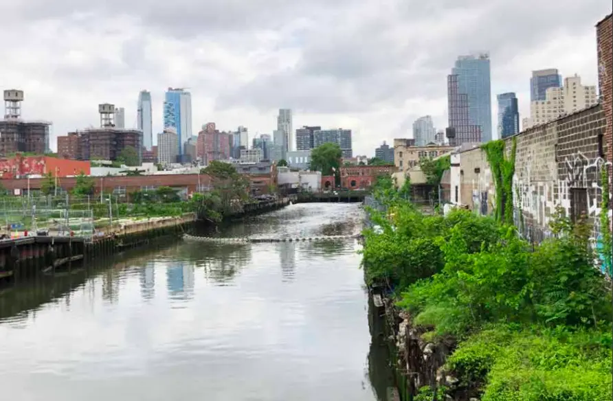
The banks of the Gowanus. Image courtesy of Department of City Planning
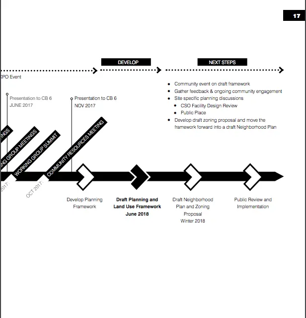
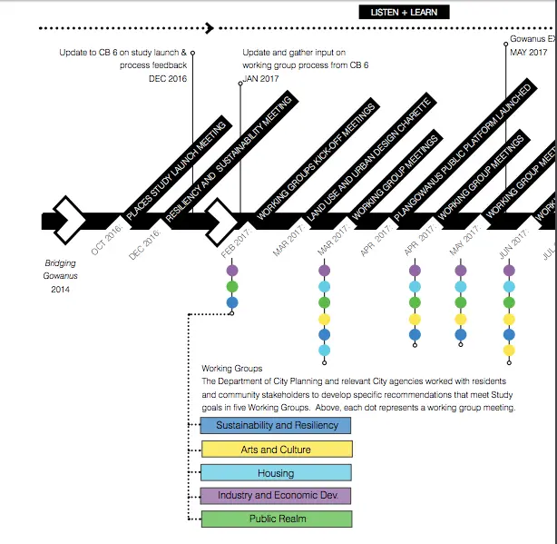
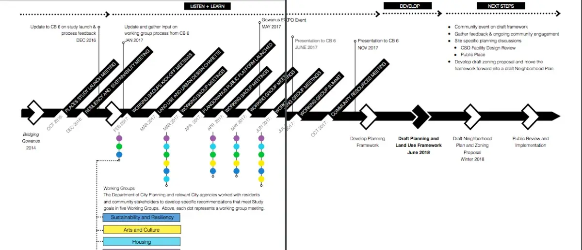
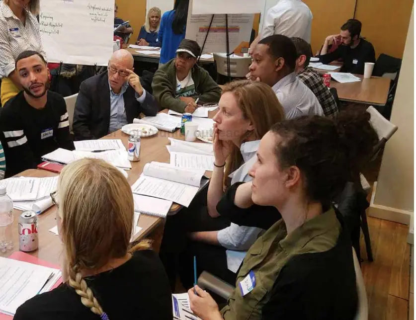
Attempts to rezone the area surrounding the Gowanus Canal, a neighborhood both affluent and in transition, have been in the works for over a decade. Now, Brownstoner reports, the long-anticipated Draft Planning and Land Use Framework of Gowanus has just been released by the Department of City Planning (DCP). The 188-page report is the result of 100 hours of outreach since the launch of the Gowanus PLACES Study in 2016 as well as information contained in a previous Bridging Gowanus Study released in 2014.
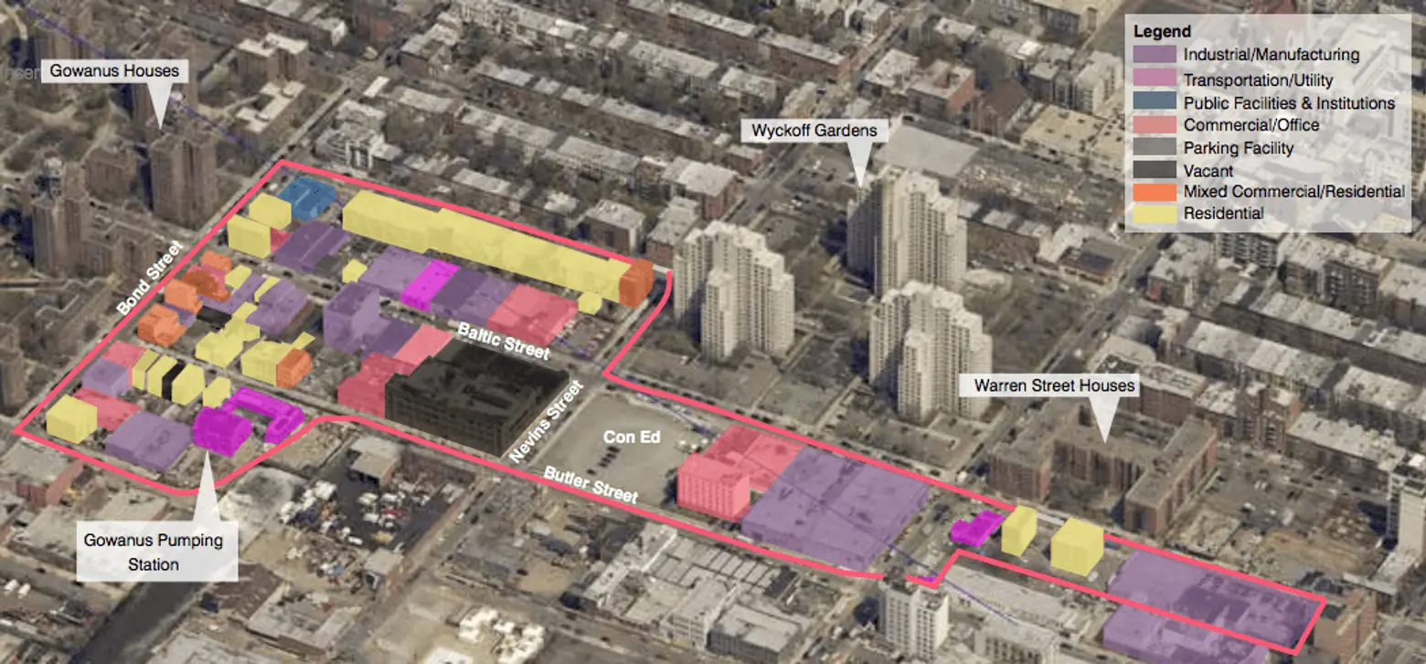
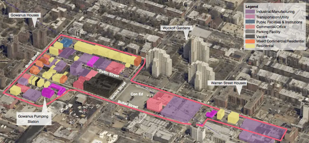
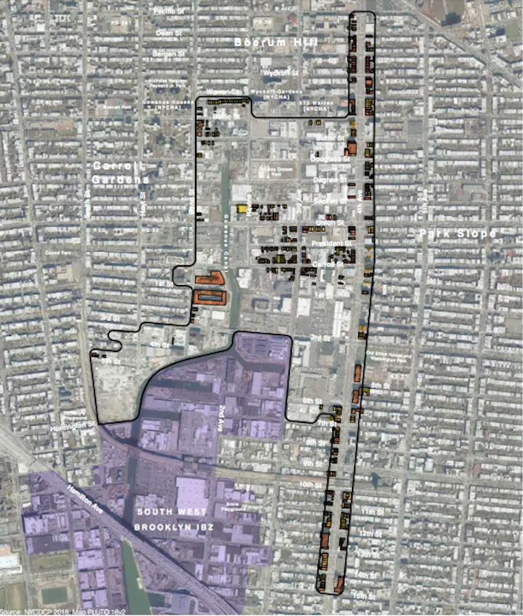
Current Gowanus land use map. Image courtesy of Department of City Planning
As 6sqft previously reported, rezoning plans for the light-industrial zone wedged between pricey Park Slope and Carroll Gardens have long been on the table along with a detailed community-designed blueprint, spearheaded by aforementioned nonprofit group Bridging Gowanus, that outlines the shape the rezoning should take; residents have expressed concerned that rezoning could lead to “a bonanza of high-priced luxury housing.”
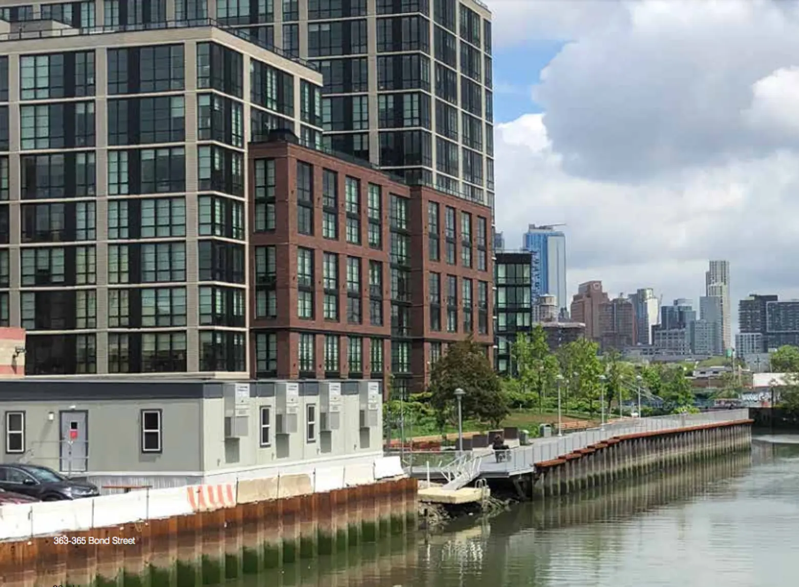
365 Bond Street apartments. Image courtesy of Department of City Planning
The canal-side enclave, despite the sometimes-fragrant waterway in its midst, is home to Brooklyn’s first Whole Foods market and is on a par with its neighbors as one of the city’s most expensive neighborhoods. Rezoning and the promise of public right-of-way could bring an esplanade like Williamsburg’s, a recreation area and lots of new development.
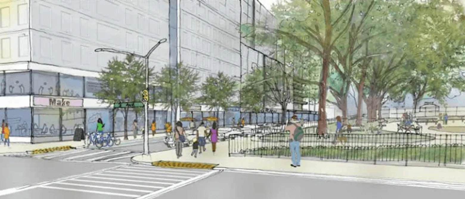
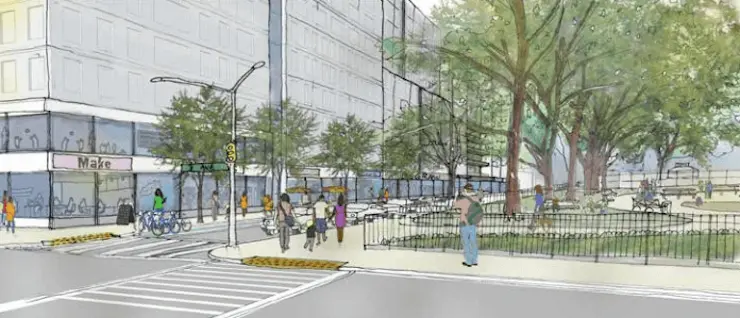
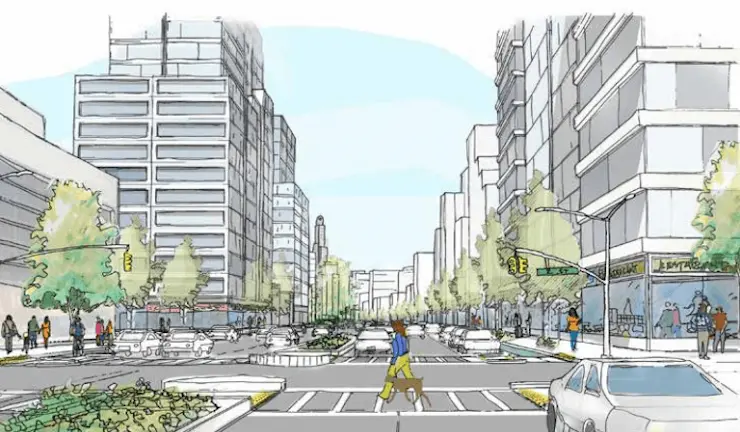
Gowanus rezoning, imagined: Degraw Street from 3rd Avenue. Drawing courtesy of Department of City Planning
Topics in the newly-released study include “Sustainability and Resiliency,” “Environmental Remediation,” “Community and Cultural Resources,” “Housing,” “Economic and Job Development,” “Transportation” and “Land Use and Urban Form.”

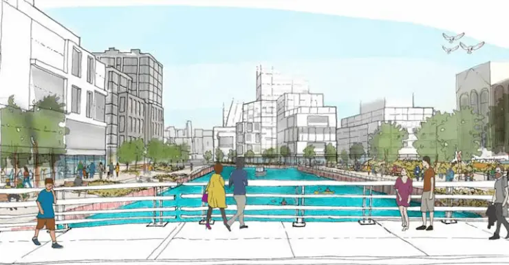
Gowanus rezoning, imagined: North from 3rd Street. Drawing courtesy of Department of City Planning

Gowanus rezoning, imagined: Fourth Avenue and Second Street. Drawing courtesy of Department of City Planning
Among the report’s notable highlights are strategies that would allow higher density mixed-use development around Thomas Greene Playground and 3rd Avenue, ease the way for public access and permit residential development along the canal “at a medium to moderate density,” as shown in sketches included in the report, which can be seen above . A rezoning from industrial to residential is expected to dramatically raise the value of rezoned property and indeed be a bonanza for the owners of the area’s industrial property.
The next step in the process is the Neighborhood Plan and Draft Zoning Proposal, which the new report expects will be finished by the winter of 2018. Then, the proposal heads for the official public review process known as Uniform Land Use Review Procedure (ULURP).
An open house will be held on Wednesday, June 27 from 5 to 8:30 p.m. at P.S. 32 at 317 Hoyt Street to discuss the framework. The DCP will be in attendance. You can all 188 pages of the report here.
[Via Brownstoner]
RELATED:
- Gowanus is now one of NYC’s most expensive neighborhoods
- Lightstone’s Paris-on-the-Gowanus Rental Building at 365 Bond Street Opens
- Pollution Cleanup Park Taking Shape at Gowanus Canal