Hurricane Sandy

June 14, 2023

New Jersey’s largest resiliency park can hold up to 2 million gallons of stormwater

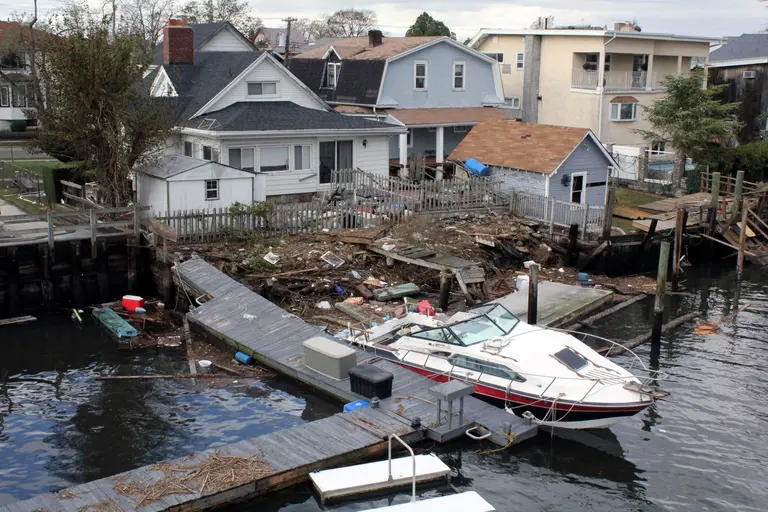
A brand new park in Hoboken will also work to prevent flooding during storms. Located at 12th and Madison Streets, ResilenCity Park includes five acres of public open space, basketball courts, and athletic fields, and has the ability to detain up to two million gallons of water. Considered the largest resiliency park in New Jersey, the new park is part of a broader effort by Hoboken to build more resilient storm infrastructure after Hurricane Sandy flooded most of the city in 2012.
Find out more
October 27, 2022

10 years after Superstorm Sandy: rebuilding, redesigning and rethinking New York City

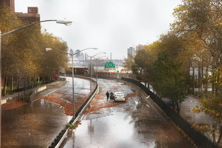
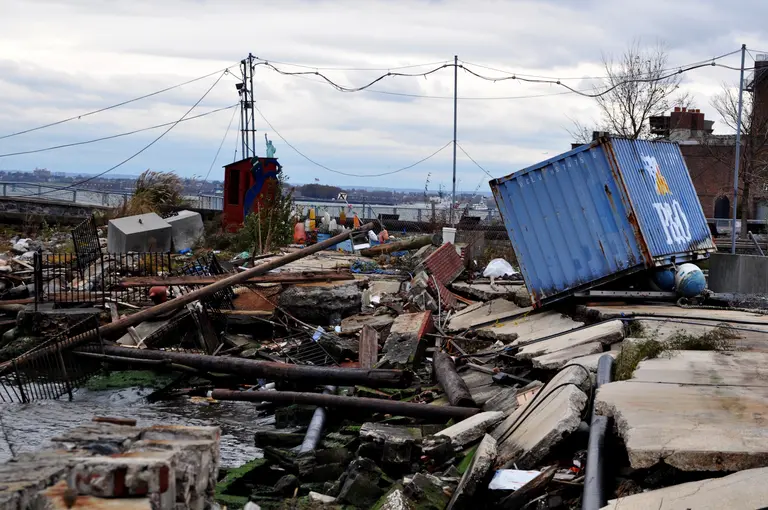
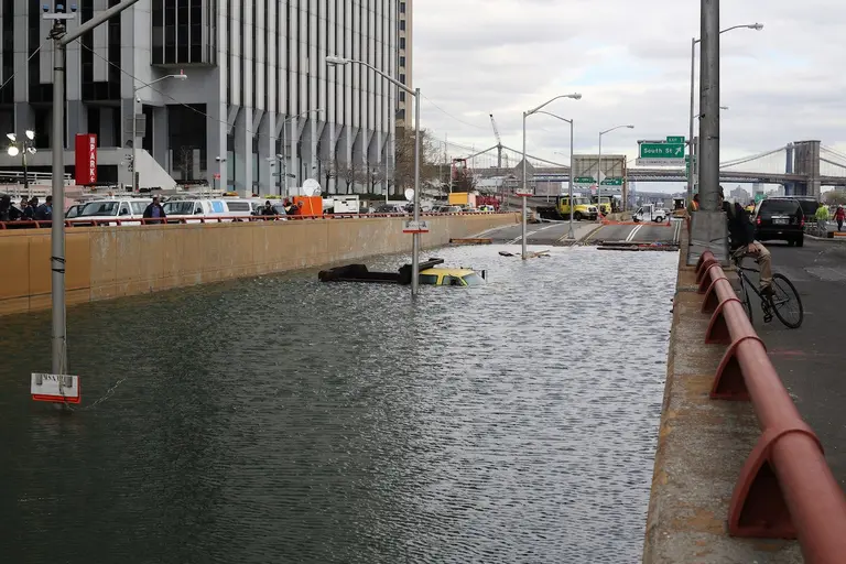
A decade ago, an Atlantic hurricane-turned-superstorm named Sandy caught ready-for-anything New York City completely off guard as it raged up the East Coast from the Caribbean to Canada. On October 29, 2012, the city was blindsided by an unanticipated storm surge that flooded streets and subway tunnels and cut power. It took some areas weeks to get the lights back on and, in the best of cases, open for business, and years to rebuild (an effort which is still ongoing). It goes without saying that the city would like this disaster to be the first and last of its kind, but predictions of future environmental impacts are front-page news daily. To that end, experts and innovators in architecture and engineering, government organizations, regulators, and planners have dedicated their efforts–and billions of dollars–to protect the city in a post-Sandy world. But what has really been accomplished–and is the city safer?
Storm clouds, silver linings, but few solutions
October 30, 2019

City has repaired just two of 35 NYCHA developments damaged by Hurricane Sandy

Seven years after Hurricane Sandy hit New York City, a majority of the city's public housing developments damaged by the storm have not been repaired. Of the 35 NYCHA complexes wrecked in 2012, totaling roughly 200 buildings, upgrades have been completed at just two of them, THE CITY reported Tuesday. The slow recovery at sites in Red Hook, Coney Island and the Lower East Side stems from a lack of federal funding and shady contracts.
Details here
March 14, 2019

De Blasio unveils $10B plan to flood-proof Lower Manhattan by extending shoreline into the East River

Mayor Bill de Blasio unveiled on Thursday a $10 billion plan to extend the coastline of Lower Manhattan as much as 500 feet to protect from future floods. The Lower Manhattan Coastal Resiliency project is the result of a study that looked at ways to build resilience in low-lying neighborhoods like the Financial District and South Street Seaport. The study found the only feasible measure for these areas would be extending the shoreline about two city blocks into the East River by adding a new piece of land at or above 20 feet from current sea level.
Learn more
February 19, 2019

Staten Island Levee project secures funding, will move forward

Mayor Bill de Blasio, Governor Andrew M. Cuomo, United States Senate Minority Leader Charles Schumer, and United States Congressman Max Rose announced today that funding has been secured for the Staten Island Levee project. The news gives the green light for the U.S. Army Corps of Engineers (USACE) to build a long-awaited 5.3 mile sea wall that would protect waterfront communities in Staten Island from future storms.
Good news for Staten Island
July 9, 2018

Army Corps proposes constructing hurricane barriers across the NY Harbor to stop flooding

Via US Army Corps In response to intensifying hurricanes that have hit the New York and New Jersey coastal region in recent years, the U.S. Army Corps is proposing a handful of measures to reduce the risk of storm damage. The proposals include constructing barriers, either in-water or land-based, and floodwalls that would stretch over 2,000 square miles across New York Habor to protect the area's waterfront neighborhoods. The barriers, already being used in cities like Stamford, Conn. and London, would have gates that remain open to let ships pass, but close when a hurricane is advancing (h/t WNYC). After completing a study that looked at nine high-risk areas, including 25 counties in NY and NJ, on the Atlantic Coast, the Corps this month will present the proposals at public information sessions across the two states.
More here
January 8, 2018

New York to be first major city with flood maps based on climate change factors

For the first time since 1983, the Federal Emergency Mangement Agency is redrawing New York's flood maps, taking into account the consequences of climate change like rising sea levels and stronger storms. With hundreds of miles of coastline and a growing number of developments sprouting along its waterfront, New York has more residents living in high-risk flood zones than any other city in the United States, according to the New York Times. FEMA's new map, while still years away from completion, could have a profound effect on the city's future developments and zoning regulations. It could place more residents and buildings in high-risk flood zones, requiring pricey flood insurance as well as tougher building codes and restrictions on new developments.
More this way
October 30, 2017

MTA to install flood-proof doors at subway stations

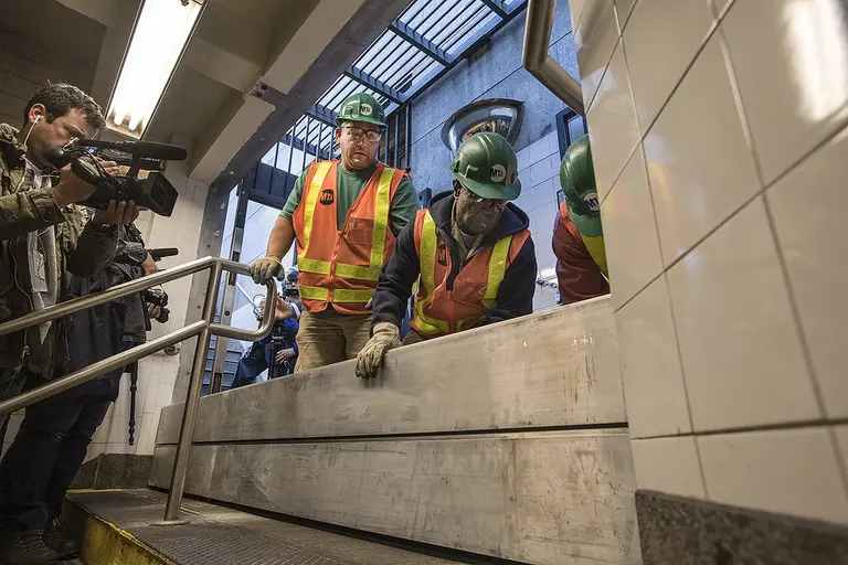
On Friday, the MTA unveiled custom doors designed to protect the city’s subway system from future floods. In October of 2012, Hurricane Sandy crippled Lower Manhattan, as well as most other parts of the city, with a 13-foot surge of water. Now, five years later, the MTA is installing custom-made, marine doors, equipped with inflatable gaskets to seal out water to be installed at the bottom of the subway’s stairwell (h/t WSJ). In addition to these doors, other stations will get metal hatch doors below street subway grates, fabric curtains to block flowing water and a system of interlocking stop logs at the entrance of some stations.
Find out more
October 27, 2017

The Urban Lens: Remembering the darkness of Hurricane Sandy five years later

6sqft’s series The Urban Lens invites photographers to share work exploring a theme or a place within New York City. In this installment, Orestes Gonzalez shares his series "Dark Sandy," photos he took five years ago when lower Manhattan lost power during Hurricane Sandy. Are you a photographer who’d like to see your work featured on The Urban Lens? Get in touch with us at [email protected]. "Never had I seen Manhattan in such darkness... I had to get over there and experience this dark phenomenon with my camera," says Orestes Gonzalez of his series of photographs taken the night Hurricane Sandy hit New York City. As we now approach the fifth anniversary of the Superstorm, the photos are a reminder of how far we've come, and in some cases, how much work still needs to be done. In fact, 20% of the 12,713 families who enrolled in the city's Build it Back program are still waiting for construction to wrap up or for a property buyout. But despite some of the post-storm issues, in the wake of the disaster, Orestes remembers the "sense of camaraderie" he experienced during those dark times, a trait that New Yorkers have come to be known for.
Hear from Orestes and see the full series
October 24, 2017

Study: New York City could get hit with a flood every five years instead of every 500

With the October 29th anniversary of superstorm Sandy approaching and storms leaving the world's coastlines waterlogged, 6sqft recently covered a new report predicting rising sea levels and a growing flood risk. Now a new study, published Monday, found that New York is almost halfway through a 500-year span of rising seas that began in 1800–and the worst is yet to come. But according to the Washington Post, this increased likelihood of flooding has a silver lining.
Find out more
October 18, 2017

New RPA report is ‘a wake up call’ on rising sea levels and growing flood risk

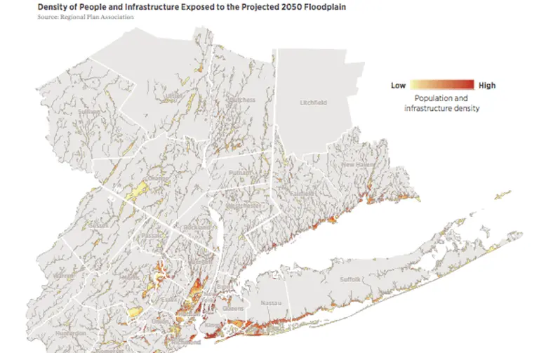
Hurricane season is impossible to ignore, and as the October 29th anniversary date of Superstorm Sandy approaches, the Regional Plan Association (RPA) has released a report titled "Coastal Adaptation: A Framework for Governance and Funding to Address Climate Change" that warns of the imminent threat of rising sea levels and outlines a strategy to protect the many vulnerable stretches of New York, New Jersey and Connecticut. According to the report, 59 percent of the region's energy capacity, four major airports, 21 percent of public housing units, and 12 percent of hospital beds will be in areas at risk of flooding over the next 30 years. RPA research found that even in light of these projections, the region’s climate change planning tends to be reactive and local rather than pro-active and regional–and it's not nearly enough.
Find out more about who's at risk and what can be done
June 16, 2017

City scales back storm-protection project in Red Hook

Flooding during Hurricane Sandy left many residents of Red Hook without basic services for weeks. While many had hoped the city’s $100 million initiative would help protect the Brooklyn waterfront neighborhood from a 100-year flood event, a new feasibility study shows the plan would actually only protect it from a 10-year flood event. As the Wall Street Journal reported, the city plans on scaling back the flood-protection system in Red Hook because of its high costs, and the study revealed a larger project could cost about $300 to $500 million more.
Find out more
May 31, 2017

Cuomo announces $151M elevated promenade to improve Staten Island’s coastal resiliency

Governor Cuomo announced a $151 million plan on Tuesday to build an elevated promenade to improve the resiliency of Staten Island’s east shores during natural disasters. The seawall will stretch from Fort Wadsworth to Oakwood Beach to protect residents from coastal flooding, while simultaneously creating new wetland habitats and recreational amenities. The state’s Department of Environmental Conservation will hold a series of community-based design forums, allowing for Staten Island residents to offer direct input into the project's final design, which will be complete in the winter of 2018, with construction expected to begin in 2019 and a completion date of 2022.
Find out more
March 24, 2017

New renderings revealed for NYCHA’s raised earth Red Hook Houses by KPF

When Superstorm Sandy hit the community of Red Hook, thousands of residents were left without power and basic necessities for over two weeks. The neighborhood’s infrastructure suffered substantial damage, with almost all basement mechanical rooms destroyed. In an effort to rebuild Brooklyn’s largest housing development, Red Hook Houses, post-Sandy, the New York City Housing Authority (NYCHA) commissioned a project by architecture firm Kohn Pederson Fox (KPF). Their “Lily Pad” design includes installing 14 “utility pods” that deliver heat and electricity to each building, as well as creating raised earth mounds to act as a flood barrier (h/t Archpaper).
Find out more here
October 11, 2016

New research says Sandy-like storms could occur in NYC every 20 years by the year 2100

With the fourth anniversary of Hurricane Sandy approaching, many New Yorkers are still reeling from its devastation; in fact, the city recently allocated another $500 million in taxpayer money for repairs due to storm damage. And though this seems grim, a new study from a group of researchers at Princeton and Rutgers universities and the Woods Hole Oceanographic Institution is even more troubling. Based on a storm-related computer simulation of flooding, "Hurricane Sandy’s Flood Frequency Increasing From Year 1800 to 2100" predicts that in a worse-case scenario, by the year 2100, such powerful storms will occur every 20 years, an increase of 17 times the current state, reports Phys.org.
Find out more details
October 21, 2015

INTERVIEW: Captain Jonathan Boulware Sets Sail as the South Street Seaport Museum’s Executive Director

The South Street Seaport Museum may not be one of New York City's glitziest institutions, but it's certainly one of the most resilient and perhaps the one most closely tied to the founding of the city itself. Using actual historic buildings and ships to provide interactive exhibits and educational programs, the museum tells the story of New York's rise as a port city and how that led to the development of the entire country. But the seaport location became all too real in 2012 when Hurricane Sandy ravaged the entire historic district, leaving the museum with $20 million in damages and the loss of its institutional partner, the Museum of the City of New York. Now, three years later, the South Street Seaport Museum is sailing into new territory, thanks in large part to its recently appointed executive director Captain Jonathan Boulware, a lifelong sailor, marine educator, expert in historic ships, and all-around lover of maritime history and culture. In August, Boulware and his team landed a $10.4 million FEMA grant to repair the storm damage, and in May, the museum launched a $10.6 million city-funded project to restore Wavertree, one of the museum’s most significant historic ships. With these exciting developments underway, we caught up with Captain Boulware to learn a bit about his background, what visitors can expect at the museum, and where the institution is heading.
Read the interview
January 7, 2015

The City Began Rebuilding 1,002 Sandy-Damaged Homes in 2014

Mayor de Blasio’s 2014 goal for Hurricane Sandy reconstruction was to start the rebuilding of 1,000 homes and distribute 1,500 reimbursement checks to homeowners who paid for repairs out of their own pockets. And not only have those goals been met, but they’ve been exceeded. According to the Daily News, the city has begun construction on 1,002 […]

December 29, 2014

Sandy-Ravaged Chelsea Building to Sprout New Apartments

A four-floor Chelsea building ravaged by Superstorm Sandy will be reborn as a new nine-unit residential building. The walk-up building at 92 Eighth Avenue near 14th street has sat vacant and shrouded since the storm triggered the collapse of its front facade, revealing its interiors "like an open doll house." With all of its similarly furnished rooms exposed to onlookers, it was soon discovered the building operated as an illegal hotel catering to European travelers.
More details here
October 31, 2014

Animated GIFs Remembering the Post-Sandy Devastation

This week marks the two-year anniversary since Hurricane Sandy devastated New York City and the surrounding coast lines. In its wake, the storm forever altered our coastal areas. These before-and-after satellite images from the Huffington Post taken via Google Earth, show just how dramatic the damage was—and they ask us to consider the progress we've made recovering from the destruction over the last two years. Our rebuilding efforts in the post-sandy aftermath have been significant, however our work is far from over.
More details here
October 29, 2014

Daily Link Fix: Memorial Events for the Second Anniversary of Hurricane Sandy; A Modest Proposal for NYC Ambassador Taylor Swift

Pix11 has rounded up memorial events in New York and New Jersey to mark the second anniversary of Hurricane Sandy. It’s National Cat Day! And in honor of the occasion Uber’s UberKITTENS will deliver an ASPCA cat to your office for 15 minutes. More on Business Insider. In today’s Daily News, Jeremiah Moss, of Jeremiah’s […]

June 3, 2014

The Results Are In: Rebuild By Design Announces Winning Proposals for Post-Sandy Flood Protection

Over a year after Hurricane Sandy tore through the metro New York area, destroying lives and homes, some areas are still in the process of rebuilding. In an effort to ensure New York City is never caught off guard from a natural disaster like we were in the fall of 2012, the Department of Housing and Urban Development launched Rebuild By Design, a contest to develop ways to rebuild the city’s most vulnerable areas in such a way that they’ll be better prepared for nature’s unpredictability. 140 proposals were submitted over a year ago, coming from 15 different countries. Last June, 10 finalists were chosen to refine their plans, developing protective strategies for all of the vulnerable areas that were struck, and will likely be struck again. After nearly a year, the Department of Housing and Development has just announced six winners that will receive a piece of the federal government's $4 billion disaster-recovery fund.
Take a look at the winning designs here