MIT’s new tree canopy map reveals New York City needs more greens

In an effort to promote urban tree cover, researchers at MIT’s Senseable City Lab have developed Treepedia, a platform for mapping the canopies of ten different major cities. Using Google Street View panoramas to serve as a Green View Index (GVI) to compare and evaluate green canopy coverage, Treepedia provides a visual map of trees and vegetation in Boston, Geneva, London, Los Angeles, Paris, Sacramento, Seattle, Tel Aviv, Toronto, Turin, Vancouver and of course, New York.
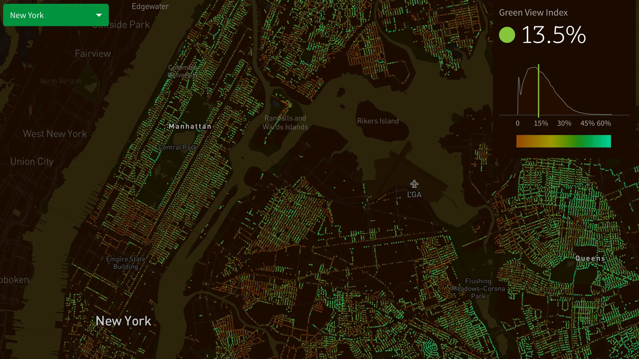
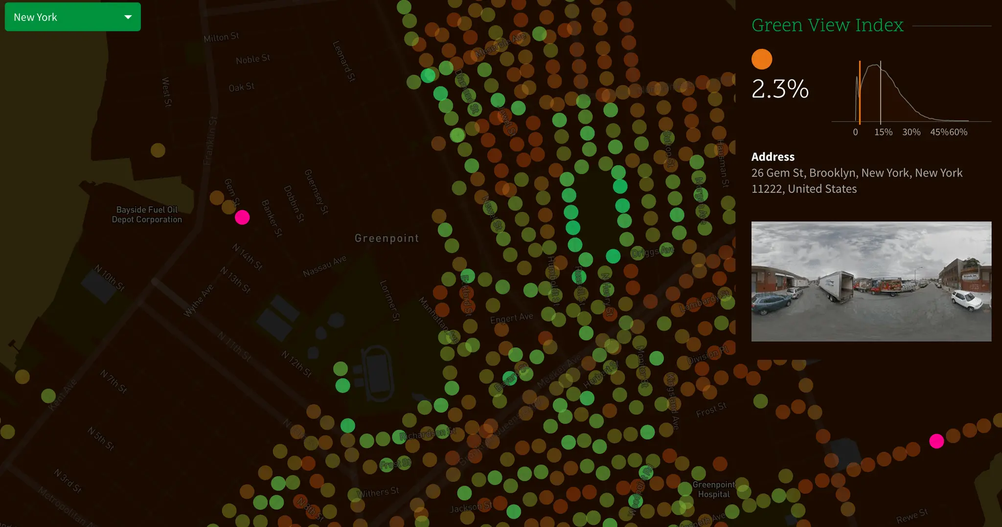
Researchers chose GVI over satellite imagery so as to “represent human perception of the environment from the street level,” according to the Treepedia site. GVI is measured on a scale of 0 to 100. A city with a GVI of 100 would be completely covered by tree canopy.
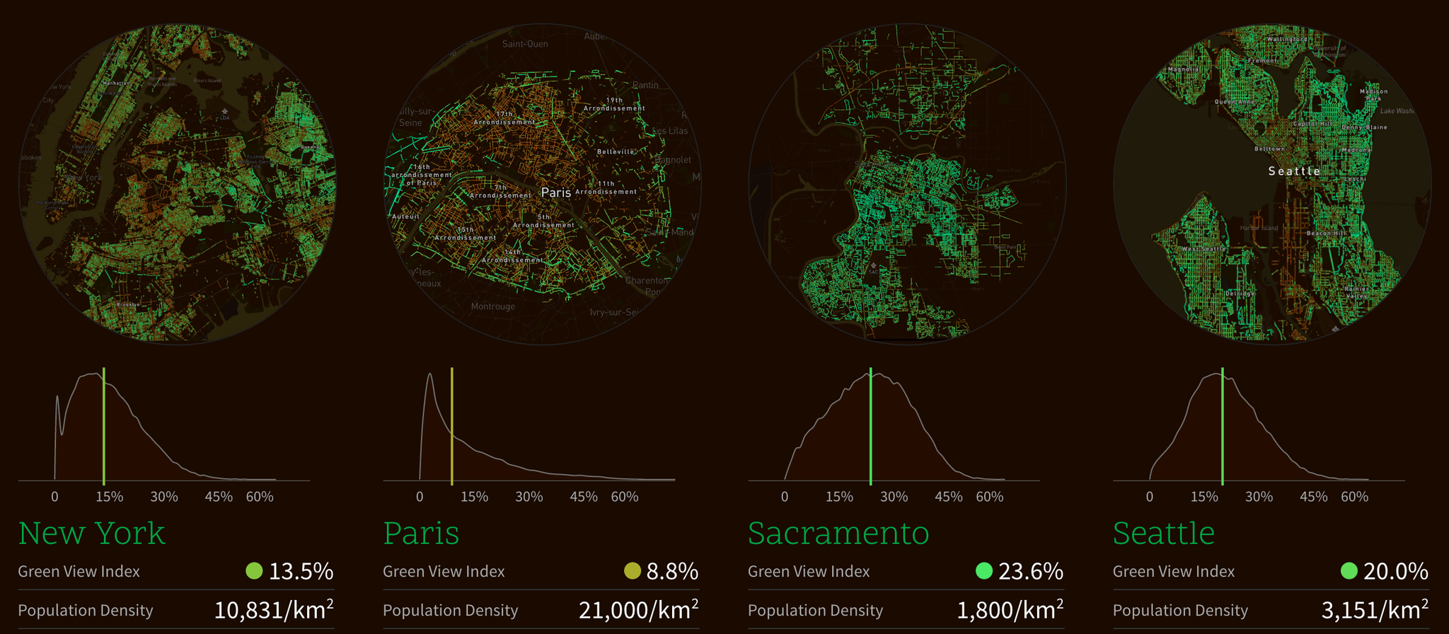
New York ranked the third lowest of the ten cities, with only Paris and London having less tree coverage. With a GVI of 25.9 percent, Vancouver was found to have the most tree coverage.
For now, Treepedia serves mainly as a visual aid for green spaces, but its creators plan on a more interactive future in which locals can tag their communities’ trees, view the location and size of trees, and “advocate for more such trees in their cities,” according to a press release. As well, the creators want to expand Treepedia to more cities and add an open-source street map to, “engage with city officials in order to request that new trees be planted in certain areas.”
 Image by Treepedia
Senseable City Lab Director Carlo Ratti commented of the new platform,
As many cities experience warming temperatures, increased storm frequency, and continued air pollution, the well-being of our urban trees has never been more important. We present here an index by which to compare cities against one another, encouraging local authorities and communities to take action to protect and promote the green canopy cover.
Treepedia provides a comparative resource for global urban nature, but for a more local tree-counting resource, check out the NYC Street Tree Map. Painstakingly compiled by thousands of volunteers, the NYC Parks map provides exact tree counts on a neighborhood to neighborhood scale for all five boroughs.
[Via CityLab]
RELATED:
- The Only Two Living Things in NYC to Have Been Landmarked Are Trees
- MAP: NYC has more than 666,000 street trees, up 12 percent since 2006
- 15 indoor air-purifying plants for your apartment or home