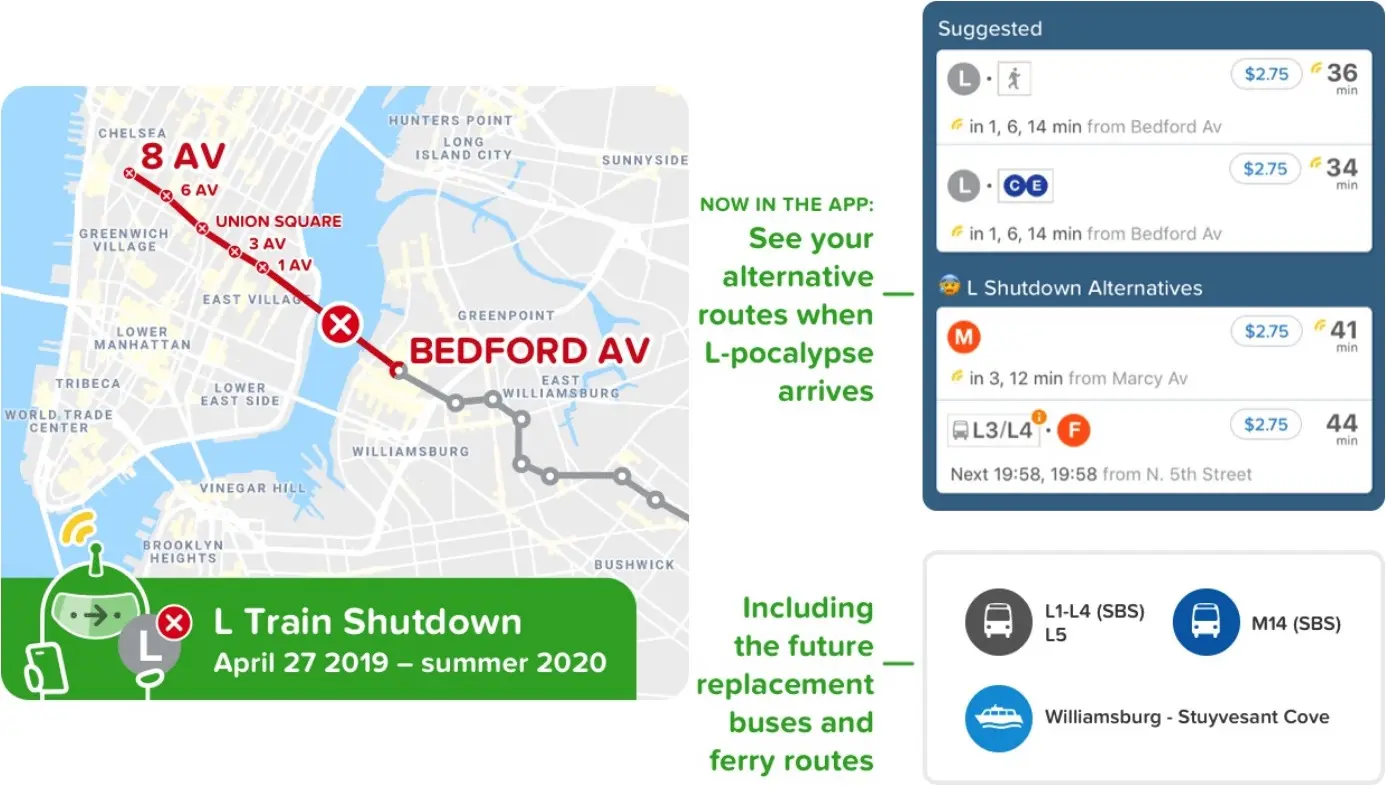
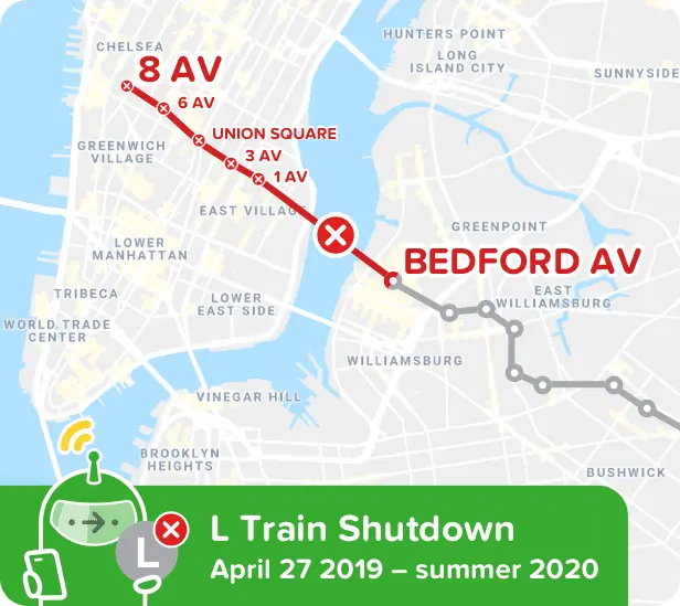
This map will help you navigate the system when the L train shuts down

As the dreaded L train shutdown of April 2019 looms ever nearer, the fine folks at Citymapper have created an addition to their interactive mapping app to show you what your commute will look like when the L is not an option. Use the SuperRouter to plan a trip between Brooklyn and Manhattan and see which of your alternative routes works best.
The alternatives shown include buses and ferry routes, some of which have been added to replace the L. You can get the app here.
The Metropolitan Transportation Authority in October announced the official date of the L train shutdown: April 27, 2019. On that date, the line will stop running between 8th Avenue and Bedford Avenue for 15 months to allow for the Canarsie Tunnel to be repaired from flooding damage caused by Hurricane Sandy.
RELATED: