1894 maps show a Manhattan densely populated with immigrants

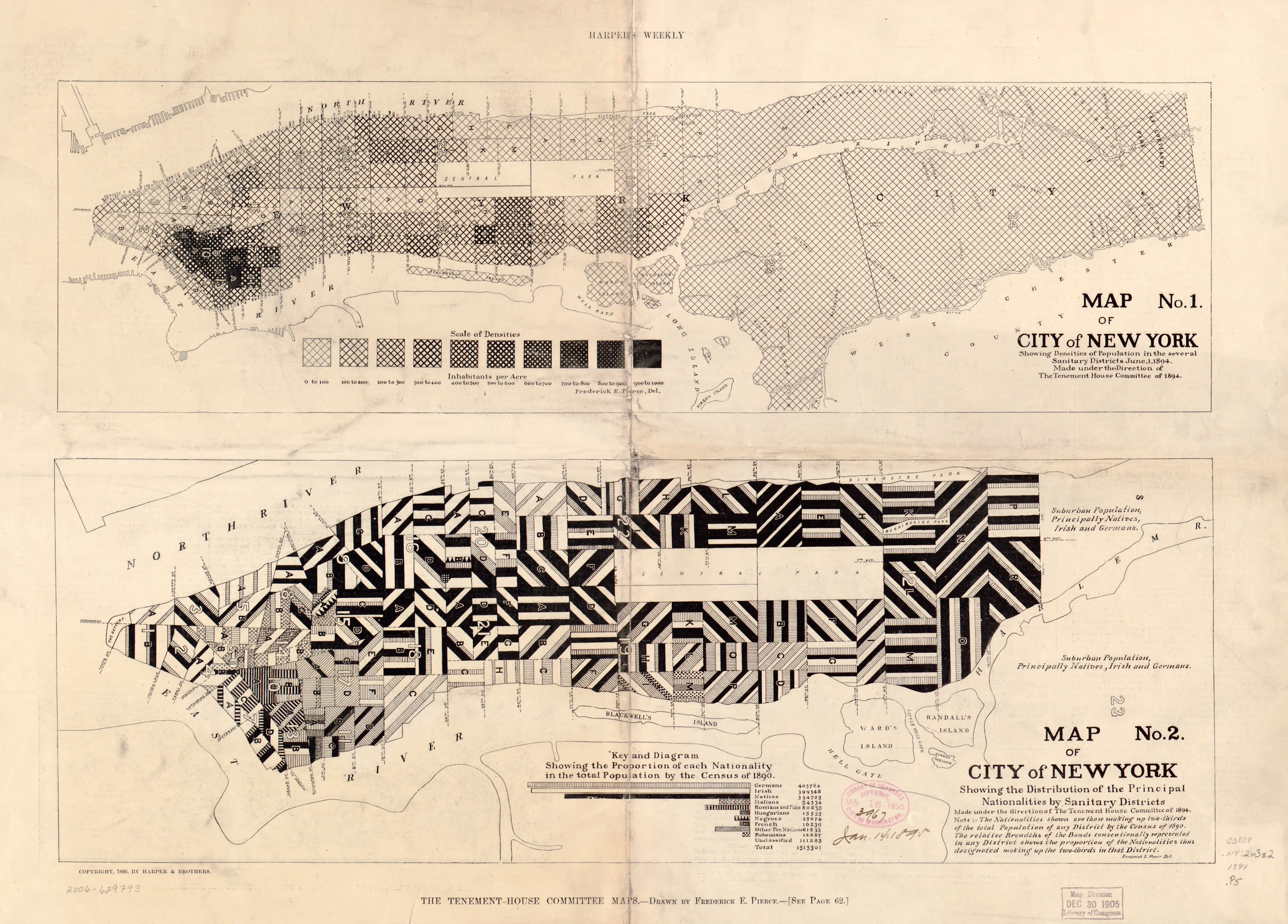
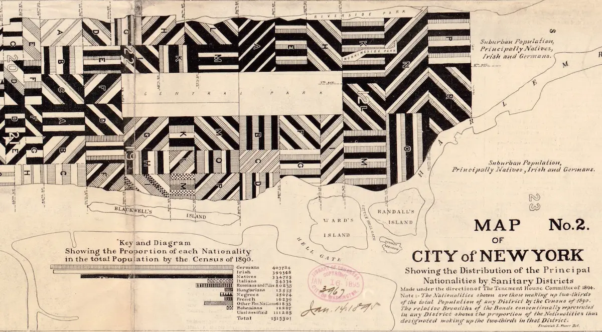
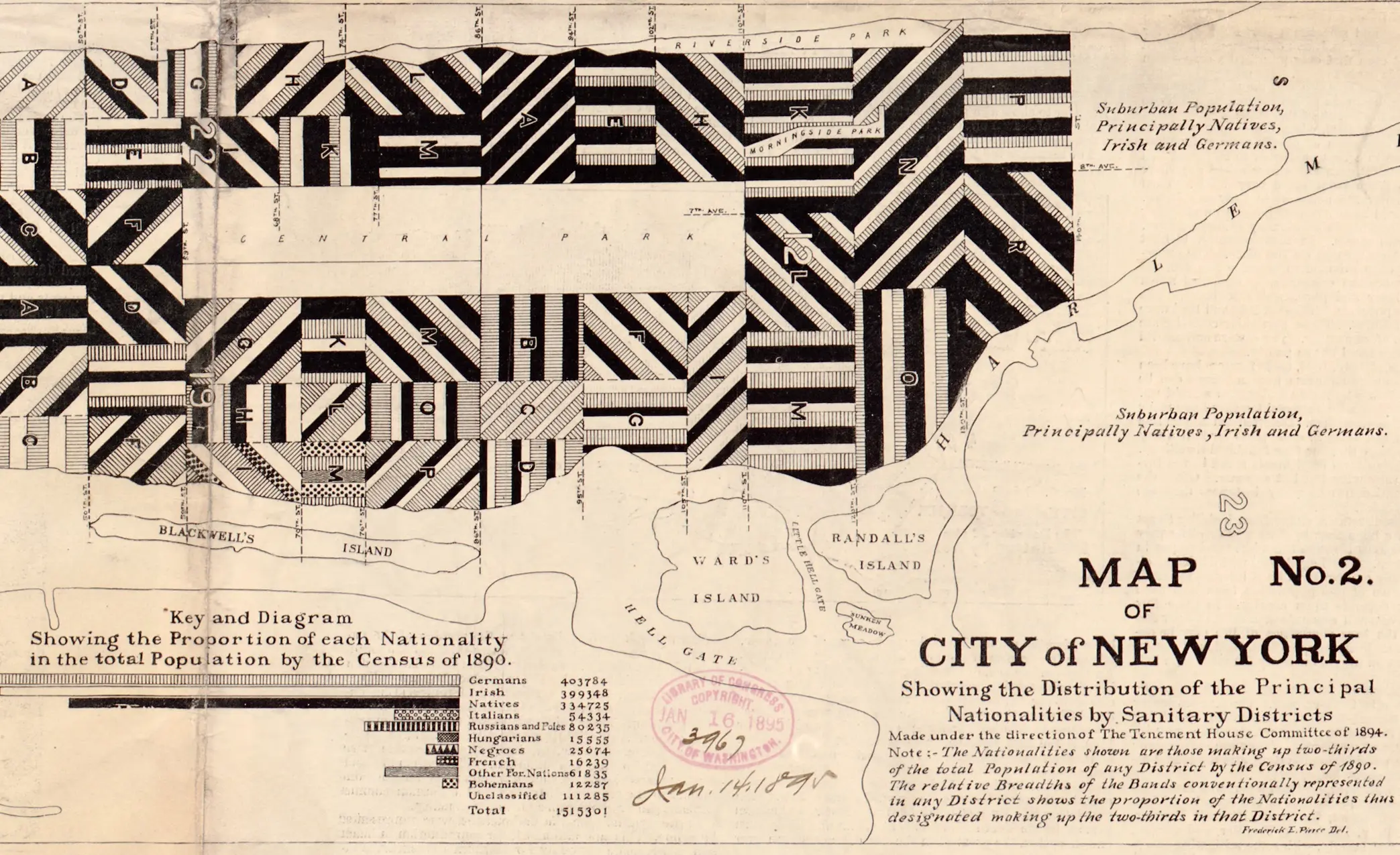
New York has always been a city of immigrants, and these historic maps—dug up by Slate—attempted to illustrate the population density and nationality in 19th century Manhattan. With data from the 1890 census, the New York’s Tenement-House Committee and Frederick E. Pierce released the maps in 1894. They tracked immigrant communities by striping each of the island’s sanitary districts (which are small service areas designated by the sanitation department) with different patterns. The stripes show the national origin of the New Yorkers that live in each area, while the width of the striped signifies the proportion of the population represented by each group.
Click here to enlarge to full size >>
As Slate points out, these two maps don’t represent the total diversity in any given sanitation district. They only show the largest two or three groups that made up two-thirds of each district’s population. The decision ultimately dramatized the strong presence of foreign-born citizens from Germany, Ireland, Italy, and Russia throughout Manhattan. Pierce told Harpers’ Weekly at the time that Scotch, English, Welsh, Scandinavian, and Canadian New Yorkers were not recorded due to “being in small numbers and perhaps less foreign than the others.”
The maps were originally drawn in color, but the mapmakers remade them with monochromatic patterns to suit black-and-white publications. You can zoom in to closely see each sanitation district here.
[Via Slate]
RELATED: