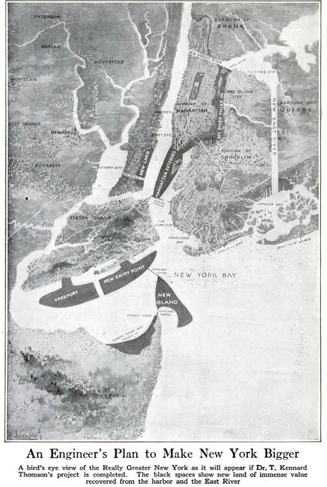
A Madcap Engineer Wanted to Pave Over the East River to Create a “Mega-Manhattan”

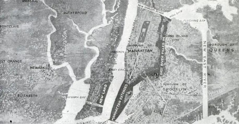
Part of the proposal, “A Really Greater New York”, that shows the East River infill and southern Manhattan peninsula
The East River may not be the most beautiful body of water we’ve ever witnessed, but that certainly doesn’t mean we’d like to see it paved over. That’s exactly what T. Kennard Thomson, an engineer and planner, proposed in 1911, hoping to create a mega-Manhattan. Plus, he wanted to add a long hunk of infill at the southern tip of Manhattan, creating a new peninsula bolstered by Governor’s Island, add more new land in the Hudson between Bayonne and Manhattan, and relocated the Brooklyn Navy Yard.
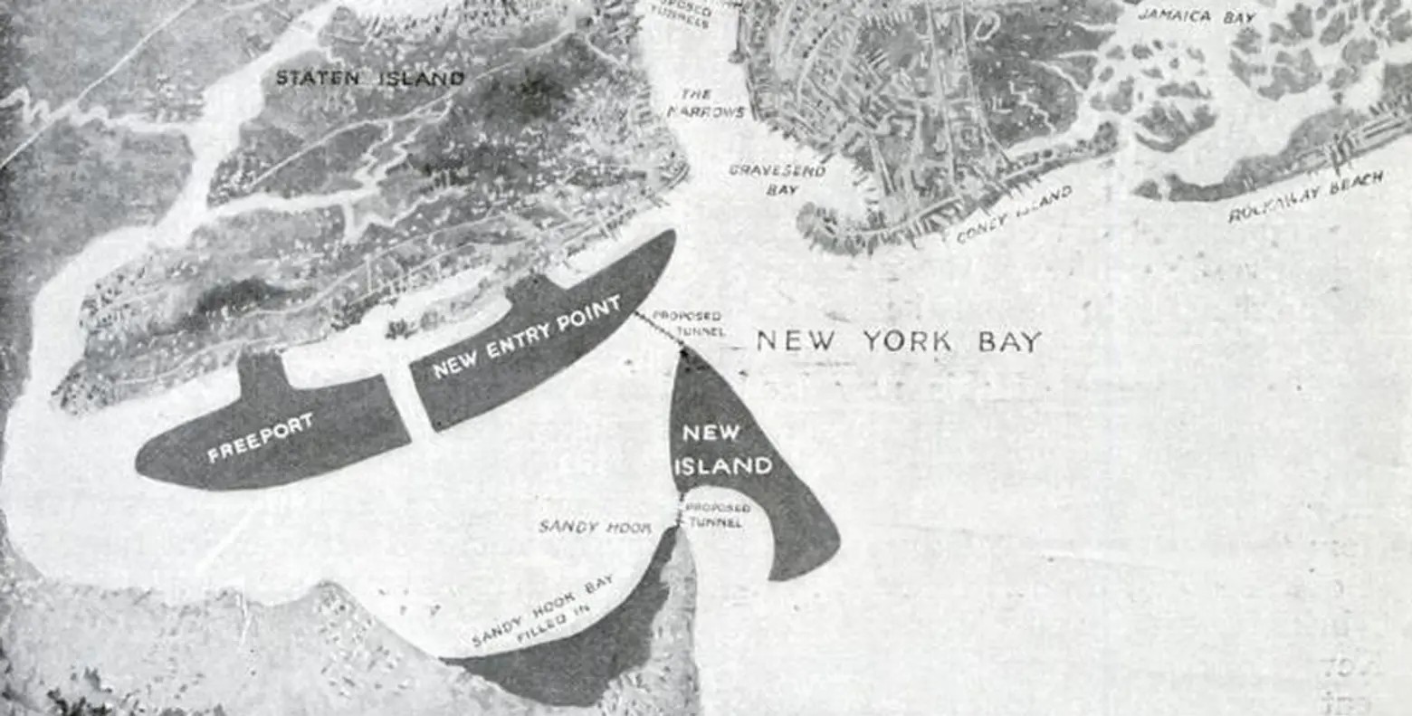
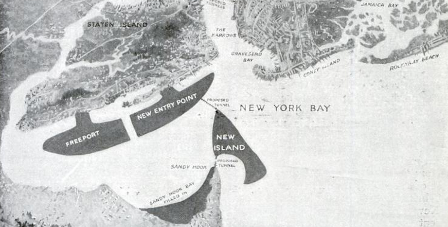
Part of the proposal that shows the Staten Island and Sandy Hook islands
Thomson’s proposal was aptly titled A Really Greater New York, and it would have added an additional 50 square miles to the already 469-square-mile New York City. The plans to infill the East River and create a new southern peninsula were of course the most ambitious, but the planner also wanted to forge a new river to connect Newark Bay to the Upper Bay, which is where he’d move the Brooklyn Navy Yard, add two massive peninsulas to Staten Island, and give Sandy Hook a new island. Additionally, a new Harlem River would have run through part of Manhattan, a new East River would have been built between Brooklyn and Queens, and Grand Central Terminal would have been constructed on top of the newly paved East River. And all of this, asserted Thomson, would cost the city nothing. A 1912 New York Times article stated:
Speaking at a meeting of the American Society of Civil Engineers… he suggested the building of two sea walls from each end of the Battery to Governors Island and the filling in of what is now the channel at the south of Manhattan Island. The work which has been in progress for years under the Government for the extension of the island to the south should be continued until it extends about ten blocks right down the center of the harbor to about a mile and a quarter of Staten Island. Mr. Thomson reckoned that thereby eight or nine miles of docks would be added to the city and a tract of 1,400 acres worth $1,000,000,000 made available for building purposes.
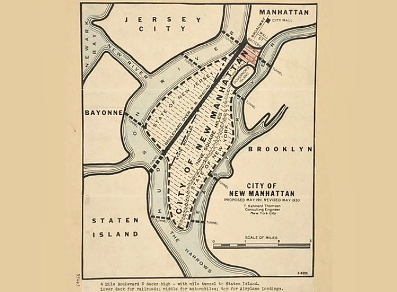
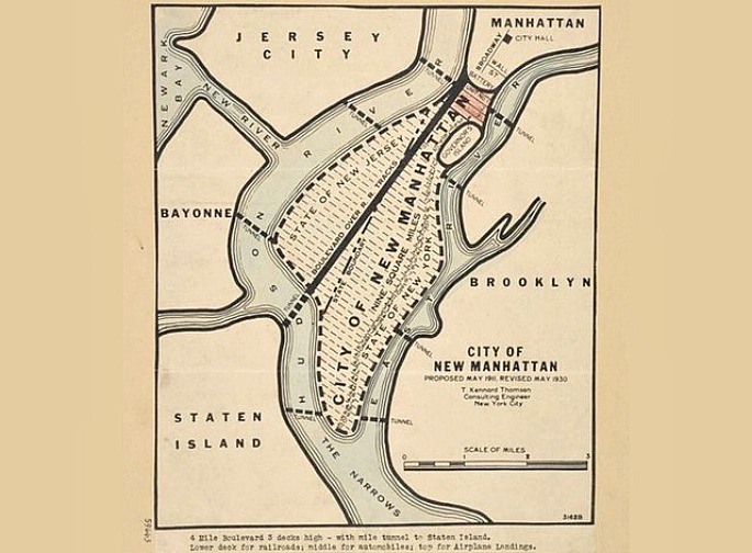
New Manhattan, the 1930 proposal, via NYPL
So by adding 100 miles of new waterfront, Thomson hoped to cement New York as an industrial powerhouse. Little did he know, though, that just 50 years later, the working waterfront of the city would be all but extinct. By the 1930s, he scaled back his plan and renamed it A New Manhattan. According to Gothamist, “This would have connected Manhattan to New Jersey, creating 10-square-miles of land, and relieved traffic congestion with subterranean tubes and tunnels.” That certainly would have given “bridge and tunnel” a new meaning.
A Really Greater New York images via Popular Science