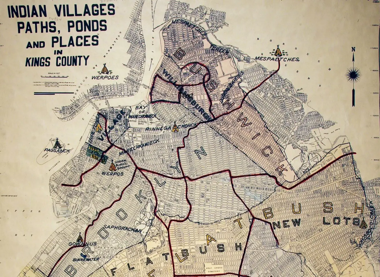
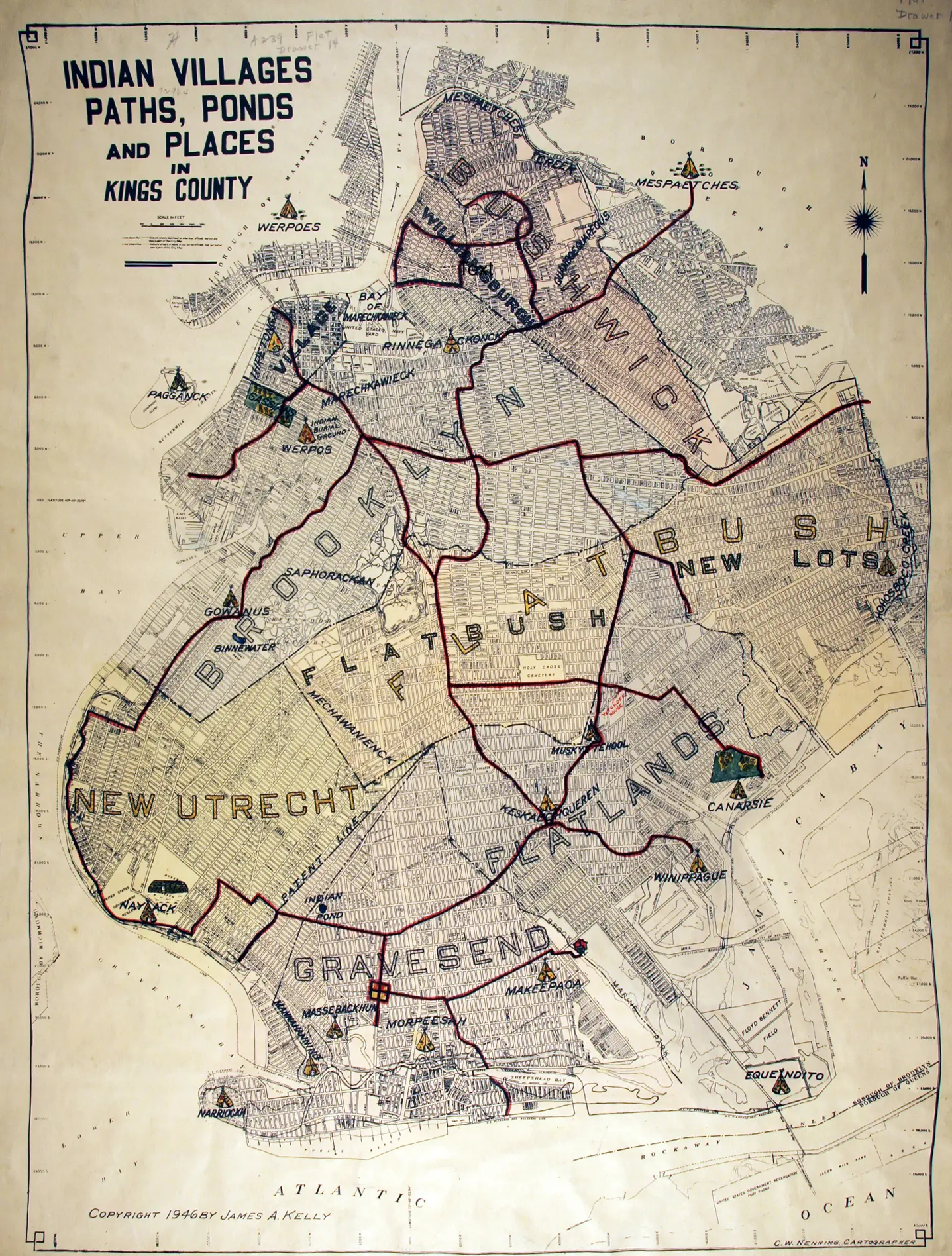
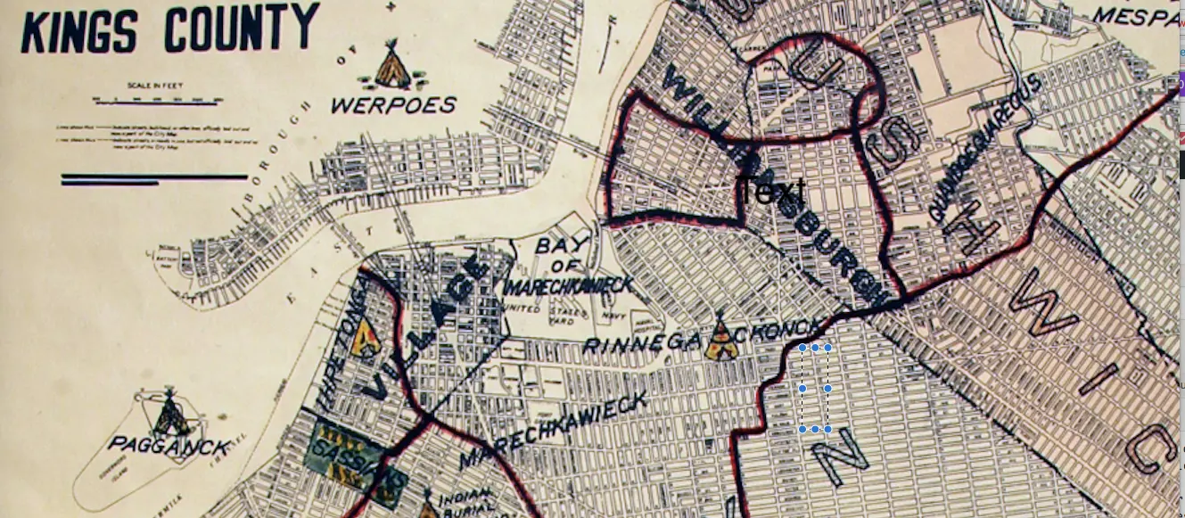
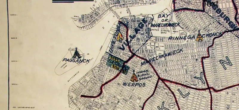
This 1946 map shows how Native American trails became the streets of Brooklyn

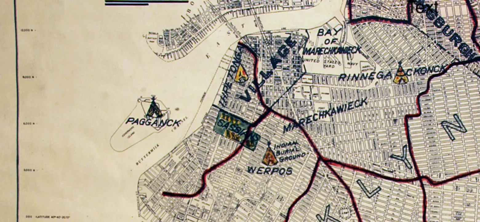
While we take for granted the paths and roads we use on a daily basis, it’s interesting to find out how they came to be. It’s not a new concept that paths worn by the comings and goings of early dwellers and subsequent settlers in a particular area became roads, streets and thoroughfares, often with names that reflect their beginnings. Brooklyn Heights Blog (via Viewing NYC) shares some insight into Brooklyn’s familiar roads that began as Native American trails on a 1946 map titled “Indian Villages, Paths, Ponds and Places in Kings County.”
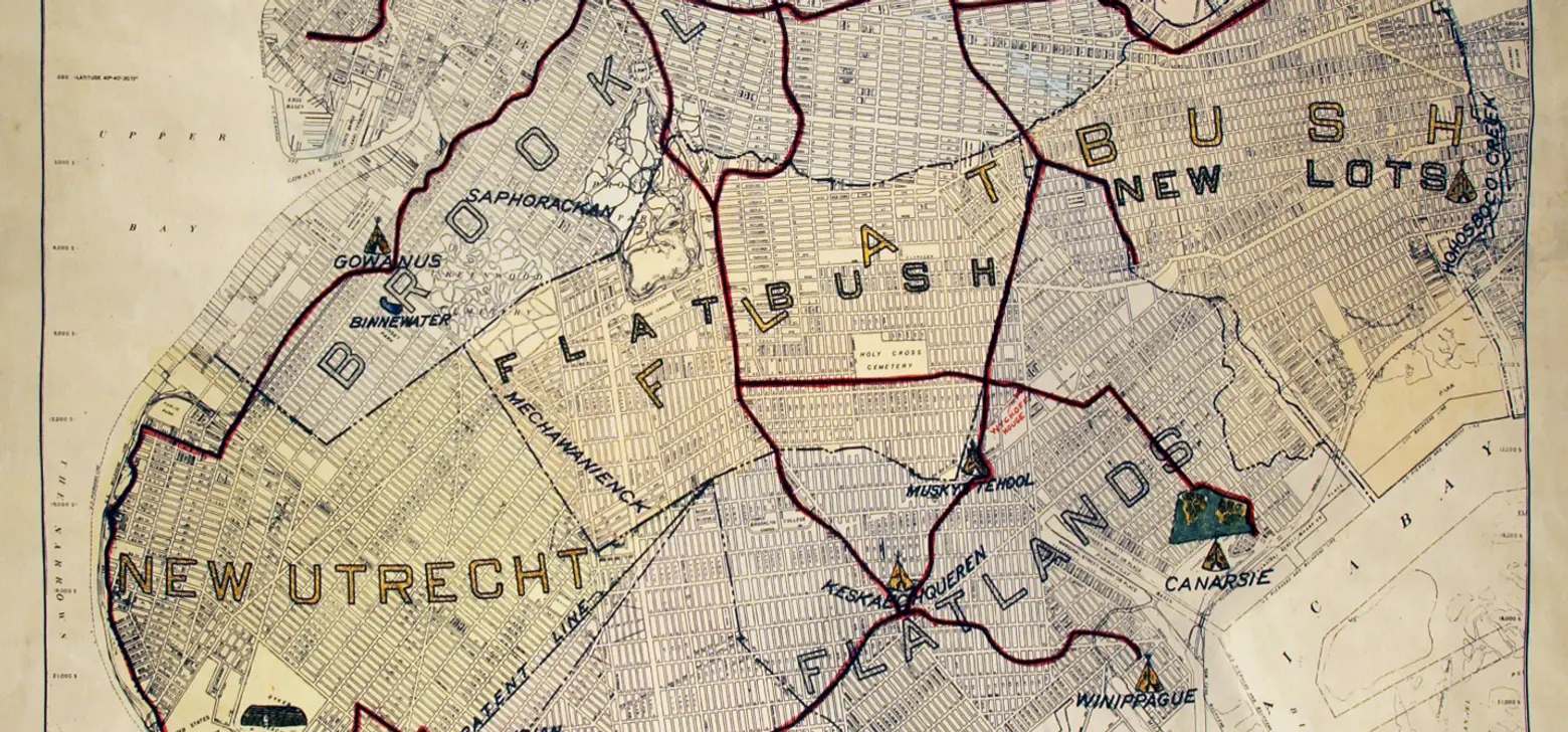
The map, which comes to us courtesy of the Brooklyn Historical Society, was published in 1946 by James A. Kelly, who was the Brooklyn Borough Historian at the time. It’s noted that “some of the trails that exist today as major thoroughfares, like Fulton Street, Flatbush Avenue and part of Atlantic Avenue.”
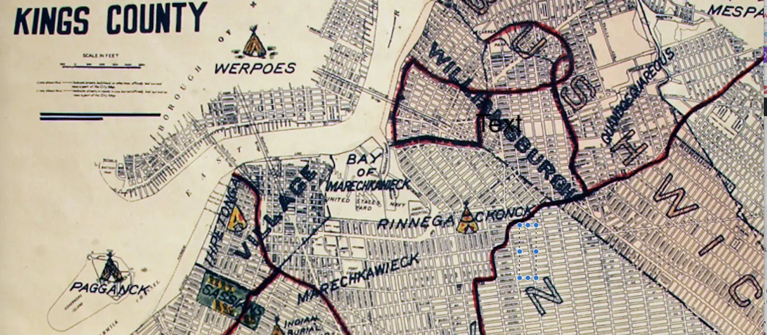
Another major Native American trail heads straight down what’s currently Division Avenue in Williamsburg.
Also noted: there’s a park on the map that’s part of what now is Van Voorhees Park. The city’s parks website gives us a bit of history that ties together yet another layer of the city we currently inhabit.

[Via Viewing NYC]
RELATED: