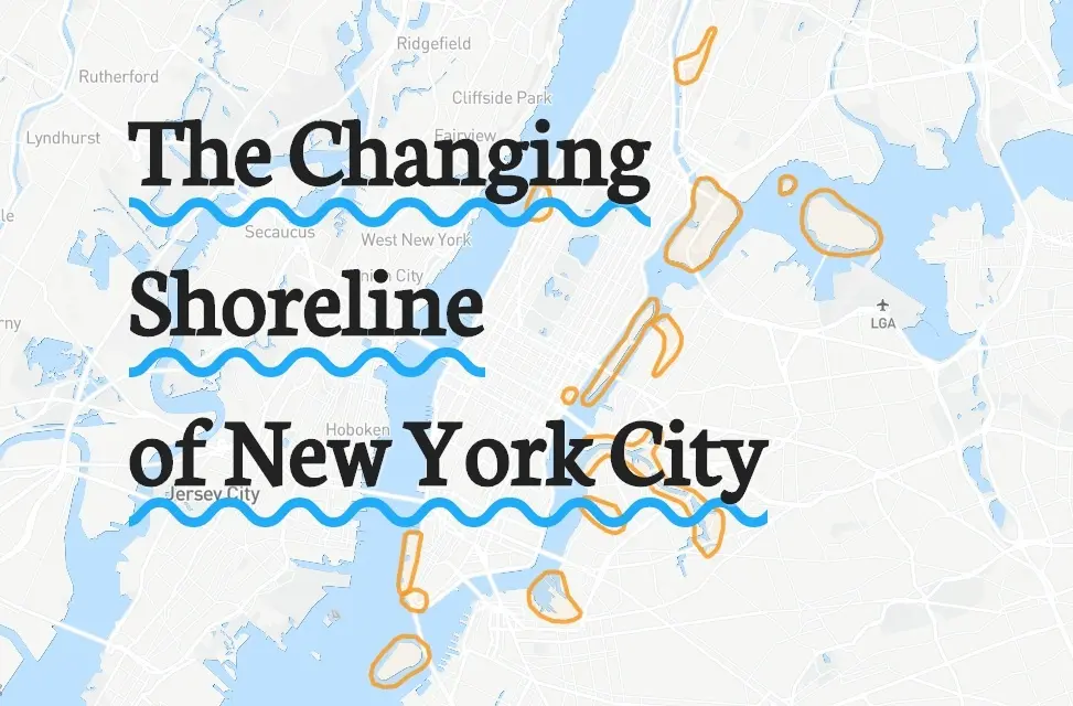
Interactive map shows how NYC’s waterways have evolved over the years

This map will delight any NYC geography buffs out there: The Changing Shoreline of New York City uses historical maps from the New York Public Library’s digital collection to explore how Manhattan has managed its waterways to expand its small city footprint. Created by Laura Blaszczak during her internship with NYPL, it’s an interactive map that highlights waterfront locales around the city. Zoom in, and you can peruse historical maps and photographs that show how our rivers, creeks, brooks, and bays have been managed or built over. There’s even an opacity control, so you can directly compare the historical map with the modern map and see how much Manhattan’s landscape has changed.

 Courtesy of NYPL
As the introduction to the interactive map says, “Historical maps of New York City juxtapose current coastal conditions of the city, revealing dramatic material landmass changes through time which are expressed through subtle contour differentiations mapped by a single line.” The idea of this project is to “destabilize the perception of coastal boundaries in Manhattan today.”
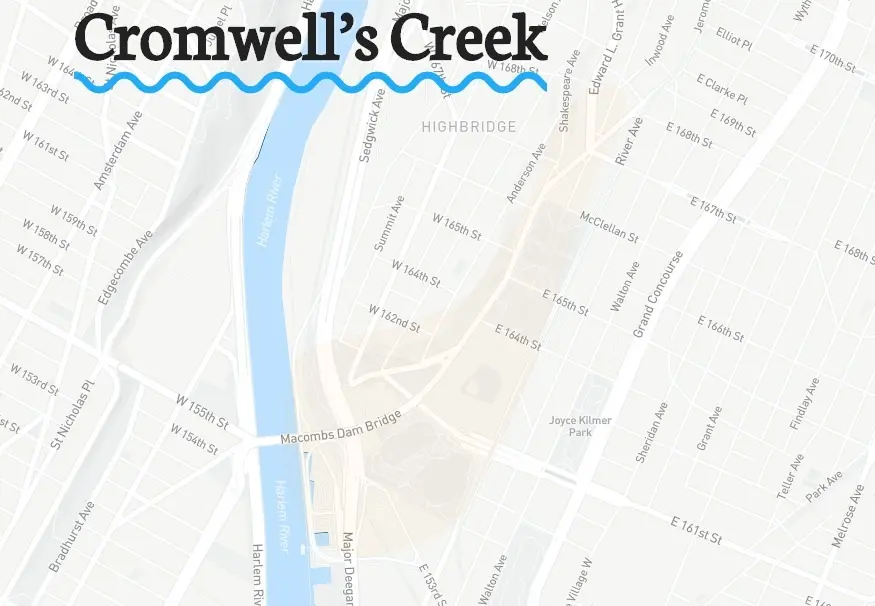
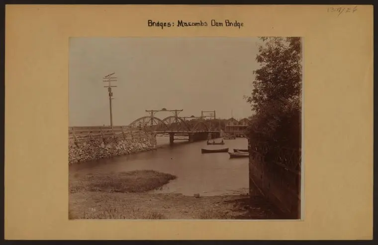
Cromwell’s Creek, for example, was completely filled in by modern infrastructure. Tidal marshes had marked the transition area between the Bronx and the Harlem River in early New York history, but the waterbody was filled in for new development starting in the 1700s. As the map shows, “Macombs Dam Bridge symbolically extends the flow of the now deceased creek and connects Manhattan to the Bronx at a very busy intersection which involves pedestrians, baseball spectators, vehicles, bicyclists, and residential blocks all coming together at once.” Yankees Stadium also sits on the buried waterway.
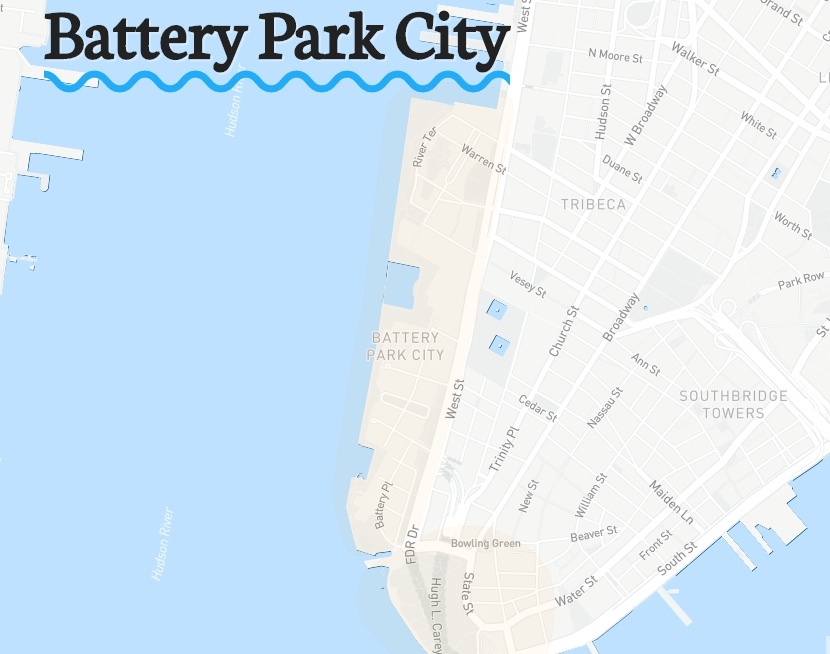
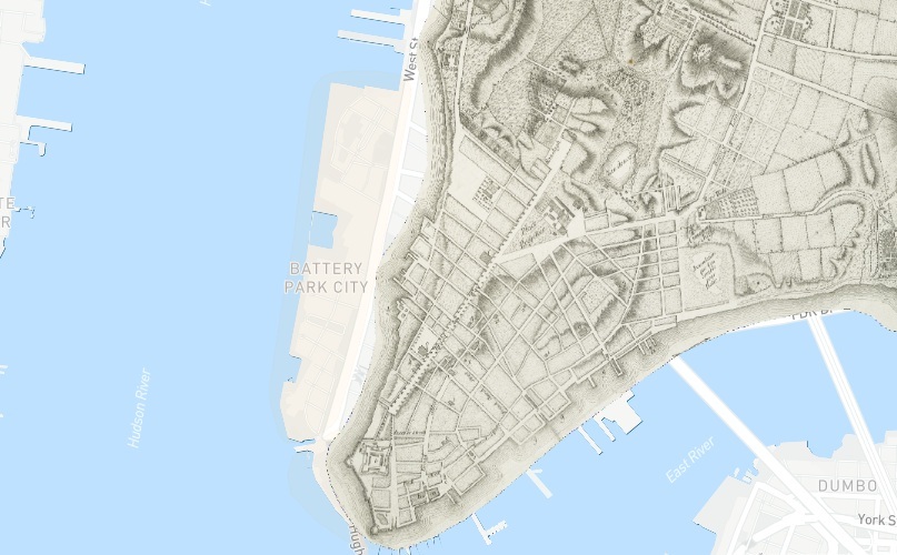
Battery Park City is a classic example of waterfronts changing to accomidate New York’s growth. In its original condition, the Battery extended in sandy beaches up to 34th Street on the West Side of Manhattan. But it’s been progressively constructed and reconstructed at the edge, erasing the beach landscape and rich marine-water habitat, to fit the demands of the growing city. Today, the coastline “is highly engineered to contain the lower part of the island and sustain its demanding accumulation of human intervention.”
 Courtesy of NYPL
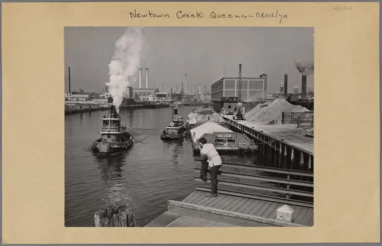
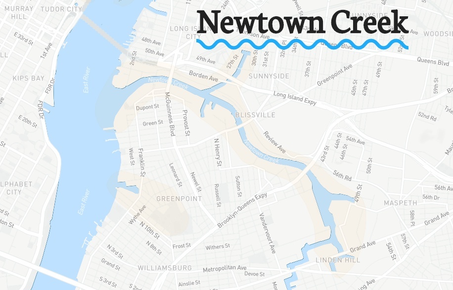
Over in Brooklyn, at Newtown Creek, this waterway has been “corrupted by the city’s industrial zone like no other.” What was once a dynamic creek has been so polluted by factories, rubbish and oil spills that the map dubs it “the city’s trash septic.” It’s since become a superfund site in an effort to help the noxious creek return to a more healthy state.
To explore many more of the city’s waterways, from Blackwell’s Island to Stryker’s Bay to Sunswick Creek to Governors Island, go straight to the map.
[Via Maps Mania]
RELATED: