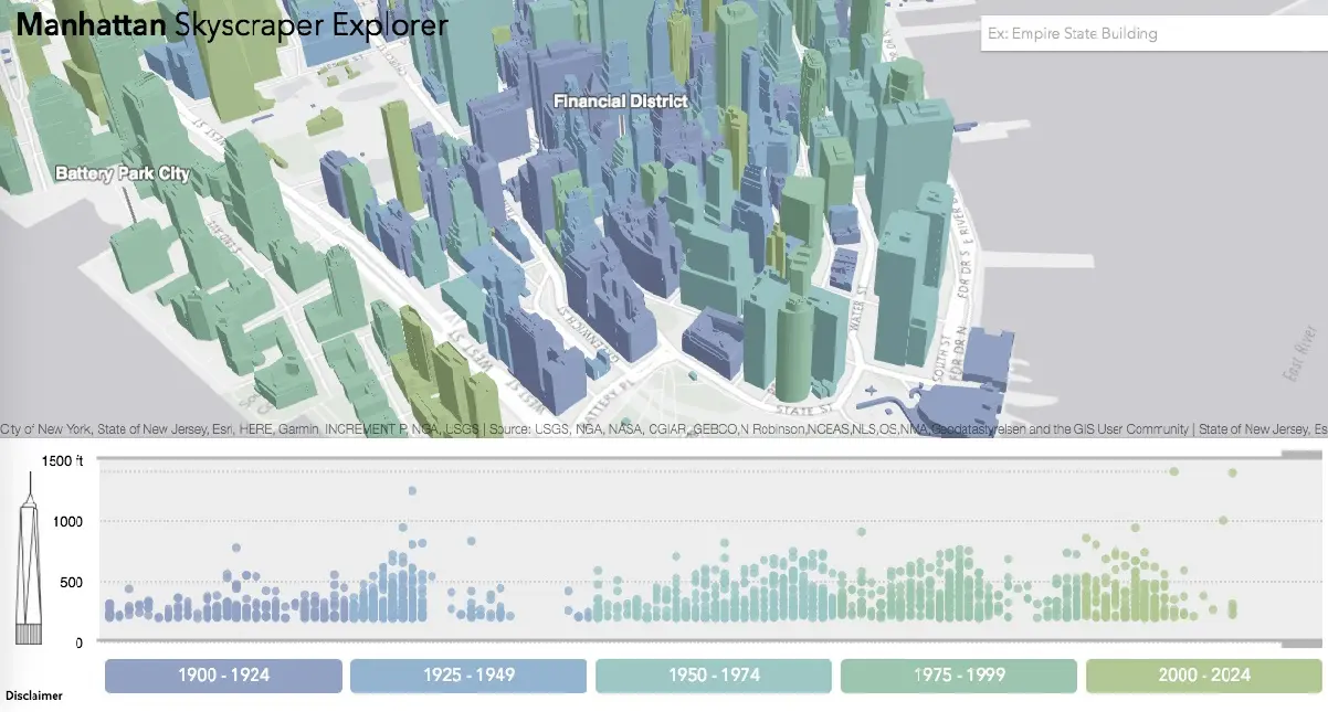
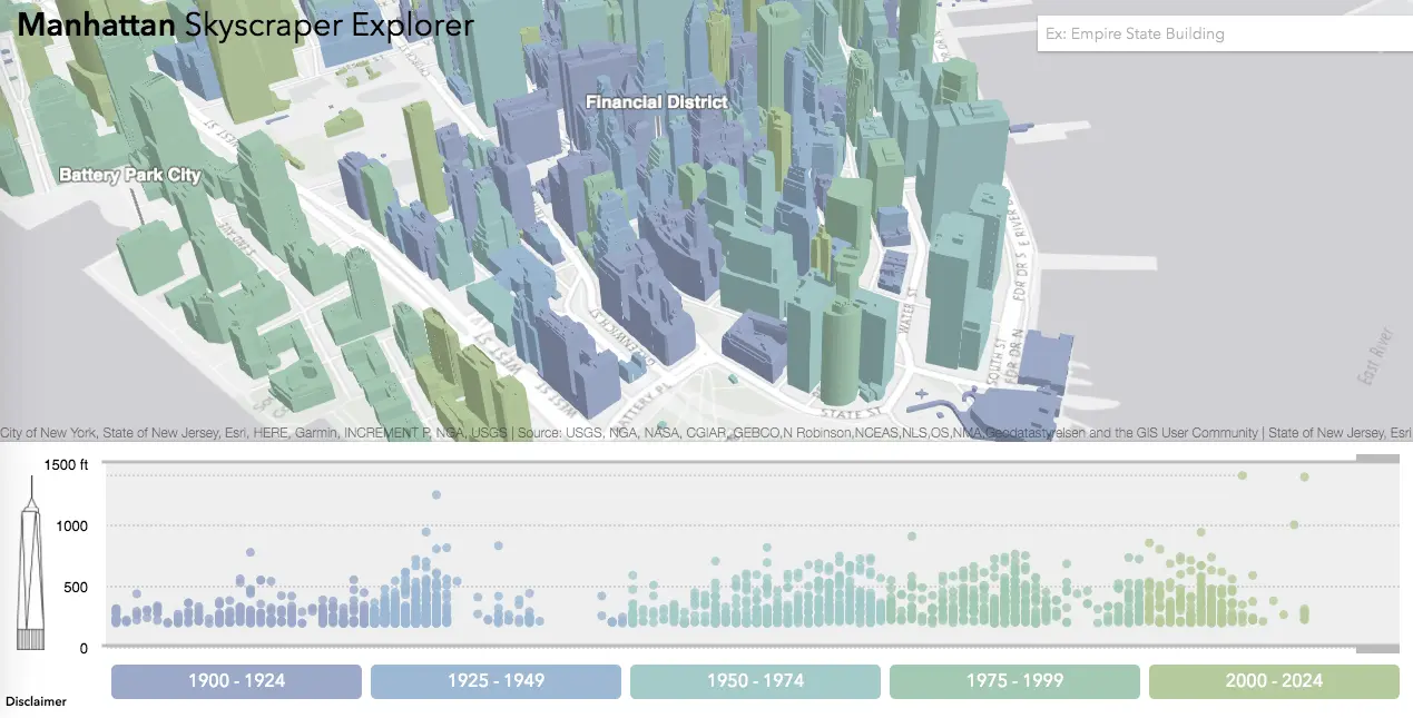
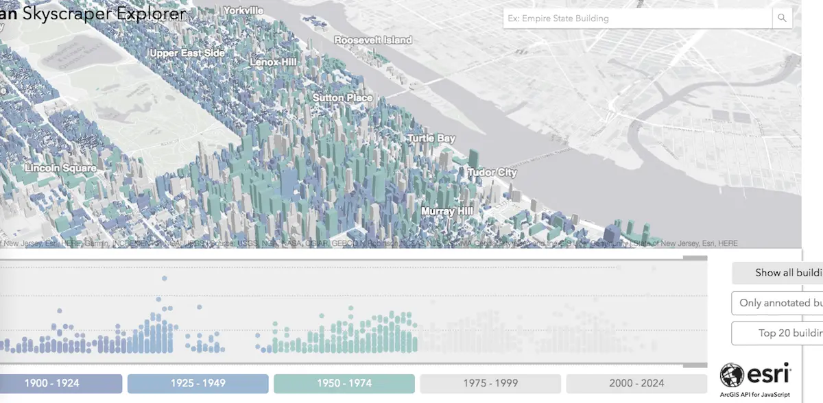
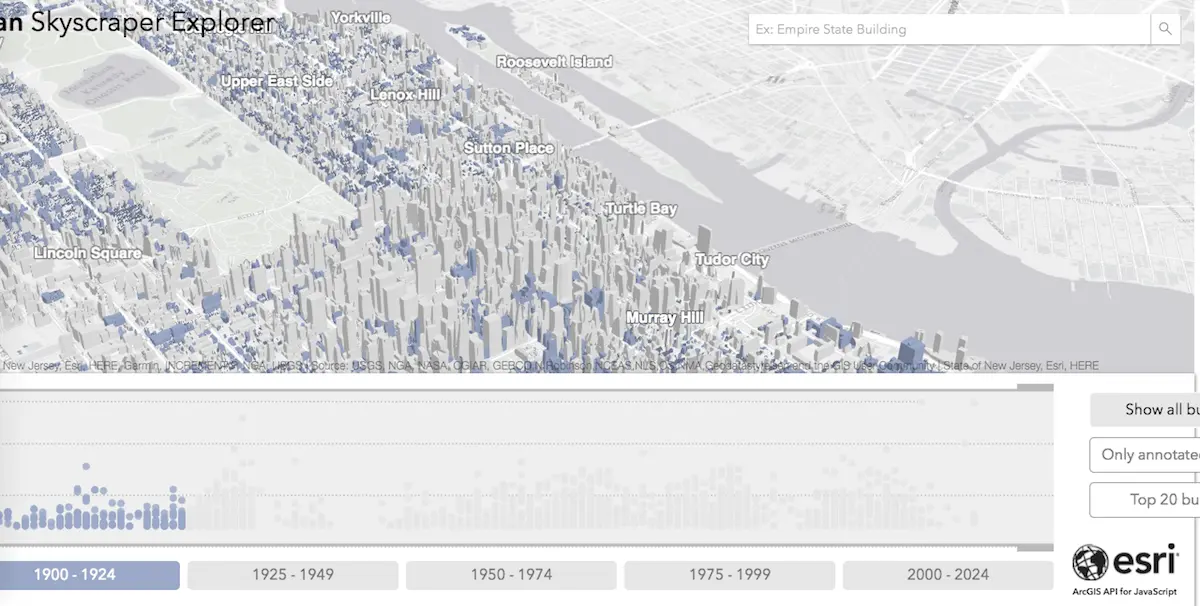
The Manhattan Skyscraper Explorer is your building-by-building skyline map

Tall buildings—from supertalls to garden-variety skyscrapers—seem to grow like weeds in New York City: A recent boom in tall Midtown residential towers has ushered in a new focus on life in the clouds. And we’re always comparing ourselves to other vertical cities. We also know there have been growth cycles and slower periods when it comes to the city’s skyscrapers. Now we can survey the landscape of Manhattan’s tallest buildings all at once thanks to the mapping wizards at Esri (via Maps Mania). The Manhattan Skyscraper Explorer reveals each of the city’s tall towers, showing its height, when it was built, what it’s used for and more.
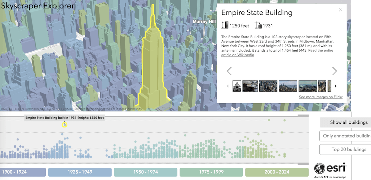
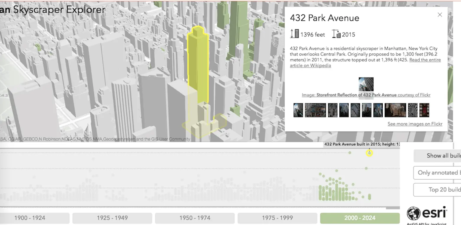
The 3-D map is accompanied by a timeline/height chart that lets you check out the city’s tall towers according to year of construction and building height.
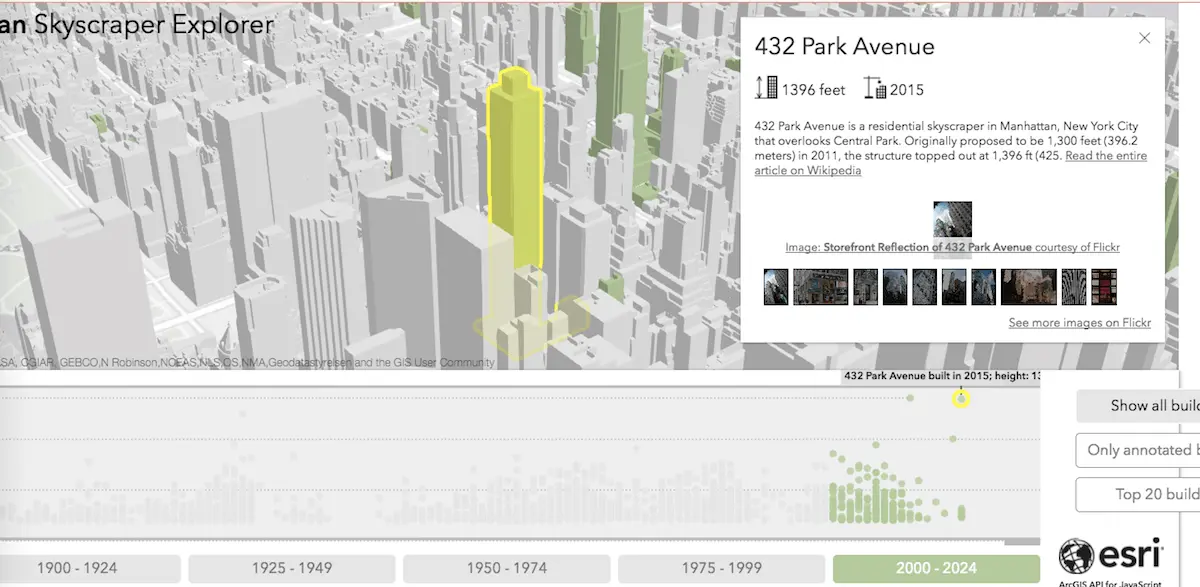
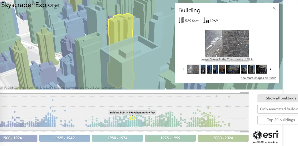
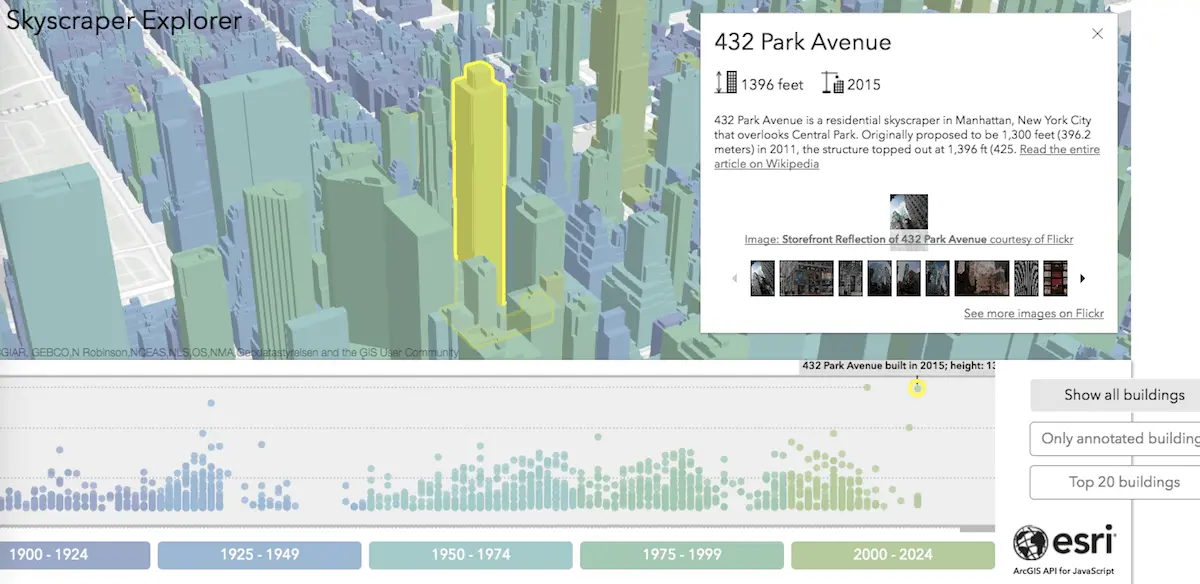
When you click on a building, the map provides more information on the selected skyscraper: its height, for example, and the year it was built. Also revealed is an image gallery pulled from around the web; in many cases you can click through and find out more on Wikipedia.
(scroll map to view info)
You can also select, for example, just skyscrapers that rose between 1900 and 1924, all the tall buildings that went up before 1975, or just the ones that have been–or will be–added to the cityscape between 2000-2024.
[Via Manhattan Skyscraper Explorer]
RELATED: