See NYC’s sweeping master plan that promises climate resilience for Lower Manhattan

Image credit: NYCEDC
New York City has taken an important step toward protecting one of the country’s largest central business districts from the costly and destructive effects of climate change. The city’s Economic Development Corporation and the Mayor’s Office of Climate Resiliency recently released the Financial District and Seaport Climate Resilience Master Plan. At a projected cost of up to $7 billion, this environmental blueprint for the Lower Manhattan shoreline imagines a resilient waterfront that can withstand severe storms and rising sea levels.
Subways, PATH transit systems, and regional highways all cross paths here, bringing millions of visitors from around the world in addition to the almost one million people who work in, live in, or pass through the Financial District and South Street Seaport neighborhoods. Protecting these low-lying districts is one of the top imperatives in creating a resilient New York City coastline.


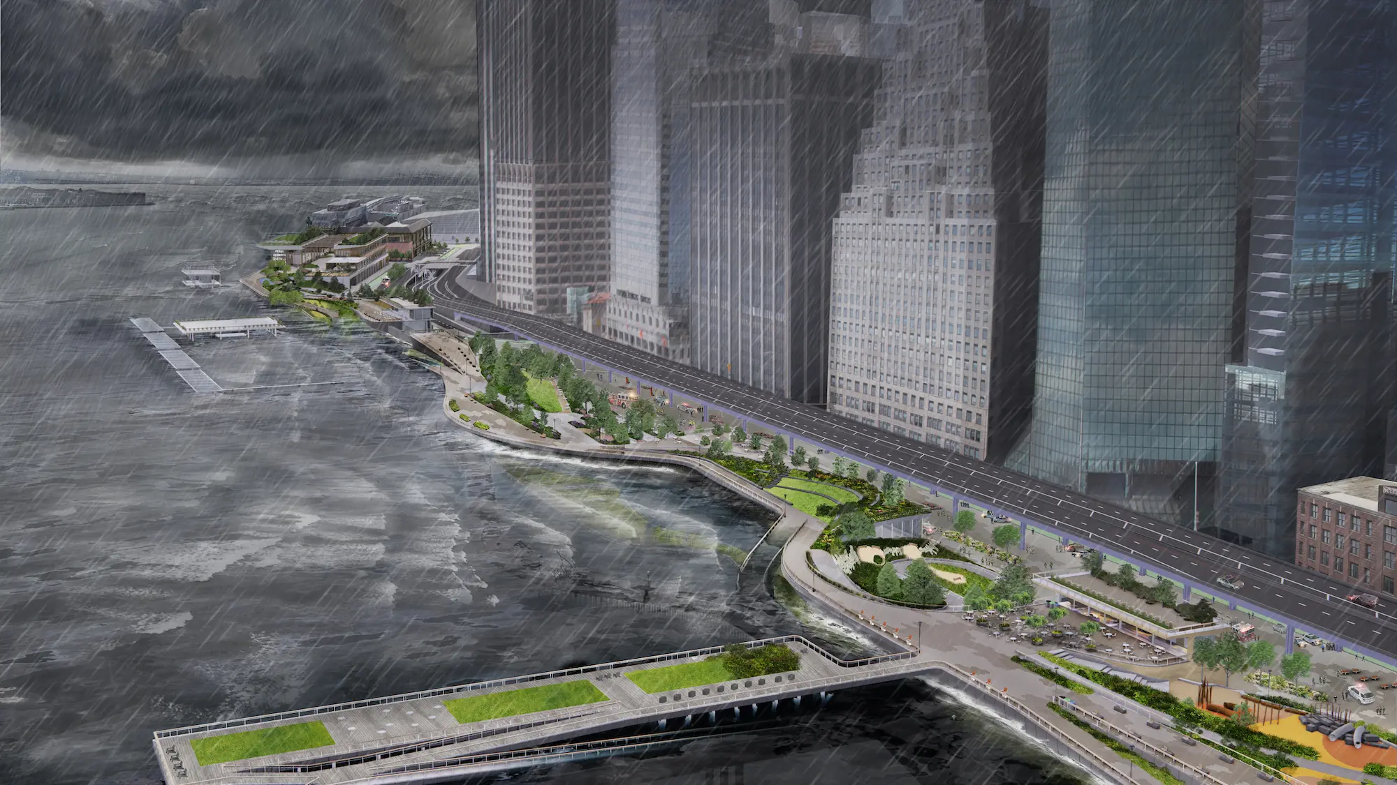
The imperatives are as urgent as they are crucial: According to projections, rising tides will flood the Financial District and Seaport monthly by the 2050s and daily by the 2080s, with some frequent tidal flooding expected as early as the 2040s. Up to $20 billion in estimated losses could be sustained by the region if no action is taken before 2100.


Mayor Bill de Blasio said in a statement that accompanied the plan’s release, which coincided with his final days as the city’s mayor: “This Plan for a protected and resilient waterfront in Lower Manhattan will help us fully confront the urgent and accelerating threat of climate change. A recovery for all of us must ensure families, businesses, and communities in Lower Manhattan are able to withstand extreme weather and rising sea levels, which this vision guarantees.”
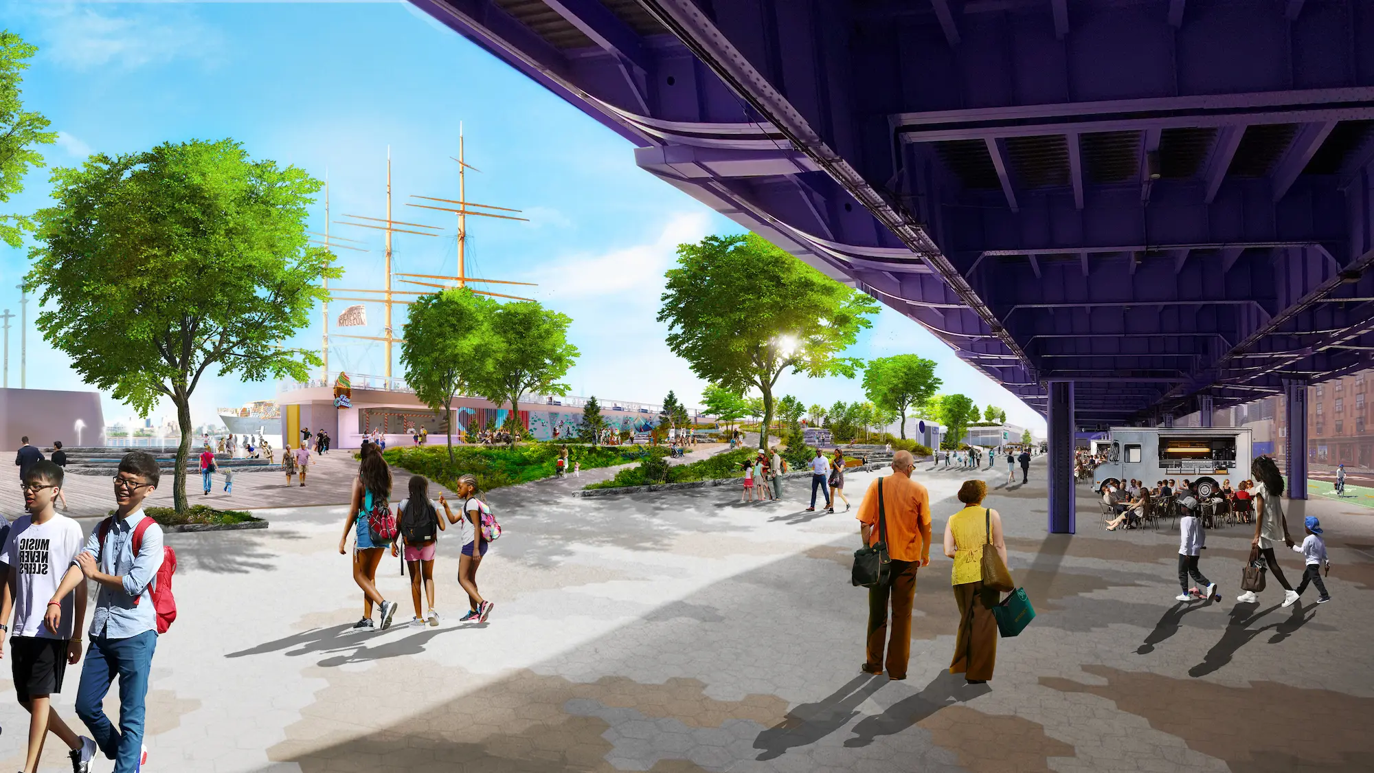
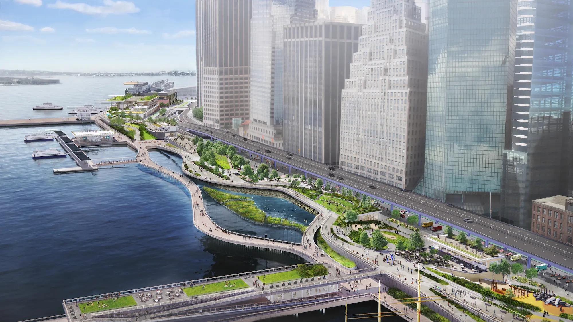
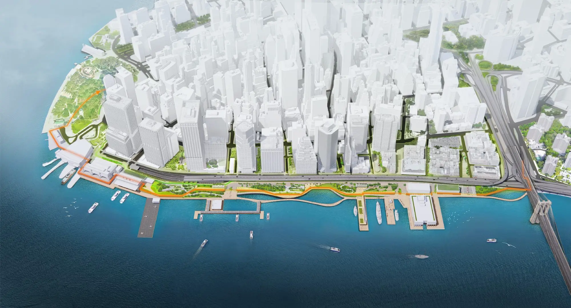
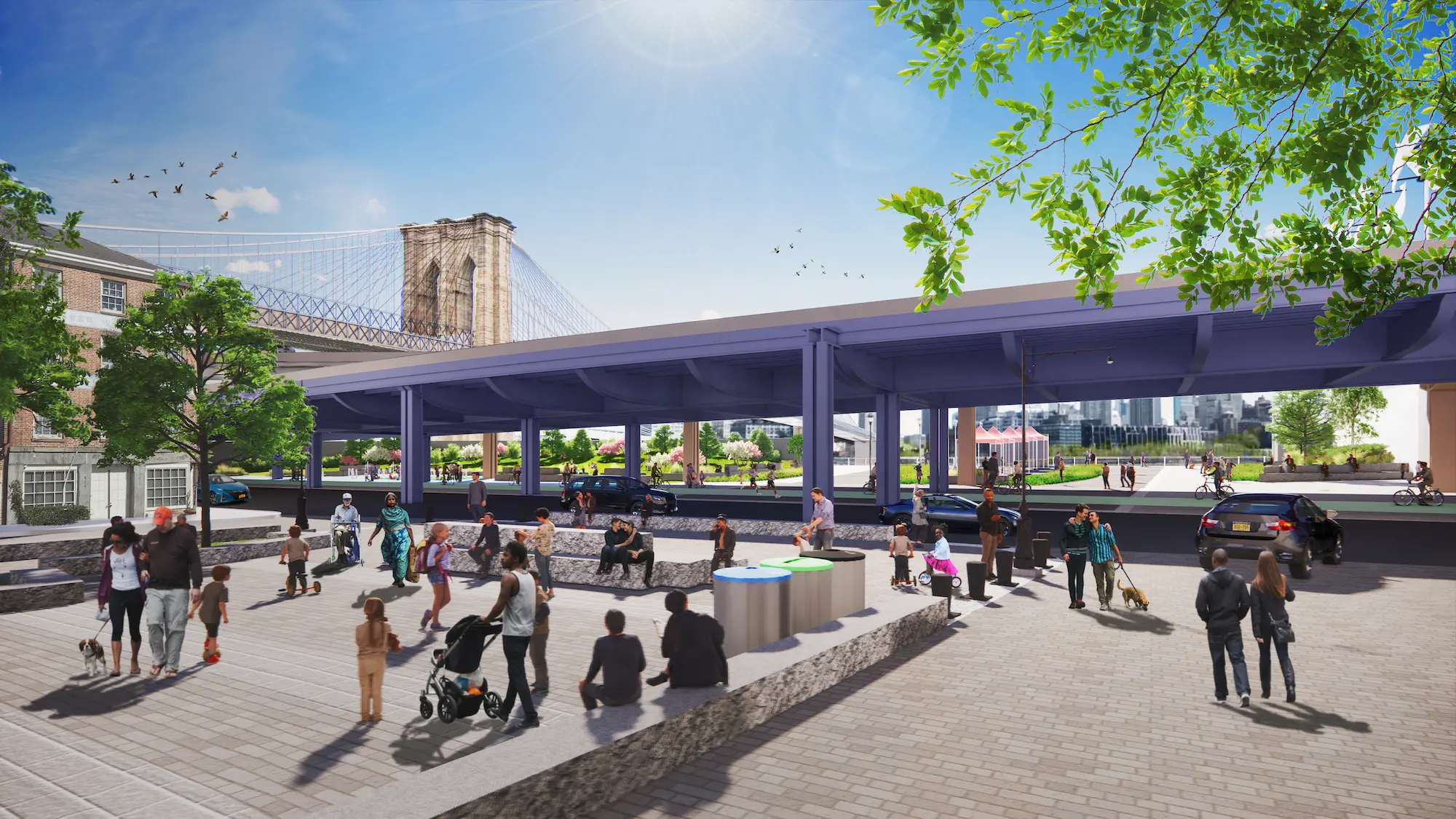
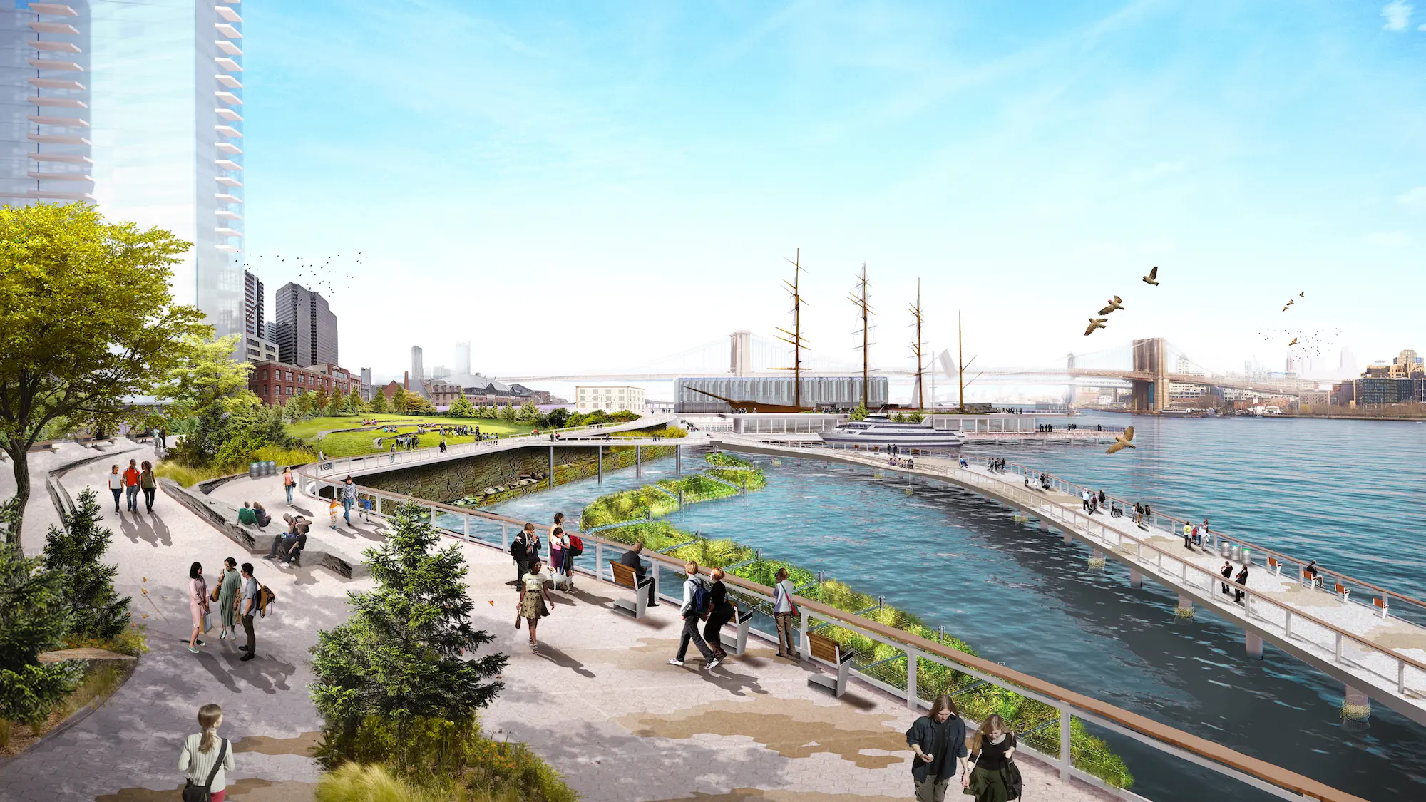
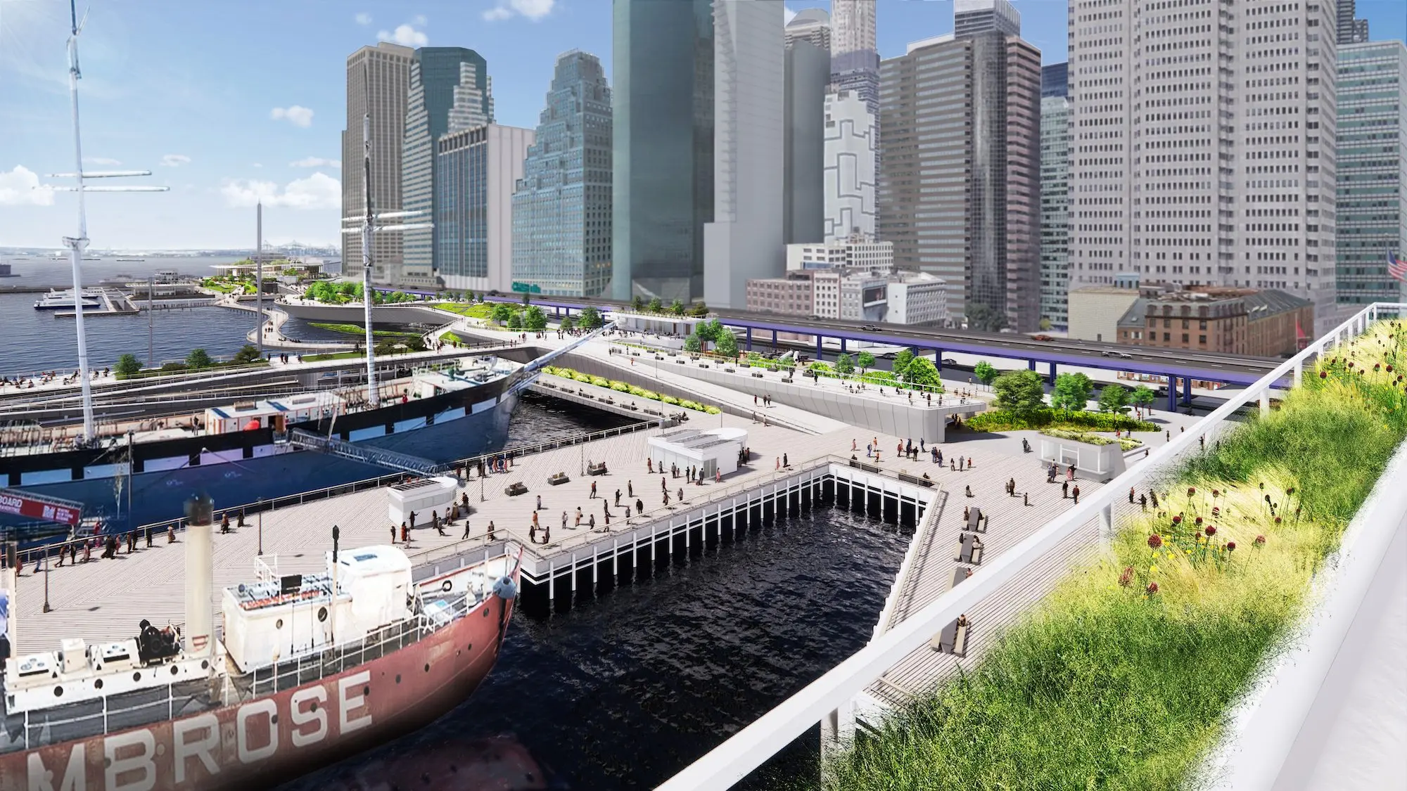
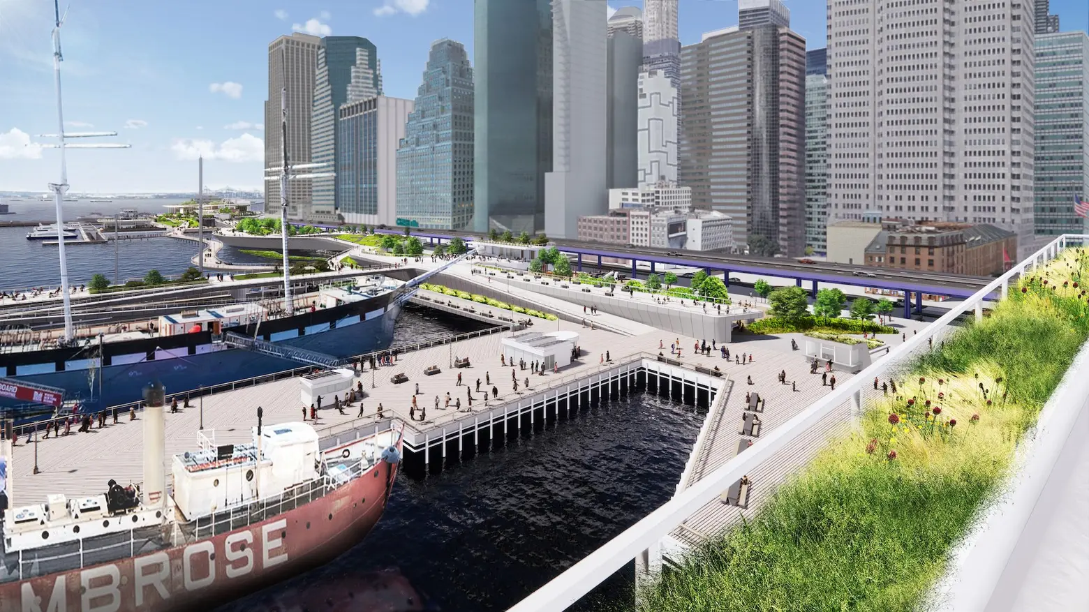
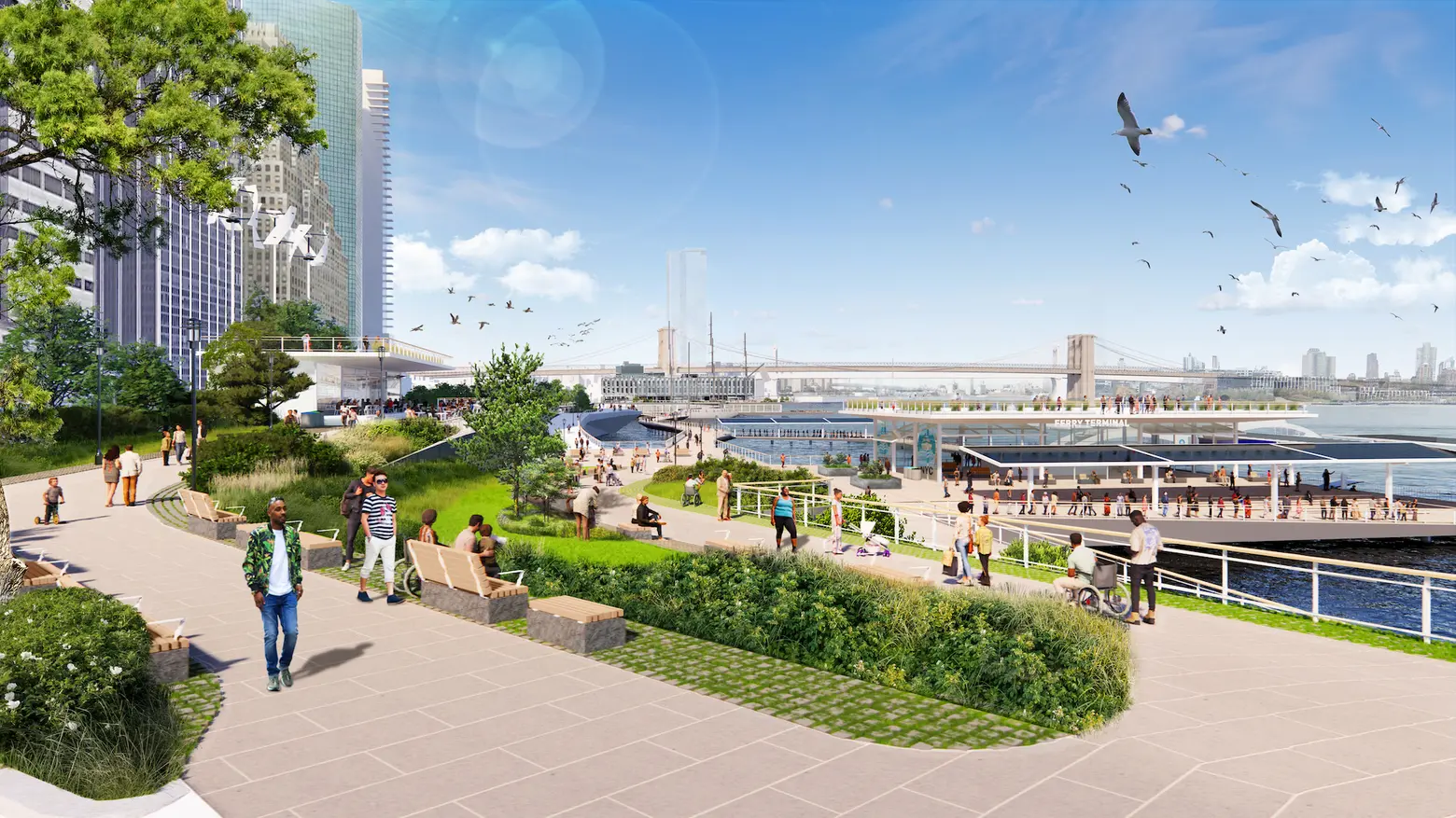
Protecting the area, which was upended by Hurricane Sandy in 2012, involves the creation of a multilevel waterfront that adds up to 200 feet of shoreline to the East River, with its upper level raised by 15 to 18 feet to protect against severe storms. These elevated spaces will do double duty as public open spaces with city and harbor views. On the lower level–raised three to five feet for protection against rising sea levels– a waterfront esplanade will provide an opportunity for New Yorkers to connect directly with the waterfront.

Notable features of the proposed plan, which covers about a mile of the waterfront from The Battery to the Brooklyn Bridge, include:
- Floodwalls buried in the landscape that create a line of ridges along this waterfront, permanently protecting Lower Manhattan from coastal storms and creating new open spaces with expansive views of the harbor
- Resilient stormwater infrastructure, including a new pump station along with green infrastructure
- Resilient ferry terminals for Staten Island, Governors Island, and NYC Ferries, among other operators
- Universally accessible entrances and pathways, designed to ensure people of all ages and abilities can get to and move around the waterfront
- New public open spaces with playgrounds, plazas, lawns, seating, and cafes
- Coves that promote habitat restoration and provide opportunities to learn about the ecology of the East River
- Resilient piers for docking historic ships, bolstering the historic character of South Street Seaport
The city and the community have worked closely together on developing the plan, gathering feedback through public meetings and workshops, an online engagement portal, and the involvement of local schools. The Climate Coalition for Lower Manhattan, a group of local and citywide stakeholders, was formed to promote community involvement.
What’s next for the plan? The design and engineering work required to apply for federal funding and state and federal permits will be moving forward this year; comprehensive flood protection could be in place by 2035. Mayor de Blasio announced $110 million in city funding for Seaport Coastal Resilience in October. That project has been designed to protect South Street Seaport from flooding in the time preceding the implementation of the master plan.
The master plan is part of the larger Lower Manhattan Coastal Resiliency (LMCR) strategy. Numerous city agencies have partnered with NYCEDC and MOCR on the plan, with technical and design support provided by consulting team led by the Dutch engineering firm Arcadis.
“NYCEDC and MOCR have envisioned a 21st-Century resilient waterfront that stands to be a model for other major cities,” Rachel Loeb, president of NYCEDC, said. “We’ve done years of work, and we have the innovation. There’s no doubt climate change is here. Sea levels are rising, and stronger, more devastating storms will only continue, which is why we must protect our coastline and safeguard our vulnerable historic Seaport area and Financial District.
“If we do not take action now residents, businesses, and critical infrastructure are put in jeopardy. We must rely on strong partnerships at all levels of government to help implement this plan.”
RELATED:
- De Blasio unveils $10B plan to flood-proof Lower Manhattan by extending shoreline into the East River
- Completed report announced following East Side Coastal Resiliency Project consultant review
- Study: New York City could get hit with a flood every five years instead of every 500
- In debate over $119B sea wall to protect NYC from superstorms, Trump says ‘get your mops’
Images: NYCEDC