10 NYC streets and parks that take you back in time
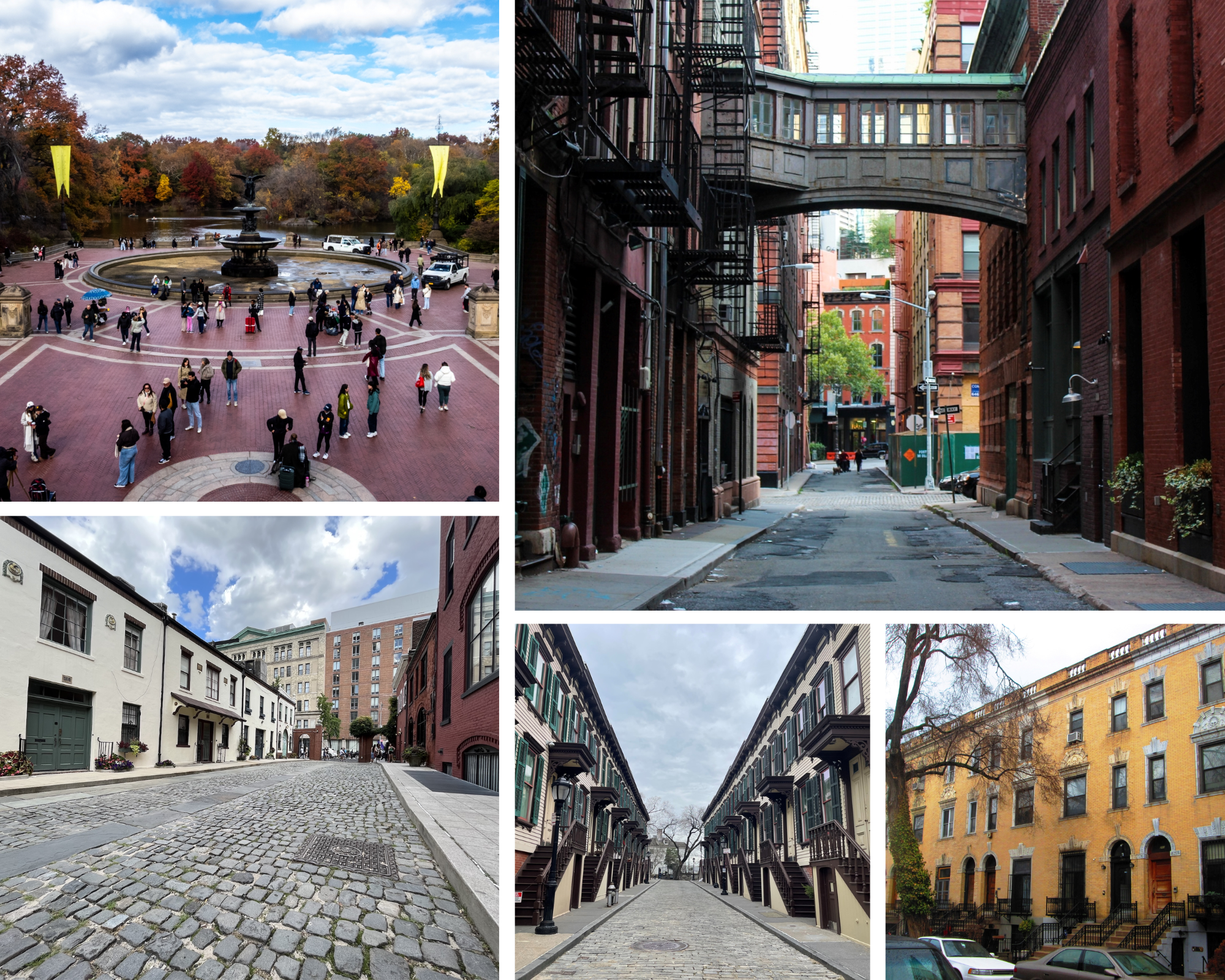
The streets of New York City are constantly evolving, as gleaming new residential towers and other buildings reshape the cityscape. Despite the constant waves of modernization, development, and the push for bigger and better, there are still many places across the five boroughs that evoke the city’s storied past. From Tribeca’s famed skybridge street to Central Park’s scenic Bethesda Terrace, these public spaces offer a glimpse of old-school New York.
Stone Street
Financial District
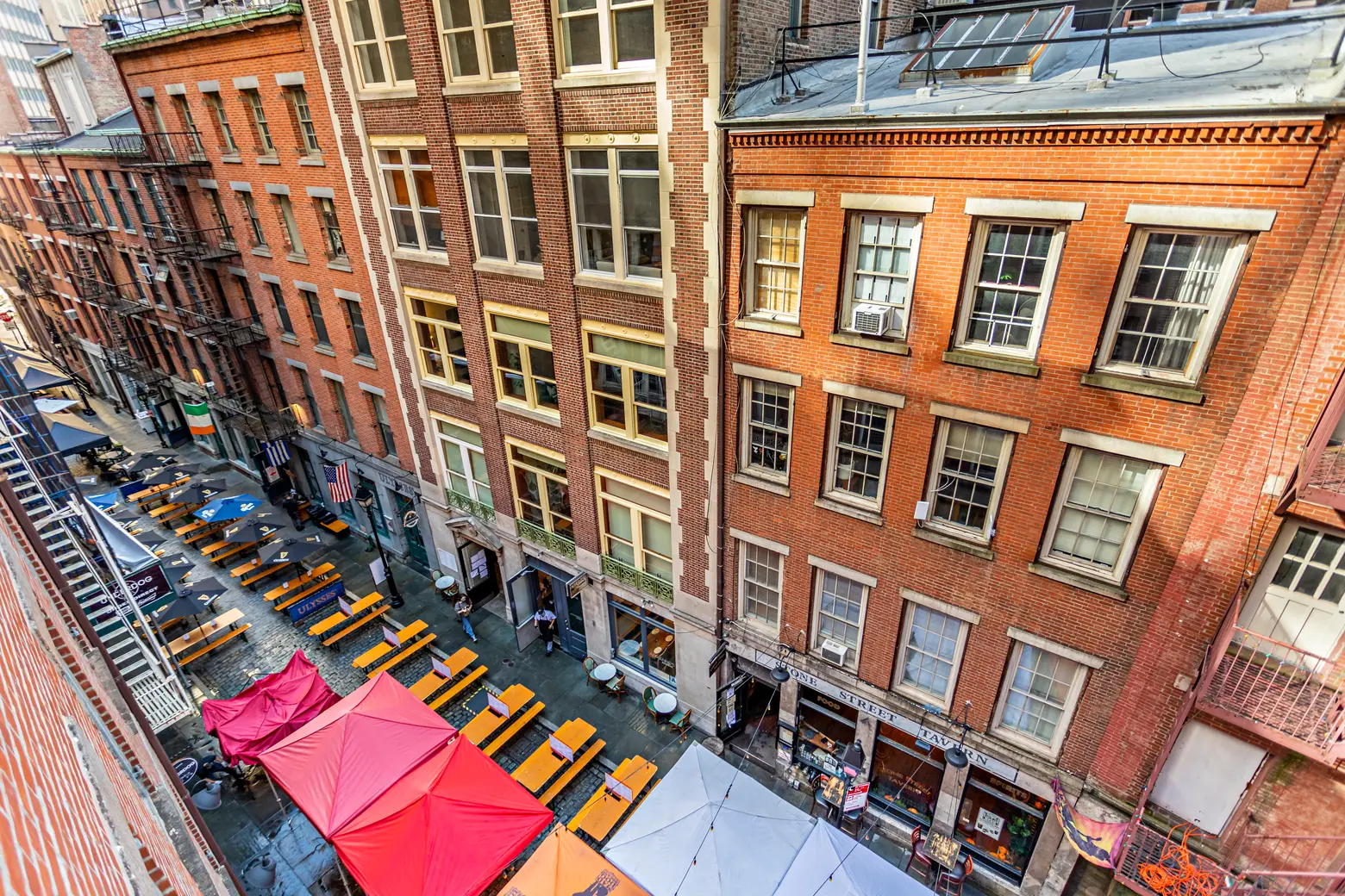
With a rich history stretching back to when NYC was known as New Amsterdam, the Financial District’s bumpy, aptly named Stone Street is one of the oldest corridors in the five boroughs. The street is composed of two original colonial roads: Breuers Straet (Brewers Street), named for the local breweries, and Hoogh Straet (High Street), which ran from Broad Street to Hanover Square. In 1658, Stone Street became the first cobbled street in New Amsterdam, according to the Stone Street Historic District.
After the British took over the city in 1664 and renamed it New York, Breuers Straet was renamed Stony Street, while Hoogh Straet was translated into English. By the late 1600s, Stone Street had become known as the “English Quarters,” as British merchants moved into the area. In 1693, merchant William Bradford established New York’s first printing press on the street, at the site now occupied by the popular pub Beckett’s.
By the 1800s, as Lower Manhattan expanded into the water through landfilling, Stone Street became increasingly commercial. As retail activity grew along the corridor, the Common Council approved petitions in 1811 to widen Stone Street by about four feet.
After the Great Fire of New York tore through much of Lower Manhattan in 1835, destroying nearly 700 buildings south of Wall Street, New Yorkers began rebuilding the neighborhood. Most of the buildings currently standing on Stone Street were constructed in the decades following the fire, during the late 1800s and early 1900s.
In 1979, during construction of 85 Broad Street, archaeologists excavated the site and unearthed a wide variety of artifacts and historic remains. Among their discoveries were the remains of a tavern built by English Gov. Francis Lovelace in 1670 to replace NYC’s first City Hall, according to Untapped Cities. The tavern’s remains are now visible through glass inside the Goldman Sachs building.
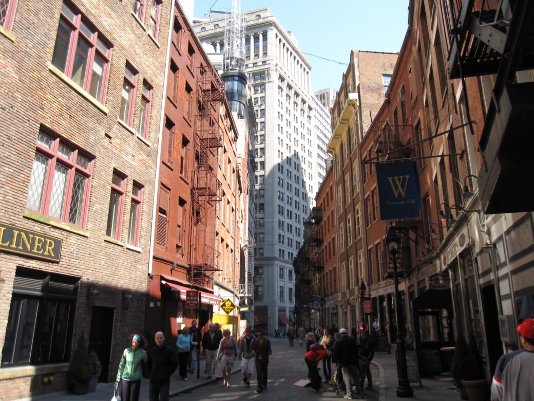
By the 1990s, centuries of wear and deterioration had led the city to pave Stone Street with asphalt. Following the designation of the Stone Street Historic District in 1996 by the Landmarks Preservation Commission, several city agencies and the Downtown Alliance contributed $1.8 million toward restoring the historic street. Completed in 2000, the project installed 23,000 Belgian-block cobblestones.
According to the LPC designation report, the Stone Street Historic District has a number of important qualities deserving of recognition. Many of the 19th-century buildings constructed after the Great Fire still stand, and the district is one of only three enclaves in Manhattan where Greek Revival-style store and loft buildings remain.
This historic character is further reinforced by the street’s signature curved layout, which remains largely unchanged from when the Dutch first laid out the roads in the 1640s.
Following its restoration, Stone Street has become one of the liveliest corridors in the Financial District, known for its nightlife and restaurants. The street is now pedestrian-only, helping transform it into a welcoming and bustling social hub. Several times a year, businesses along the corridor band together to host street-wide festivals, including celebrations for St. Patrick’s Day, Oktoberfest, and more.
Sylvan Terrace
Washington Heights
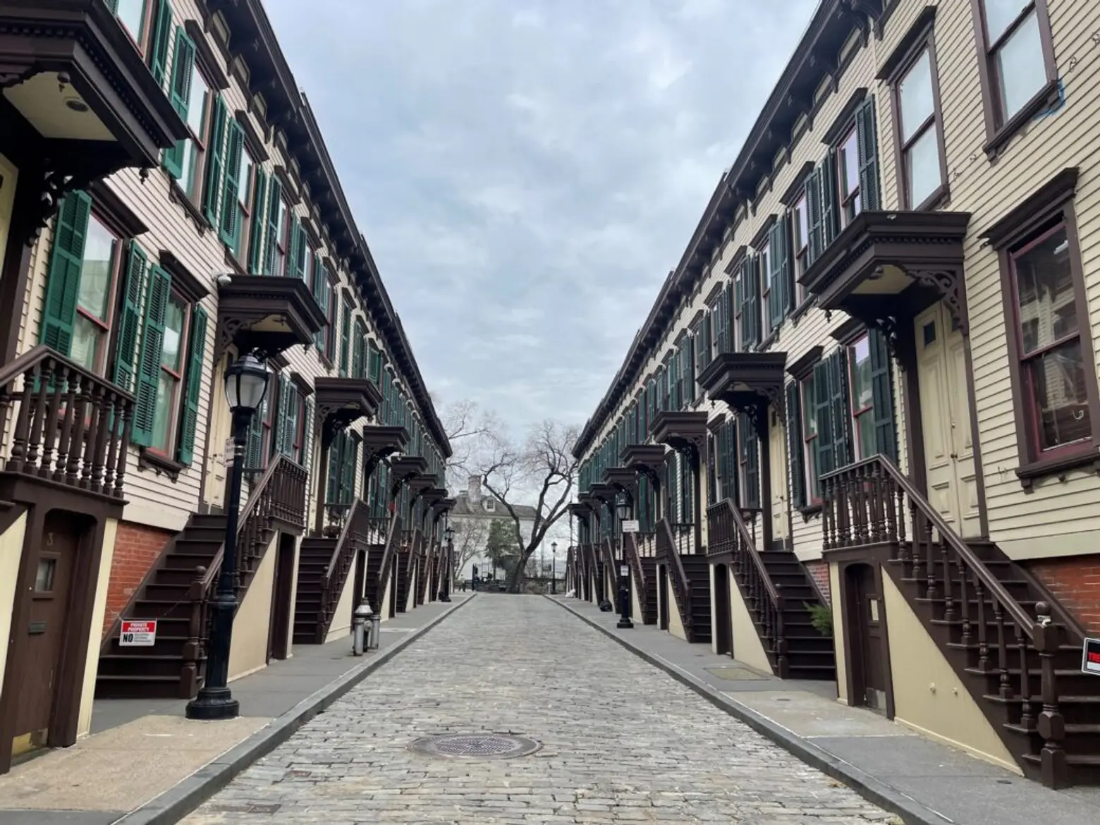
A walk down Washington Heights’ cobblestoned Sylvan Terrace is like taking a stroll back in time. The block is one of the few places in the five boroughs where you can find wooden homes, and even rarer, they are all on the same street.
Originally created as the carriage drive for the adjacent Morris-Jumel Mansion, Sylvan Terrace was lined with 20 wooden rowhouses built in the 1880s to provide housing for working-class residents, not servants of the mansion, a common misconception, according to Untapped Cities. Looking east down the street, the picturesque mansion is framed by the yellow houses and their ornate brown details.
Designed by architect Gilbert Robinson Jr. for developer James E. Ray, the homes marked one of the area’s first residential developments. At the time, Washington Heights was primarily farmland, located far from downtown Manhattan. As residents moved into the homes, more residential buildings began to sprout up on surrounding streets, with the wooden houses joined by brick homes in the Queen Anne and Romanesque Revival styles, as well as early 20th-century apartment buildings.
Over the years, evolving architectural trends led to changes on the street. Many of the homes’ original details and doors were lost, while their wooden clapboard facades were replaced with faux brick, stucco, or aluminum siding. Still, the Jumel Terrace Historic District, which includes Sylvan Terrace, was designated in 1970.
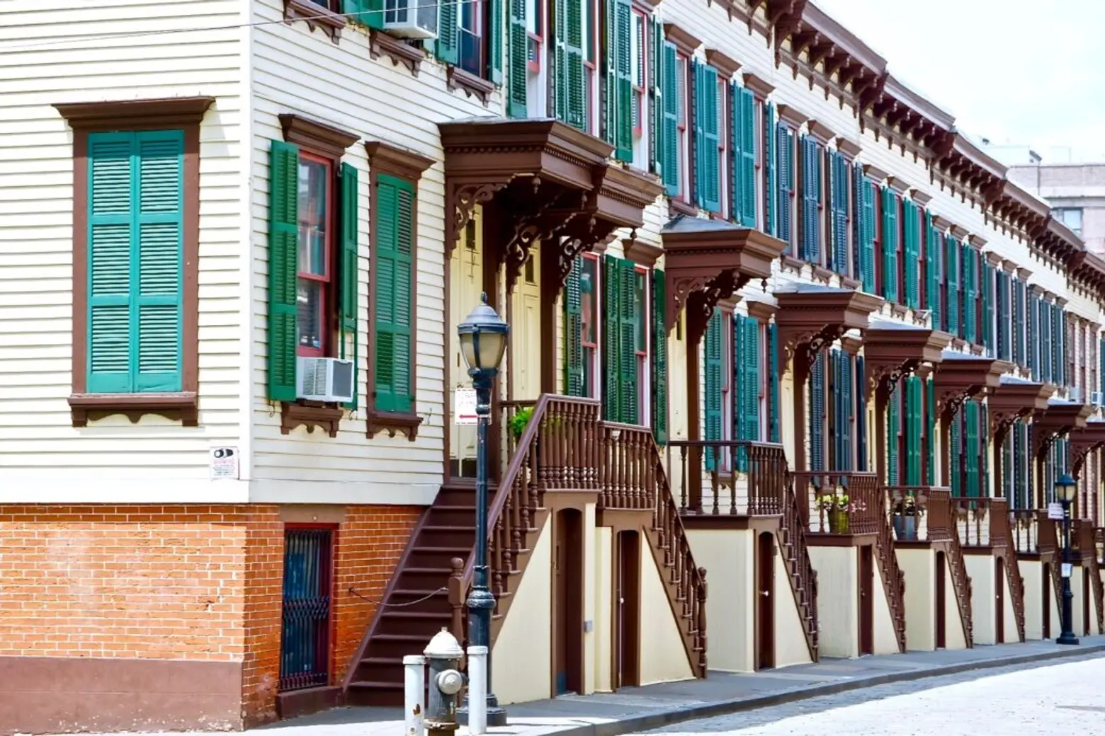
Following the designation, a comprehensive facade restoration project backed by federal funds was completed in 1981, restoring the street’s uniform appearance and bringing back decorative cornices, canopies, and wooden shutters based on historic photographs.
Today, Sylvan Terrace remains one of the most photographed streets in Manhattan. Its unique appearance makes it a popular location for movies and TV shows, and it was featured in the first season of Boardwalk Empire.
Rare opportunities to own one of the street’s coveted homes have arisen over the years. In 2021, No. 8 on the block hit the market for $1.795 million.
Washington Mews
Greenwich Village
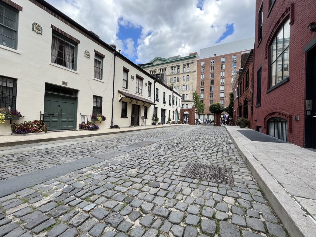
Offering a glimpse into the early days of Greenwich Village, quaint Washington Mews stands a half-block north of Washington Square between Fifth Avenue and University Place. Retaining much of its historic character, the street is lined with ivy- and wisteria-covered homes, while its weathered cobblestones and historic blue street signs add to its old-world charm.
Its history dates to the end of the 18th century, when the surrounding area was little more than a cemetery. As New York’s population and wealth grew in the following decades, affluent residents began moving northward, spurring new residential development across Manhattan.
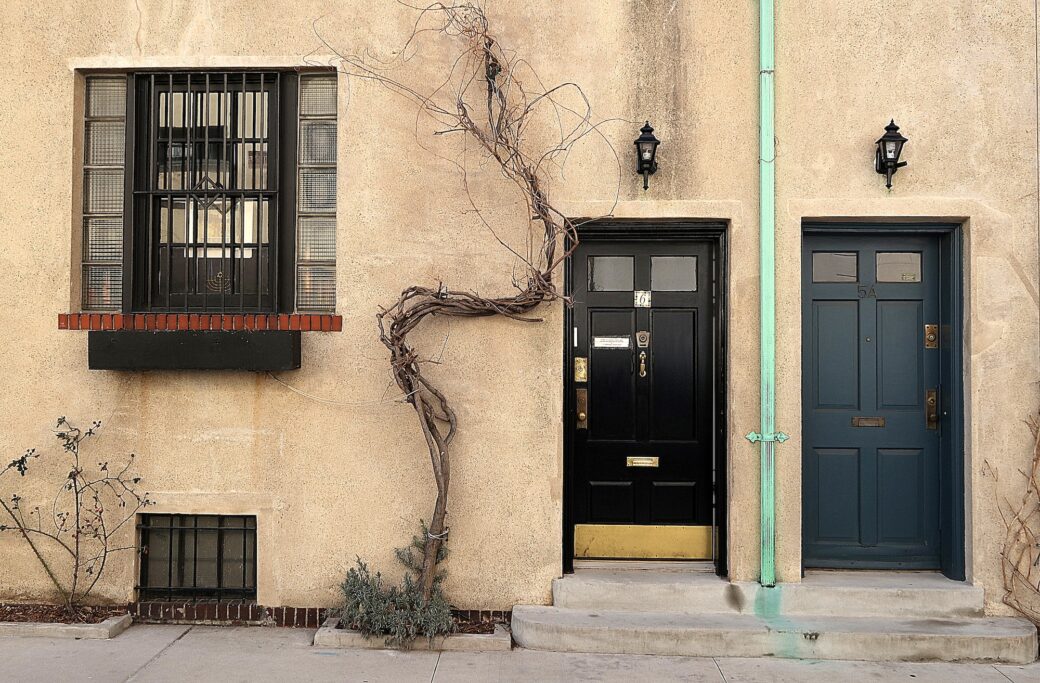
In the early 19th century, wealthy sea captain Robert Richard Randall purchased a large tract of land along the northern edge of Washington Square Park. Upon his death, Randall left the land to Sailors’ Snug Harbor, a retirement home for sailors. The property was later developed with a row of elegant Greek Revival townhouses on Washington Mews, each featuring a garden and two-story stables, according to Second Story.
In 1881, the city’s Department of Public Works constructed gates at each end of the Mews in order to distinguish the block from public streets.
In 1916, Sailors’ Snug Harbor had 12 of the two-story stables remodeled into artist studios by the architectural firm Maynicke & Franke. During the 20th century, the street became home to a wide variety of influential figures, including Gertrude Vanderbilt Whitney, founder of the Whitney Museum, as well as sculptors Paul Manship and Gaston Lachaise, as reported by Pops Spot NYC.
Ten new two-story homes were built on the south side of the street in 1939 in the style of the existing buildings.
During the 1950s, New York University leased most of the Mews and began converting the buildings into offices and faculty housing. In 1988, the university tapped architect Abraham Bloch to design a new six-foot-tall gate on Fifth Avenue, replacing the previous post-and-chain gate.
Though technically private property, the gates on Fifth Avenue and University Place are usually unlocked during the day, allowing visitors to venture down the street.
Doyers Street
Chinatown
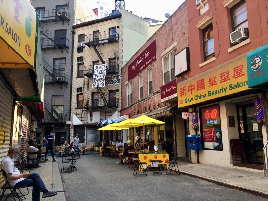
While droves of tourists flock to Chinatown’s Doyers Street to take photos of the vibrant, distinctive block, you wouldn’t guess that the L-shaped corridor has a dark past. Named after 18th-century Dutch immigrant Hendrik Doyers, who owned property on the block where Doyers Street meets the Bowery, the 200-foot-long thoroughfare is one of Chinatown’s most recognizable streets.
It was home to New York City’s first Chinese-language theater from 1893 to 1911, and in the early 1900s, it became known as the “Bloody Angle.” Warring gangs would hide behind the street’s sharp bend to stage surprise attacks on enemies as they rounded the corner. One particularly gruesome battle took place in 1905, when members of the Hip Sing Tong gang targeted On Leong Tong members watching an opera at the theater.
In the middle of the show, a Hip Sing Tong member threw lit firecrackers onto the stage while four gunmen opened fire on the crowd of 400 people, killing four On Leong Tong members and two civilians, according to the Museum of Chinese in America.
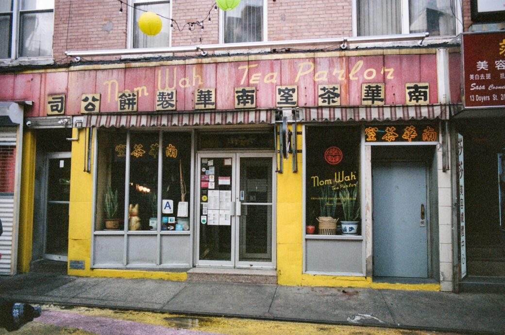
However, the violence that once plagued the street is long gone. Today, Doyers Street is a pedestrian-only corridor and one of Chinatown’s most frequented attractions. It is home to a variety of restaurants and businesses, including the historic Nom Wah Tea Parlor, Chinatown’s oldest continuously operating restaurant.
Orchard Street
Lower East Side
There’s a reason why the Lower East Side’s Orchard Street was named one of the world’s coolest streets by Time Out in 2015. The historic eight-block stretch, which runs from Division Street to East Houston Street, has deep roots tied to immigrants who arrived in the five boroughs in the late 19th and early 20th centuries and transformed the corridor into a vibrant, diverse thoroughfare lined with retailers, pushcart vendors, and the tenement buildings where many of them lived.
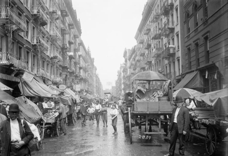
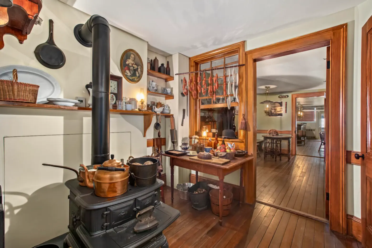
The lives of these immigrants, who came to the city seeking a better life for themselves and their families, are documented at the nearby Tenement Museum at 97 Orchard Street. The museum preserves the stories of more than 7,000 immigrants, remembering their resilience and hard work while highlighting Orchard Street’s roots.
Over the decades, the street’s immigrant character has faded, though many traces of its history remain. While its diverse demographics are less apparent today, the street retains aspects of its original identity. Today, it is packed with unique shops, boutiques, restaurants, and bars, making it one of the city’s most frequented retail corridors.
Staple Street
Tribeca
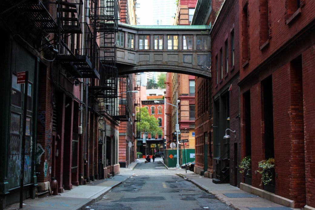
Though one of the city’s smallest streets, Tribeca’s famed Staple Street is known far and wide for its signature skybridge, a cast-iron passageway suspended above the alleyway. Once owned by New York Hospital, now known as NewYork-Presbyterian, the skybridge connected the third floors of two hospital facilities on opposite sides of the street, allowing staff to move patients between wards more easily, as 6sqft previously reported.
The origin of the tiny, two-block-long street’s name is shrouded in mystery. Some sources suggest it refers to the unloading of goods, “or staples,” to the many nearby markets on Manhattan’s Lower West Side beginning in the Dutch colonial era, according to Forgotten New York.
According to the Landmarks Preservation Commission’s designation report for Tribeca West, the street’s name, like many others in the area, may have come from an influential political figure, prominent resident, or someone associated with Trinity Church.
The report notes that a John J. Staples owned nearby property around 1800. Another possibility is that the name is a mispronunciation of “stable,” of which there were many in the area during the Colonial era.
While the hospital has long since left the site, the street’s quaint charm and distinctive skybridge have made Staple Street a popular tourist attraction, and it is one of the most photographed spots in Manhattan.
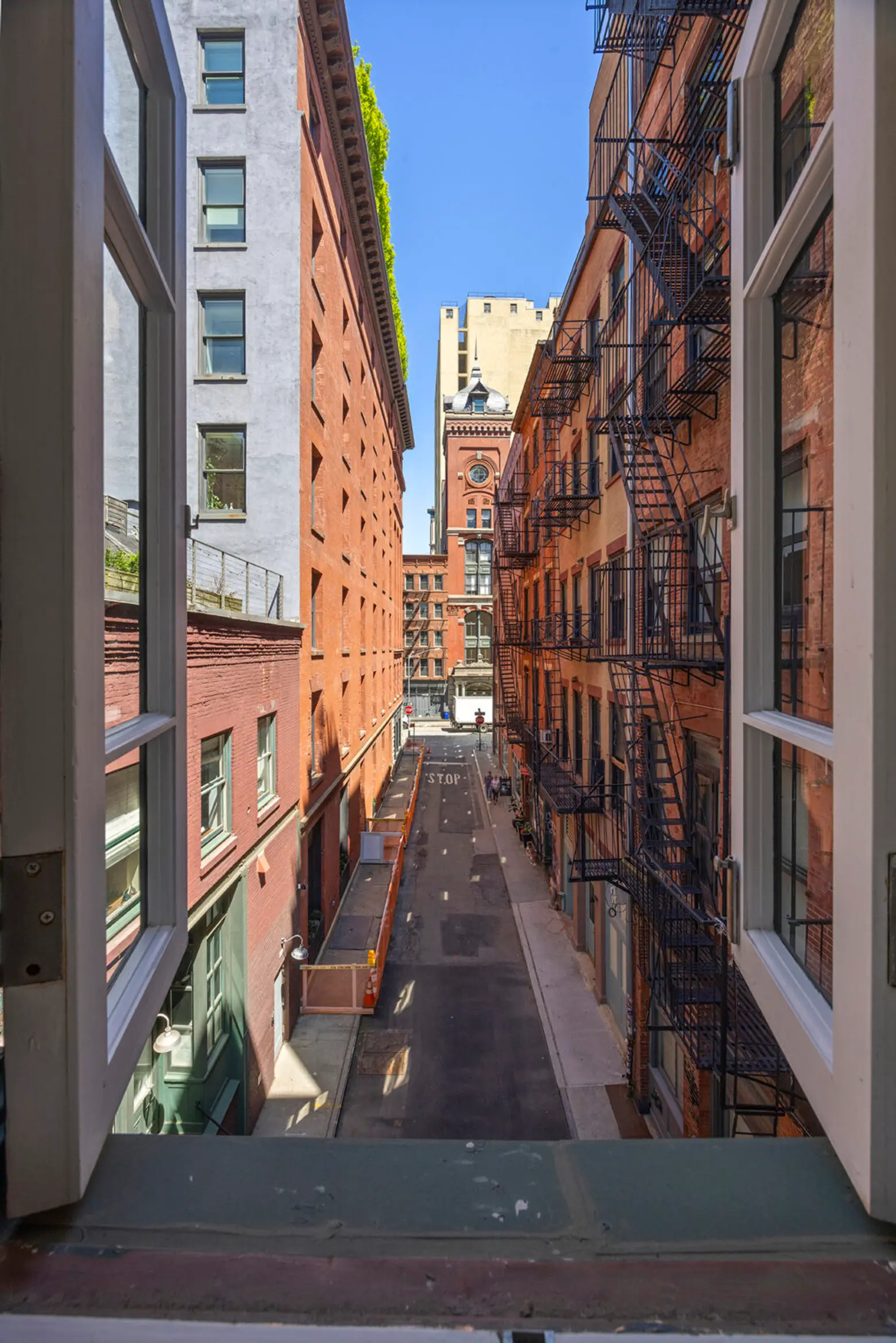
The two buildings have also gone up for sale several times over the years, offering one lucky and wealthy buyer the chance to look down on Staple Street from their own private skybridge.
Last November, the famed skybridge residence returned to the market for nearly $30 million after selling for $22 million in an off-market deal in August 2022. Earlier that month, another notable residence on the street, a two-building assemblage at 4 Staple Street and 1 Jay Street, also hit the market for roughly $30 million.
Strivers’ Row
Harlem
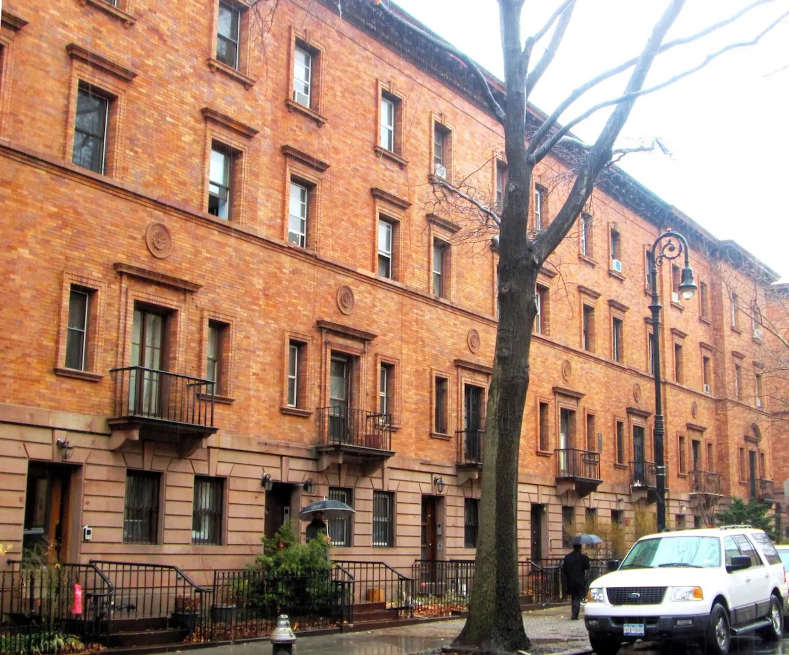
The storied history of Harlem’s Strivers’ Row begins in the 1890s, when developer David H. King, the same developer behind a previous version of Madison Square Garden, the Mills Building, and other city landmarks, constructed a series of townhouses called the “King Model Houses.” Initially intended for upper-to middle-class white residents, King hoped the project would create its own micro-neighborhood with modern amenities, according to Strivers’ Row website.
After King sold very few houses, the development failed, and the entity that financed the project foreclosed on nearly all of the units in 1895. Around this time, the neighborhood’s white population had begun leaving the area, but the company still refused to sell the vacant homes to Black New Yorkers. Many of the houses sat empty until 1919 and 1920, when they were finally made available to African Americans for $8,000 each.
The development soon attracted leaders of the Black community and “upwardly mobile” professionals, including doctors, lawyers, and artists, earning the street its name, “Strivers’ Row.” Notable residents included Vertner Tandy, the first commissioned African American architect in New York; preacher and Congressman Adam Clayton Powell Jr.; and actor and singer Bill “Bojangles” Robinson.
The street was also home to influential Black musicians, including W.C. Handy, considered the “father of the blues,” and his business partner Harry Pace, founder of the first Black record company, among many others, according to Untapped Cities.
Beyond its history, Strivers’ Row is also renowned for its distinctive architecture. The row was designated a historic district by the city’s Landmarks Preservation Commission in 1967 and listed on the National Register of Historic Places in 1975. Its buildings are divided into three distinct architectural styles.
On the south, even-numbered side of West 138th Street and at 2350-2354 Adam Clayton Powell Jr. Boulevard, the red brick and brownstone buildings were designed by architect James Brown Lord in the Georgian Revival style.
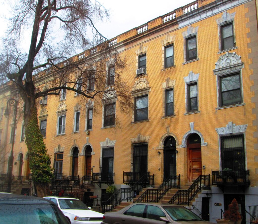
A series of yellow brick and white limestone buildings with terra cotta trim can be found on the north, odd-numbered side of West 138th Street, the south, even-numbered side of West 139th Street, and at 2360-2378 Adam Clayton Powell Jr. Boulevard. Designed by Bruce Price and Clarence S. Luce, the buildings feature the Colonial Revival style.
Lastly, a set of dark brick, brownstone, and terra cotta buildings can be found on the north, odd-numbered side of West 139th Street and at 2380 Adam Clayton Powell Jr. Boulevard. These buildings were designed by Stanford White of the renowned architectural firm McKim, Mead & White in the Italian Renaissance Revival style.
You can learn more about the rich history of Strivers’ Row and see its stunning architecture for yourself on one of the popular free walking tours offered online.
Bethesda Terrace
Central Park
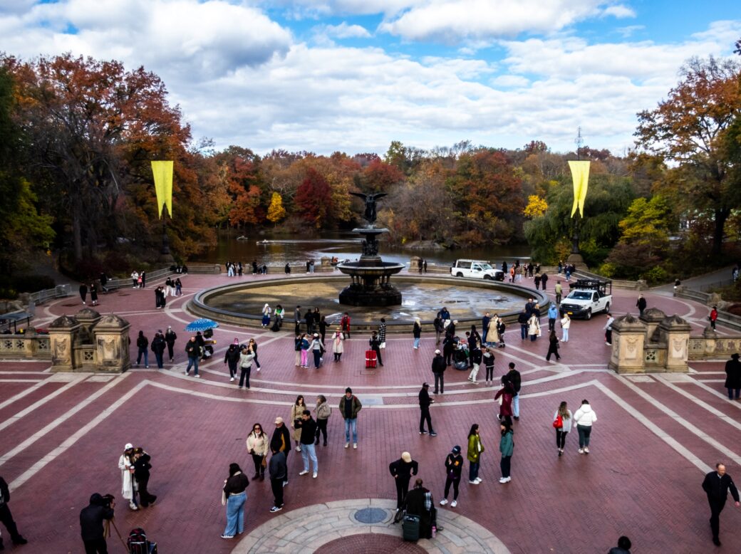
Of all the landmarks in NYC, Central Park is arguably the most famous and frequently visited. And within the sprawling park, Bethesda Terrace is perhaps its most recognizable feature. First proposed by Frederick Law Olmsted and Calvert Vaux in their 1858 plan for Central Park as an “open air hall of reception,” the two visionary architects envisioned the terrace as a sweeping promenade leading to a terrace overlooking the park’s scenic lake.
Rather than take away from the natural beauty of the green space, Vaux wanted the structure to be “subordinate to the landscape,” with “nature first, second, and third—architecture after a while,” according to NYC Parks.
One of the first structures built in the park, construction on the terrace began in 1859, just months after workers excavated and filled the lake. Building on the emphasis on the natural environment, Vaux commissioned architect Jacob Wrey Mould to create ornate carvings and decorative elements depicting the passage of day and night.
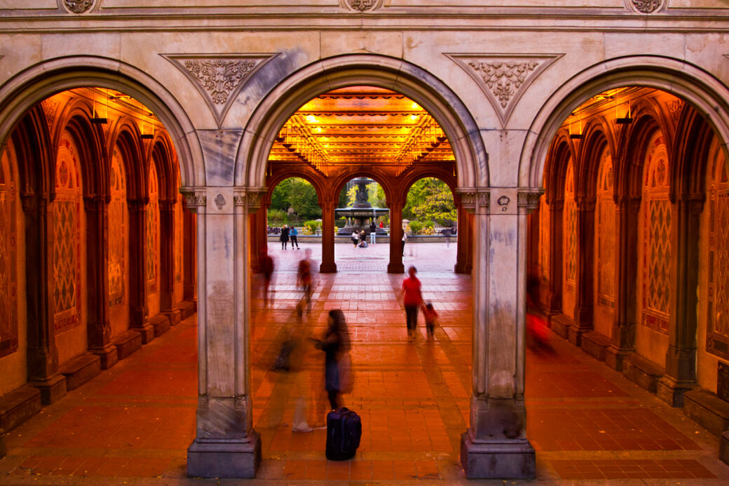
The area’s upper terrace offers views across the lake to the wooded Ramble, with 22-foot-tall ornamental poles framing the vista. Below, the terrace’s stunning tunnel features towering arched entryways and walls adorned with ornate carvings and moldings. A popular spot for buskers, the tunnel also offers an introduction to the lush, whimsical design that awaits visitors as they emerge onto the terrace.
The terrace is also home to “Angel of the Waters,” the only sculpture commissioned as part of Central Park’s original design, created by sculptor Emma Stebbins. The 26-foot-tall fountain spans 96 feet in diameter, making it one of the largest fountains in New York.
Bethesda Terrace, considered by many to be the architectural and social heart of Central Park, continues to serve as a gathering place for visitors to relax, take in the scenery, or simply sit in contemplation.
But visitors will have to wait until next summer to see the terrace’s fountain restored, as the Central Park Conservancy has begun a $37 million rehabilitation project. Expected to reopen in summer 2027, the revamped fountain will feature new plumbing and mechanical systems, waterproofing, replacement of historic cladding, and repairs to weather-related damage.
Inwood Hill Park
Inwood
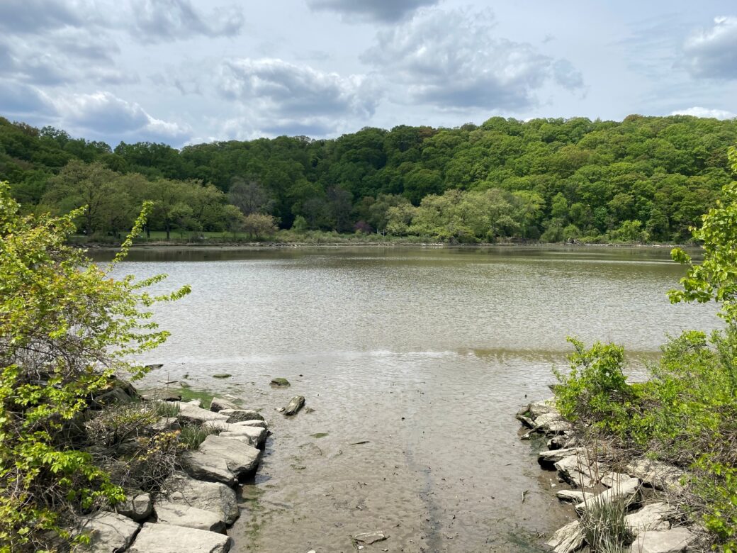
Inwood Hill Park’s history stretches back long before NYC, or even New Amsterdam, existed. Spanning 196 acres, the green space at the northern tip of Manhattan is believed to have been a site of human activity since prehistoric times.
Until the 17th century, the area was home to the Lenape, with evidence of a major encampment once located along the park’s eastern edge still visible today. Other evidence of their presence includes artifacts and the remains of old campfires found in Inwood’s rock shelters, suggesting that the shelters were used as temporary homes.
Before it became parkland in 1916, the area was known during the colonial and post-Revolutionary War periods as Cock Hill or Cox Hill. The name is thought to have been a variation of the Indigenous name for the area, “Shorakapok,” which could mean “the wading place,” “the edge of the river,” or “the place between the ridges,” according to NYC Parks.
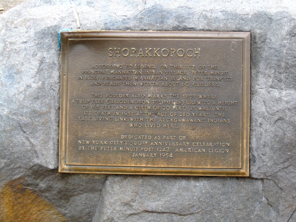
The park is also believed to be the site where Peter Minuit, director general of New Netherland, purchased the island of Manhattan from the Lenape in exchange for a shipment of goods. The transaction is said to have taken place beneath a tulip tree that survived at the site for centuries before dying in 1938. Today, the location is marked with a plaque, according to Untapped Cities.
European colonists settled in what is now Inwood Hill Park during the 17th and 18th centuries. During the Revolutionary War, American forces constructed a five-sided earthwork fort in the northwestern corner of the park. After the fort fell to British troops in November 1776, it remained under British control until the war’s end in 1783.
By the 1800s, much of the area was occupied by homes and philanthropic institutions, including a charity house for women and a free public library. The wealthy Straus family, which owned Macy’s, also maintained a country estate in Inwood, the foundation of which can still be seen in the park today.
When NYC Parks acquired the land in 1916, the area’s salt marsh was preserved and landscaped, while a portion was later filled in. The existing buildings were eventually demolished, leaving the area to become the park that visitors know today.
Today, NYC Parks’ Urban Park Rangers work with schoolchildren from across the five boroughs on projects aimed at improving and protecting the park’s health and appearance. A large team of volunteers also helps care for the park, ensuring that future generations of New Yorkers can continue to enjoy its beauty and rich history.
Historic Richmond Town
Staten Island
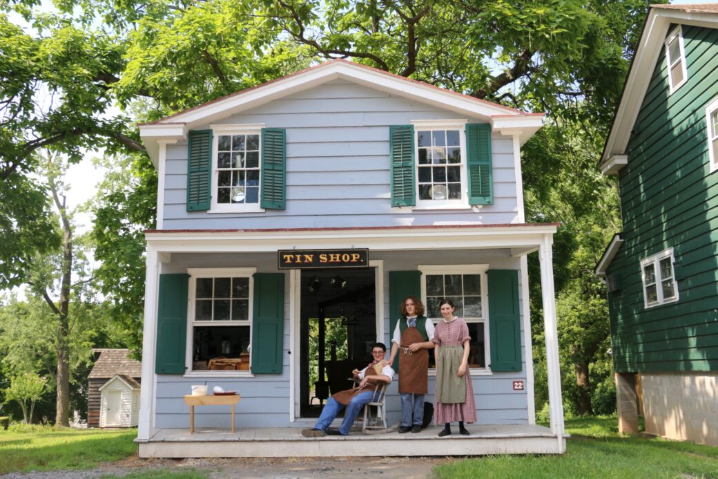
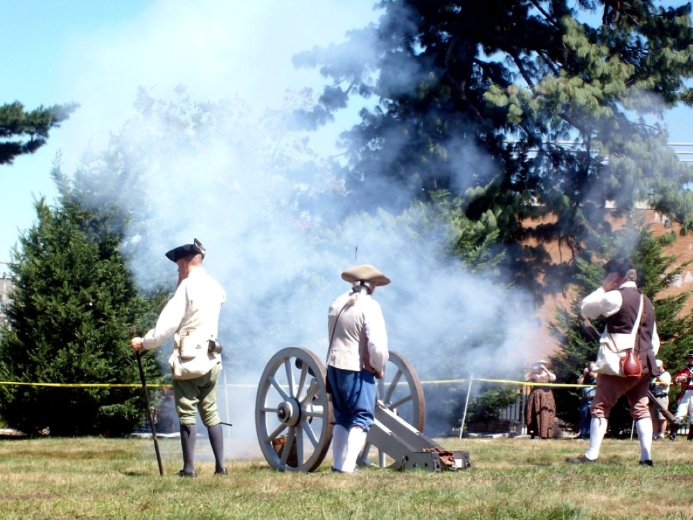
Historic Richmond Town, located in the center of Staten Island, was established as a living-history museum in the early 20th century and still closely resembles the thriving village that once stood there centuries ago. The town has been meticulously preserved, with its roughly 30 historic buildings appearing as if they were built yesterday. Today, the site offers visitors a glimpse into what life was like for the town’s inhabitants from colonial times through the early 20th century.
The town is divided into three sections: the Main Village, built in the 1860s; the Outer Village, built in the 1780s; and the Lower Village, built in the 1820s. Throughout the quaint town, visitors can explore shops that once played an essential role in residents’ daily lives, staffed by costumed historians who help bring the past to life.
A general store is stocked with items from the 1890s, while shops representing a tinsmith, carpenter, and printer are also open for visitors to explore. The town’s 1819 Guyon Tavern, a simple two-story frame building, serves as a popular entertainment venue, hosting intimate candlelit concerts.
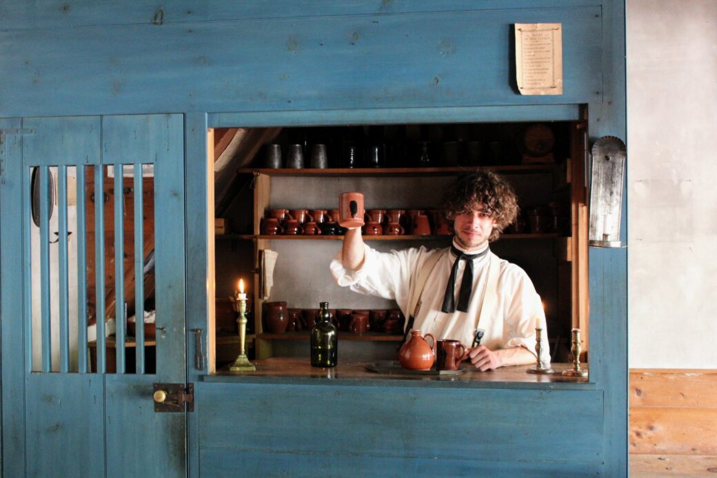
The town’s visitor center and museum store are housed within the Third County Courthouse, a 1837 building constructed in response to Staten Island’s growing population. The courthouse once housed a court and jail for Richmond County. The building was landmarked by the LPC in 1969, 50 years after the last court session was held there, according to Untapped Cities.
Also located nearby is the Treasure House, one of the oldest buildings in the borough, dating back to 1700. Legend has it that the building got its name after Revolutionary War-era British gold coins were discovered hidden behind its walls.
In the fall, Decker Farm, one of the nation’s oldest continuously operating family-style farms, offers pumpkin picking and other seasonal activities.
Every Labor Day weekend, Richmond Town hosts a festival that draws more than 15,000 visitors to the historic grounds. The village’s largest fundraiser, the event generates proceeds that help preserve its historic buildings, grounds, and collections.
RELATED: