Rare photos of the High Line being demolished in the 1960s tell the story of a changing West Village

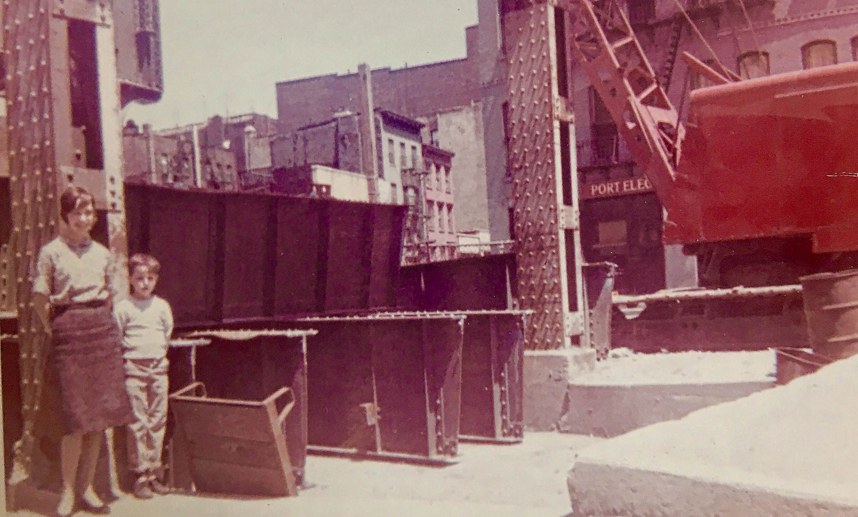
Crane with wrecking ball mounted on the trestle. Photo by Peter H. Fritsch (1962). Photo courtesy of the Greenwich Village Society for Historic Preservation/Fritsch Family Collection.
Few structures have had a more far-reaching impact upon the West Village and Chelsea than the High Line. Its construction in 1934, then partial demolition in the early ’60s, and final preservation and conversion into a park a decade ago have profoundly shaped the way these neighborhoods have changed over the last 85 years. And while photos of its heyday and those of it today as an internationally recognized public space are plenty, few exist of those interim years. But GVSHP recently acquired some wonderful images of the High Line being demolished in 1962 at Perry Street, donated by the Fritsch Family who lived nearby at 141 Perry Street.
The Fritschs’ photos say a lot about how the High Line, and its demolition, changed the West Village. It’s apparent from the images just how much more industrial, and gritty the Far West Village was in those days. But it also shows how the demolition of the High Line left a huge gap in this unpretentious neighborhood, which housed both disappearing industry and a diverse and vital residential community.
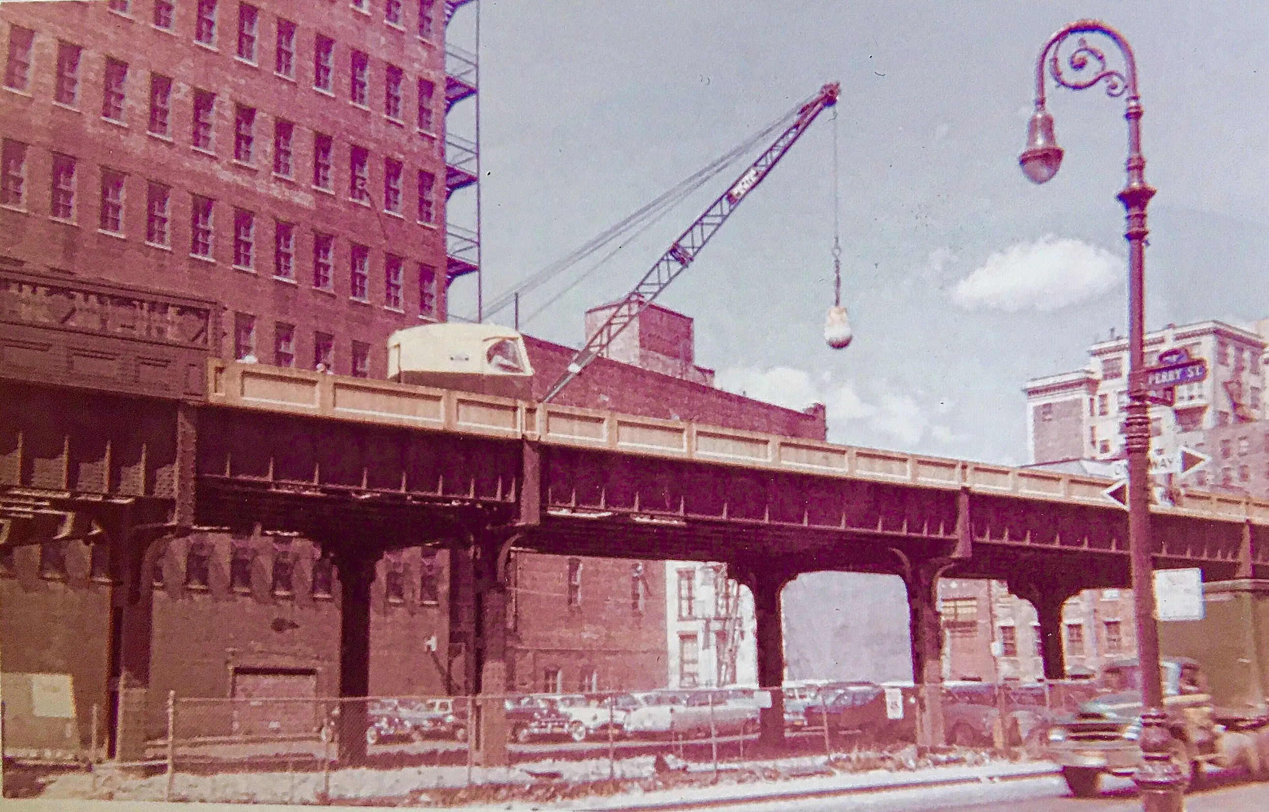
 The crane and wrecking ball is getting into position in the middle of the intersection of Perry and Washington Streets. Photo by Peter H. Fritsch (1962). Photo courtesy of the Greenwich Village Society for Historic Preservation/Fritsch Family Collection.
Constructed in 1934, the High Line originally stretched from 34th Street to Spring Street, allowing the elimination of street-level freight trains that ran along Tenth Avenue and earned that thoroughfare the nickname “Death Avenue” because of the number of fatal collisions between trains and people. While the elevated line allowed the easier transport of freight such as meat and other food products into warehouses and factories along the West Side, it also cast a shadow that loomed heavily over the surrounding neighborhoods. Worse, by the post-War era, many of the industries the High Line served were leaving the area, heading to points further out in the metropolitan region and across country. The once-miraculous overhead rail line quickly spiraled into obsolescence. In fact, by 1960 demolition began upon the southern end of the High Line. It worked its way up as far as Bank Street in the West Village, where the High Line drove through the massive full-block Bell Telephone Labs complex, which Bell abandoned for New Jersey around this time.
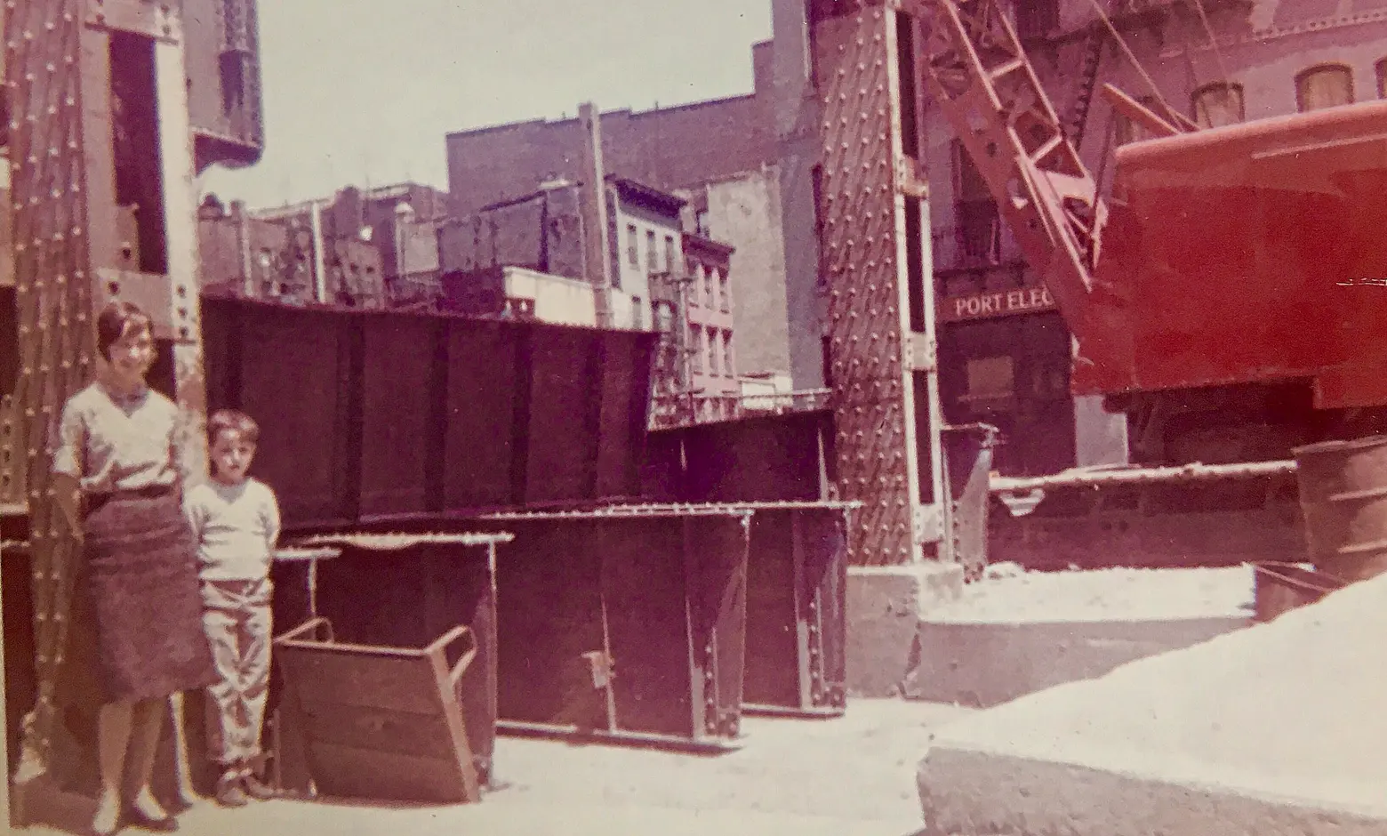 Facing east across Washington Street, Nick Fritsch (aged 7) and his older sister Erica, in the foreground in front of cut pieces of the High Line trestle. Their home at 141 Perry street is visible on upper center-left. Photo by Peter H. Fritsch (1962). Photo courtesy of the Greenwich Village Society for Historic Preservation/Fritsch Family Collection.
Between Morton and Bank Streets, including the Perry Street sites the Fritsches photographed, the demolition of the High Line led to a struggle for the soul of the neighborhood. Robert Moses saw the Village west of Hudson Street as blighted, and proposed replacing the entire area with high-rise towers surrounded by open space. The neighborhood, including Jane Jacobs who lived in the “blighted” area, rose up and eventually defeated Moses’ urban renewal scheme. Instead they put forth their own plan for development on the blocks left vacant by the High Line’s demolition: simple walk-up buildings, modest in scale and design, with small front yards and shared rear yards — a sort of prototype of the blocks Jane Jacobs wrote about as successful models in her book “The Death and Life of Great American Cities.” A group called the West Village Committee was formed to advocate for this plan, and Peter Fritsch, who took the pictures of the High Line being demolished in 1962, and his wife Theresa were among its most active members.
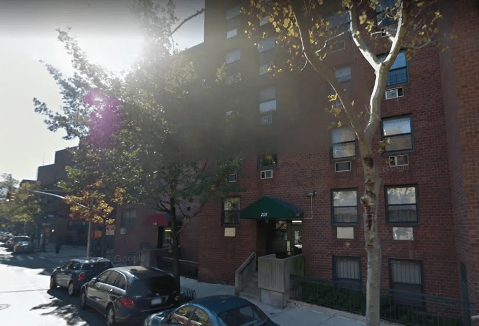 Current Google Street View of the West Village Houses
The West Village Committee won – sort of. The West Village Houses were built in 1974: 42 buildings containing 420 affordable apartments on six blocks of the West Village vacated by the High Line. They drew working-class and middle-income families, including teachers and civil servants, to what many considered a dicey, semi-industrial neighborhood on the edge of the city. But due to the city’s fiscal crisis, and the time that they took to build, West Village Houses ended up a somewhat stripped down, simplified version of the original ideal – Jane Jacobs-inspired in their contextual infill site planning, but quite Spartan in their outward appearance. Nevertheless, the houses flourished.
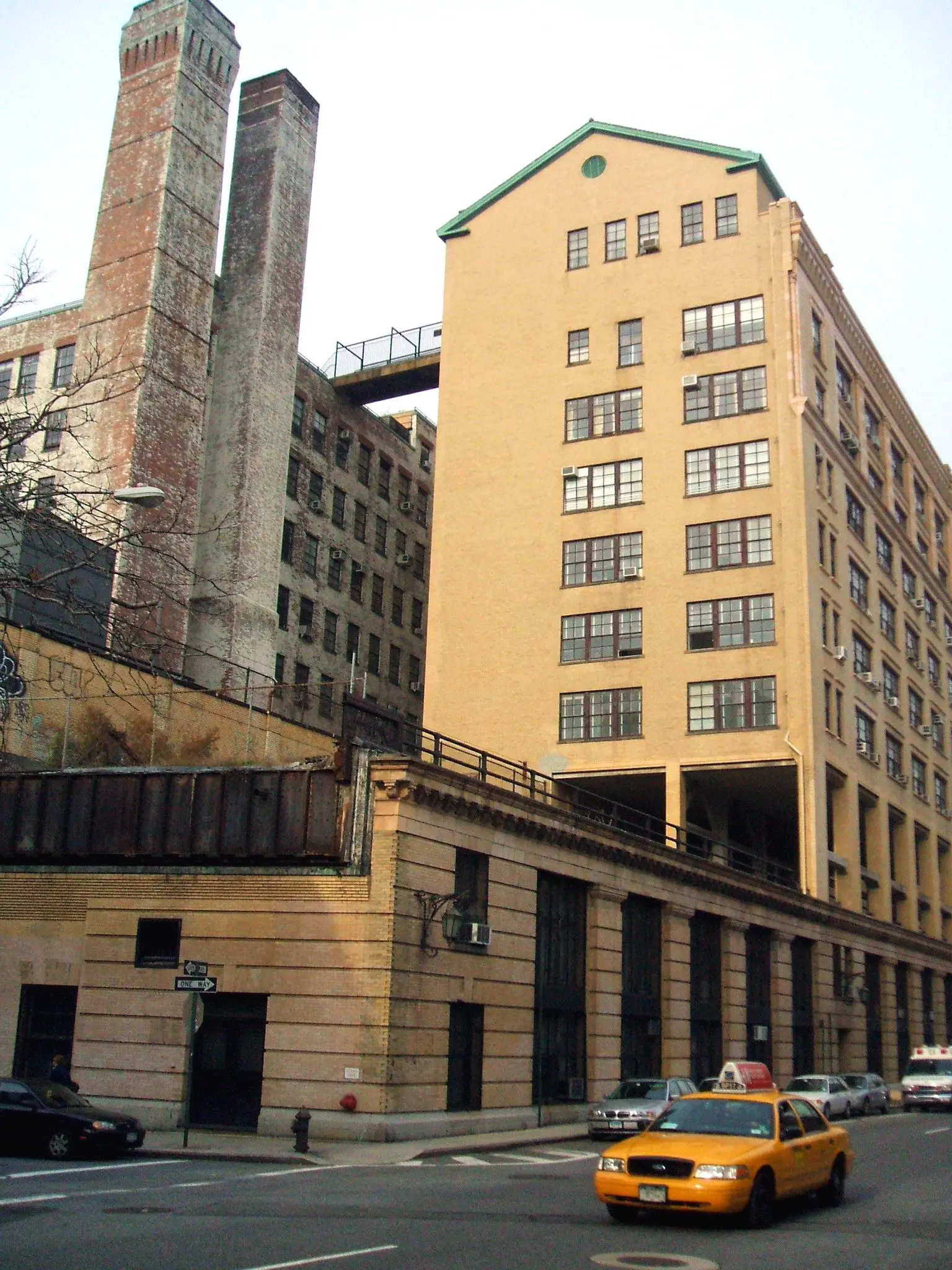
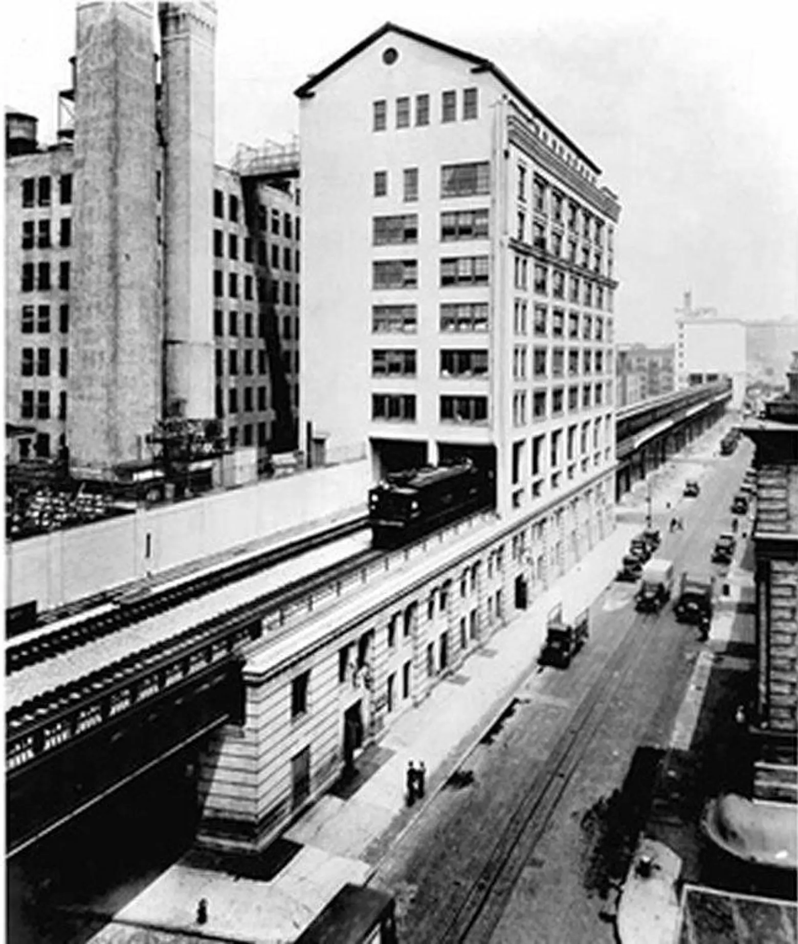 Train passing underneath the Bell Laboratories Building, seen from Washington Street in 1936 (this section still exists) via Wiki Commons
 The same view of Westbeth today, via GVSHP
Just a few years earlier, the Bell Telephone Labs had been converted to first-of-its-kind publicly-subsidized artists housing and studios now known as Westbeth, to the designs of a young, virtually unknown architect named Richard Meier. The pioneering adaptive reuse as residences was made possible by the trains of the High Line no longer needing to run through this complex to the south, though the disused High Line rail-bed remains embedded in Westbeth to this day. After their respective openings in 1970 and 1974, Westbeth and the West Village Houses helped turn the Greenwich Village waterfront from a fading industrial center to a thriving residential community.
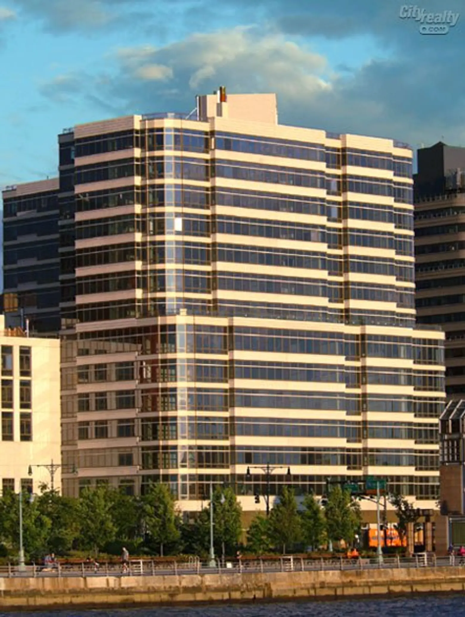 One Morton Square, via CityRealty
Soon after in 1980, the last train delivering holiday turkeys ran on the High Line, signaling a new phase in the neighborhood’s evolution. By 1991, another stretch of the High Line, from Westbeth north of Bank Street to Gansevoort Street, where the High Line now terminates, was also dismantled. The planning for these blocks, as well as the ones formerly occupied by the High Line south of Morton Street and the West Village Houses, was not nearly so utopian as for West Village Houses or Westbeth. There, market-rate developments, such as One Morton Square and 99 Jane Street, became among the most expensive in the neighborhood, attracting stars like the Olsen Twins and James Gandolfini. These expensive high-rises sprung up all around West Village Houses and Westbeth, which had seen the neighborhood through the tough times of the 1970s and ’80s. So dramatically did this area transform during this time that in 2006 the owners of West Village Houses opted to leave the affordable housing program which had subsidized it. Residents organized to save the affordability of their homes, but only temporarily; that deal will run out in 2018.
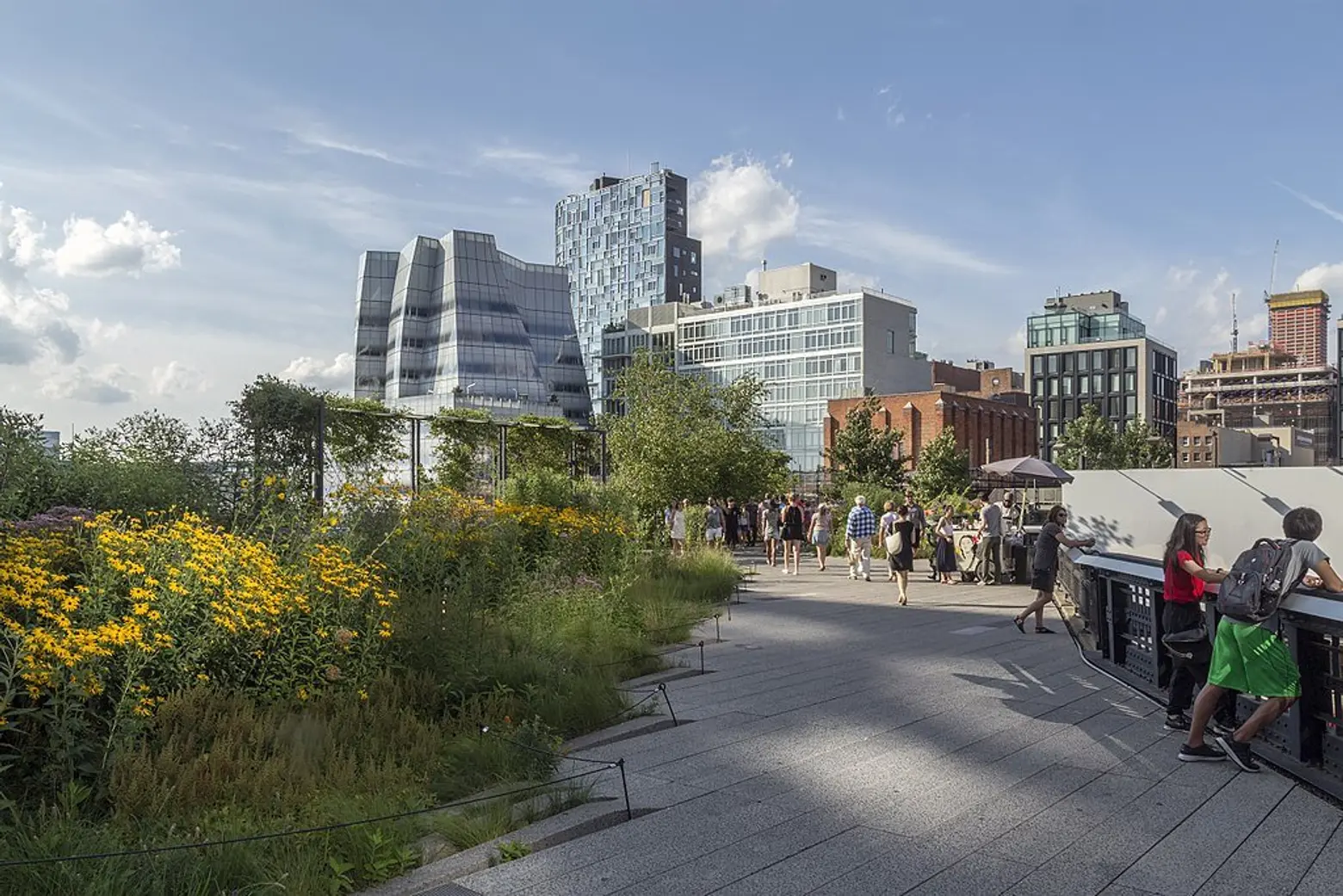
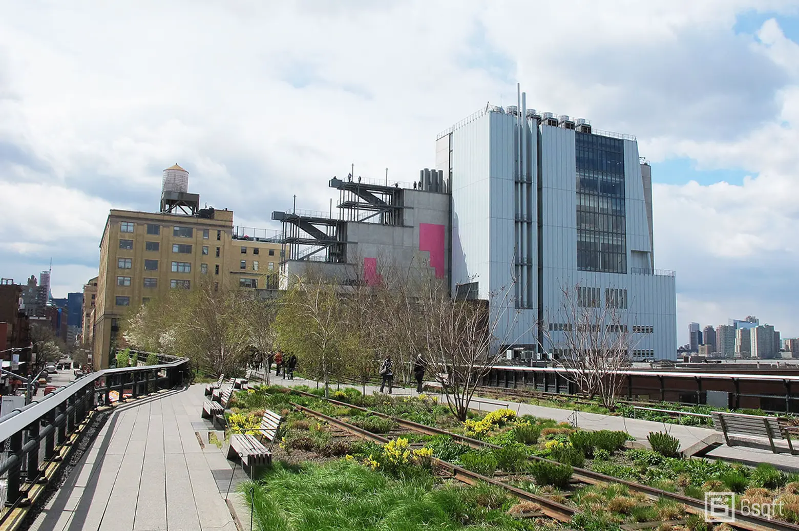 The High Line today with the new Whitney Museum in the background, via 6sqft
By the late 1990s, there was a movement afoot to demolish the High Line in Chelsea as well. However a group led by local residents Robert Hammond and Joshua David fought to instead save the structure and turn it into a park in sky, inspired by the Promenade plantée in Paris. They succeeded in convincing the City to do so, but at a price. The preservation and conversion of the High Line to a park was tied by the City to a plan to upzone the surrounding blocks for luxury housing development, spurring their transformation from a low-key industrial backwater to a glittering, ultra-high-end residential district. While affordable housing was promised as part of the plan, little materialized due to the city’s zoning scheme which required new developments to pay into a fund towards the High Line’s conversion before any benefit went to housing. In the end, little did, and what was once a manufacturing district surrounded by low-income housing projects and modestly-priced housing became one of the most expensive and exclusive precincts in the city, with more new residential development than any other district in the five boroughs.
 Via Wiki Commons
In its relatively brief life, the High Line went from miraculous pedestrian safety and transportation technology improvement, to outdated looming blight, to impetus for the creation of pioneering affordable housing, to transformative public space, to unprecedented catalyst for the creation of vast quantities of luxury housing. This one simple rail line delivered a lot more than just turkeys to the West Side of Manhattan.
The Fritsch photos and other images can be found in GVSHP’s online historic image archive, prints of which are available for sale.
+++

This post comes from the Greenwich Village Society for Historic Preservation. Since 1980, GVSHP has been the community’s leading advocate for preserving the cultural and architectural heritage of Greenwich Village, the East Village, and Noho, working to prevent inappropriate development, expand landmark protection, and create programming for adults and children that promotes these neighborhoods’ unique historic features. Read more history pieces on their blog Off the Grid.
RELATED: