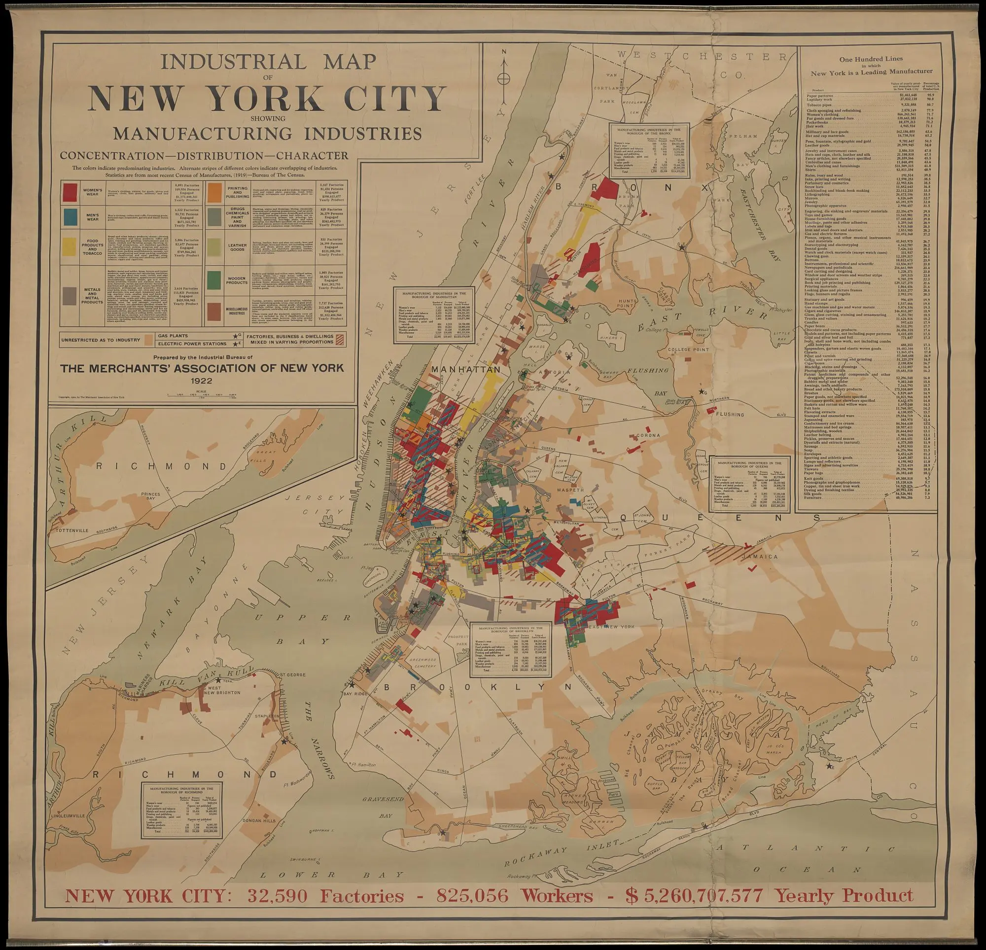
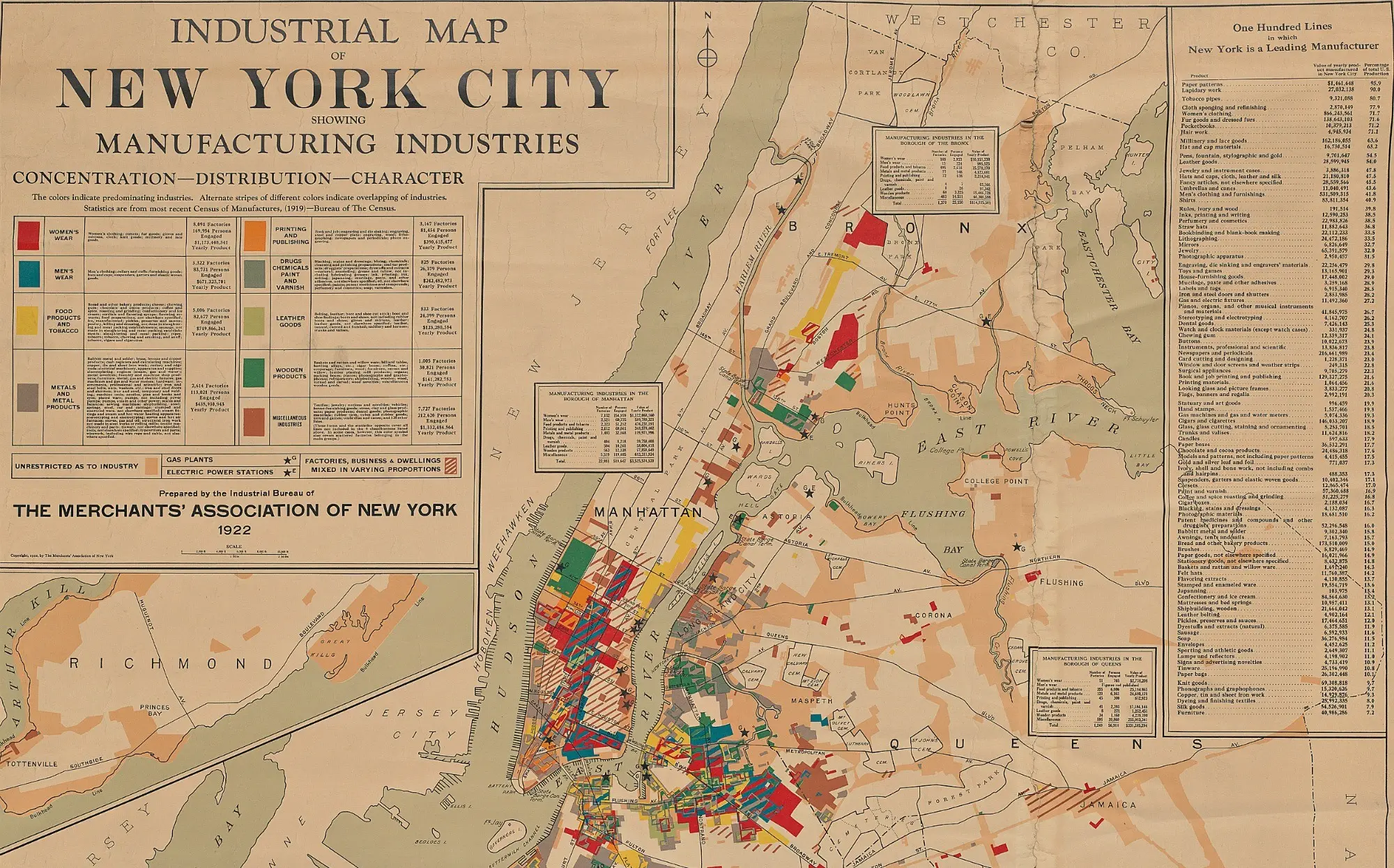
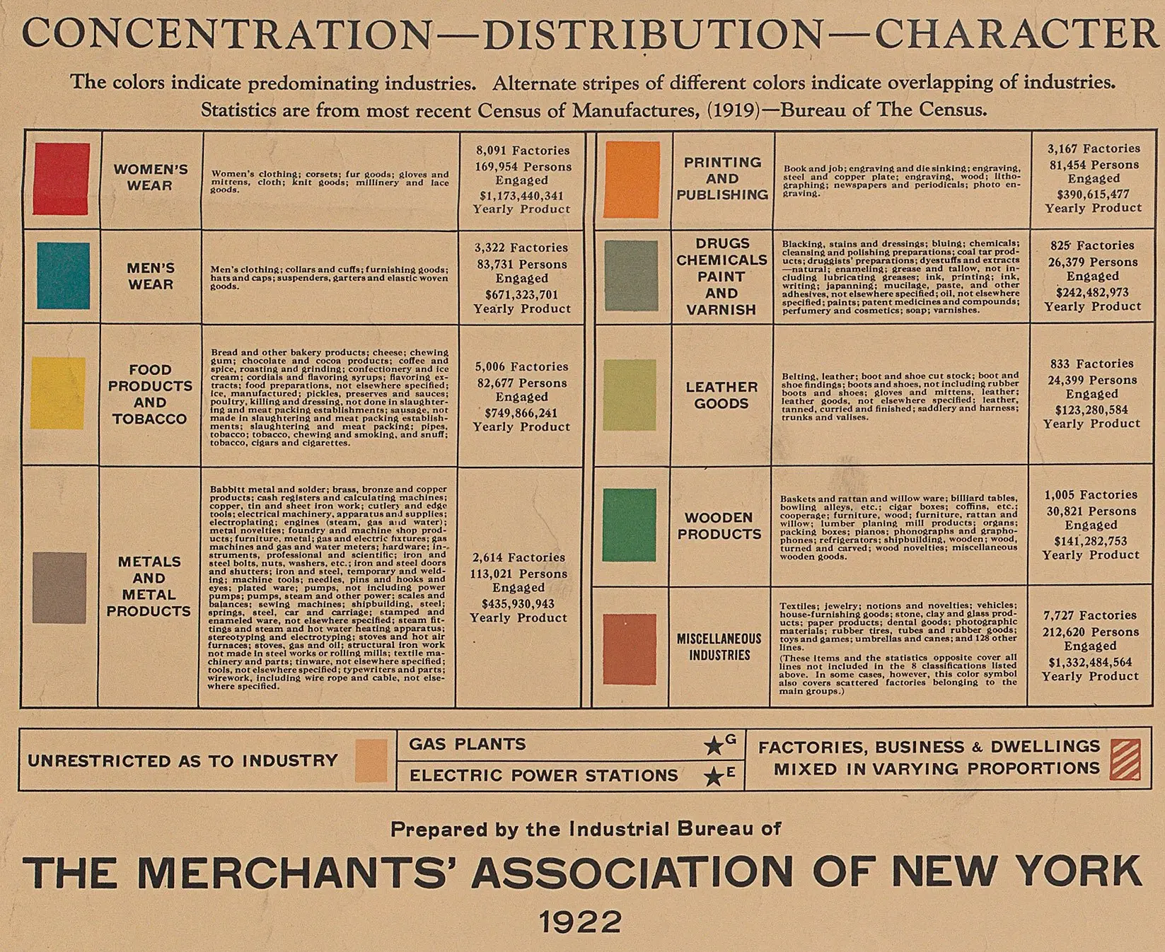
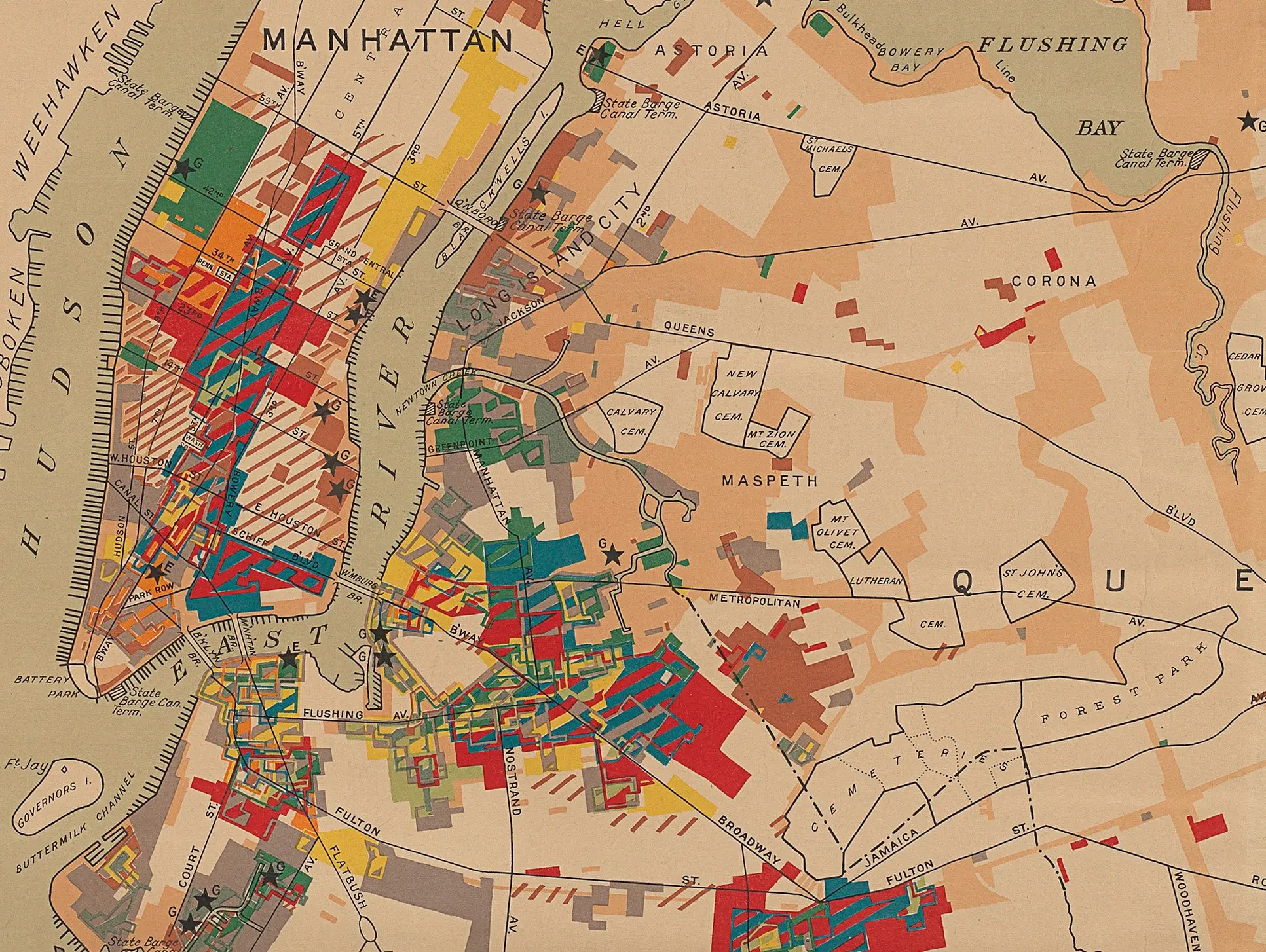
Historic map shows the manufacturing industries of 1919 NYC

As part of their new exhibit “Mastering the Metropolis: New York and Zoning, 1916–2016,” the Museum of the City of New York has shared this historic map of manufacturing industries across the city. Published in 1922 using census data from 1919, the colorful depiction shows us that women’s wear was the industry of the time, with more than 8,000 factories employing 169,965 people and coming in with a yearly product value of $1.7 billion. Manhattan was all but covered with manufacturing, and as CityLab points out, this included everything from rubber tires and umbrellas to coffins and cigar boxes.
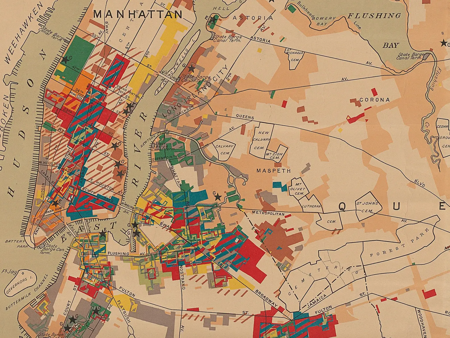
The map was created by the Merchants’ Association of New York as a promotional tool, advertising the beige areas as those “available for industrial development.” Until the city’s first zoning ordinance in 1916, factories could locate anywhere, hence the overlapping of industries and concentration of manufacturing sites in residential areas.
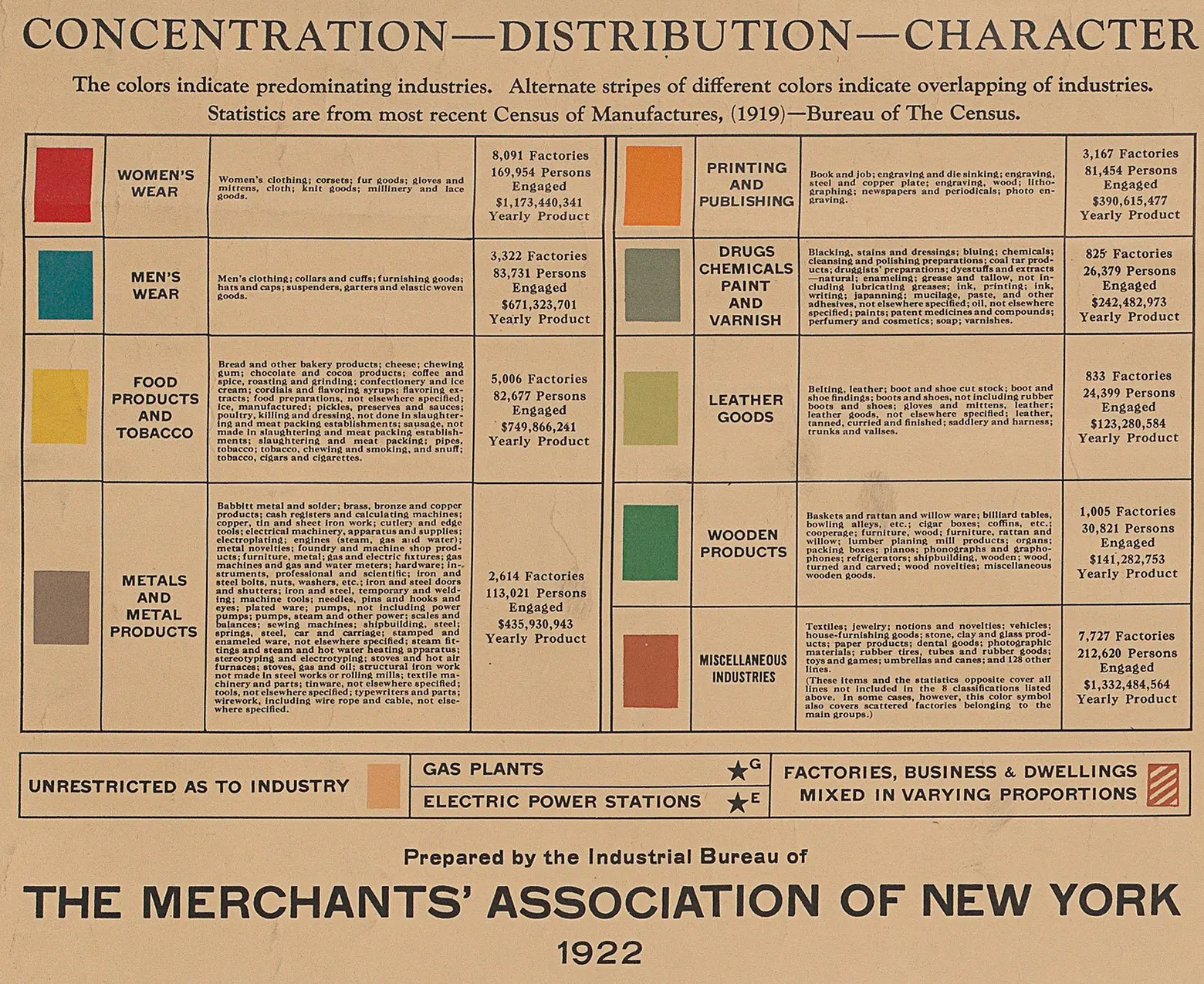
The clothing industry in general was the biggest at the time, followed by food products and tobacco, which was centered in Midtown East/the Upper East Side and Williamsburg. Midtown West specialized in wooden products, while printing and publishing took up the Herald Square area (this was known as Newspaper Row).
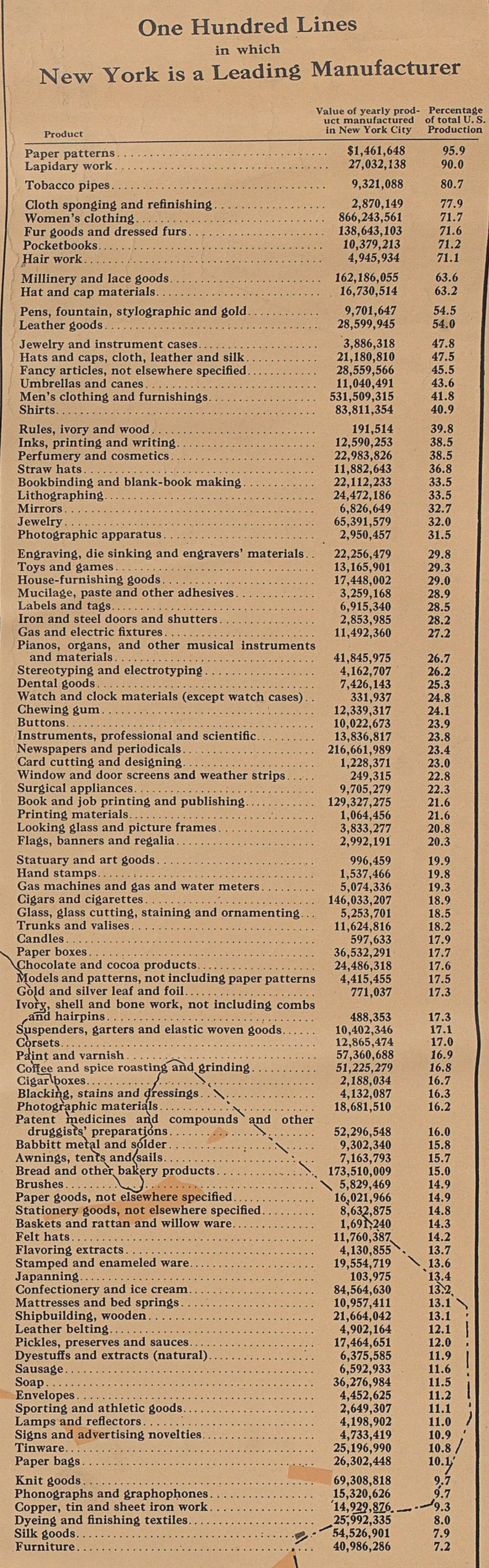
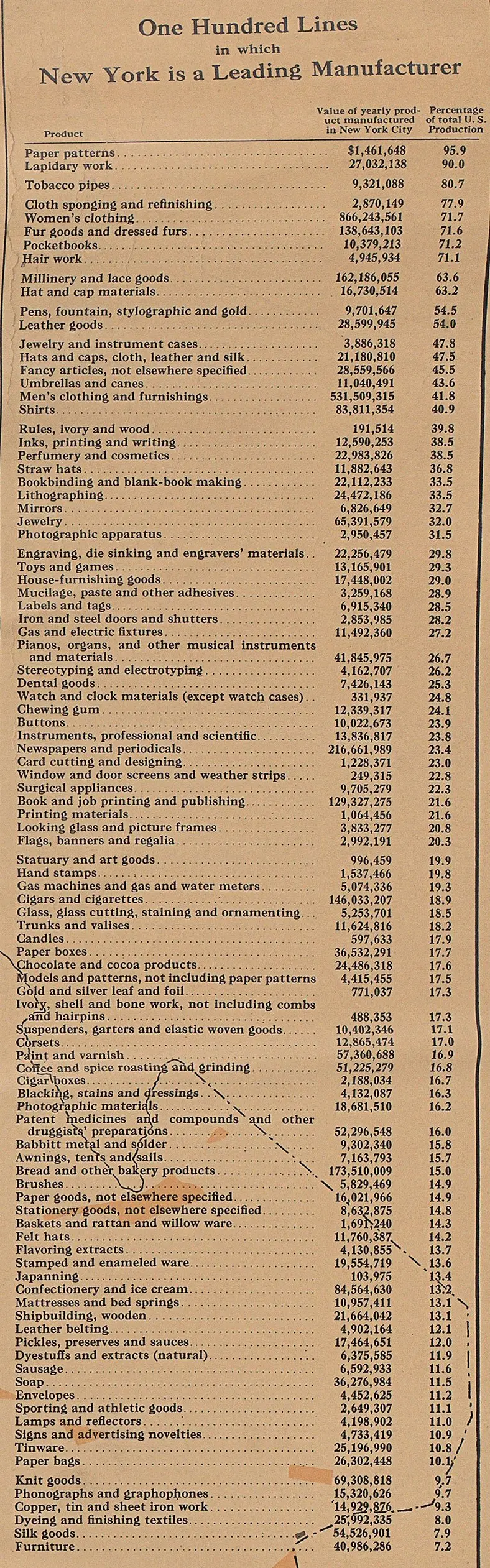
The map also provides this list of 100 items in which New York was a leading manufacturer. Paper patterns and lapidary work accounted for over 90 percent of total U.S. production, with tobacco pipes not far behind.
To learn more about the MCNY exhibit, which, on the 100th anniversary of America’s first comprehensive zoning resolution, looks at the history and future of zoning in NYC, click here >>
[Via CityLab]
RELATED: