Explore Manhattan When It Was Just Forests and Creeks With the 1609 Welikia Map

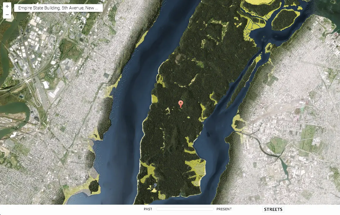
It’s hard to imagine New York as anything but a dense landscape of glassy towers, apartment buildings and millions of bodies moving throughout the streets. But once upon a time, the city wasn’t much more than forests, creeks and wildlife. The Welikia Project, formerly known as the Mannahatta Project, has gotten a powerful update that now lets you explore the city’s historic ecology using a satellite map that imagines how Manhattan might have looked back in 1609—and all the years between then and now.


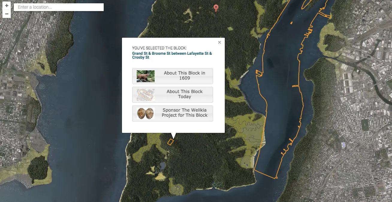
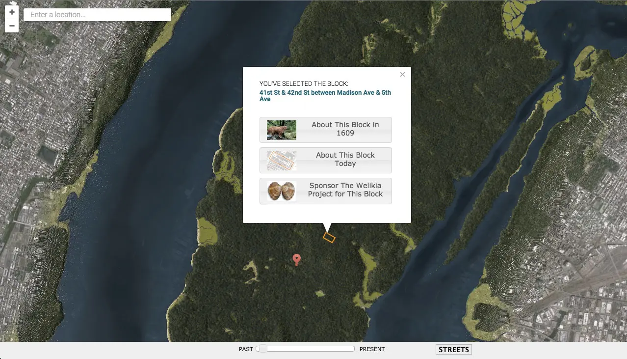
Using the Welikia map is simple. As directed, all you have to do is click on a particular neighborhood to learn more, or enter your address or a landmark name into the search box. The slider control at the bottom of the map allows you to transition years between 1609 and today, while the streets button turns the roadways on and off.
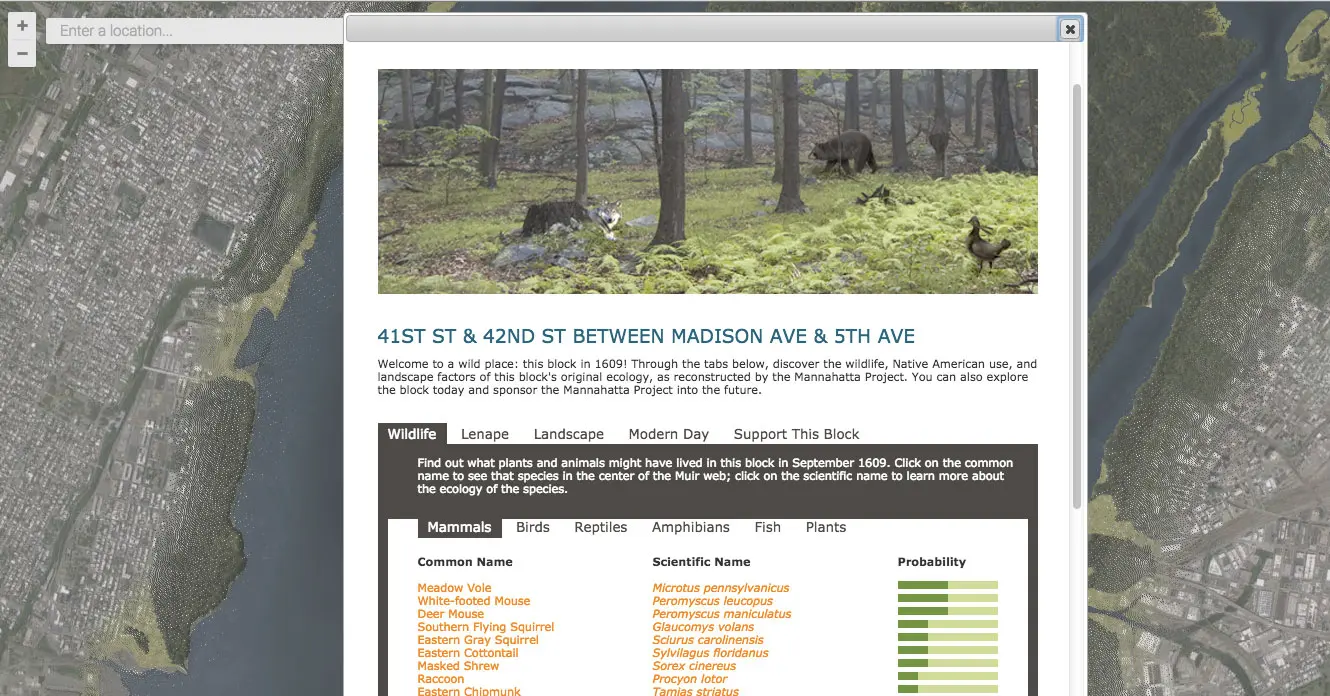
Clicking on the menu buttons “About This Block in 1609” or “About This Block Today” will provide a pretty mind-blowing then-and-now comparison; the map is incredibly detailed and lets you learn, in depth, the types plants and animals that would have inhabited the area in the early 17th century. You can also see how the landscape transformed from valleys, forests, fields, freshwater wetlands and salt marshes into the bustling urbanscape we’re all familiar with today.
Want to give it a try? Explore the Welikia Project map here >>>
RELATED: