How One Man Created a 3D Map of Manhattan When It Was Just Hills, Rivers and Wildlife

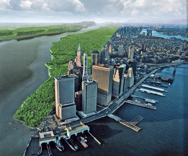
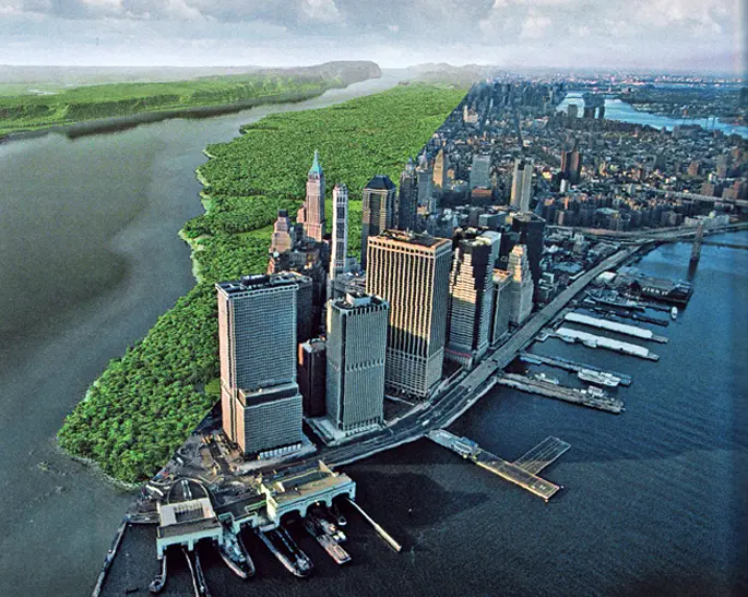
Many of you probably recognize the image above, but what you may not know is that creating it required far more than a bit of Photoshop magic. The work of Wildlife Conservation Society ecologist Eric Sanderson, this incredible photo is a true-to-life depiction of what once grew on the island of Manhattan before it was all paved over. By using an 18th-century map, a GPS and reams of data, Sanderson has recreated, block by block, the ecology of Manhattan in the early 17th century. “We’re trying to discover what Henry Hudson would have seen on the afternoon of September 12, 1609 when he sailed into New York Harbor,” says Sanderson.
Watch his riveting TED talk on the ‘Mannahatta Project‘ ahead and see what used to make up areas like Columbia University, Greenwich Village, and even Times Square at the time of the American Revolution. You’ll certainly look at what remains from our city’s verdant, hilly and marshy past in a whole new way.
[Via Architecture Lab]
Get Insider Updates with Our Newsletter!
Leave a reply
Your email address will not be published.


good stuff