Map This: Seven Cool New York City Maps That Will Enlighten You

Maps have changed quite a bit since we were kids. The information age and rapidly evolving technology have allowed us to turn once-intimidating amounts of data and numbers into cool visualizations that can totally transform the way we understand the world. From looking at where tourists flock in our city to surveying how old every building in Manhattan is to measuring just how noisy NYC is compared to the rest of the states, here are seven of our favorite city maps—all of which will help navigate New York in a whole new way.
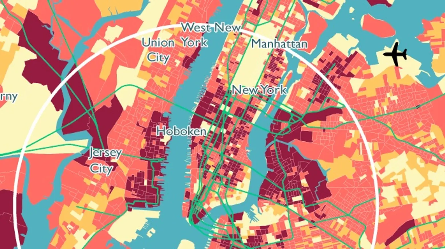
Mapping Where in NYC Millennials Live
Whatever your age–or your perspective on “youths”–this map, developed by Generationed City, will help you decide what areas of New York City (and New Jersey) could make a good home for you. Though the initial results may not surprise you–young adults living in New York City tend to set up shop in North Brooklyn, the Far West Side, the Upper East Side, the East Village and western Queens—there are some other trends, both within the city and compared with other cities, that are a bit more curious. ZOOM IN HERE >>
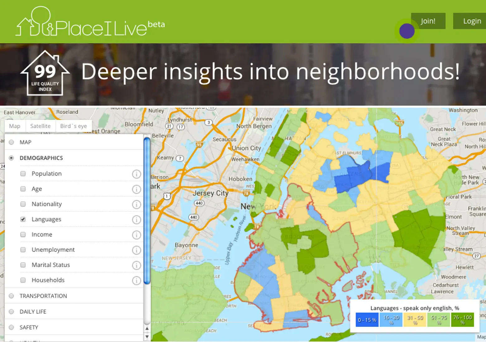
Do You Really Know Your Neighborhood?
Do you? The creation of Šarūnas Legeckas and his data team, PlaceILive is a handy map that helps you find out more about how your neighborhood rates when it comes to everything from demographics to health to transportation to daily life, safety, sports and leisure and entertainment; it even takes into account how many ramen houses and cheese shops are within reach. With info drawn from city agencies and locals, PlaceILive gives a complete view of a neighborhood or place. ZOOM IN HERE >>
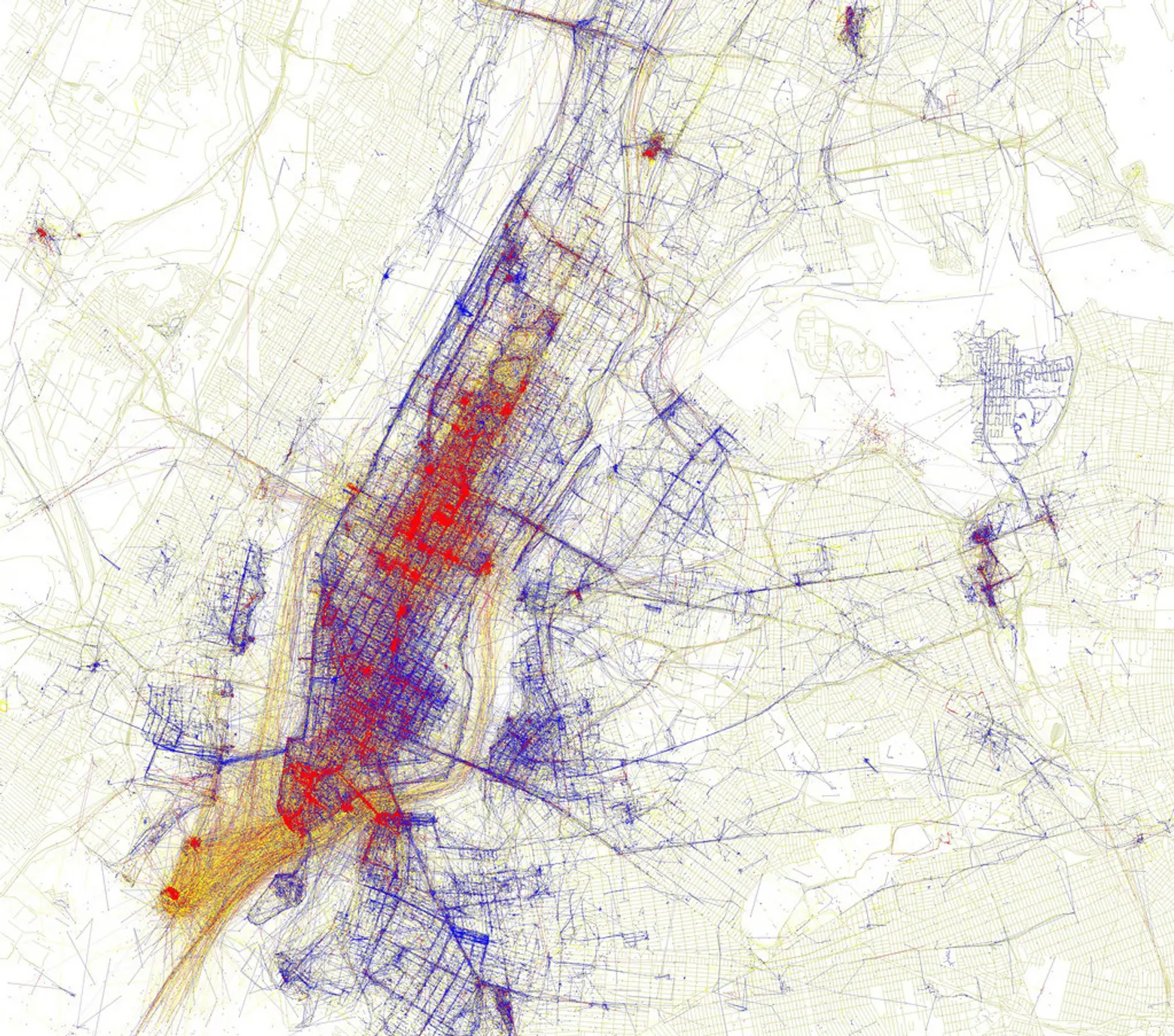
Interactive Map Pinpoints Where in NYC Tourists Flock (and Locals Avoid)
The city’s a bustling place and those who hate battling crowds will certainly appreciate this map. Created by data artist Eric Fischer, Locals & Tourists used tweets from across the five boroughs (and beyond) to determine what areas are most concentrated with out-of-towners and what areas are dominated by locals. The map does reveal heavy concentrations of tourists in all the places you’d expect—like Times Square—but there a certainly a few spots that might surprise you. ZOOM IN HERE >>
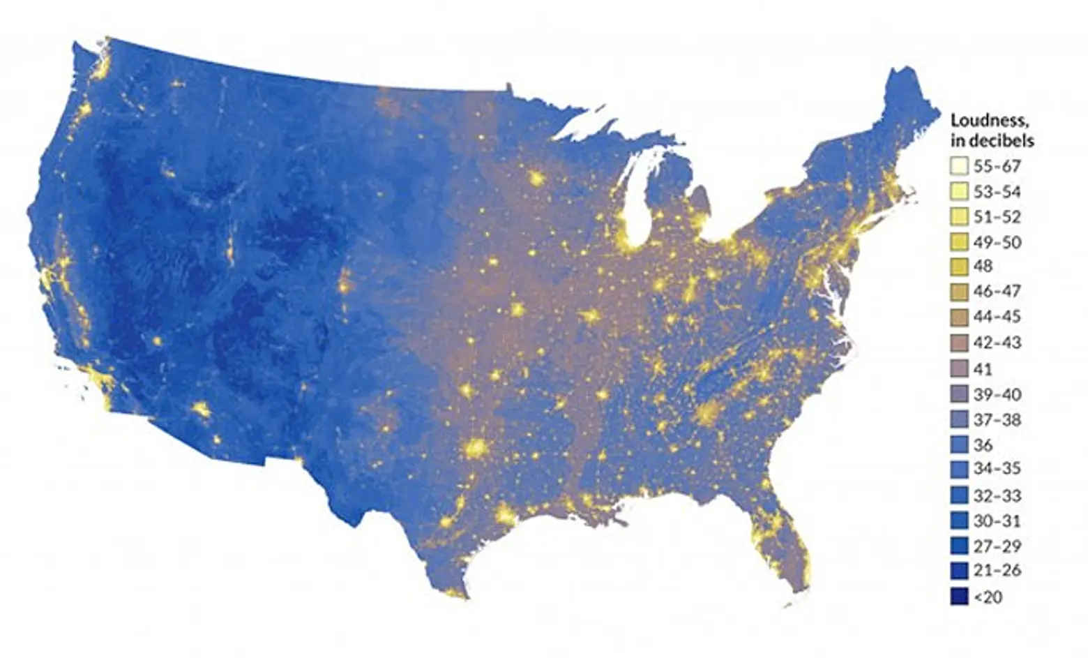
New Map Reveals the Loudest and Quietest Places in the USA
New York City is loud, but how loud? This cool map created by the National Park Service (NPS) shows us where we can find solace in silence and where to expect sleepless nights. The city being one of the loudest in the nation is certainly not a shocker, but how it compares to the rest of the nation is certainly eye-opening. And be warned, you may start to question why you live here after delving in. ZOOM IN HERE >>
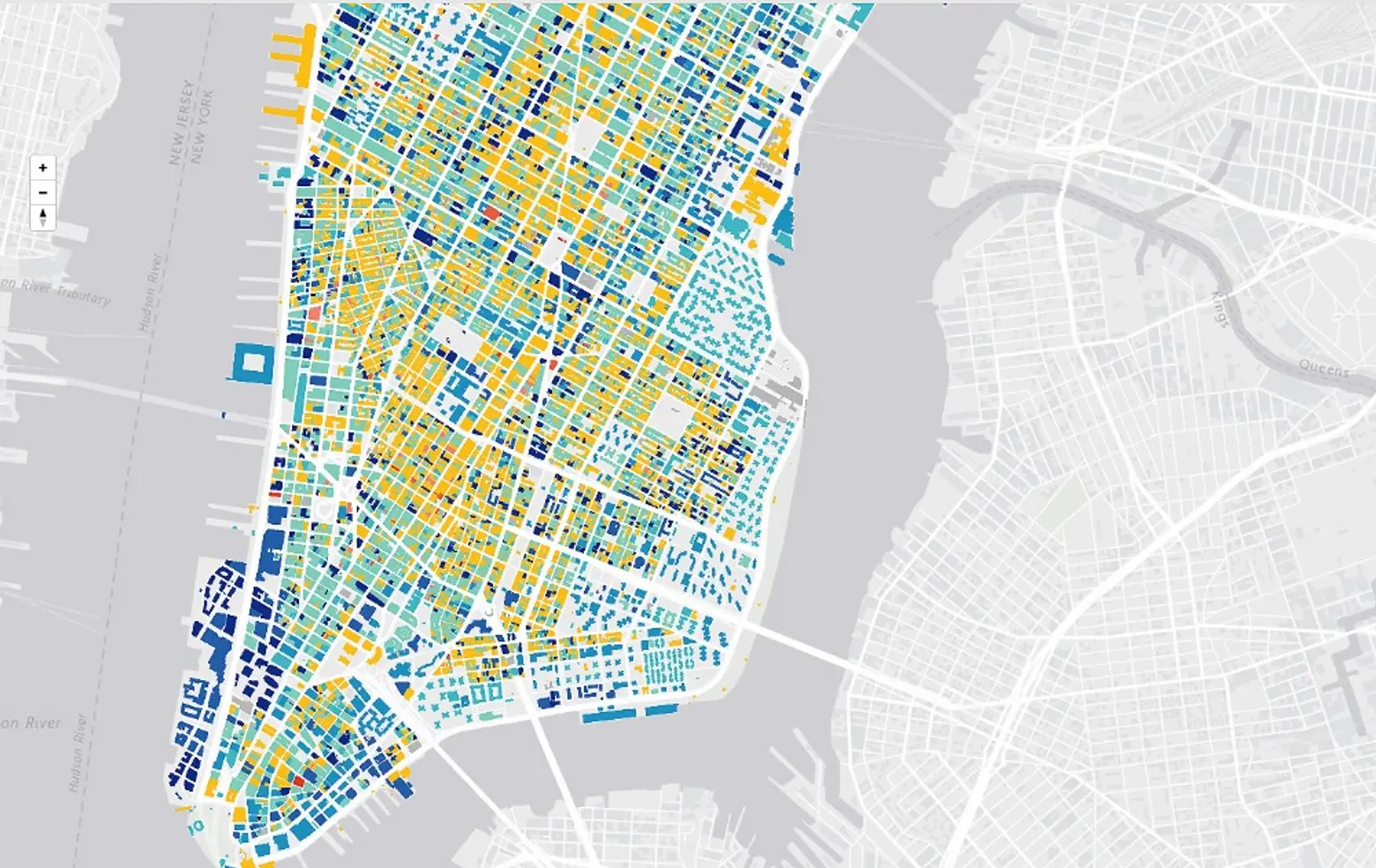
New Mapping Tool Urban Layers Tracks the Age of Every Building in Manhattan
Is that a building from the 19th century or the 20th? If you often find yourself asking what era a piece of architecture has hailed from, look no further than this map created by Morphcode for the answers. Called Urban Layers, this interactive map lets users see almost every building still standing in Manhattan today and reveals exactly when it was built.
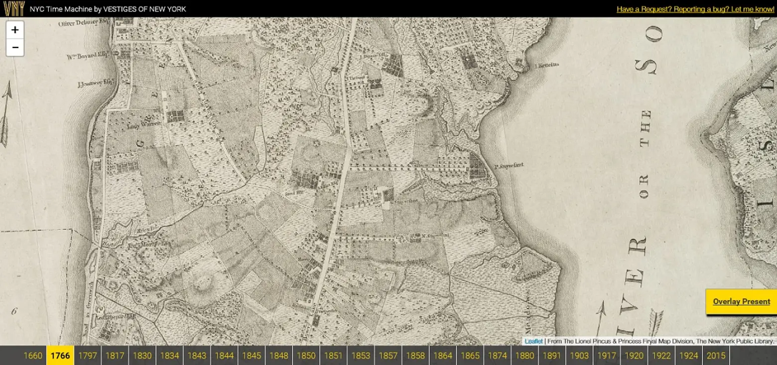
NYC Time Machine Lets Users Navigate Overlaid Maps from 1600 to Present Day
Like the Urban Layers, NYC Time Machine is a blast from the past ready to enlighten you on the urbanscape. But rather than simply pointing out age, this interactive map allows users to “navigate perfectly-overlaid maps of NYC from 1660 to present day.” ZOOM IN HERE >>
The Air Up There: New Map Shows Untapped Development Potential of Every Manhattan Property
A developer’s best friend? The Municipal Art Society created a map showing just how much untapped development potential exists in the square footage above every property in Manhattan. The map, developed using data from the city, was created to help give New Yorkers “a voice in major development decisions that will impact their neighborhoods” (i.e. curbing too tall buildings), but we can’t help but wonder if it’s more to the benefit of real estate big-wigs on their unrelenting hunt for the next air rights deal. ZOOM IN HERE >>
Want more maps? Check out our archive here.


