Interactive Map Shows the NYC Skyline in 2020

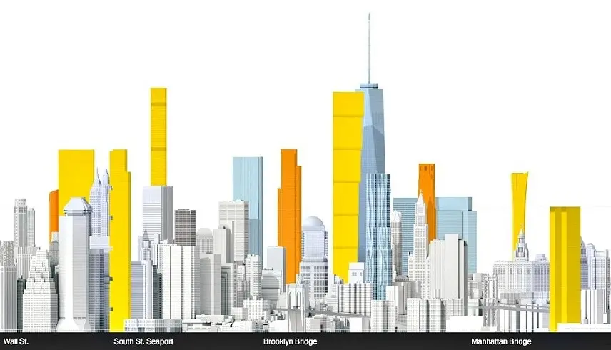
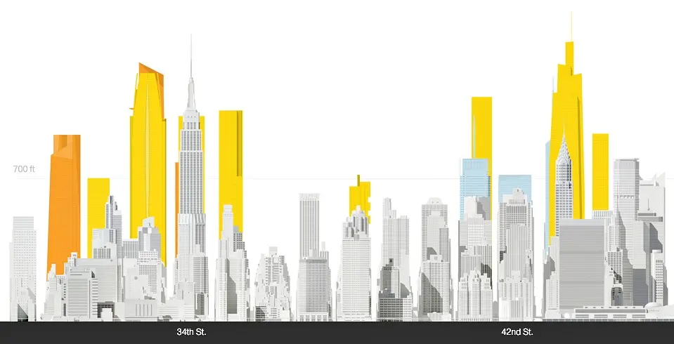
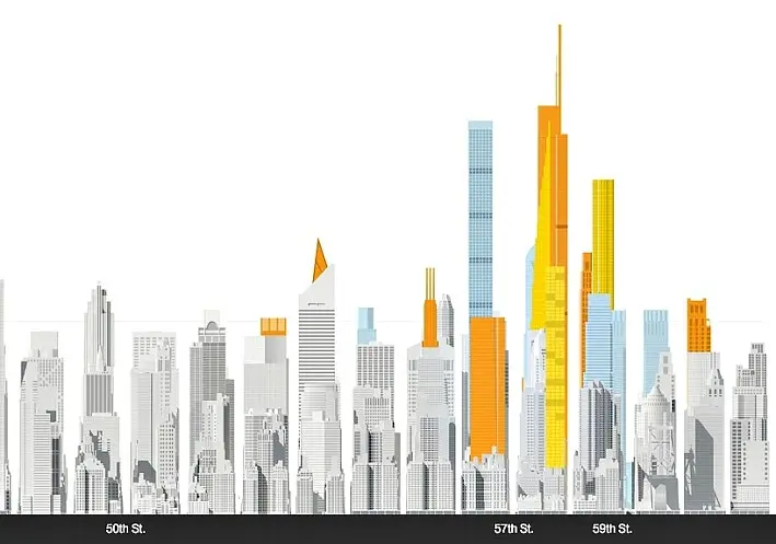
“Before 2004, Manhattan was home to 28 skyscrapers 700 feet and taller. Since then, an additional 13 have been built, 15 are under construction, and 19 are proposed—47 more in all.” Because of this supertall building boom, National Geographic has created an interactive map that lets users explore the NYC skyline in 2020 (h/t Untapped). The light blue buildings are those completed between 2004 and 2015; the orange are under construction; and the yellow proposed.
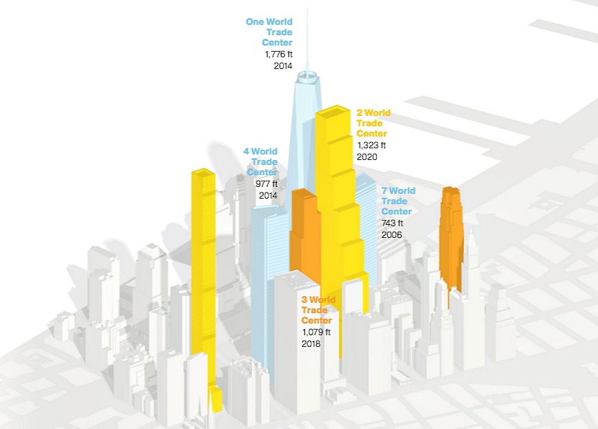
The map is divided into three sections that also expand to 3D versions–the Financial District/World Trade Center, Hudson Yards/East Midtown, and Billionaires’ Row. In the 2D skyline view, users can scroll over a building for its name and height, and the 3D view comes with a blurb about the neighborhood’s development.
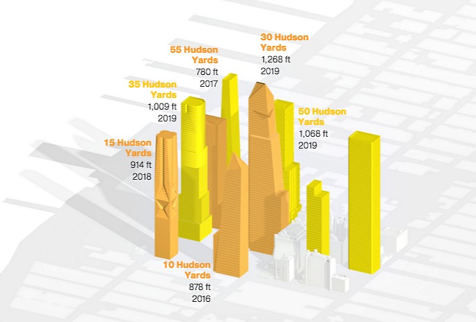
Though the midtown view includes both Hudson Yards and the area included in the Midtown East Rezoning (including the soaring One Vanderbilt), only Hudson Yards is modeled in 3D.

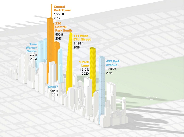
Billionaires’ Row, probably the most talked-about of all the supertall clusters, includes the notorious Central Park shadows in its 3D view. This view also starkly demonstrates just how much taller these new towers are than their current surroundings.
Explore the full interactive map on National Geographic right this way >>
[Via Untapped]
RELATED:
- Central Park Sunshine Task Force Meets to Speak Out Against Supertall Shadows
- Check Out the Views From 1,438 Feet in the Air at 111 West 57th Street
- ‘Inception’-Inspired Map Shows a Horizonless NYC
All maps via National Geographic