This map tells you how far you can walk, bike, drive or ride public transit in a set amount of time

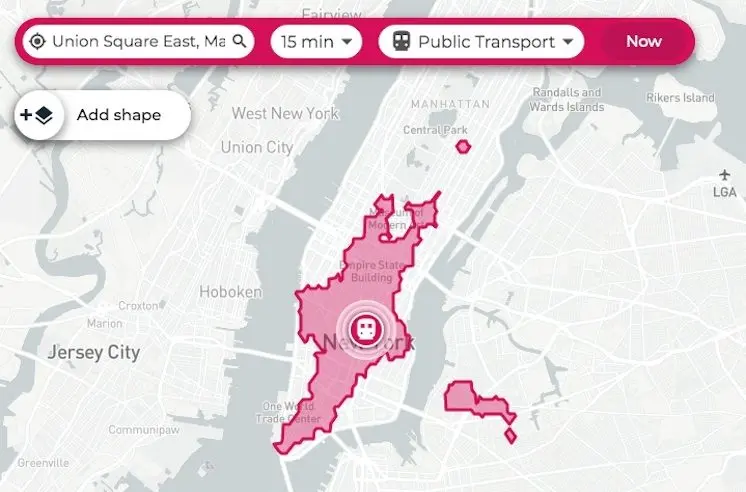
Here’s a handy map that will allow you to find areas you can reach by walking, cycling, driving or using public transport, anywhere in New York, in a set amount of time. Called TimeTravel, it’s a pretty straightforward tool: you plug in an address, a time frame, and mode of transportation. The map then comes up with a layout where you can go from that point in a given amount of time on a certain mode of transit. Above, you’re looking at how far a New Yorker could travel in 15 minutes, from Union Square East, on public transit. The map even allows you to specify what date and time you’re leaving, to give you the most accurate estimate possible.
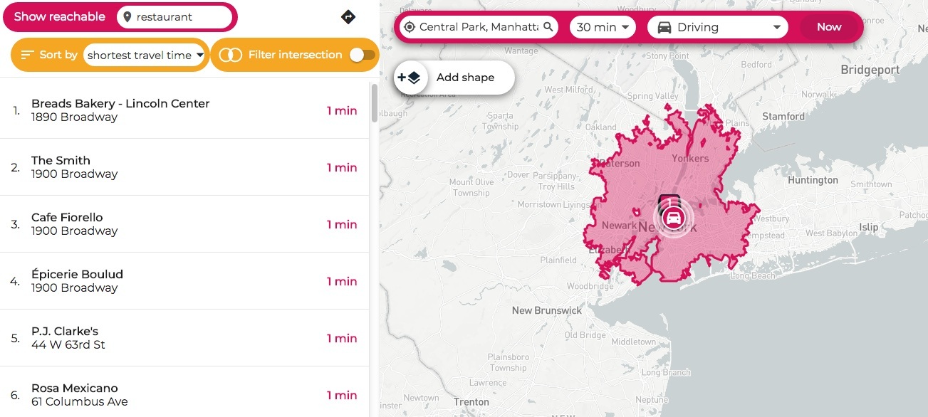
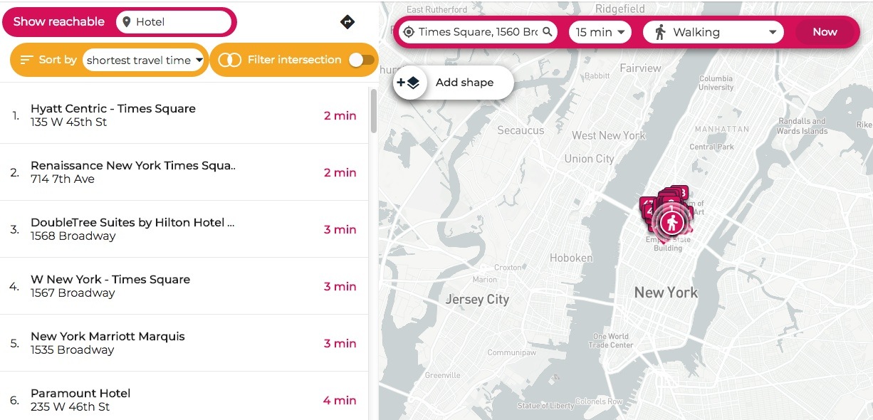
If you decided to share your location with TravelTime, you can also view an isochrone map showing you how far you can travel using different lengths of time. For example, you could view all the places you could walk to within 15 minutes. But there are also opportunities to get more specific. TravelTime allows you to search for venues and points of interest within your allocated travel time–as you can see above, you get a breakdown of all the restaurants within a 30-minute drive of Central Park.
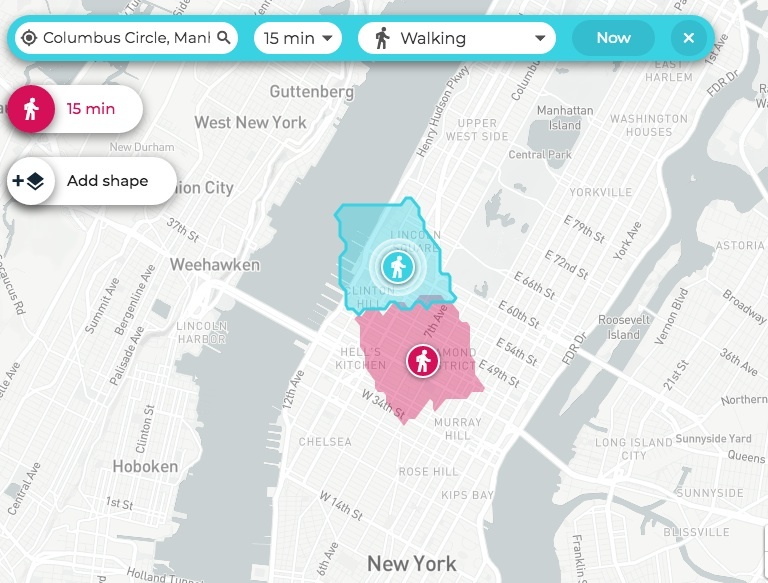
The TravelTime map also allows you to search from more than one location. Above, it’s showing where you could walk within 15 minutes from both Times Square and Columbus Circle. If you wanted to meet a friend at a cafe between those two points, the map will show you which places can be reached within a 15-minute walk from either point.
Finally, you can use the Radius Map tool to draw a radius around any location. This allows you to quickly see any area that’s a set distance from the location you punch in. You can also add a “travel time layer” to directly see all the areas within a set radius which are reachable within your travel time. The radius map will even calculate the percentage of the area within your radius which isn’t accessible in your set time.
There are so many options to get from Point A to Point B in New York City, and this map covers them all! Test your own locales at the Travel Time platform.
[Via Maps Mania]
RELATED: