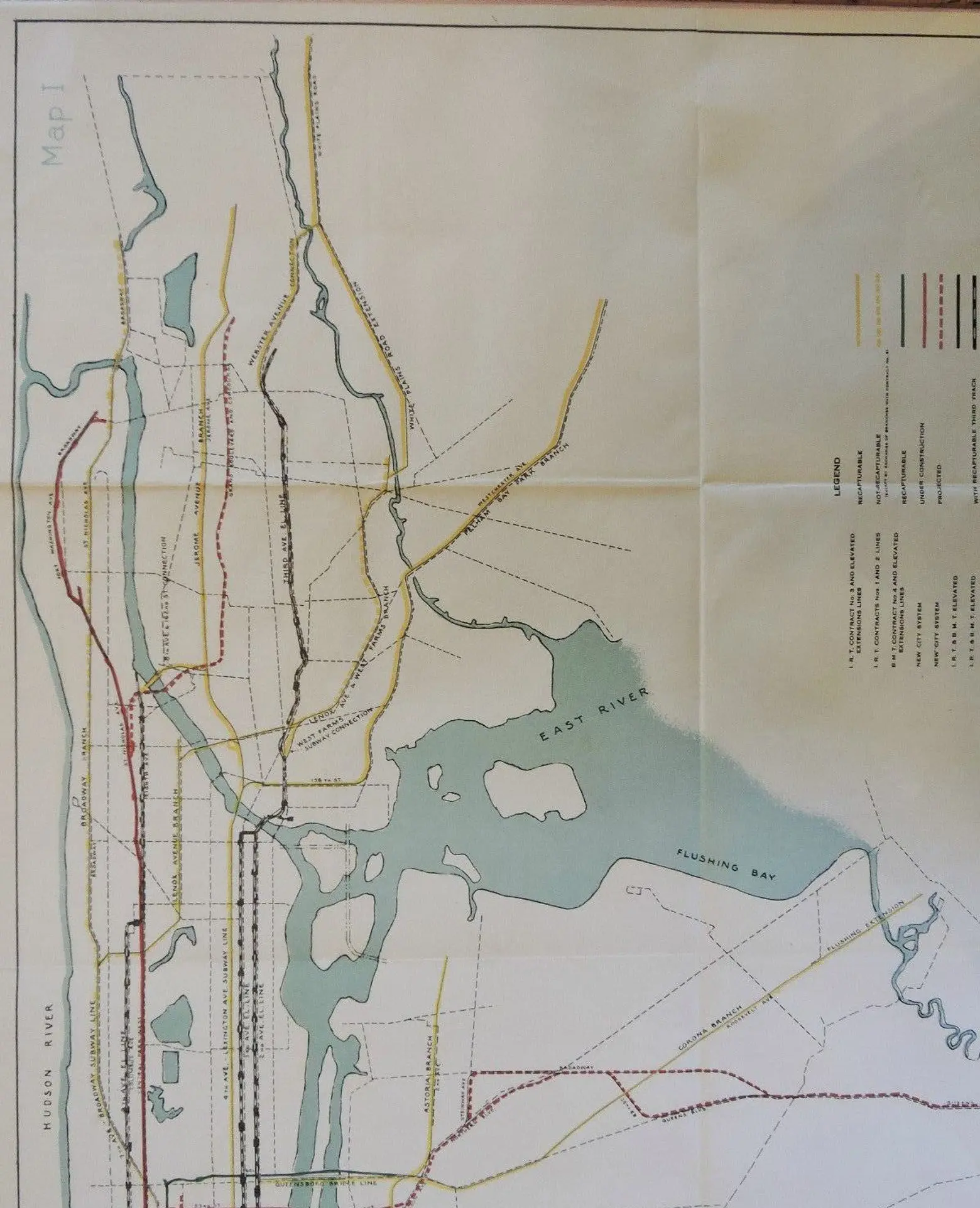
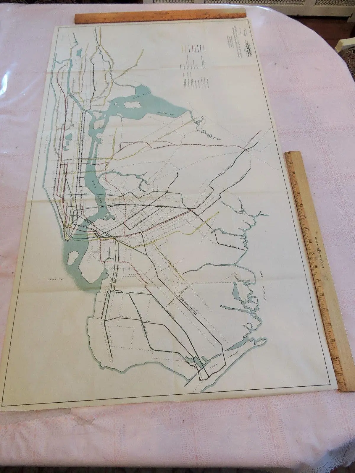
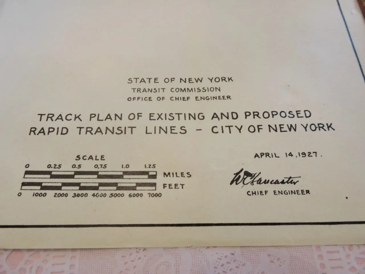
This 1927 city subway map shows early transit plans

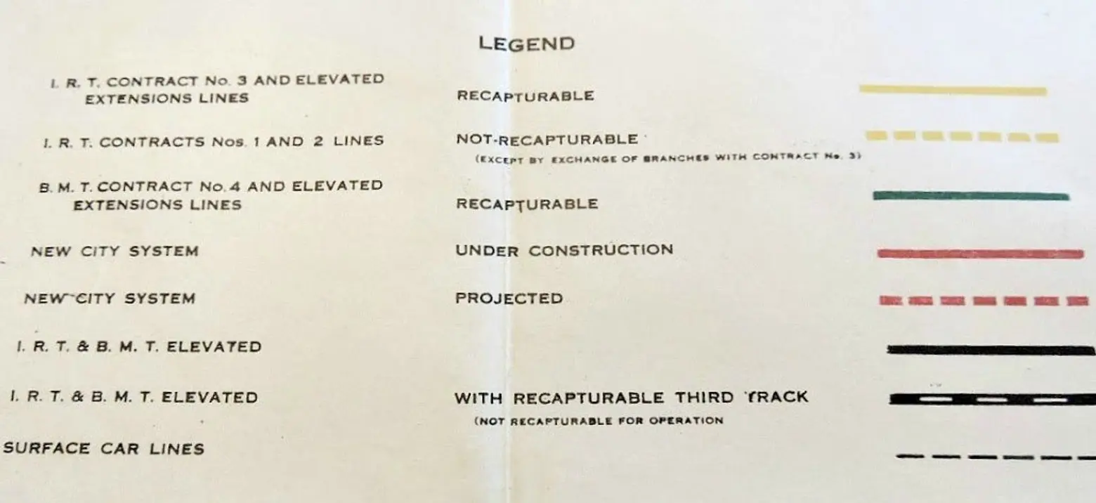
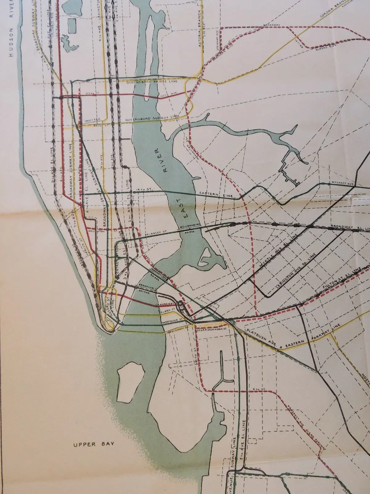
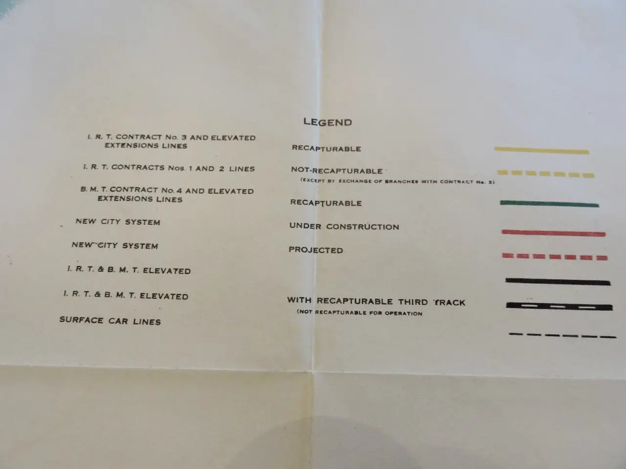
If you’re navigating the NYC subway and wishing you could start from scratch, these map outlines from 1927 might prove interesting. Found by hyperreal cartography, the maps, from the state’s Transit Commission Office of Chief Engineer, outline the “plan of existing and proposed rapid transit lines” for New York City. What’s shown on the map appears to be the Independent Subway System; the ISS or IND, as it was known, was first constructed in 1932 as the Eight Avenue Line.
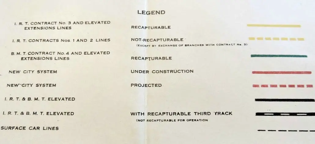
As one of the three networks that was integrated into the modern New York City subway, the IND was meant to be fully owned and operated by the city government, as opposed to the privately-funded Interborough Rapid Transit Company (IRT) and Brooklyn–Manhattan Transit Corporation (BMT) companies. The three lines merged in 1940.
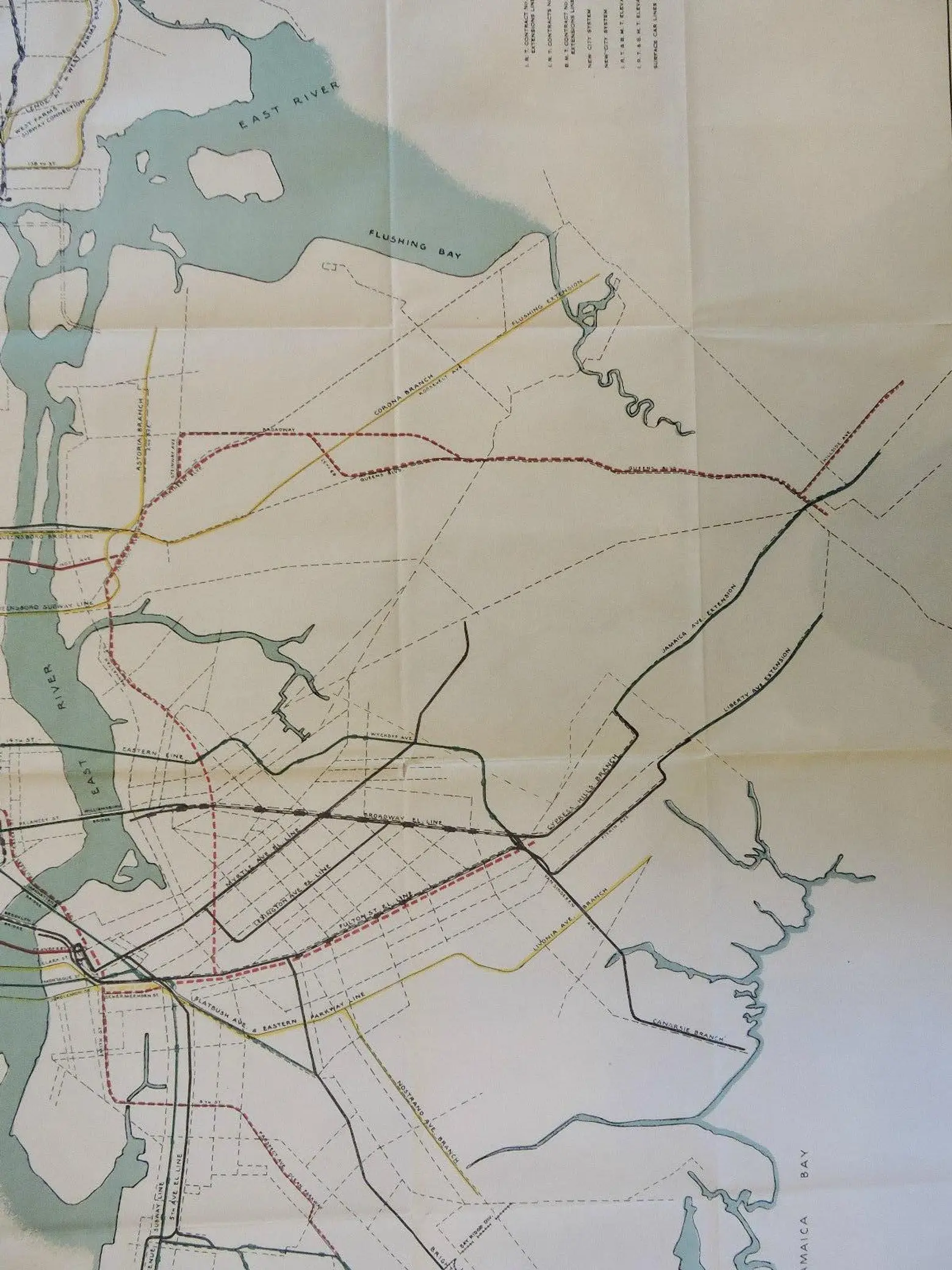
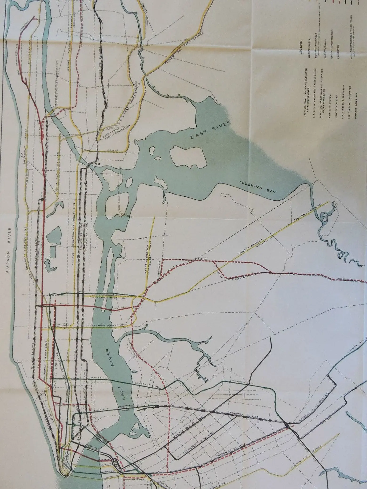
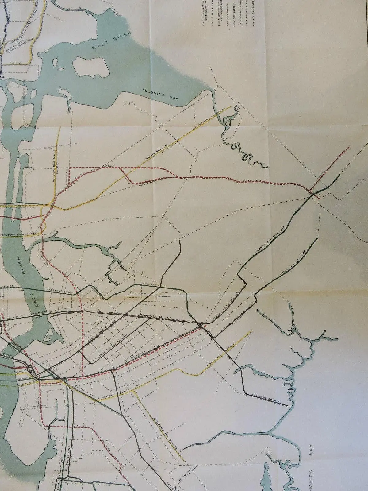
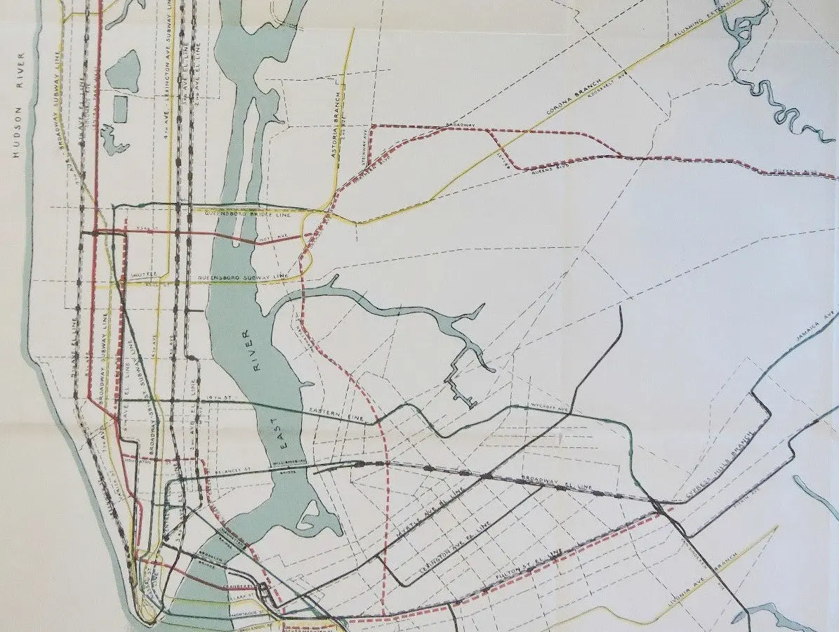
The maps show the first section of this line (the A/C/E trains), with the 6th Avenue Subway, Queens Blvd Subway, Concourse Subway, Crosstown Subway, South Brooklyn Subway and Fulton Street Subway shown as “Projected.”
The map shows alternative routes for the Brooklyn and Queens lines, showing a plan to have the express and local tracks split along 69th Street. Apparently this may have had something to do with the proposed Windfield Spur, a local branch of the Queens Blvd Line that would have meandered through Maspeth and Middle Village before heading to Rockaway Park.
The F/G trains were originally supposed to run a straight shot from 7th Ave in Park Slope to Prospect Ave in Windsor Terrace, which would have tunneled under Prospect Park and private property until it reached Prospect Avenue. The IND planners added a station at 15th St-Prospect Park; the local track split off the express tracks made this direct path under the park a less-used alternative.
The cross-Brooklyn G train looks to be a work in progress here, as if planners hadn’t yet found an ideal route south of Broadway. The Concourse Line (B/D trains) terminates at Bedford Park Boulevard as the trains currently do. Plans for the Brooklyn leg of the Fulton Street Line (A/C) stop at Broadway Junction, which would seem to indicate that planners had not yet completely figured out a suitable route beyond that station.
Back then as now, planners were constantly tinkering with the subway; it would turn out that what they were building would be only the first phase of a much grander of a two-phase plan; what is now remembered as the Second System would see proposed new lines like the 2nd Avenue Subway and Utica Avenue Subway.
RELATED:


Interested in similar content?
Leave a reply
Your email address will not be published.


“The Concourse Line (B/D trains) terminates at Bedford Park Boulevard as the trains currently do.”
Still don’t know what possessed the city to build a subway under Grand Concourse when it was so close to the Jerome Ave (#4 train). They could’ve used that money to build a cross-Bronx route like the Lafayatte Avenue line proposed in 1929.
I was told that trees were planted along the Grand Concourse and each tree had a plaque dedicated to a Bronxite who had been killed in World War One. Having recently ridden the entire length of the boulevard, the few trees that I saw were in horrible condition. Also, how could trees grow properly since they were atop the concrete tube that contained the D/B train right- of- way. Also, both Joyce Kilmer and Franz Siegel parks’ trees had been severely cut back; I assume for security reasons