NYPL’s ‘digital time travel’ maps let you compare today’s New York City with the past

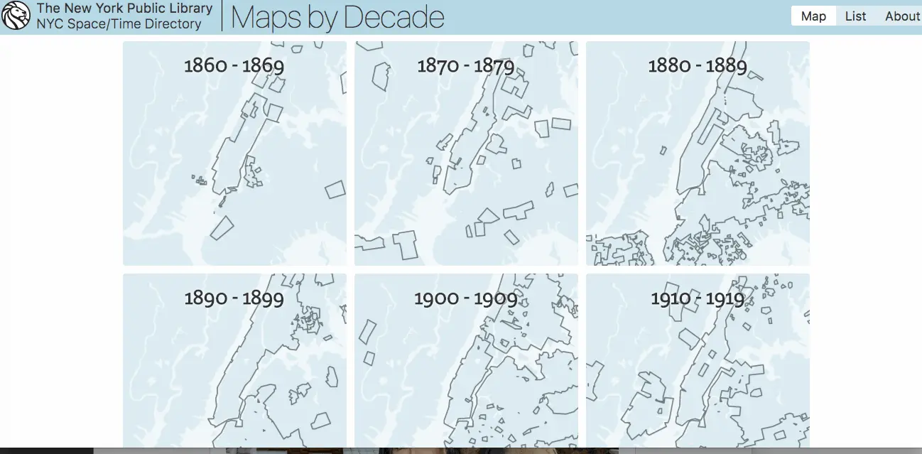
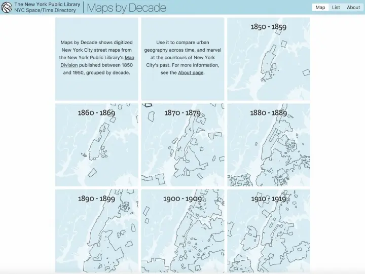
6sqft previously reported on the “time machine” map function that allowed users to navigate overlaid maps from 1600 to the present to see what used to occupy our favorite present-day places. Now, the New York Public Library has released the Space/Time Directory, a “digital time-travel service” that puts the library’s map collection–including more than 8,000 maps and 40,000 geo-referenced photos–to work along with geospatial tools to allow users to see the city’s development happen over more than a century, all in one convenient place. Hyperallergic reports that the project, supported by a grant from the Knight Foundation, plots 5,000 digitized street maps across the five boroughs, organized by decade from 1850 to 1950.
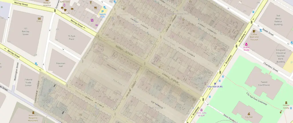
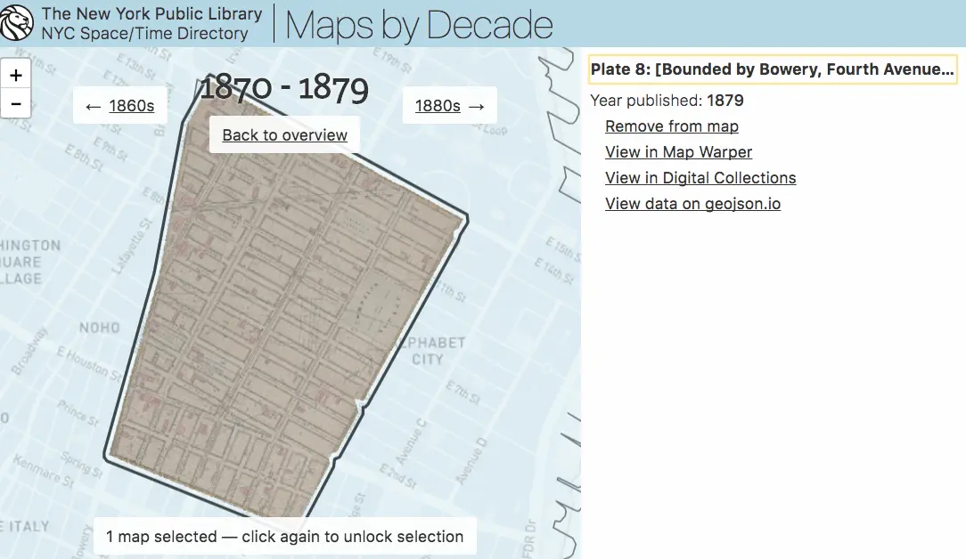
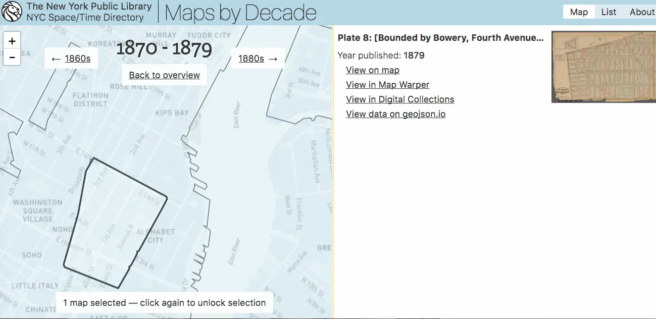
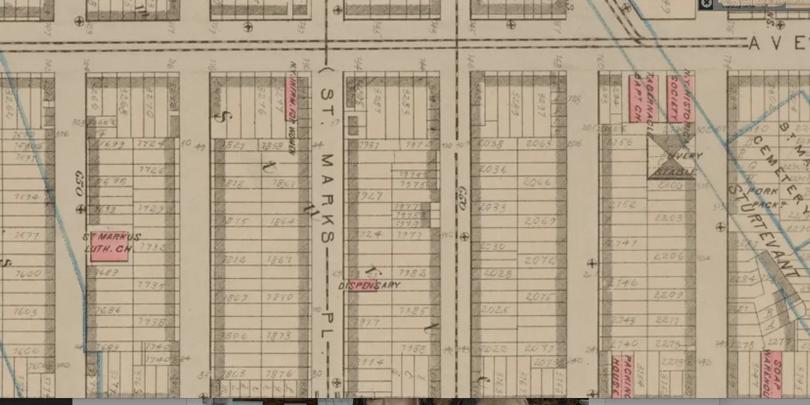
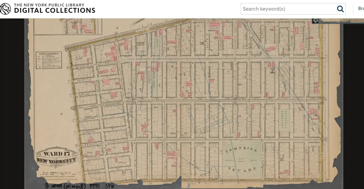
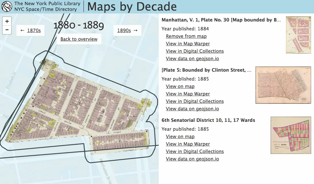
The just-released Maps by Decade aggregates maps from the library’s collection, expanding on the library’s Map Warper georectification tool which contains data sets, outlines and locations, crowdsourced and georectified, combined with digitized maps from the collections. The map below highlights a section of the East Village, with a ward map from 1879 transposed onto present-day streets.
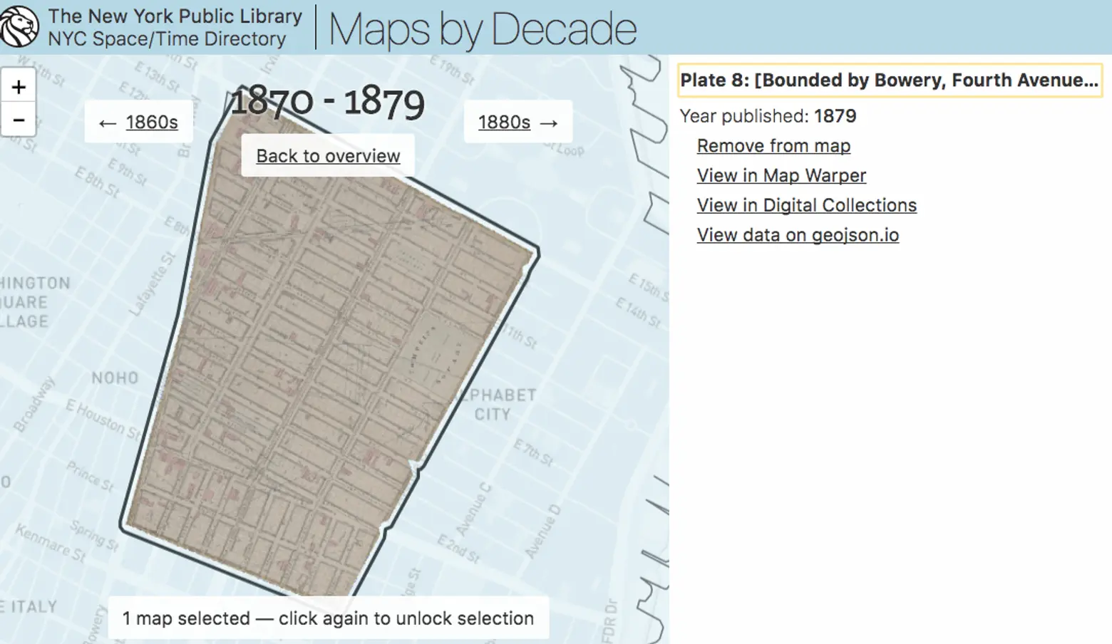
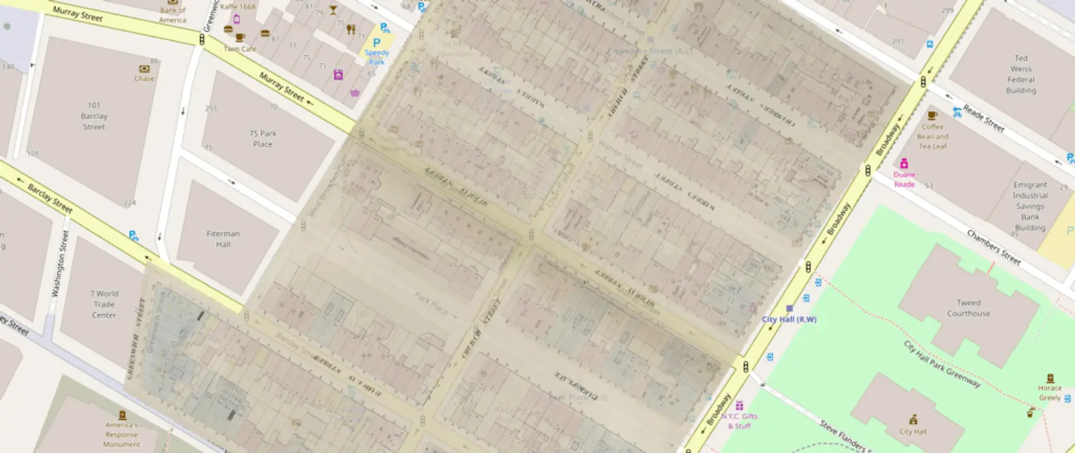
Here’s a close-up version. Users currently can log in to use the map warper to “rectify” maps or “warp” them together.
The project is all open source, each map’s geospatial data is accessible, and the source code for Maps by Decade is on GitHub. And even cooler map tools are in the works: According to Bert Spaan, NYPL’s Space/Time Directory engineer, future tools might, for example, use the crowdsourced data of What’s on the Menu?, focused on the transcription of historical restaurant menus.
[Via Hyperallergic]
RELATED:
- Website “WhatWasThere” Lets Users Tour Their Neighborhoods Through Historic Photos
- NYC Time Machine Lets Users Navigate Overlaid Maps from 1600 to Present Day
- Find Out What Businesses Were on Your Block Way Back in 1855 With This Interactive Map
- New York Public Library Releases Interactive Map of Its 80,000 Historic Photos