REVEALED: See new renderings of the QueensWay elevated park

For the past couple years, there have been no major updates on the QueensWay, the High Line-style elevated park and cultural greenway proposed for a 3.5-mile stretch of abandoned railway in central Queens. But today, the Trust for Public Land and Friends of the QueensWay said in a press release that they’ve finished the schematic design for the first half-mile, which could open as soon as 2020. Along with the announcement and details comes a new set of renderings from DLANDstudio Architecture + Landscape Architecture.
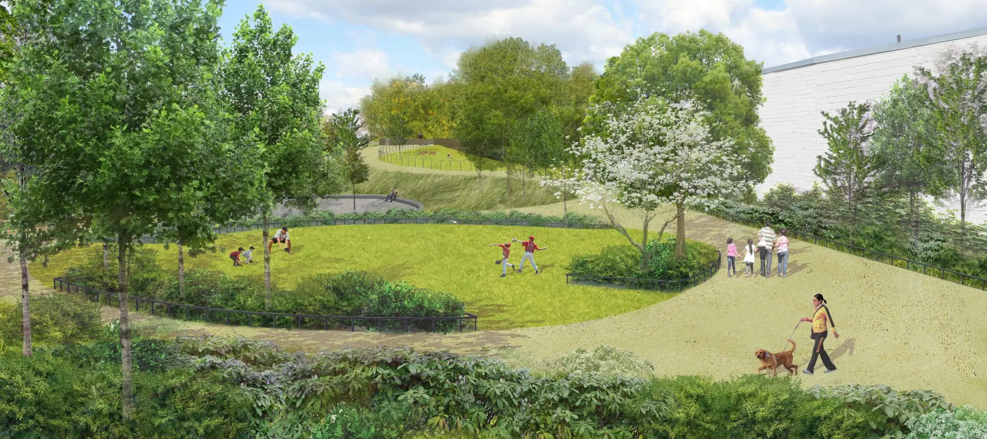
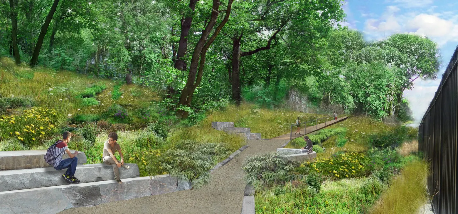
 An outline of the “Hub”

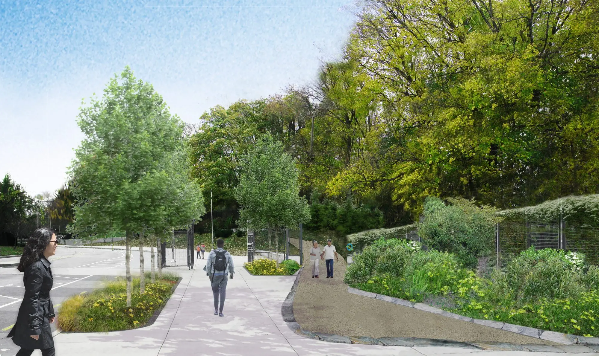
Metropolitan Expeditionary Learning School (MELS) Entrance
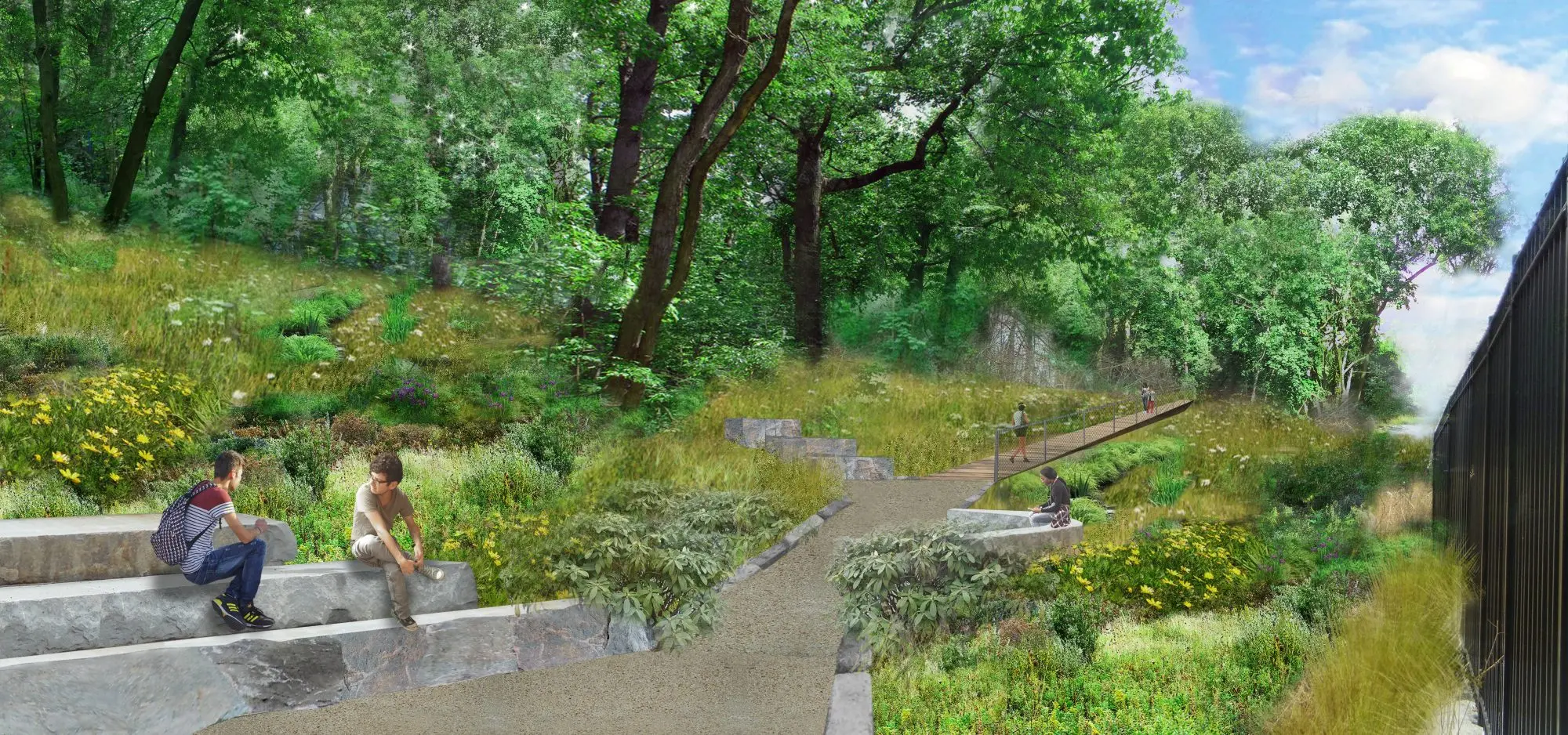
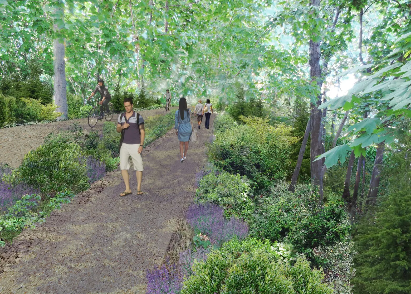
 Outdoor classrooms
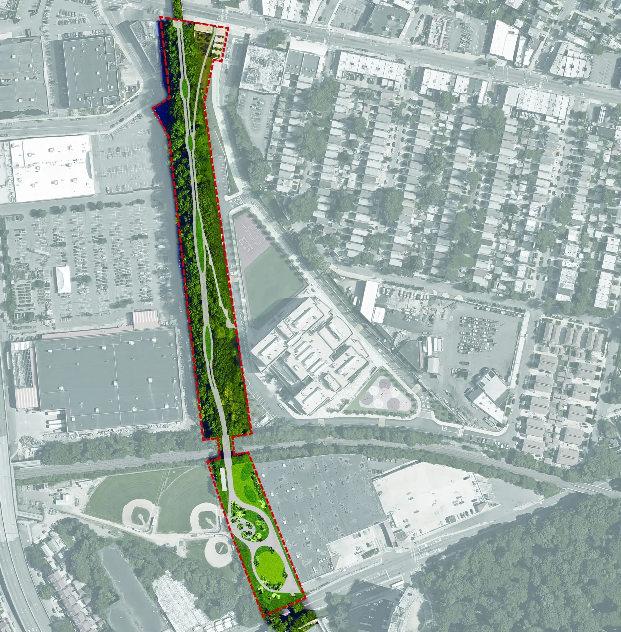
The QueensWay would be located on the defunct Long Island Rail Road Rockaway Beach Branch, which extends through Rego Park, Forest Hills, Woodhaven, Richmond hill, and Ozone Park. There are roughly 320,000 people who live within a one-mile stretch of the railway.
This first phase is dubbed “the Metropolitan Hub” and will run along an existing path in Forest Hills and Glendale from Metropolitan Avenue south to Union Turnpike, improving pedestrian and bike access to Forest Park. It will have learning gardens and outdoor classrooms for the 300+ students in the nearby Metropolitan Education Campus.
WXY Studio Architecture + Urban Design is working on the overall plan for the QueensWay; previous conceptual designs have included a zip-line and giant slide, green infrastructure engineered to reduce the risk of flooding, and a shrubbery buffer zone to provide privacy for local residents.
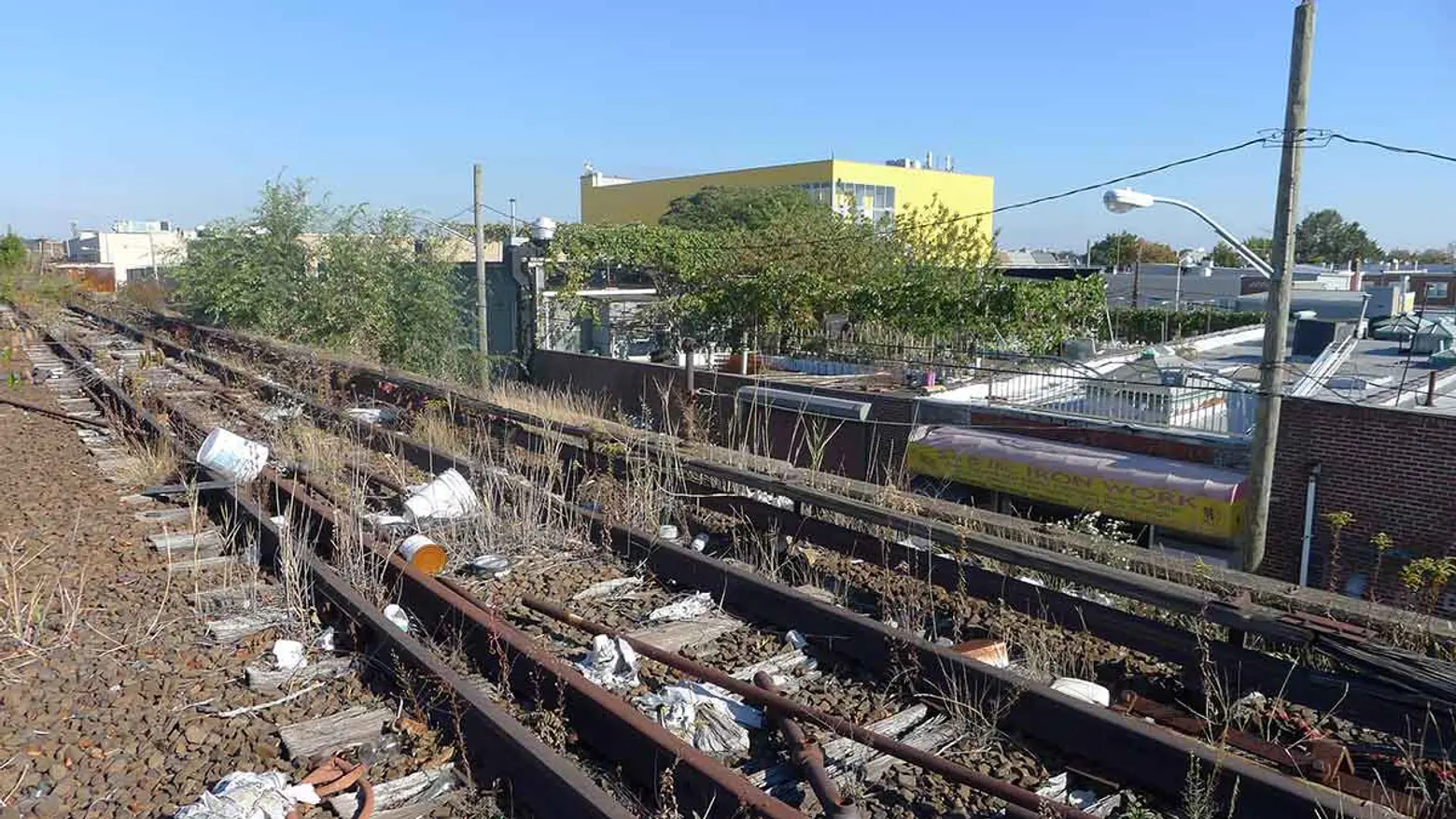
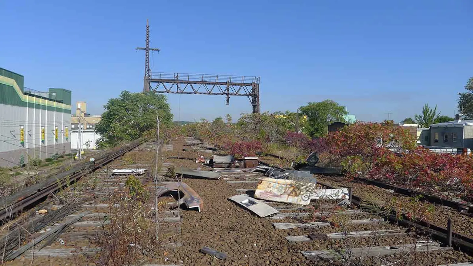
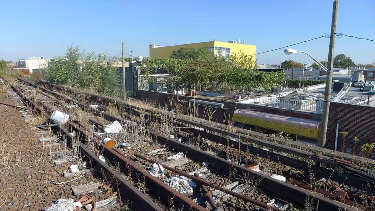
Current conditions at the site
Back in October 2014, a feasibility study put the cost of the QueensWay at $120 million, which seemed steep to some considering the 1.45-mile High Line cost $152 million for its first two sections and $35 million for the third. But just two months later, the state allocated nearly $444,000 to the design of the first phase. To date, the groups have raised $2 million in private funds and state grants, despite opponents who feel the rail line should be put back in commission in order to provide rail mass transit to JFK Aiport.
The following three options use all or part of the existing Rockaway Beach Branch of the LIRR (which, it should be noted, is the site of the proposed QueensWay park). It’s currently an abandoned line that runs 4.8 miles from Rego Park to Howard Beach, and it connects with the Lower Montauk Branch (a freight line) and the Atlantic Branch to Downtown Brooklyn’s Atlantic Terminal. They would function in addition to the AirTrain, but would cost significantly more than the AirTrain Connection outlined above.
In a statement, Andy Stone, New York City Director of The Trust for Public Land, said: “Today’s announcement is a tremendous step forward for the QueensWay, which would not have been possible without our partners in government and the community, who enthusiastically provided ideas for safe routes for biking and walking, outdoor classroom space, and enhancements to baseball fields. The completion of a compelling design for the first phase will bring us that much closer to making the QueensWay a reality for hundreds of thousands of people who live within a 10-minute walk.”
RELATED:
- QueensWay Elevated Park Moves Closer to Reality, State Allocates $444K for First Phase
- Study Says QueensWay Will Cost $120 Million and Help Local Economy
- The Bronx May Get Its Own Lowline-Style Park at Abandoned Mott Haven Rail Tracks
- High Line-style park proposed for a half-mile stretch of abandoned Staten Island rail
Renderings via DLANDstudio; photos of the current site via The QueensWay