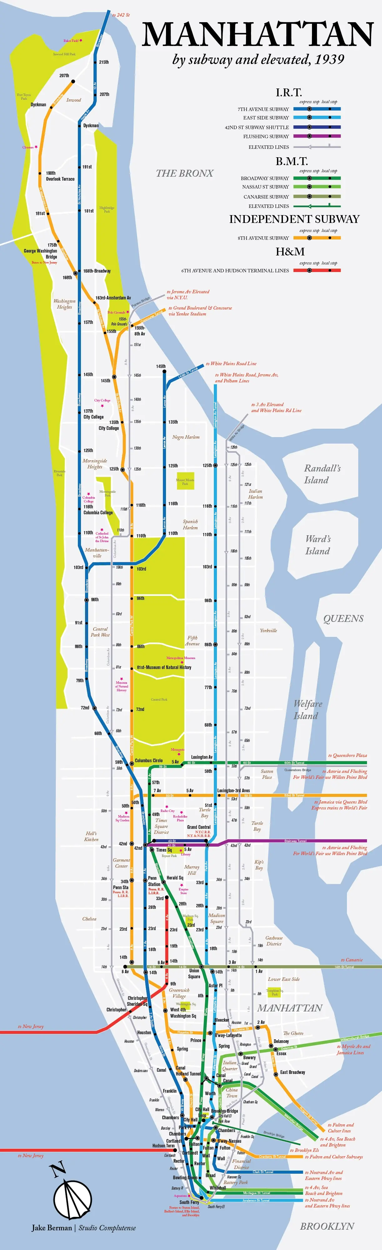
MAP: Here’s what the NYC subway system looked like in 1939

We often think of the NYC subway as a relatively modern marvel, a system that has expanded and evolved tremendously over 100-plus years, and a shell of what it was when it first debuted in 1904. However, the reality is that the majority of the lines that make up today’s network were actually built before The Great Depression. In fact, as graphic designer Jake Berman’s insightful throwback map depicts, it was pretty much all systems go by 1939.
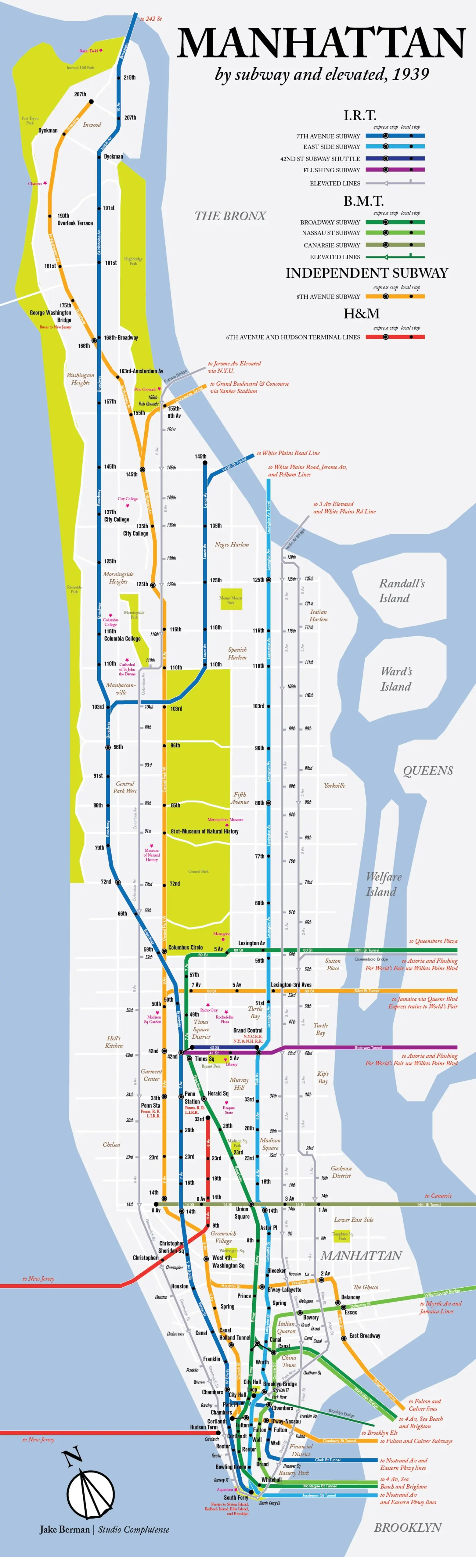
Though the map doesn’t look radically different than today’s, there are a few notable differences. First, as Berman points out, there is no 6th Avenue BDFM (it opened a year later); the map also details the elevated lines that used to run along 9th Street, 3rd and 2nd avenues, as well as over the Brooklyn and Queensboro bridges. The creator notes that he chose 1939 because “the IND was finished by then, but the majority of the elevated lines were still intact.”
For an extra bit of early 20th century immersion, Berman also denotes the “historical” names of various neighborhoods (pulled he says from a 1939 tourist’s guide), which include Roosevelt Island’s former moniker “Welfare Island” and the Lower East Side’s “The Ghetto”—these among some other dicey appellations. Several markers also point out the original locations of institutions like NYU, which was in the Bronx, and Madison Square Garden, which was formerly up near 50th Street.
Apart from the Second Avenue Subway, which is slated to open in December, the city’s last great subway project was the IND. The system’s comprehensive coverage early on can be largely attributed to the fact that automobiles and highways had not yet proliferated. These two things would ultimately quash any meaningful expansion.
RELATED:
- All the MTA Fare Hikes of the Last 100 Years–and a Video of When It Cost Just 15 Cents
- This Map Explains the Historic Tile Color System Used in NYC Subway Stations
- PHOTOS: Go Inside the NYC Subway Cars Dumped in the Atlantic Over a Decade Ago
- Amazing Detailed Map from the 1950s Shows 300+ ‘Wonders of New York’