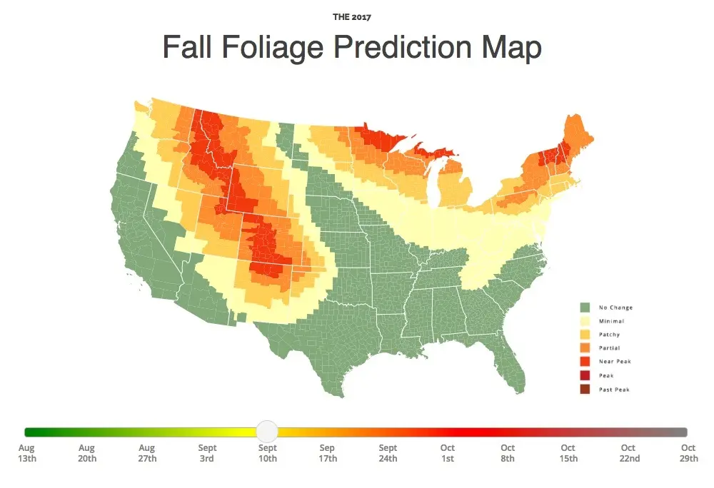
MAP: Find out when fall foliage will hit its peak in your area

The temperature is falling, the air is brisk, and the kids are heading back to school. This can only mean one thing: Autumn is upon us. While you may lament the end of days spent sunning beachside, don’t forget that sweater weather brings with it a bounty of fiery colors. If you’re hoping to catch the changing season in all its beauty, there’s no better tool to plan your leaf peeping expedition than SmokeyMountains.com‘s Fall Foliage Map. This handy interactive cartograph will tell you when and where foliage is expected to appear, and more importantly, when it will peak in your area.
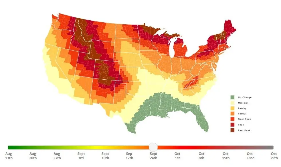
DRAG THE BUTTON TO ENGAGE THE MAP:
To create the map, SmokeyMountains developed an algorithm able to analyze several million data points culled from the National Oceanic and Atmospheric Administration ranging from historical temperatures, historical precipitation, forecast temperatures, and forecast precipitation, as well as historical leaf peak and peak observation trends from other sources.
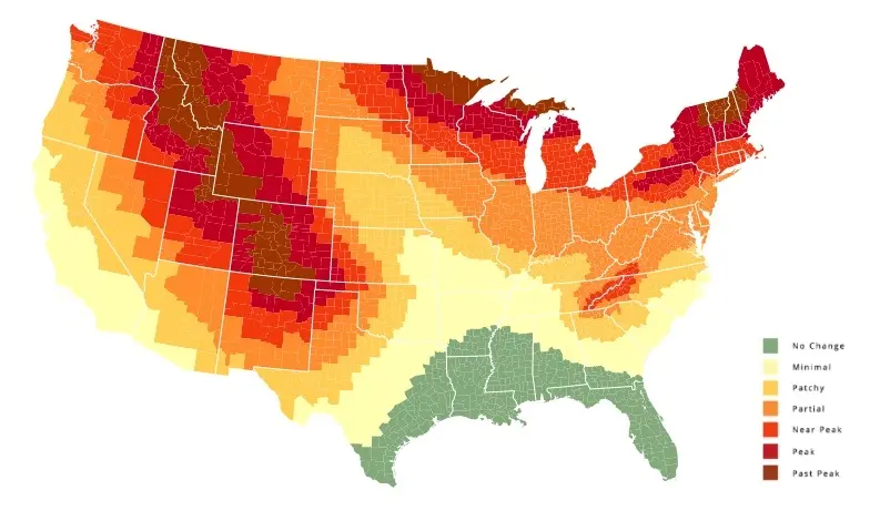
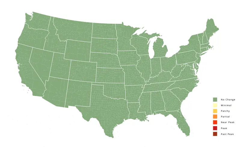
The map can forecast county-by-county the precise moment when fall peak will occur, and covers an 11-week period between August 26 and November 11.
[Via SmokeyMountains.com]
RELATED: