If Hurricane Joaquin Were to Hit NYC, Do You Know What Your Evacuation Zone Is?

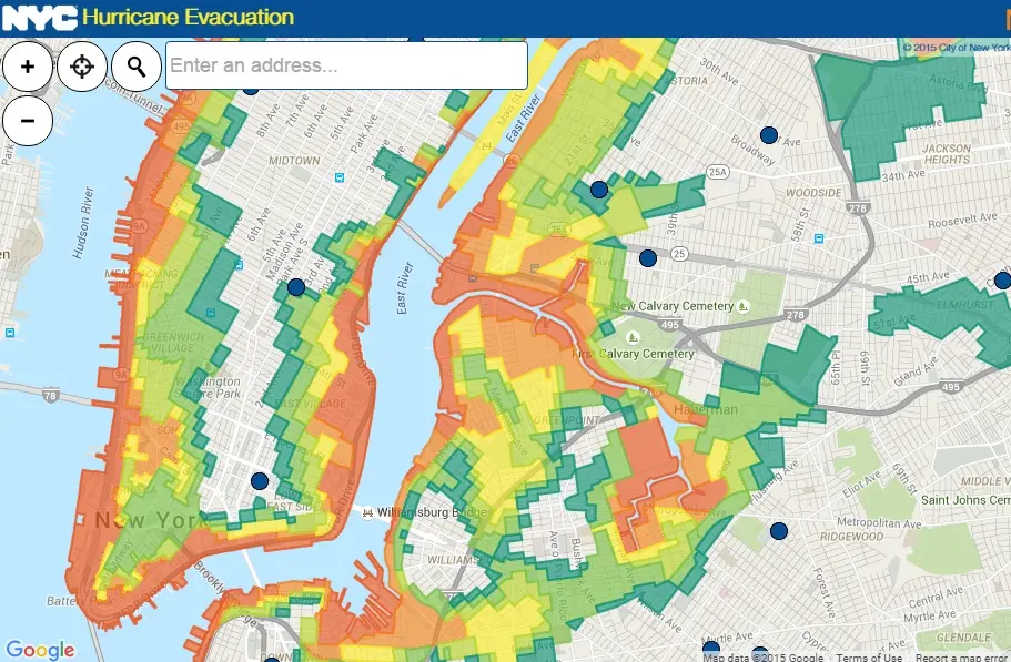
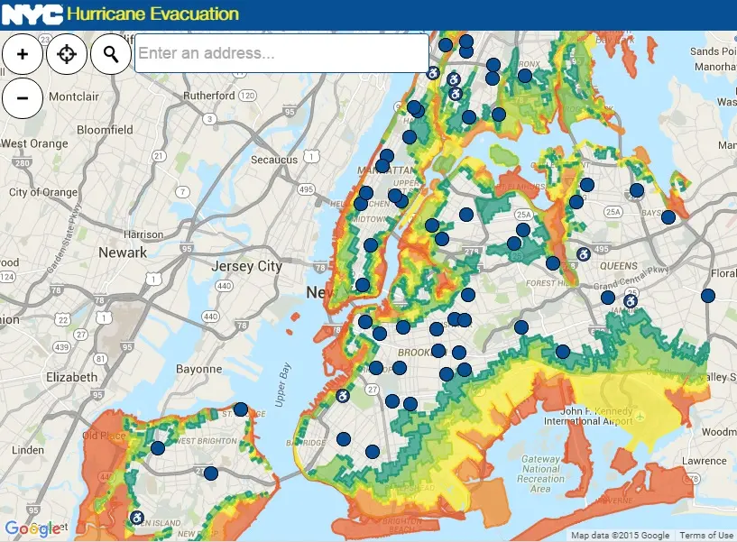
With Hurricane Joaquin getting upgraded to Category 4 and New Jersey already declaring a state of emergency, panic is starting to set in. But to quell your fears, take a look at the city’s official hurricane evacuation map. It color codes zones 1 (red-the most threat) through 6 (teal), as well as providing locations for evacuation centers (the blue dots). The non-colored areas are considered safe zones, so be sure to check to see if you have friends or family who live here.

Of course the coasts are the most susceptible to flooding, with lower Manhattan, Stuy Town, Red Hook, Gowanus, Coney Island, East Elmhurst, Flushing, the Rockaways, Pelham Bay Park, City Island, and much of the eastern and western shores of Staten Island having the highest levels of threat. The map also lets users search by address and provides directions to all of the evacuation centers. And if an evacuation order goes into effect it will flash on the screen.
Find out what evacuation zone you’re in here >>
RELATED: