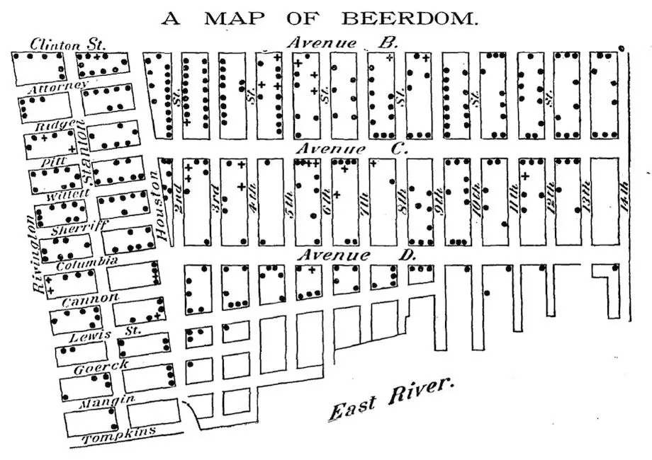
‘Beerdom’ map shows 19th century Lower East Siders drank more

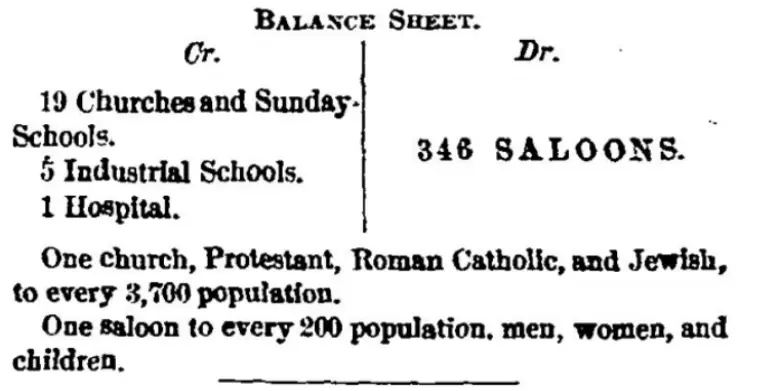
While today’s Lower East Side has no shortage of bars and clubs, New Yorkers of the late nineteenth century may have imbibed way more than current Big Apple dwellers. Slate shared this map drawn in 1885 and published in the Christian Union that details the number of bars per block in the neighborhood. Although the coinciding article described the social effects of LES drinking culture, overall the report found residents to be quite happy. It may have had something to do with the 346 saloons found in the area, compared to today’s mere 47 establishments.

The Union newspaper was founded by Henry Ward Beecher, who was a Brooklyn minister and temperance advocate. The “Beerdom” map focused on the Lower East Side because of its dense population at the time. The reporter wrote: “The streets are full, the schools are full, full are the nooks and corners of the houses.” According to census data for 1880, the population in the neighborhood was 68,779. As the Union reported, residents had access to 19 churches, five industrial schools, one free reading-room, one hospital and 346 saloons.
To see the transformation of Beerdom, Slate looked at the current number of bars and people residing in LES. As the number of bars decreased, it seems so did the residents. In a 2010 census, only 62,076 individuals inhabited the entire neighborhood.
[Via Slate]
RELATED: