Tri-State Trail proposal would connect New York, New Jersey and Connecticut with 1,650 miles of trails

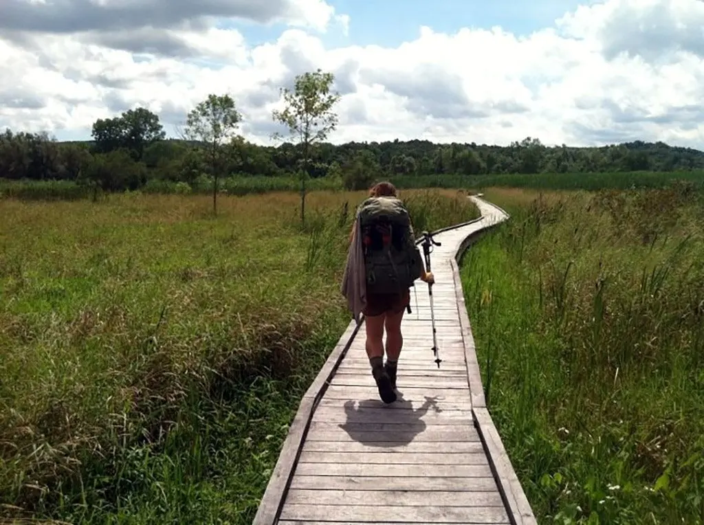
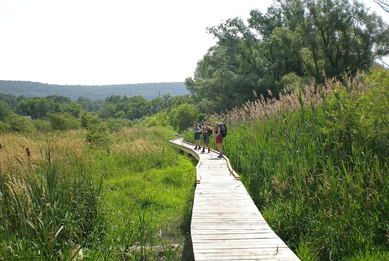
Pochuck Creek, photo via Pixabay
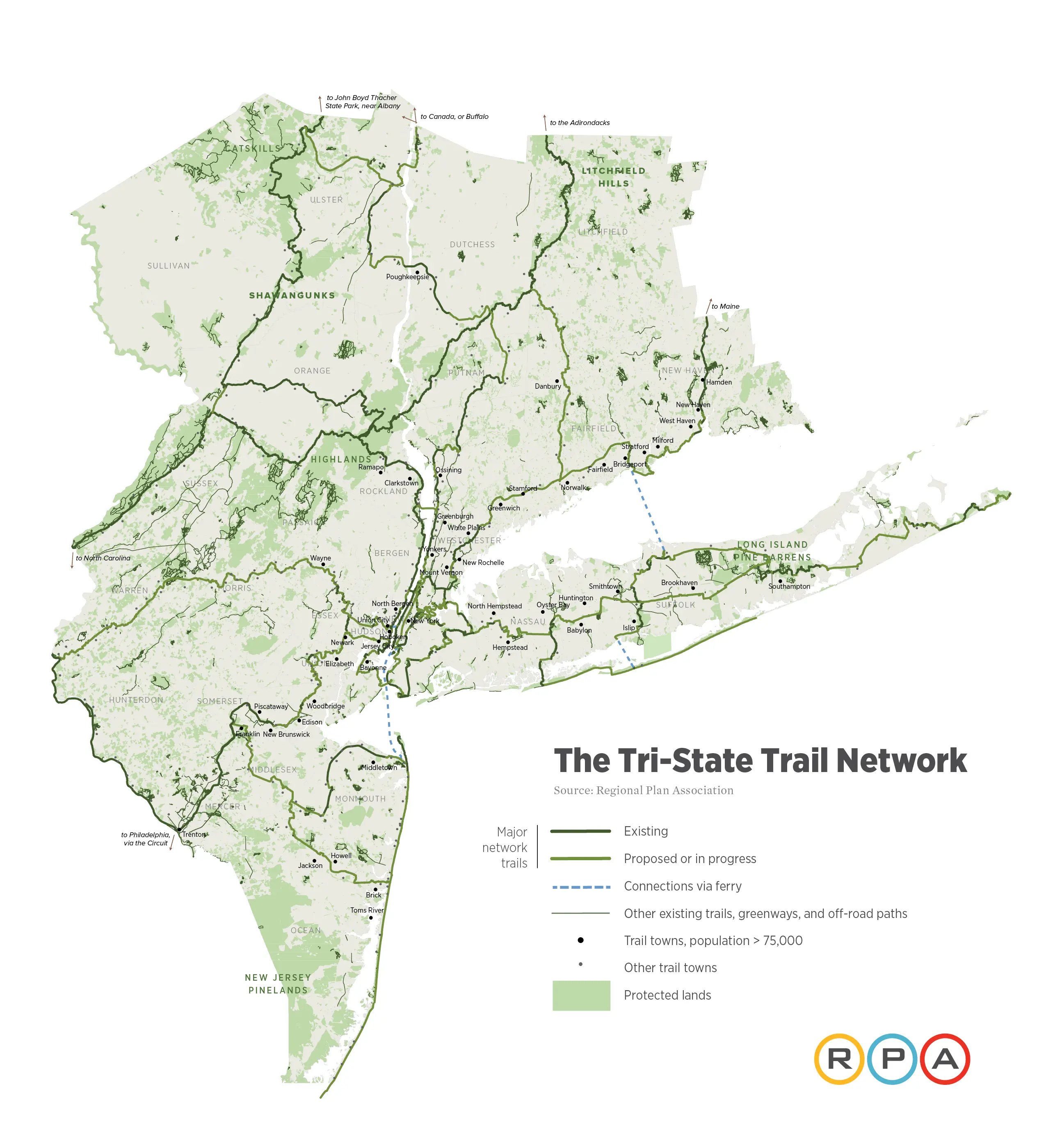
The NY-NJ-CT region features hundreds of parks and landscapes, from the Catskills and Pinelands to the beaches of Jersey and Long Island. Despite all of this open space, these recreational spots are disjointed from each other and from the communities that would use them. To better connect the parks to one another and to residents, the Regional Plan Association (RPA) has released a new proposal that calls for a Tri-State Trail network, linking 1,650 miles of biking, hiking, and walking trails in the greater New York region. The trail network would put over 8 million of the area’s residents within a half-mile of a trail, increasing access by 25 percent. It would put over 80 percent of today’s residents, or roughly 18.6 million, within just two miles of a trail.
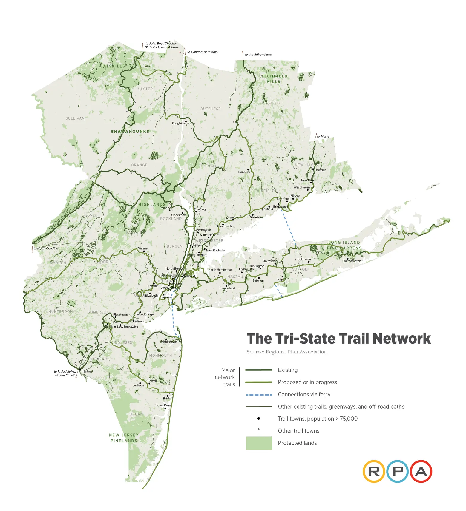
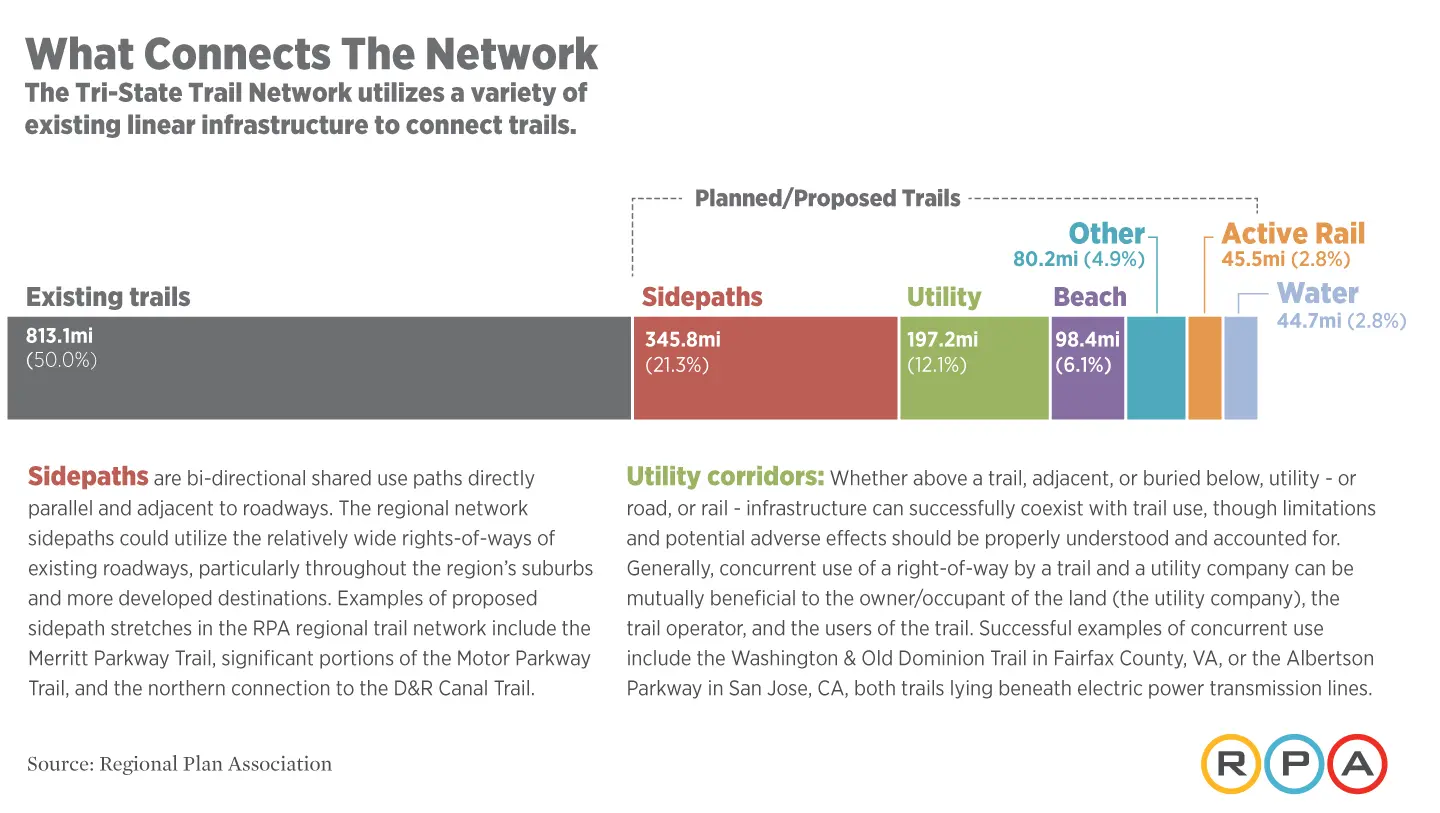
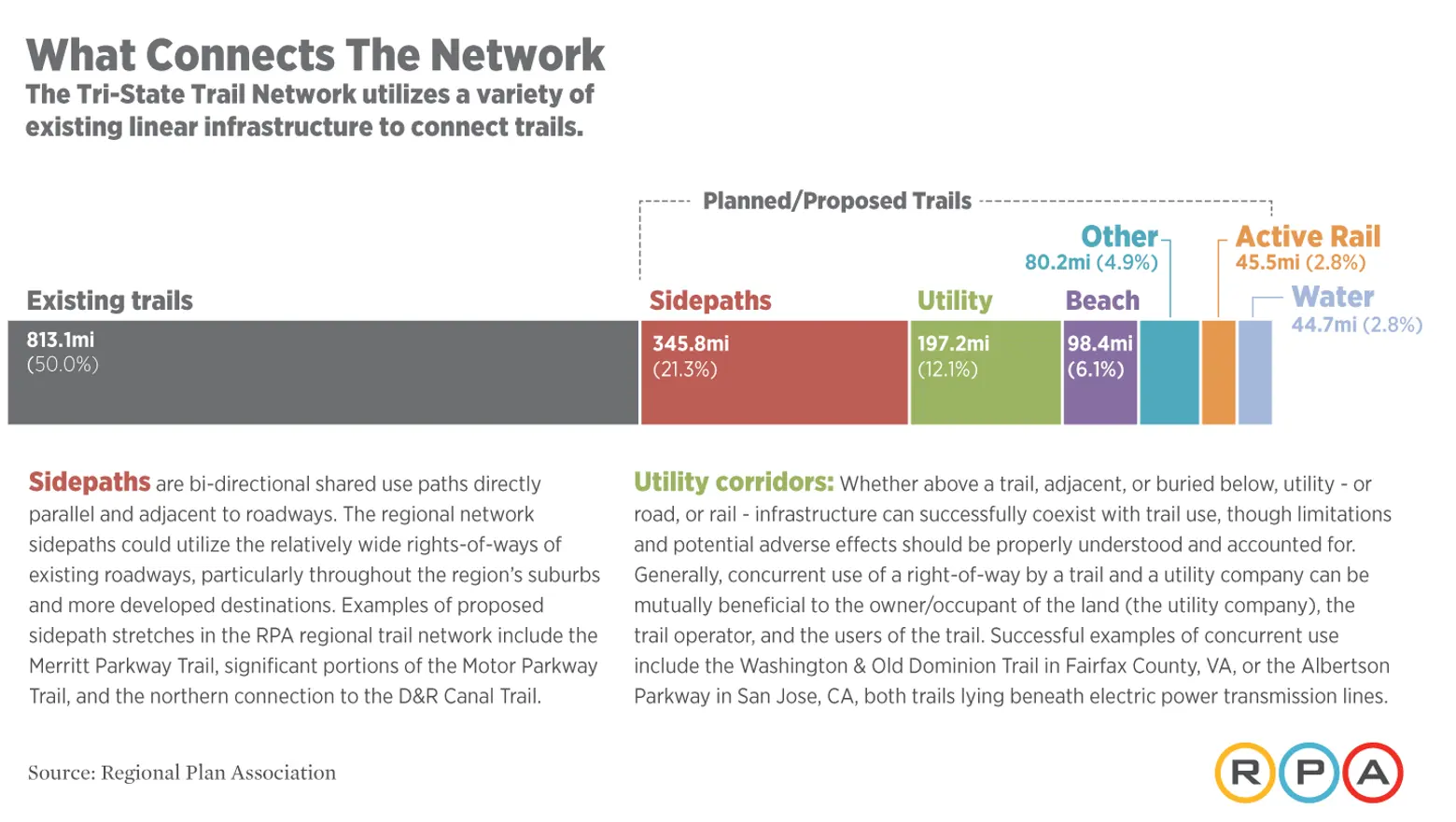
RPA’s report, Accessing Nature, highlights the need for increased access to both trails and to the communities where they are located. The group’s vision builds on the thousands of miles of existing trails, and trails under construction, in the area, with 800 of the 1,650-mile network already developed. According to the RPA, the Tri-State network will promote health, equity, help preserve the environment and boost economic activity throughout the region.
The report says a regional trail network could lift the economy of the “trail towns” along the routes, stemming from an increase in tourism, hospitality facilities, and property values. The network would provide residents that have limited access to open space, especially low-income urban neighborhoods, with better and more affordable connections to nature. Other advantages of the project listed in the report include promoting physical activity and fostering support for protection of open space.
Residents along the Tri-State Trail would have access by trail to 141 state and national parks or preserves, for a total of 297,000 acres. The trail would pass through 278 of the region’s towns and municipalities, which could spur economic development opportunities.
The proposal’s “urban core” routes include three trails that stretch throughout New York City, all which are partially completed. The Harbor Ring extends 43 miles and connects communities along New York Bay, from lower Manhattan across via ferry to Hoboken, Jersey City and Bayonne. Then, across the Bayonne Bridge to Staten Island, over the Verrazano Bridge over to the Brooklyn Greenway and across to the Brooklyn Bridge. The plan would add a pedestrian pathway on the Verrazano Bridge, or at least a bus equipped with bike racks.
The Manhattan Trail proposal would make Broadway a single lane from 59th to 14th Street, Union Square. To make it more street-safe for bikers and walkers, the plan calls for Times, Madison and Herald Squares to be closed to traffic. The trail would build on existing routes to Highbridge and Morningside Park, connecting four parks and allowing residents of upper Manhattan to reach the Long Path, Empire State Trail and Merritt Parkway.For the Inner Sound Shore Loop, which spans 55 miles, the South Bronx Greenway would be extended, moving it closer to the waterfront and connecting it to North Queens.For the Inner Sound Shore Loop, which spans 55 miles, the South Bronx Greenway would be extended, moving it closer to the waterfront and connecting it to North Queens. The route would use both city- and utility-owned land.
In New Jersey, residents will be able to access the 107-mile long Morris Canal Greenway, which aims to connect the Hudson River and the Meadowlands to the Lehigh Valley. Other trails include the Jersey Shore Trail, connecting Sandy Hook to the southernmost point of Long Beach Island, and the Shore to Somerset Connector, a route that would link Point Pleasant to Franklin, with connections to Pigeon Swamp State Park and Monmouth Battlefield State Park.
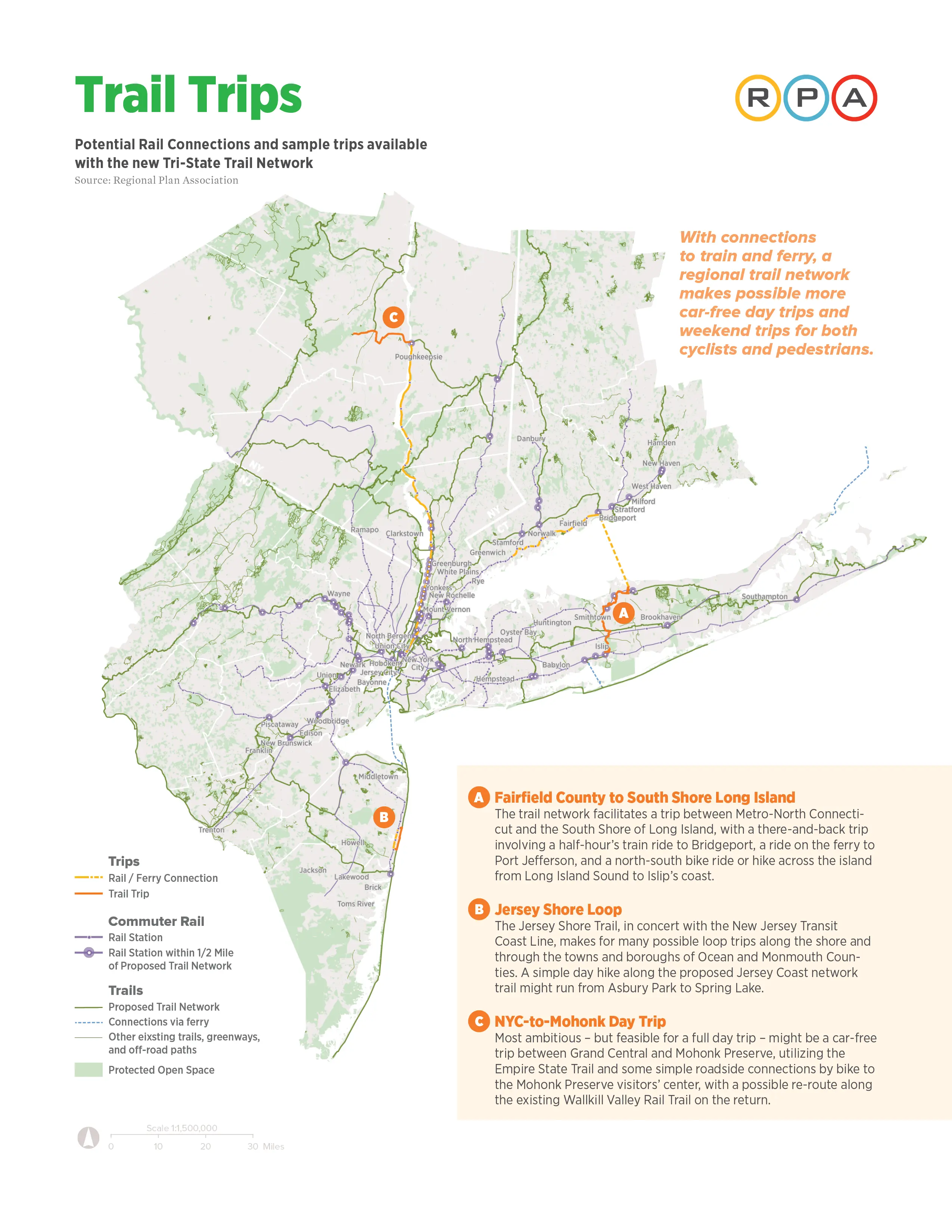
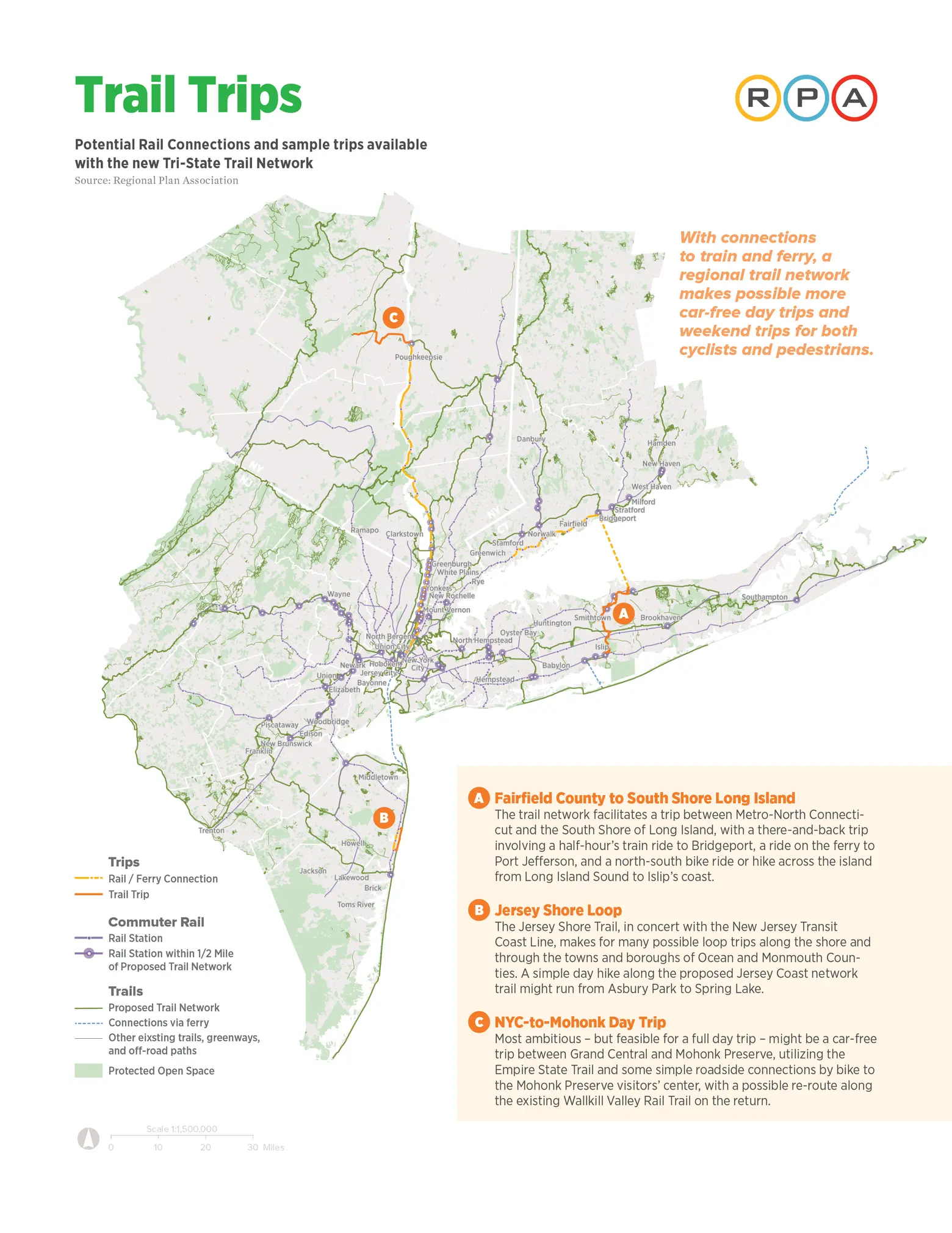
Connecticut residents would be able to access parks and scenic landscapes through the Merritt Parkway Trail, the Appalachian Trail and the East Coast Greenway. Both the Long Island region and the Mid-Hudson region will see a big increase in accessibility to the trails. Overall, the RPA’s report includes 16 routes that need to be built upon or completely constructed.
To make these routes a reality, the association plans to collaborate with federal, state and local governments, as well as with land trusts and trail groups. And of course, the planning and implementation of the trail networks need funding, on both a federal and local scale. Read the full report from RPA here.
RELATED: