Nyc Subway

November 23, 2015

The Story Behind Those Infamous ‘Sick Passenger’ Subway Announcements

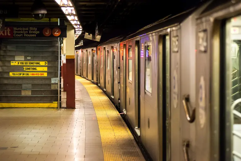
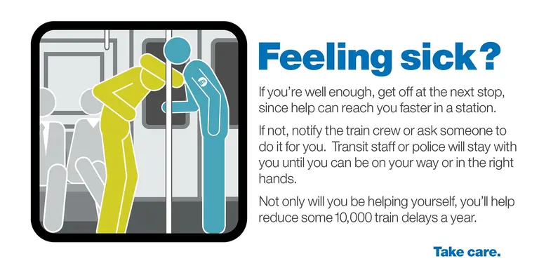
Admit it–despite your general concern for the well-being of your fellow New Yorkers, you can't help roll your eyes when that dreaded "sick passenger" announcement comes over the subway intercom. "Why get on the train if you're not feeling well?" or "Can't they just move the person to the platform?" are common moans heard during these all-too-common delays. But, it turns out, it's a lot more complicated than that. The New York Times took a look at the rise in sick passengers, up to 3,000 a month this year as compared with 1,800 each month in 2012. Every time this happens, the train crew has to notify the rail control center, who then will call an ambulance. It depends on the specific station and time of day how long it will take emergency medical workers to locate the sick patient. Then, if it's deemed the passenger cannot safely walk, he or she must remain on the train to be assessed. Further, if the passenger has no one to wait with them and there's no police officer available, it falls on the train conductor to stay with the patient until help arrives. This can lead to the train being pulled out of service altogether. And of course, the delays start a ripple effect throughout the line.
More this way
November 19, 2015

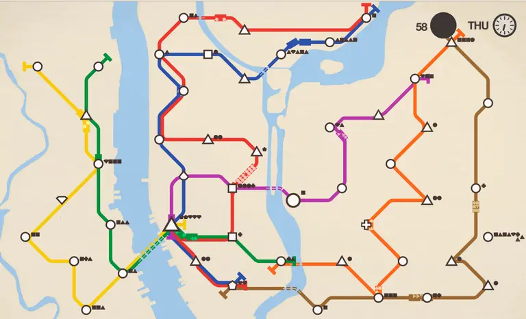
Think You Can Design a Better NYC Subway System? Try It With Mini Metro

The New York subway system is a complex but pretty efficient network that (for the most part) gets us to where we need to get when we need to get there. But that's not to say there aren't some neighborhoods that wouldn't benefit from a few more stations—and better connections from one line to another. Well, if you're a savvy straphanger that thinks that you can engineer a far more efficient system than the MTA, the game Mini Metro is the perfect place to flex your dormant urban planning skills.
Where to try out the game here
November 2, 2015

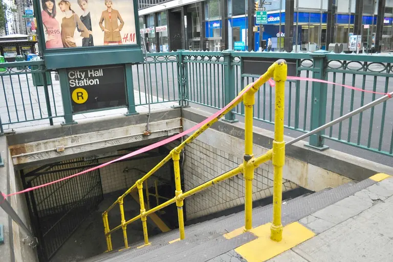
25 Percent of Subway Station Entrances Are Closed, Worsening Congestion

There's so much to kvetch about when it comes to the MTA and poor subway service: unprecedented debt, increased ridership that hasn't been matched with increased service and outdated technology to name a few. But here's another to add to the laundry list: closed station entrances. amNY reports today that one out of four subway entrances are closed at a total of 119 stations, which "create bottlenecks that make it difficult to get in and out of increasingly jam-packed stations, while stores miss out on the foot traffic." In total, a whopping 298 staircases are inaccessible, and some closures have been in effect for so many decades that the MTA doesn't even know why they're not in use.
Find out more
October 29, 2015

POLL: Would You Like to See the MTA Use This Modern Subway Map?

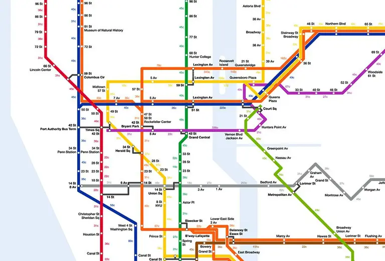
Yesterday, 6sqft brought you this modern subway map redesign by Tommi Moilanen. His version keeps the current map’s basic structure, but infuses it with a bit of Massimo Vignelli‘s famous graphic style. Geographically and systemically accurate, Moilanen’s map also uses thick and thin lines to represent express and local service; tints skipped stops a lighter shade; more clearly […]

October 28, 2015

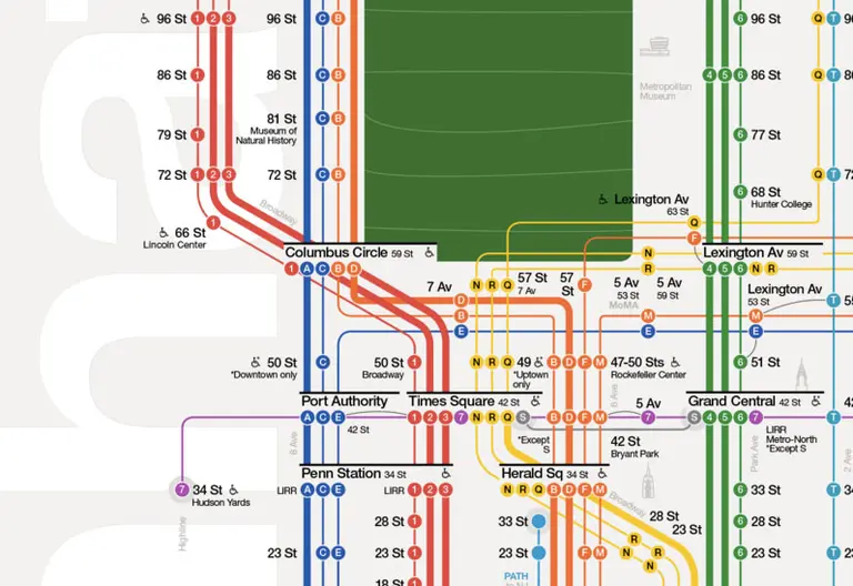
Tommi Moilanen’s New Subway Map Design Makes It Easier to Navigate the City

The subway is one of New York City's greatest assets, but this only holds true if you can actually navigate through the various tunnels and platforms. And despite the countless transportation apps out there today, the good 'ole subway map is still the best way to find your way around. There's certainly been no shortage of map redesigns, but 6sqft is particularly impressed with the stylings of this new map by Tommi Moilanen, a Finnish industrial and interactive designer. His version uses the system's existing design language, but incorporates a fresh, modern aesthetic.
More details and the full map
October 23, 2015

PHOTOS: Go Inside the NYC Subway Cars Dumped in the Atlantic Over a Decade Ago

By now, you've probably seen Stephen Mallon's insane photo series showing thousands of subway cars being tossed into the ocean. The unlikely MTA initiative was undertaken more than ten years ago with the goal of creating artificial reefs that would support sea life along the Eastern seabed. Now fast forward a decade plus, and the fruits of the agency's environmental efforts can finally be seen in these incredible underwater images from Express Water Sports.
See them all here
October 12, 2015

State and City Finally Agree on Funding Plan for the Debt-Ridden MTA

After months of squabbling over who's responsible for funding repairs and expansions of NYC's transit system, Governor Cuomo and Mayor de Blasio reached an agreement on Saturday to keep the MTA's $26.1 billion, five-year capital plan on track. The state will put in $8.3 billion and the city $2.5 billion (much more than de Blasio's original $657 million planned contribution). However, Cuomo was clear that their commitment won't come from increasing taxes and that he's confident the money can be found in the existing state budget. The city, too, said it would not raise taxes, but rather take $1.9 billion from city funds and the rest from sources that could include development rights or rezoning. The agreement still leaves the MTA $700 million short of its total, but the agency hopes to close the gap by finding "further efficiencies."
READ MORE
October 7, 2015

Cities Would Take Up 37 Percent More Space if It Were Not for Public Transit

The major benefits of public transportation are clear: riding the subway or bus is way cheaper than maintaing a car, and more often than not, it's a much faster means of getting from point A to point B. But as Streetsblog points out in this recent study by the Transportation Research Board, transit is a major of driver of density within a city, and it's something that incentivizes developers and city planners to put things closer together. While this may not be an earth-shattering revelation to you, if you quantify the effect, you just might be surprised. According to the report, U.S. cities on average would take up 37 percent more space to house current populations if it were not for public transit.
Find out more here
September 3, 2015

Here’s How Many Calories You’ll Burn if You Walk, Jog, or Cycle Instead of Taking the Subway

Looking to shed a few pounds after all the summer cookouts and outdoor happy hours? Perhaps you should consider ditching the old Metrocard and traveling by foot or bicycle instead. To put into perspective just how fit this will get you, the folks over at Treated have calculated how many calories you'll burn by walking, jogging, and cycling between subway stops. As Curbed notes, the analysis provides calorie info for every single subway stop and also charts the longest stops, which unsurprisingly are mostly over bridges, and the shortest stops, mostly located in lower Manhattan.
See the full map and calorie charts here
September 2, 2015

VIDEO: Riding the Subway in the 1940s Wasn’t Much Different From Today

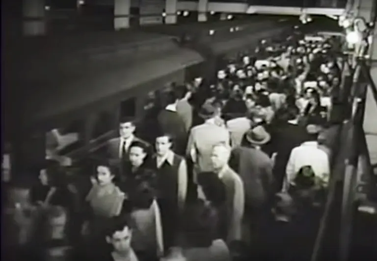
Here's a picture of the New York City subway–mobs of commuters crowding the platforms; train cars filled to the brim; passengers blocking the train doors; people walking while reading the paper, oblivious to their surroundings. Sounds like your commute this morning, right? But believe it or not, we're describing the subway from the 1940s. Unearthed today by Gothamist, this video from the New York Transit Museum archives shows just how little things have changed in the past 75 years.
Watch the video here
August 28, 2015

Hudson Yards 7 Train Station Will Officially Open on September 13th

We once had a friend who lived in midtown all the way over on 12th Avenue...and let's just say we rarely visited. But what was once a subway wasteland is finally getting its very own subway station. After years of delays, the new 7 train stop at 34th Street-Hudson Yards will officially open on September 13th, at 1:00pm to be exact. The extension from its current endpoint at Times Square has cost the city $2.4 billion since construction commenced in 2007.
More details
August 26, 2015

See NYC’s Subway Lines Superimposed Over an Aerial Photo of the City

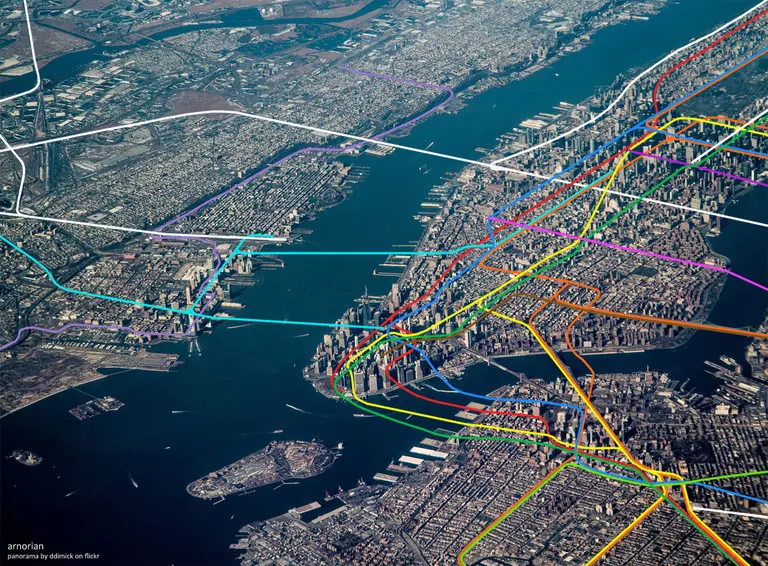
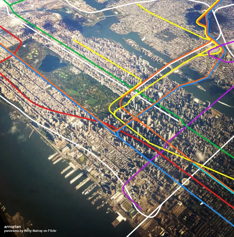
When we head underground and board the subway, most of us don't give much thought to all the streets and landmarks we'll be zipping past as we move along to our destination. But here’s an incredible mash-up from map enthusiast Anorian that offers a much different perspective on exactly where the subway travels. An amalgamation of digital photos taken from a commercial plane and the expert mapping of each line, this beautiful image is far more captivating and insightful than any printed or online map out there.
See more views here
August 21, 2015

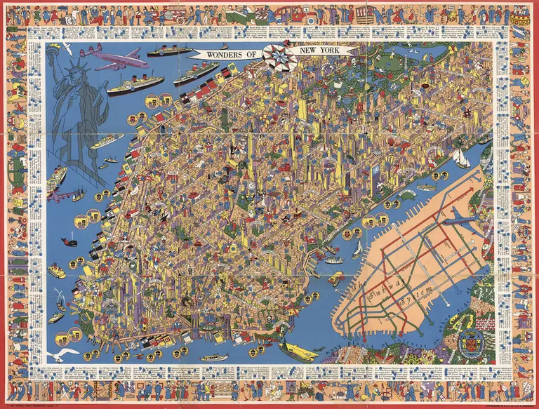
Amazing Detailed Map from the 1950s Shows 300+ ‘Wonders of New York’

Click to expand >> One of a growing collection of transit maps, this cool detailed New York City map, designed by graphic designer/sailing enthusiast/IBM employee Nils Hansell sometime around 1953-1955, offers a mind boggling tableau of (mostly) Manhattan's points of interest, numbered, with a corresponding key. There's also a color-coded schematic to the subway system, which was at the time divided up by its operators, BMT, IND and IRT; the map also shows a remaining few of the city's elevated railway systems, the last of which was ended in 1955.
Check it out here
August 14, 2015

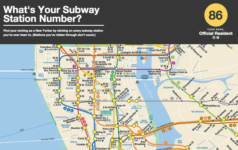
What’s Your Subway Cred? New Game Judges You Based on the Number of Stations You’ve Visited

Akin to pinning all of the cities you've visited on a world map, "What's your Subway Number?" allows you to visually quantify your worldliness—or in this case your "New Yorkness"—by accounting for every subway stop you've stepped foot in. The game is the clever creation of digital designer Mike Solomon, and breaks straphangers down into four categories: Rich Tourist, Junior Commuter, Official Resident, and NYC Lifer.
Find out more here
August 13, 2015

Study Says: The 4 Train Is the Worst Performing, the L Train the Best

The L train may be painfully packed during rush hour, but at least it can tout the title of being the best performing of all of NYC's subway lines—which appear only to be getting worse. The Journal reports that an audit recently conducted by the state comptroller’s office revealed that, on average, the subway system's on-time performance (how frequently a train reaches its last stop within five minutes of the scheduled time) is on the decline, falling to 74 percent on weekdays and 81 percent on weekends in 2014, from 81 percent and 85 percent in 2013. But the worst performing train of all? The 4 train.
More on the best and worst trains here
August 6, 2015

Map of ‘Subway Deserts’ Shows Outer Boroughs Left High and Dry

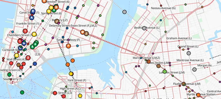
Though we may already know there are places in NYC that we can't easily get to, transit data junkie Chris Whong lays it all out on a map that points out the city's lesser-served regions, at least by underground means. The interactive map shows all NYC land areas more than 500 meters (about .3 miles) from one of the city’s 468 subway stations–that’s about two avenue blocks or six or seven shorter street blocks (around a seven-minute walk) according to Google maps. A big blue dot blots out this radius surrounding the station; everything outside the dot, well, you’re hoofing it (or taking a bus, car or rickshaw).
Find out more
July 27, 2015

VIDEO: Go Behind the Super Antiquated Switchboard of Today’s NYC Subway

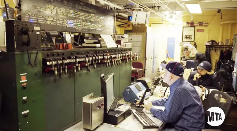
The MTA is showing its age in a new video put forth by the public benefit corporation. "People know the system is old," the narrator of MTA's video opens, "but I don't think they realize just how old it is." The New York City subway system has been running since 1904, and as we previously reported in December, it's been running on the same technology used in the 1930s. In the video, computers are noticeably absent from the West 4th Street Supervisory Tower, which is in control of all of the train movements around the area. Instead there are plenty of pens and papers, as well as old, lever-operated machinery that the railroad industry has long stopped manufacturing. It's no wonder that the MTA has put out this video promoting their Communications-Based Train Control (CBTC) system, a project that aims to modernize the subway.
Watch the incredible video here
July 24, 2015

New Yorker Spotlight: Gabrielle Shubert Reflects on Her Ride at the New York Transit Museum

On the corner of Boerum Place and Schermerhorn Street in Downtown Brooklyn is what looks like a regular subway entrance. But upon further inspection, it becomes clear that there's no uptown and downtown platforms here. This is the New York Transit Museum, the largest museum dedicated to urban public transportation in the country. It's fittingly located inside a decommissioned–but still working–subway station. And over the last 40 years, it has told one of New York's most important stories–how mass transit and city development are intricately connected and how public transportation is one of the city's crowning achievements, in spite of its delays and crowded rides. Gabrielle Shubert has served as the museum's director for the past 24 years. She transformed a young institution into a go-to destination for learning about and engaging with urban history. From vintage cars to subway fares, Gabrielle has offered visitors a chance to go behind the scenes and marvel at the wonders of New York City's incredible public transportation system. On the eve of her retirement, we sat down with Gabrielle in one of the museum's vintage cars and found out about her early days as director, the range of exhibits and programming she has overseen, and the institution's bright future.
Read the interview here
July 15, 2015

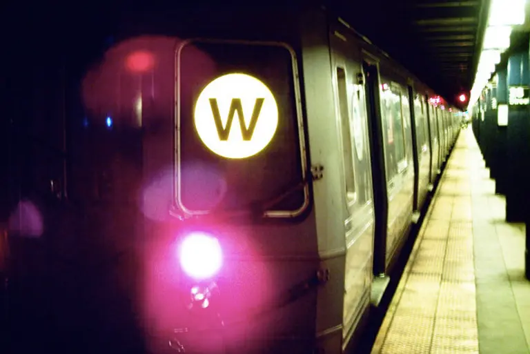
The MTA May Revive the W Train Line

Rumor has it that the W train may be returning from the dead. According to AM NY, the MTA is in talks with both public officials and rider advocates to bring the train back to service once the Q train is diverged to the Upper East Side to the new Second Avenue line in December 2016. Restoring the old line would prevent disrupting subway service in Astoria, an area with thousands of daily strap-hangers and only a few subways to choose from. The MTA hasn't made any official announcements on the matter thus far, but with the opening of the Second Avenue Subway line rapidly approaching, they are said to be seriously mulling it over.
More on the rumor here
June 18, 2015

This Poster Displays All 468 Subway Station Signs

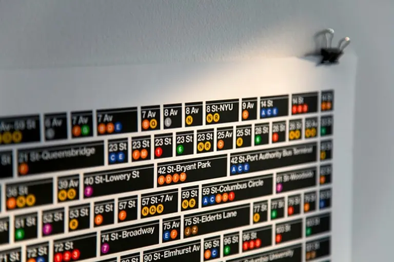
For all intents and purposes, we do not want any visual of the subway hanging in our apartments. The grimy stations don't really complement our decor, and we'd prefer not to be reminded of the daily bloodbath that is trying to squeeze onto the 6 train. But this poster is the exception to our no-MTA-in-the-house rule. Printed using 11 Pantone® spot colors, this snappy piece of wall art displays all 468 subway station signs throughout the city, arranged in alphabetical order. It was designed by Hamish Smyth, one member of the duo who reprinted Massimo Vignelli's iconic Standards Manual last year. Once again inspired by Vignelli's graphic visual approach, Smyth created the new poster because he feels "this is an iconic design that should be remembered and celebrated, and we think a beautifully printed poster is a great way to get it into many people's hands."
Find out how to get your own copy and watch a video from the design team
May 27, 2015

NYC Households Spend $130 a Month Funding the MTA

Today's dose of disheartening news about the MTA comes via the Daily News, who reports that the debt-ridden city agency collects $4.8 billion a year from city taxpayers through taxes, fees, and the city budget. This comes out to $130 a month for the average New York household, even more than the cost of a monthly Metrocard, according to a new report by Comptroller Scott Stringer. Keep in mind this is in addition to the $5.3 billion they collect from fares and tolls.
Find out more here
May 19, 2015

The MTA Explains Why Your Subway is Delayed with This 8-bit Video

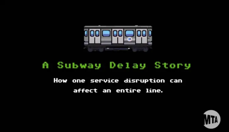
We're quick to write off the MTA as incompetent whenever we experience a subway delay, but let this video convince you that they do indeed know what they're doing. This new short created by the agency explains why holding a train can actually prevent additional delays from happening. As it turns out, keeping gaps from growing and restoring evenness to a line will help keep service on schedule overall. Check out their awesome 8-bit video ahead to get the visual explanation.
Watch the video here
May 18, 2015

Live Data Map Lets You Watch the World’s Mass Transit Systems Move

If you've ever marveled at how the world's public transit systems keep people moving across town and back every day, TRAVIC (Transit Visualization Client), which shows scheduled routes of trains and buses as well as real-time positions (the MTA provides real-time data feeds) from more than 200 public transportation systems worldwide, will keep you busy for a while. The data map, created by Swiss-German IT company GeOps and the University of Freiburg, lets you watch the C train (or your own regular punishment) crawl slowly through its scheduled stops–and wonder why there seem to be so many more trains running on the Paris Metro.
More this way

April 22, 2015

Subway Rent Map Shows Manhattan Rental Prices Along Each Train Line

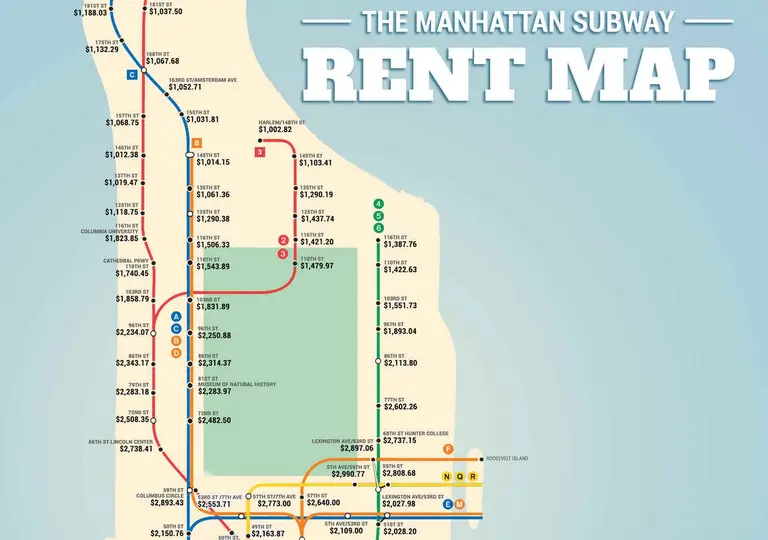
The folks over at Thrillist have put together the fun new Manhattan Subway Rent Map, which shows "where you can't afford to live, by stop." The figures come from the median rent per bedroom near every Manhattan subway stop. For the most part, the trends are what you'd expect -- prices along the 4, 5, 6 line get incredibly lower above 96th Street; living near a 14th Street train station will cost you; and the A, C, E train carries pretty steep prices throughout Manhattan until you reach 125th Street. But what's interesting is that the 59th Street corridor reigns supreme, with prices across the board coming in around $2,800.
See the full map here