In anticipation of a Landmarks overhaul, maps lay out the commission’s applications and decisions

This January, the Landmarks Preservation Commission released a series of amendments that would overhaul how the commission reviews certain applications–with the idea to cut down the time it takes to approve routine applications. And later this month, on Tuesday, March 27th, the Commission will hold a public hearing on how these changes would affect the city’s landmark process. In advance of the meeting, the Municipal Art Society of New York created a pair of interactive maps to better inform New Yorkers on the LPC’s process. One map, the Commission Review Map, shows what type of alterations have been permitted or denied by the full LPC commission. The other, the Staff Review Map, shows what type of alterations have been permitted by the LPC staff or withdrawn by the applicant. As MAS puts it, “We hope these maps help bring to light how the LPC fulfills its ‘purpose of safeguarding the buildings and places that represent New York City’s cultural, social, economic, political, and architectural history’ through regulation.”
MAS pulled its data from the “Permit Application Information” available on the NYC Open Data portal. Then they overlaid the maps with LPC Historic Districts, were used to provide context for permit and application data.
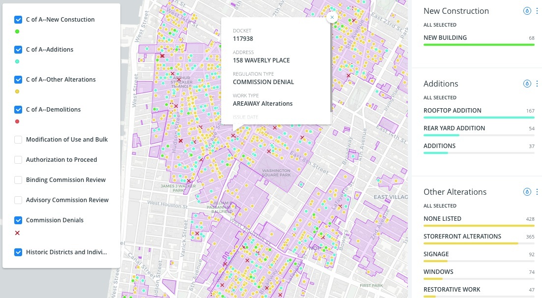
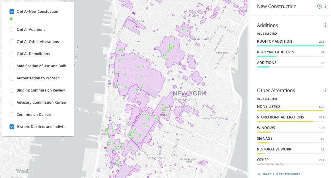
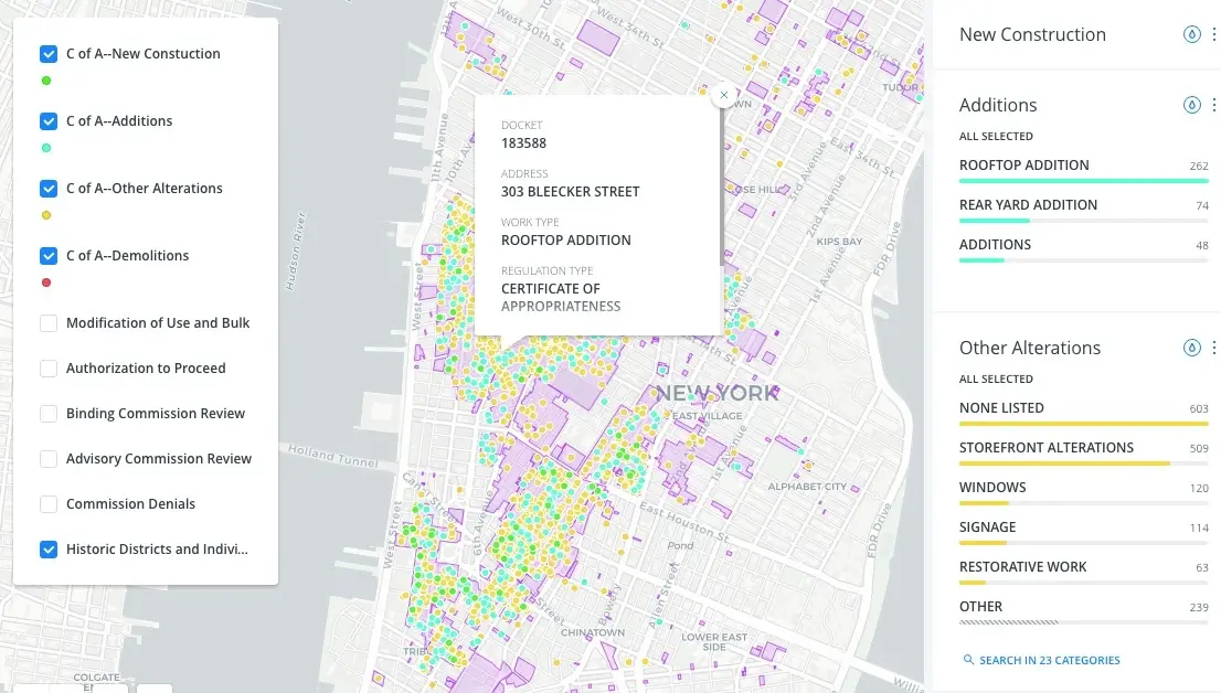
The Commission Review Map (depicted in the images above) allows you to search a number of details surrounding changes to landmarked buildings. They include certificate of appropriateness, new construction, additions, other alterations, demolitions, modification of use and bulk, authorization to proceed, binding commission review, advisory commission review, and commission denial (pictured in the map above).
From there, you can search more details about specific permits. MAS included information for each application or permit regarding the docket number, address, regulation or permit type, work type, issue date and expiration date.
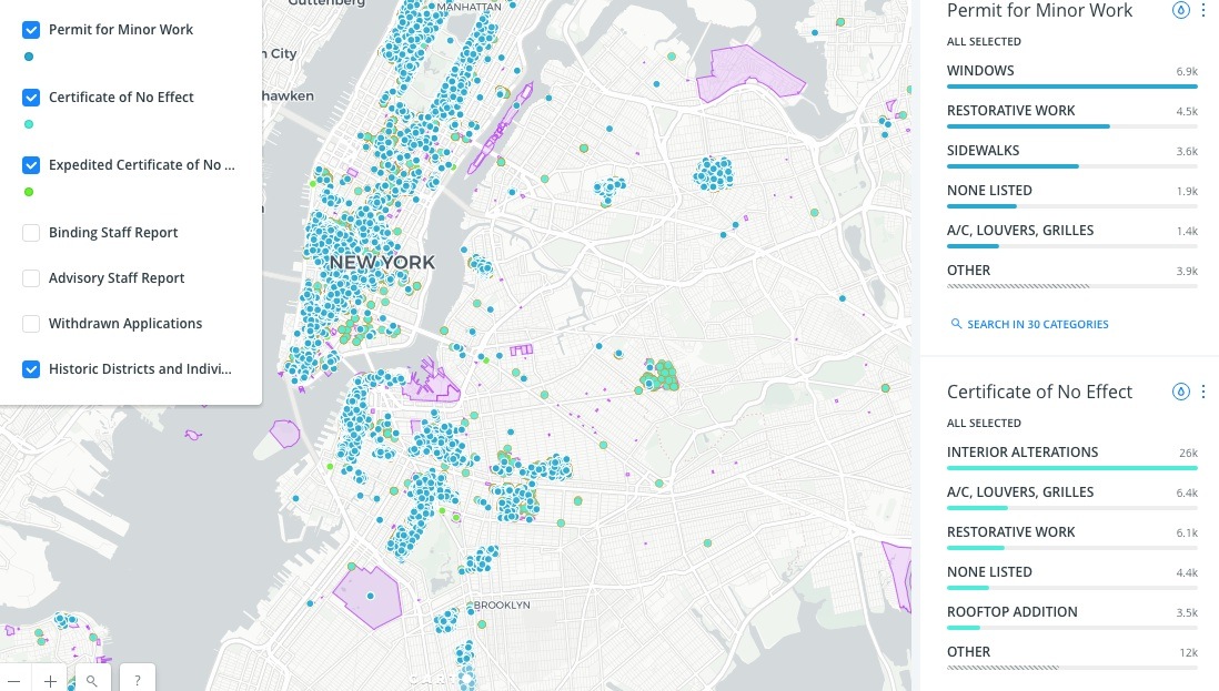
The Staff Review Map looks fairly similar, though the MAS pulled different data. Here, you can search permits and certificates issued, as well as read binding staff reports, advisory staff reports, and withdrawn proposals.
Ultimately, the maps lay out how, and where, the LPC makes decisions regarding changes to city landmarks. It’s a helpful tool for the LPC’s upcoming meeting, regarding proposals intended to streamline the process for approving work on designated properties. One big change would allow fewer applications to go through the public-review process, while other shifts will more clearly outline the rules for making routine alterations to buildings.
The overhaul, unsurprisingly, has support from the Real Estate Board of New York. Preservation groups have been quieter, though it’s expected some could take issue with the idea that fewer applications will be part of a public process, and will instead be handled privately by staffers.
RELATED: