Mapping Subways, Buses, and Free Transfers in One Place

One MetroCard. One map. Done.This new set of maps from map obsessive Anthony Denaro shows all the ways we can use the New York City transit system’s unlimited MetroCard and transfers in one convenient, color-coded place. This includes both subways and buses, and important junctions where you can transfer within and between them.
Included are all NYC transit services that can be accessed with an unlimited MetroCard. As the map’s creator puts it, “Millions of NYC residents live beyond a 15-minute walk to a subway station. Hundreds of thousands of people start their commute by boarding a bus and then transferring to the subway. This is a map for us. One complex transit map, for one complex transit-reliant city.”
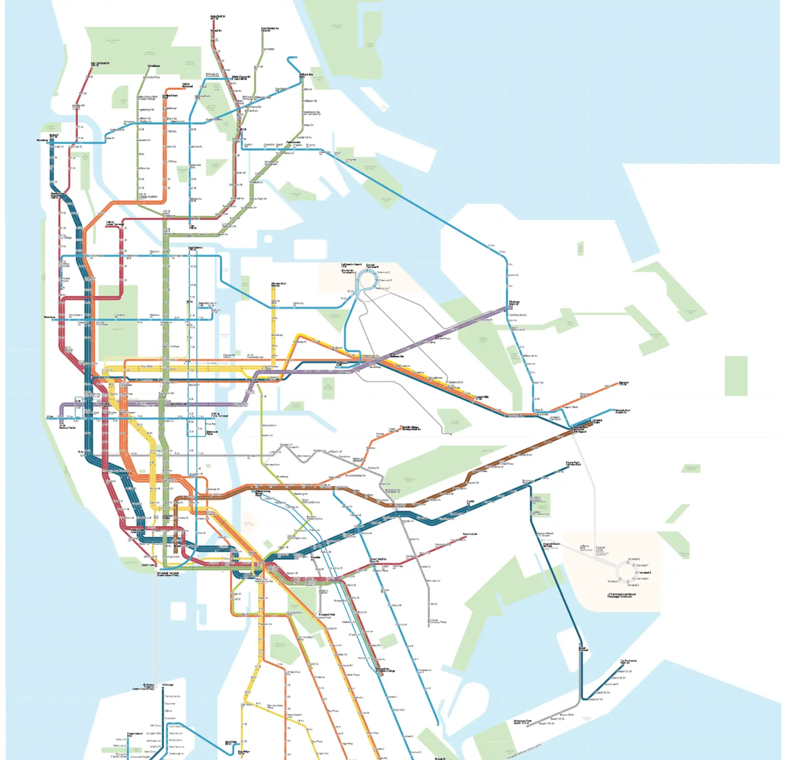
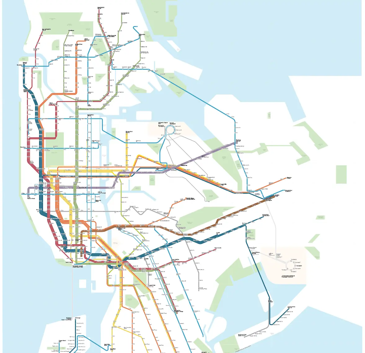
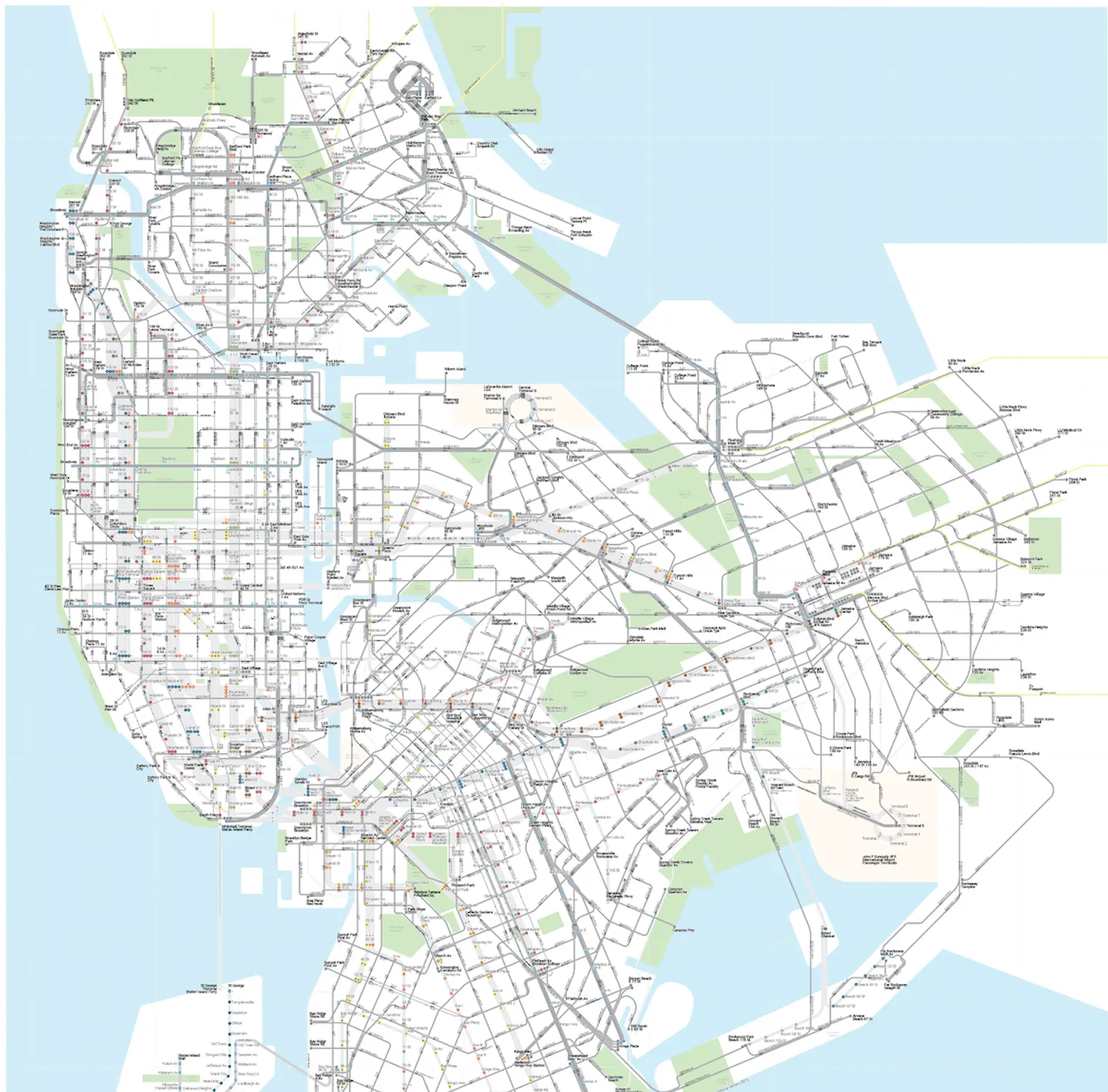
The entire NYC transit system, mapped.
The map was born during time spent idly gazing at a station subway map as one does, wondering why it didn’t show places where one could transfer to the city’s buses, though that is a widely available–and in many cases necessary–option. The author’s lightbulb moment: “If I can transfer to the bus for free, why isn’t there a map that shows where to connect with buses?” In other words, why does the subway system map only show subways?

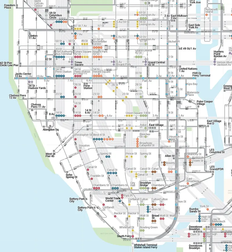
The Manhattan transit system.
Which led, of course, to more questions: “Why aren’t local buses, crosstown buses and the new fancy SBS buses shown? Could the whole bus system fit over a subway map, especially in the areas that aren’t served by the subway?”
This led to the question of why subway ridership has surged while bus ridership has dropped: Are people so confused by the bus system that they just ignore it? Is it seen as an unreliable option? Are people who live outside of subway territory aware of all the bus options at their disposal? Thus began the long, slow journey to fit the whole system of buses and subways on one map.
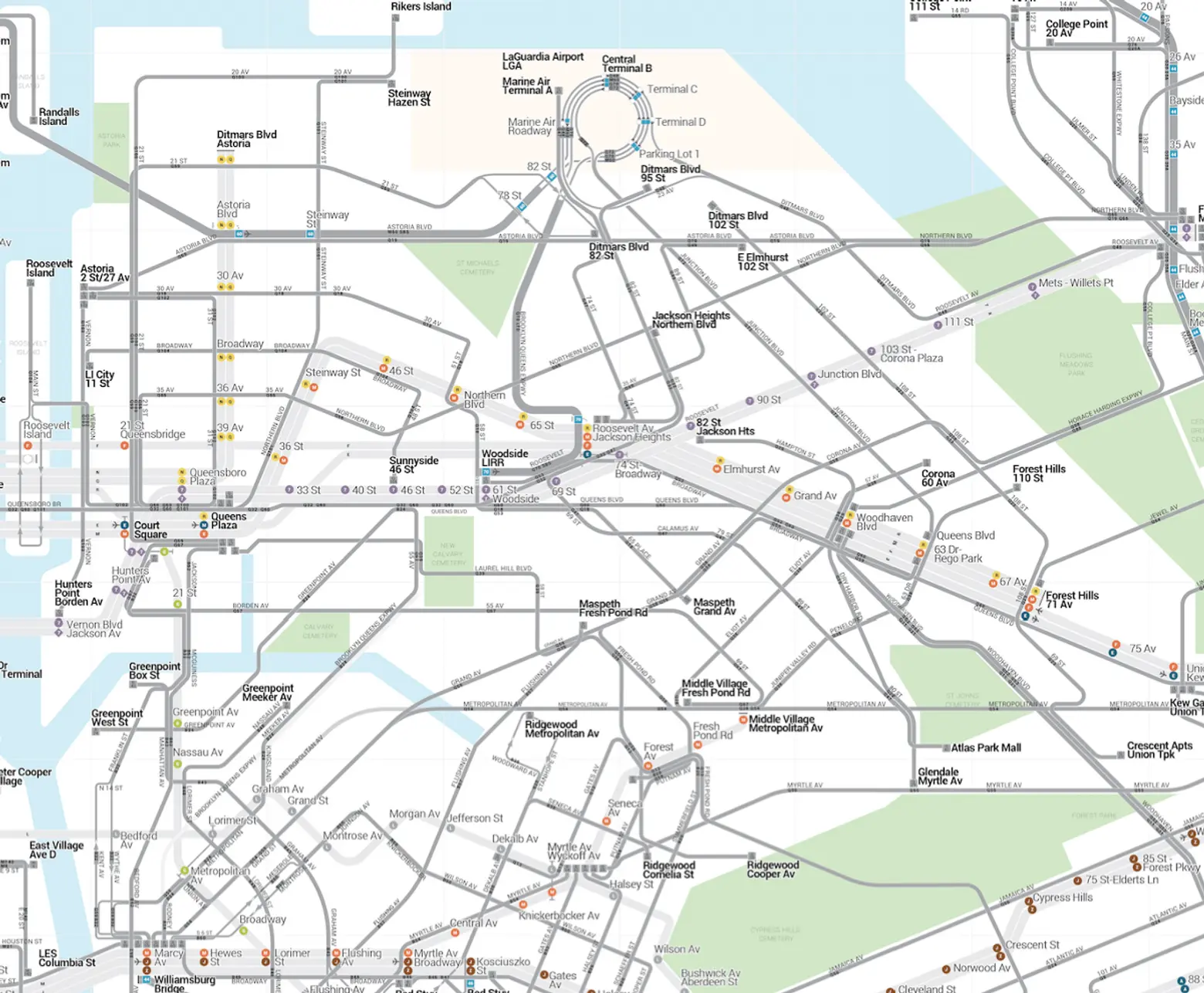
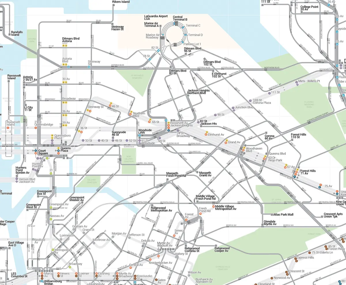
The Queens transit system.

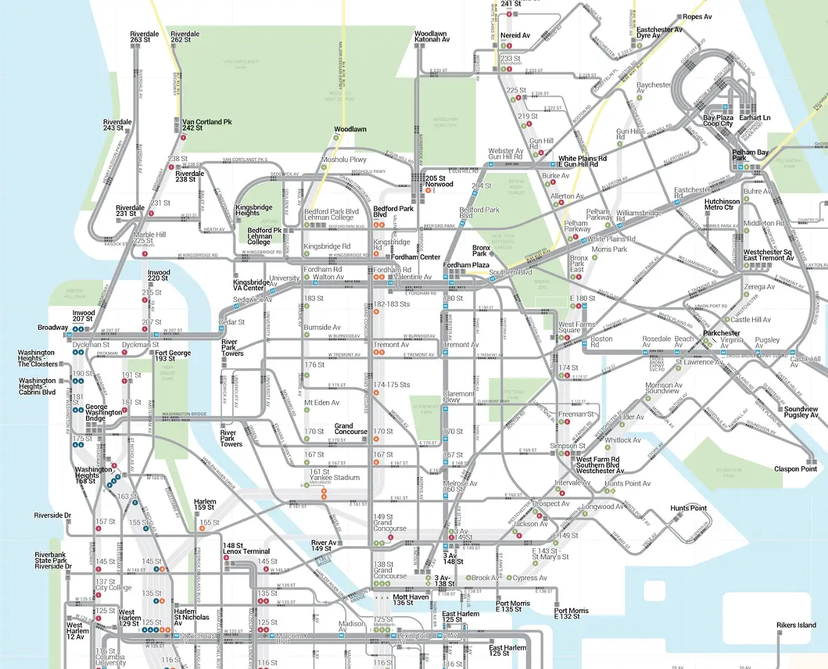
The Bronx transit system.
The resulting maps follow a few simple guidelines. Make it simple. The riding public needs to know most of the turns and most of the streets as well as relative distance relationships between lines and stations. But not too simple. The focus is on subway lines, streets with buses, arterials and secondary streets, as well as major expressways, rivers and big parks. Stay in bounds. Include only services that can be paid via unlimited MetroCard or offer a free transfer with a pay-per-ride MetroCard. This includes the subway, all NYC Transit and MTA Bus lines, NICE Bus (Long Island) and Bee-Line Bus (Westchester). (Some might take issue with the fact that PATH, LIRR, MNR, Express Buses and EDC Ferries aren’t included.)
The main design directive was to create one graphic system that works for both the subways and buses while remaining true to existing NYCT standards for route bullets, typesetting and language. Everything is displayed at one scale, together, using station names and neighborhoods to denote a terminal.
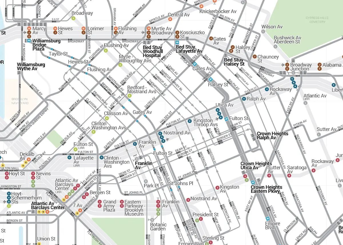
The Brooklyn transit system.

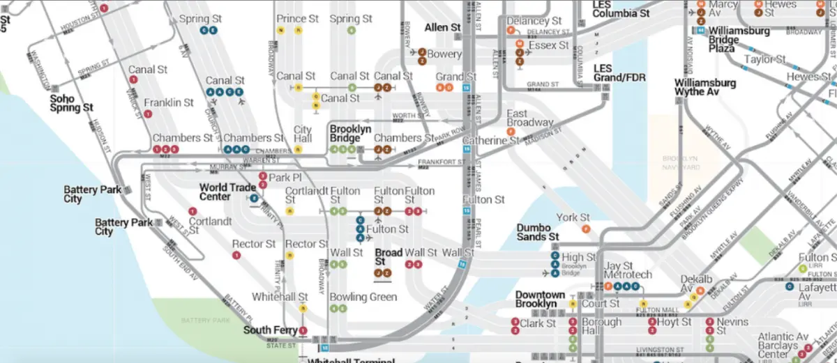
Brooklyn transit system, detail.

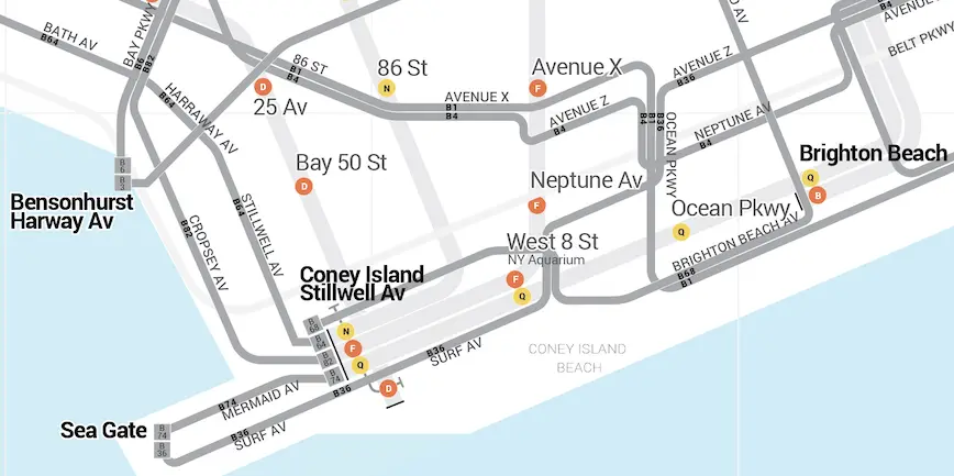
Brooklyn, Coney Island area detail.
As might be expected, Brooklyn proved the most challenging due to the borough’s many unique conditions–one way streets, areas where several bus lines share a street, junctions where six different street grids meet, for example. Says the map’s author: “Six street grids compose the Brooklyn street network. Then these grids needs to connect to Western Queens and Southern Queens. The subway lines then need to relate to Manhattan. Brooklyn’s street layout requires the need for a incremental angle grid. The magic angle turned out to be 22.5/45/90 degrees. 22.5 is the magic number that made this project work. It afforded the right subsect of minor angled lines at 22.5/67.5/112.5 degrees. This kept the map looking neat enough.”
As far as the actual task of getting people to ride the bus more and making the system more efficient and desirable, Denaro hands the task over to the city, the MTA and New Yorkers themselves. “New York, here’s your subway and bus system together in one map, for the first time. Step lively to the surface and the ride the bus, NY.” You can investigate Denaro’s maps further here.
RELATED: