NYC is the focus of Bjarke Ingels’ ‘Humanhattan 2050’ vision for protecting cities from future storms

Image via BIG
In 2014 6sqft reported on the Department of Housing and Urban Development’s Rebuild By Design contest to develop ways to shore up the city from future flooding. Among the short list of winners whose projects will receive funding was “The Big U” from Bjarke Ingels Group (BIG), a flooding solution for Manhattan that doubles as a social environment, with over a third of the $920 million in prize money to go toward its development. Now BIG is making a bigger splash with a similar vision now on display at the 2018 Venice Architecture Biennale, the Observer reports. Called “Humanhattan 2050,” the project, created for the Biennale, which the firm calls “an academic exploration in urban environments and resiliency” could someday represent the first effort to keep cities safe while creating a new, improved social space along the waterfront.
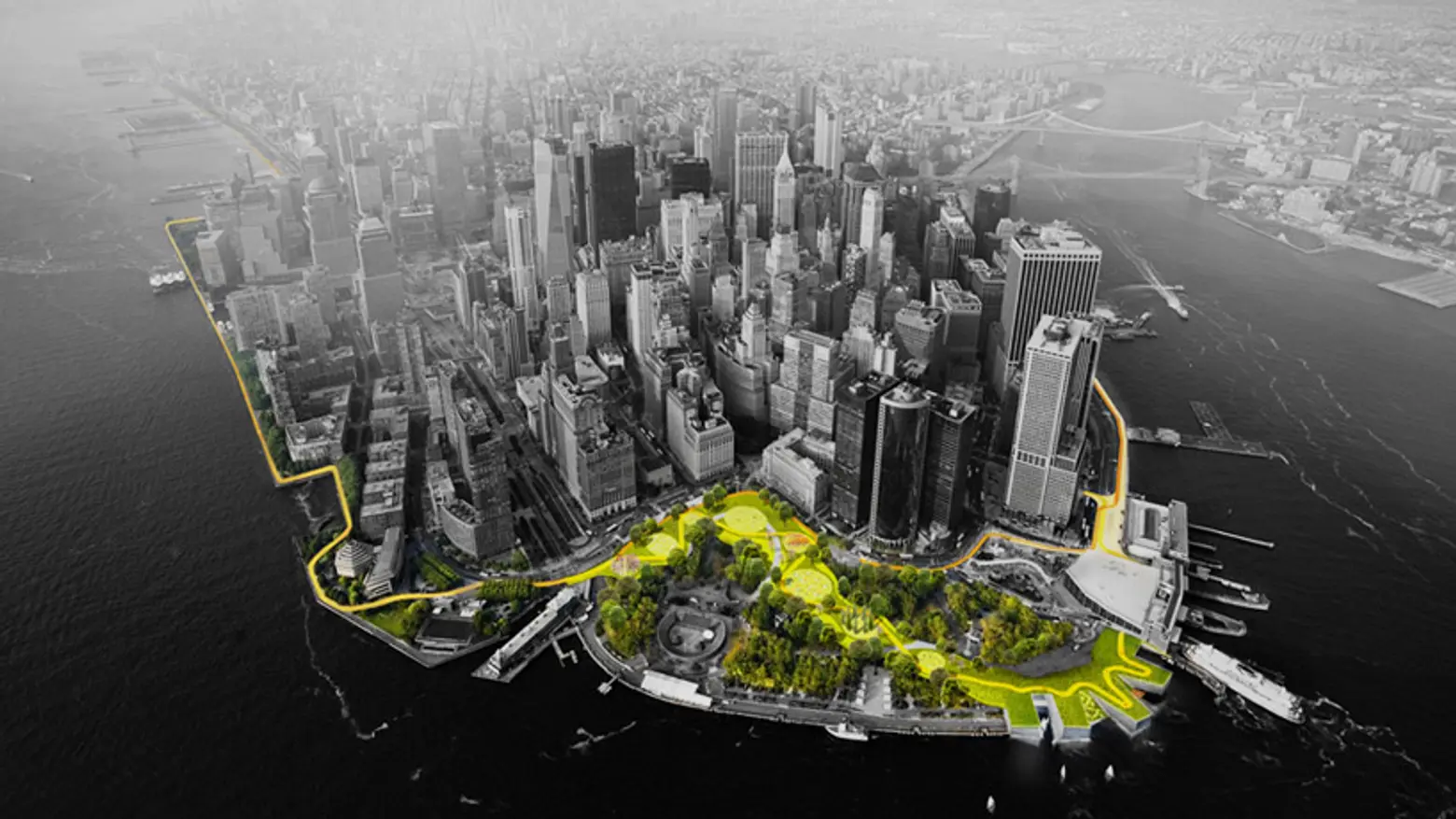
In the contest-winning plan–now in development stages–the project would extend from West 57th Street to East 42nd Street all the way down to the Battery for 10 continuous miles of protection. The plan consists of self-sufficient flood zones that will surround the most vulnerable areas of Manhattan in the shape of a U. These areas will be great for socializing, relaxing and sightseeing, with local artwork and resilient plant life to better withstand storms and floods. However, in the event of a hurricane, the areas will serve as flood barriers and shelters. Raised land “walls” separating low-lying areas from water bodies offer protection from storm surges and rising water while deployable walls beneath the FDR Drive would be used as a both a flood barrier and an open area for seasonal markets.
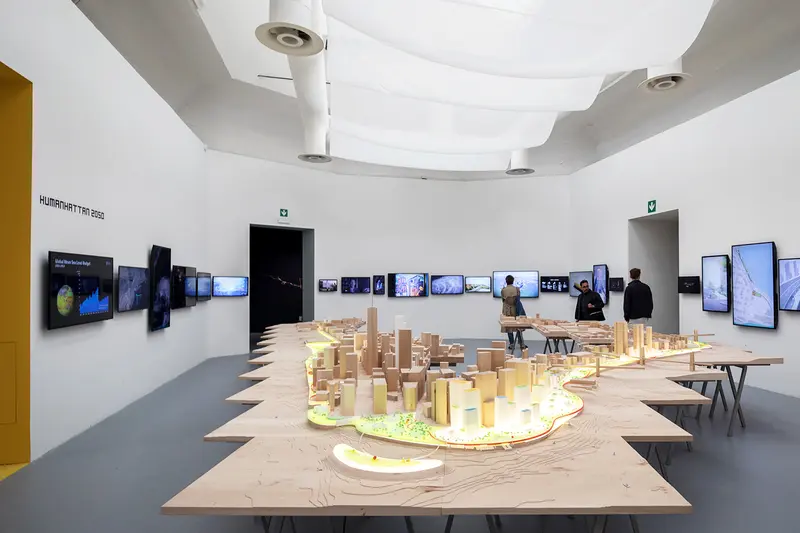
Occupying an entire gallery of the Venice exhibition’s Central Pavilion, “Humanhattan 2050″ offers an architectural model of Lower Manhattan’s waterfronts displayed on tabletops and over 30 monitors mounted on the walls showing video footage of the devastation from Hurricane Sandy. The screens are “flooded” every three minutes to show the wrath of nature and the suddenness of storms like this one. The project extends the land on Manhattan’s shoreline, calling it MOMA–short for MOre MAnhattan and addresses climate change and future growth, factoring in private real estate development as a way to finance public projects.
Buildings in the model are color coded, with yellow structures offering solar power, green ones supplying vegetation and blue buildings providing stormwater retention, with the protection line shown in red. The intent overall is to keep with the waterfront’s scale while connecting the neighborhoods along its path.
In a video of the project Ingels says, “We built a model of Lower Manhattan, but we only built the parts that are threatened by flooding in the next hundred years. We came up with this idea of social infrastructure, which will keep the city dry when the next big storm comes, while working with the local communities so that it actually comes with positive social and environmental side effects.”
#Humanhattan2050 is on at @la_Biennale Italian Pavilion! The exhibit is a mix of BIG’s @rebuildbydesign concepts, independent visions & interpretations of #Manhattan's potential to accommodate #climatechange & growth in the future! #Odico @ABBRobotics Matthijs/ONE @burohappold pic.twitter.com/H4PYXHwxJ2
— BIG (@BIG_Architects) June 4, 2018
The project is related to many of BIG’s environment-focused projects in the works and on the drawing board.
[Via NYO]
RELATED: