Before & After: 10 NYC blocks and enclaves transformed by pedestrian-friendly design

New York clocks in more steps on average than any other state in the country, and that number is most definitely skewed by New York City where more residents hit the pavement than the gas pedal. But in a town that’s seemingly dominated by pedestrians, car culture maintains the right of way. According to Vision Zero, NYC’s program to reduce traffic-related fatalities, being struck by a vehicle is the leading cause of injury-related death for children under 14, and the second leading cause for seniors.
Providing more public space for pedestrians has become an increasing concern for the city over the last decade, and as such, a multitude of plans have been put forward to create sanctuaries from traffic or to reconfigure streets to keep people safe. But beyond preventing traffic accidents, by planting more trees, expanding sidewalks and bike paths, and installing seating, these urban renewal projects have also been key in promoting walking, biking, health and ultimately a more desirable and habitable New York City.
 Bloomberg and Sadik-Khan
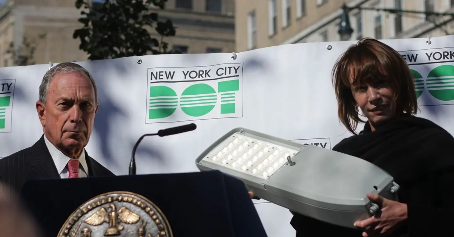
Although Vision Zero is driving pedestrian-friendly design forward, a lot of the changes we’re seeing and have seen date back to Mayor Michael Bloomberg, who for served for 12 years, and whose administration transformed our understanding of public spaces and what makes a city livable. “In the end, great public space is what makes people want to stay in the city,” Amanda Burden, director of the New York City Department of City Planning and Chair of the City Planning Commission under Bloomberg, said in 2013.
But it was Bloomberg’s transportation commissioner, Janette Sadik-Khan, who played the biggest role in making NYC streets more people-friendly. Sadik-Khan arrived in 2007 and focused her work on pedestrians and cyclists, pushing for the expansion of bike lanes, the introduction of a bike share program, and most notably creating public plazas (more than 60 of them) using planters or other barricades to close off sections of road—her most lauded being the stretch of Broadway in Times Square that was closed off to cars.
These innovative spaces brought not only safe havens for pedestrians, but they also came complete with seating and space for citizens to gather. With Sadik-Khan at the helm of the Department of Transportation (DOT), 180 acres of former roadway were reprogrammed as plazas, pedestrian medians were expanded along busy corridors, and bike lanes were introduced across all five boroughs. (Though to be sure, she was not without critics)
There’s no denying the streets today are more vibrant than ever before, and ahead we’ve culled some before and after images from Google Maps showing a few pedestrian-centric projects that have come to life, and brought back life, during the last 10 years.
+++
[twentytwenty]
[/twentytwenty]
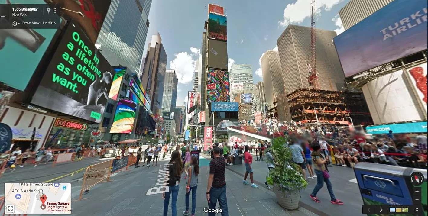
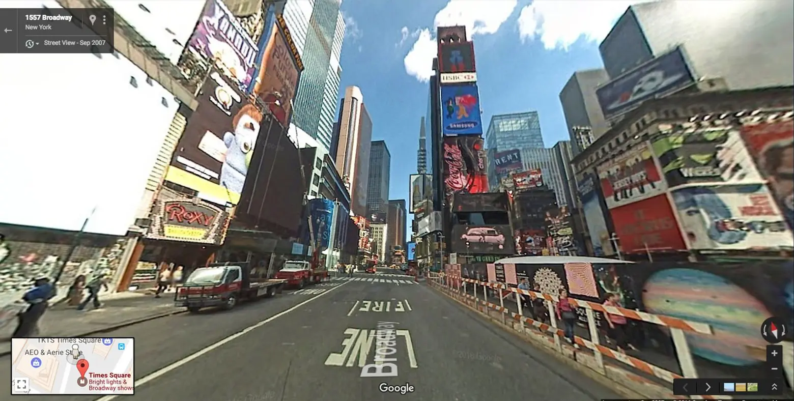
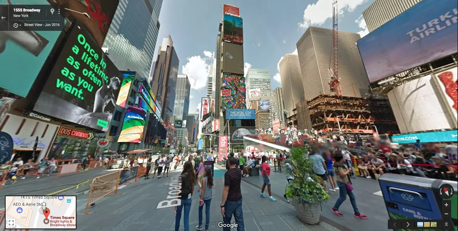
Times Square ↑
The granddaddy of them all may not be the first, but it’s easily the most noted. In early 2009, Bloomberg announced that traffic lanes along Broadway from 42nd Street to 47th Street would be closed to cars and transformed into pedestrian plazas as part of an experiment to see how Midtown gridlock would respond. The effect on traffic was not significant, but traffic injuries decreased and the number of on-foot visitors to Times Square spiked as a result. Roughly a year later, Bloomberg announced that the pedestrian plaza would be made permanent.
[twentytwenty]
 [/twentytwenty]
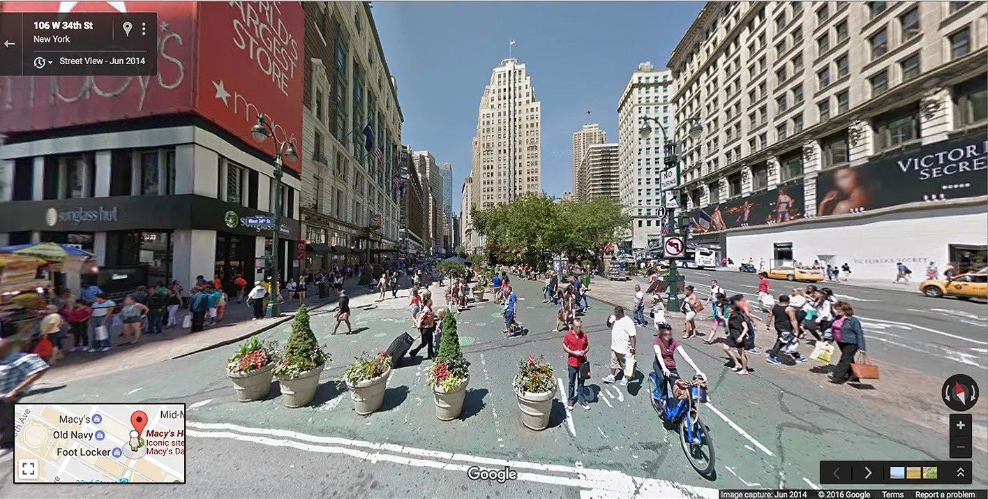
Herald Square ↑
During that same time, Herald Square received a similar treatment with a segment of Broadway between 33rd and 35th Streets completely pedestrianized. “Broadway Boulevard,” as it was named, served to complement the Herald and Greeley Squares’ existing greenspace. It also doubled the amount of area available to the public.
[twentytwenty]

[/twentytwenty]
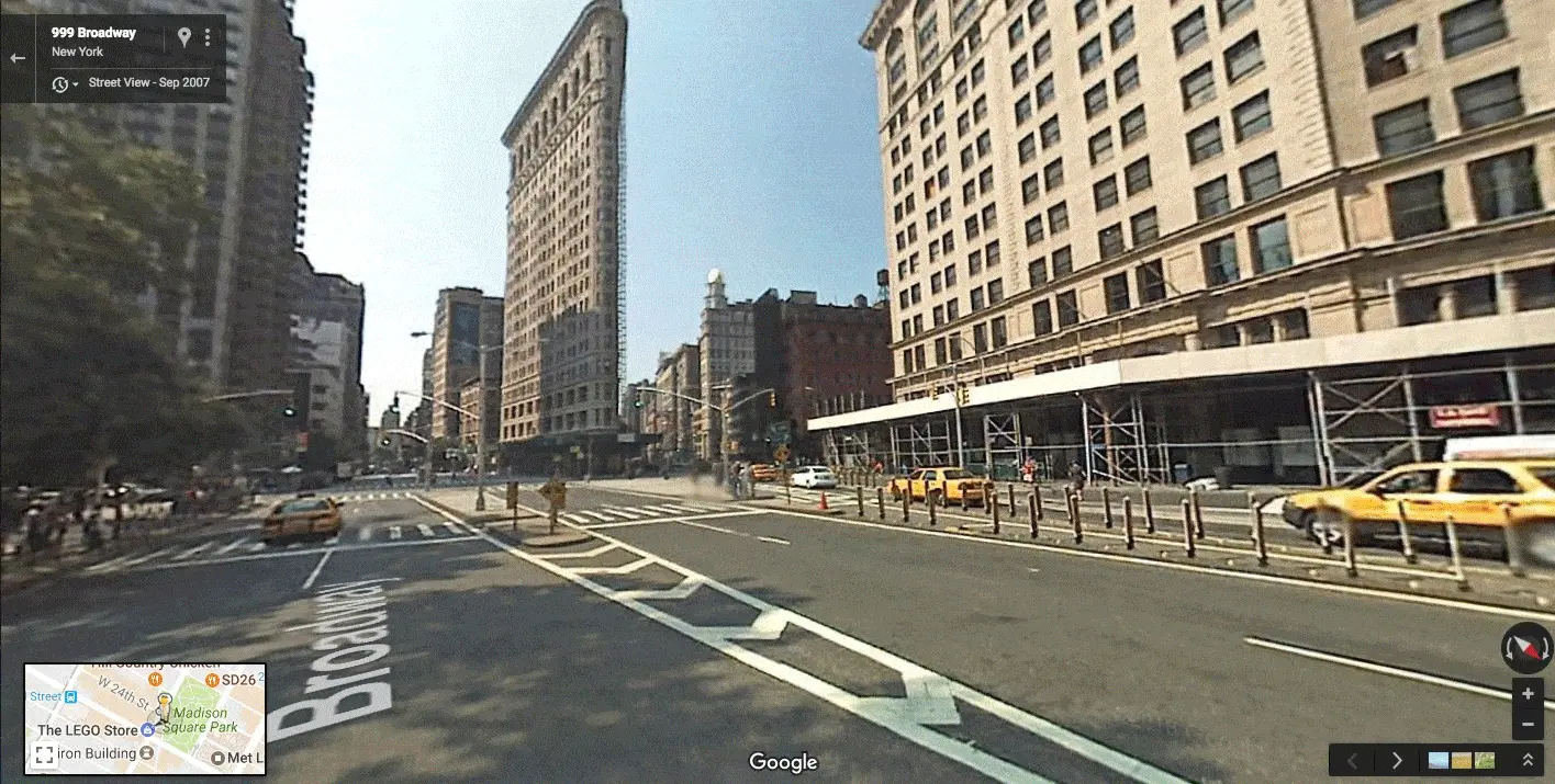
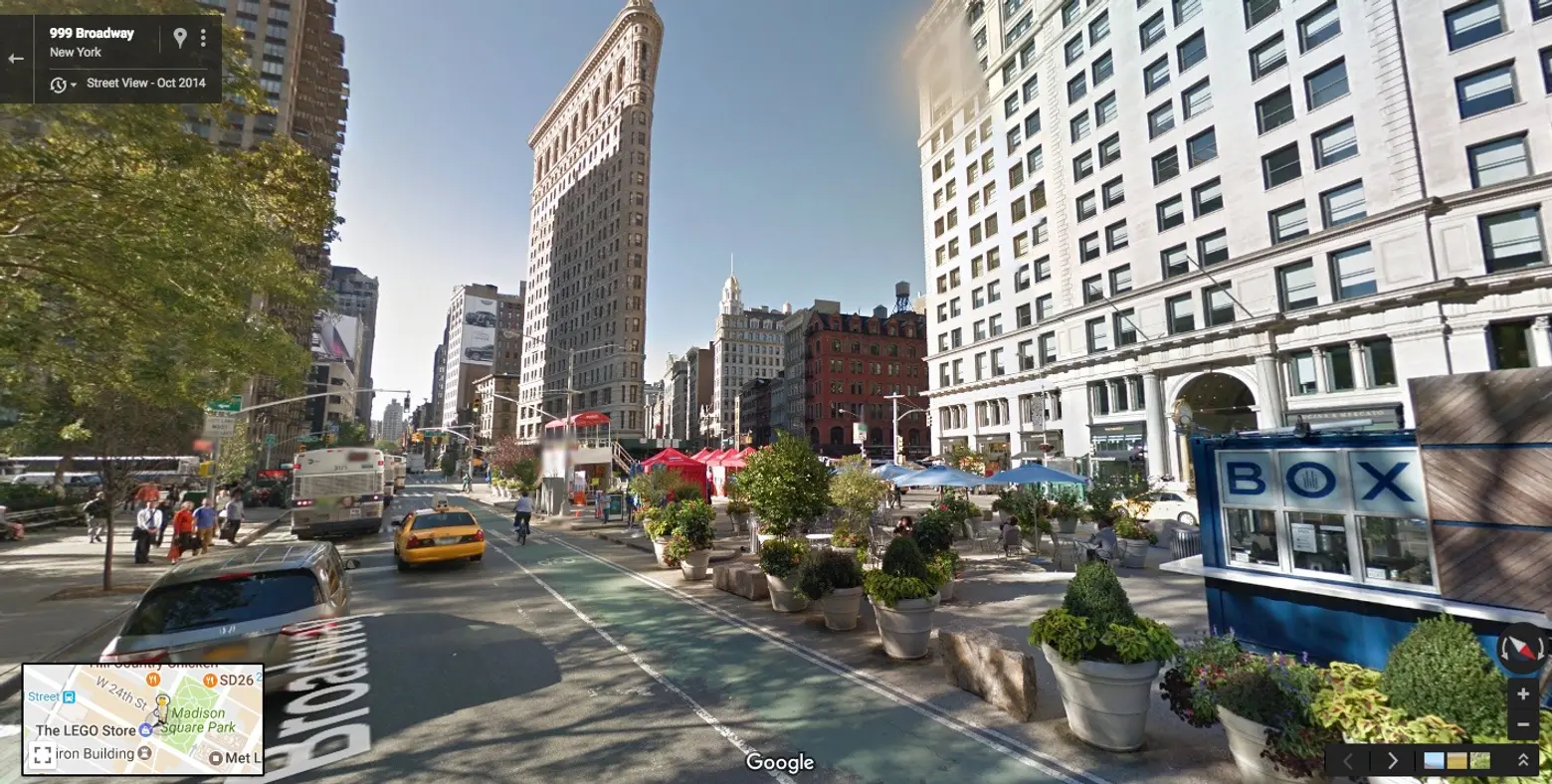
Madison Square Park/Flatiron ↑
The Flatiron Public Plazas were put in place in the summer of 2008 as temporary spaces stretching from 22nd Street to 25th Street between Fifth Avenue and Broadway. But like the Times Square and Herald Square stretches, they became permanent fixtures in the area. The project added 37,000 square feet of public space and the conceptual design for them was donated by starchitect Norman Foster.
[twentytwenty]
[/twentytwenty]
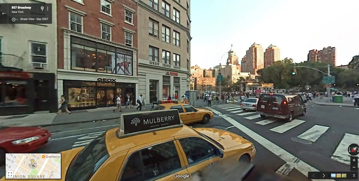
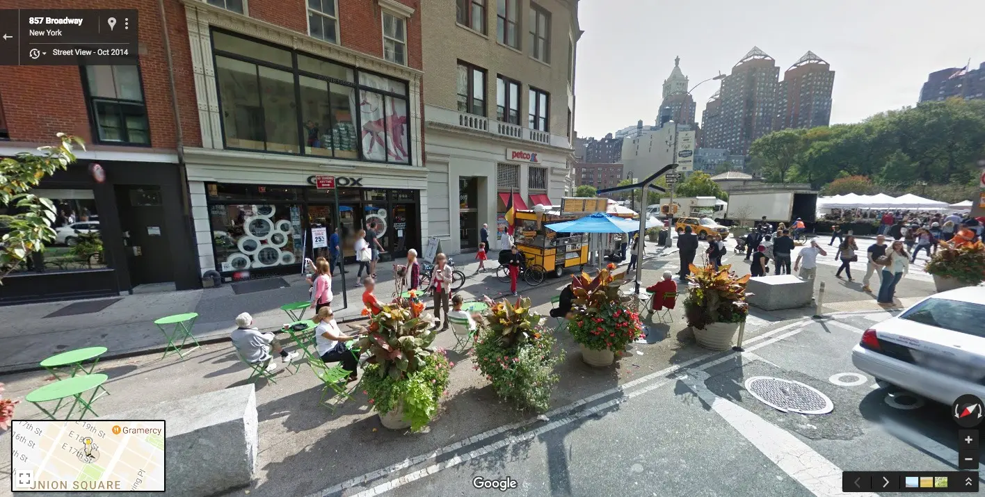
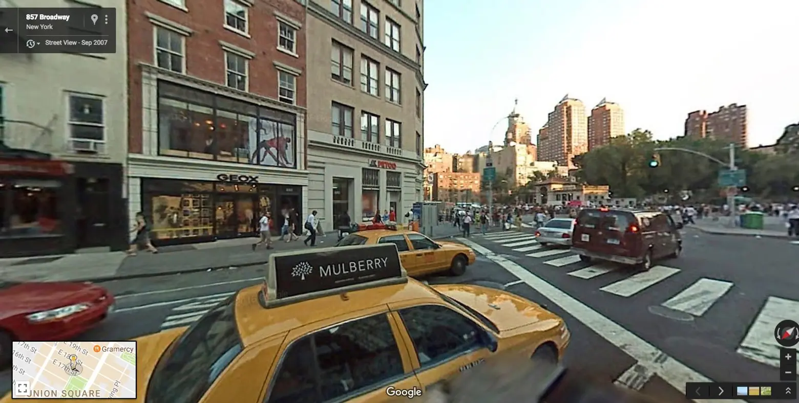
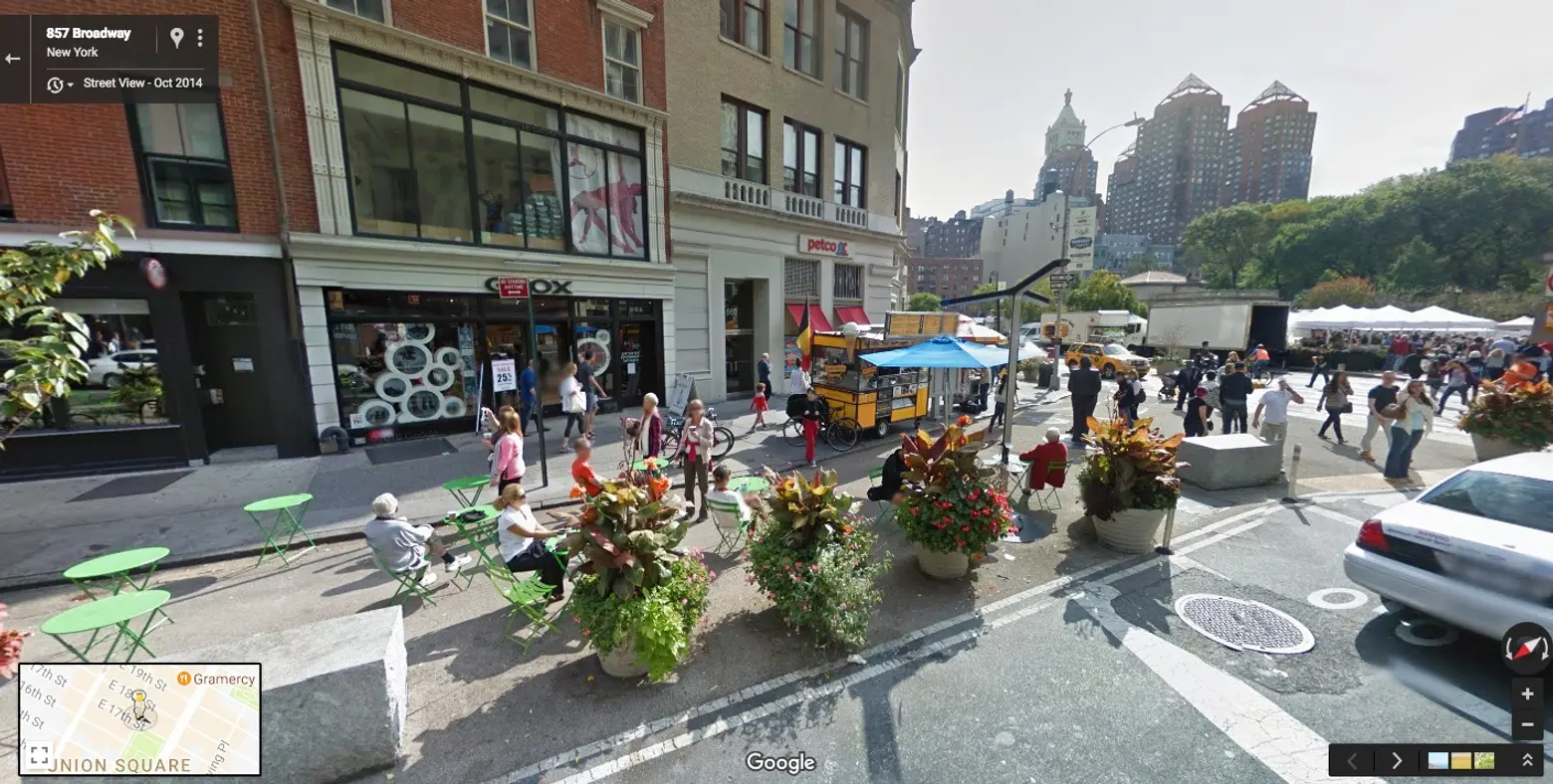
Union Square North at Broadway ↑
Union Square’s two-block pedestrian plaza plan was unveiled in April 2010 and implemented shortly after. Updates included a bike lane, changes to the traffic pattern and plenty of seating and plants on the east side of Broadway between 17th and 18th Streets. The change has led to a dramatic decrease in pedestrian accidents involving vehicles, and has been a boon to the Greenmarket which is hosted four days a week in the square.
[twentytwenty]
[/twentytwenty]
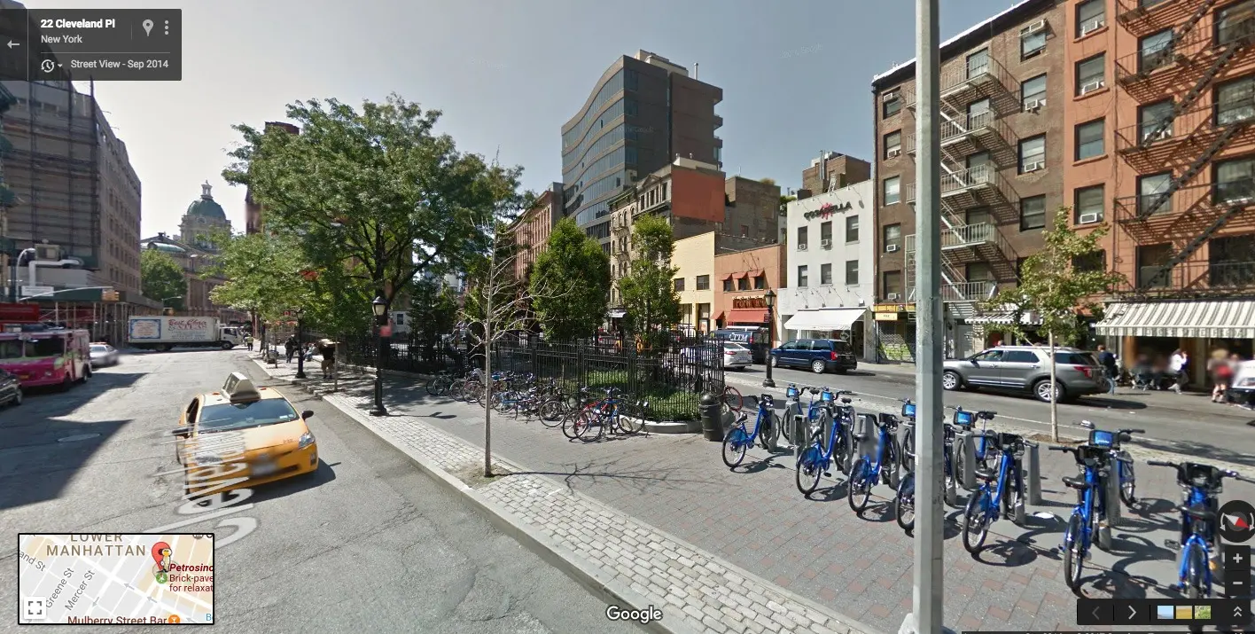
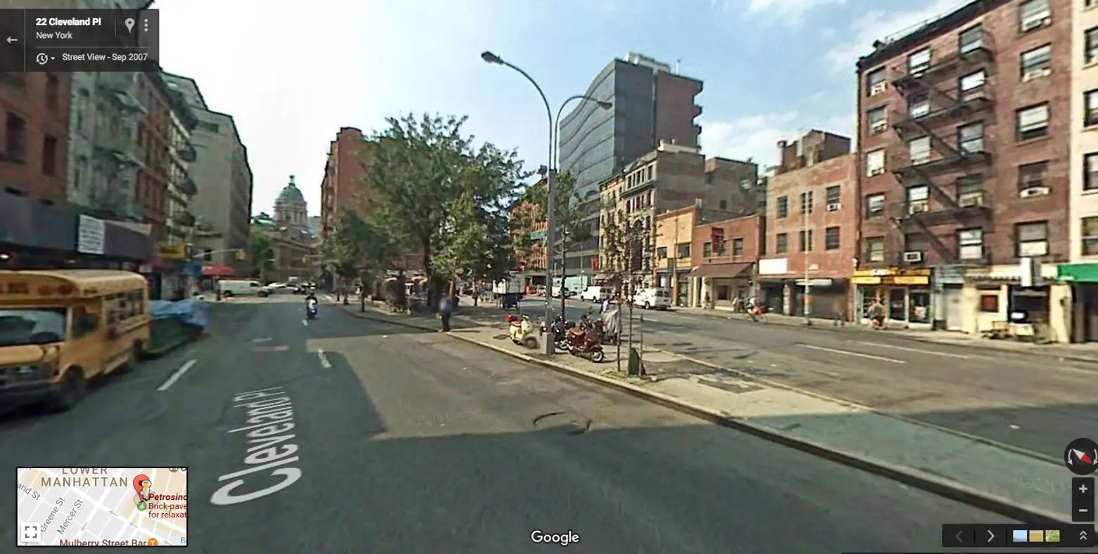
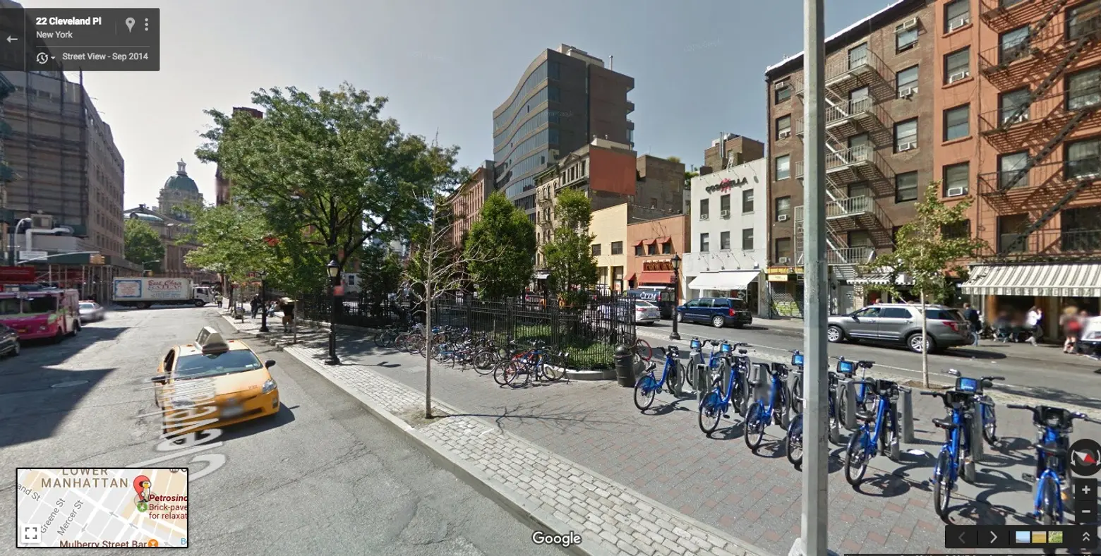
Lieutenant Joseph Petrosino Square, Soho ↑
This small concrete triangle in Soho was once called by Mitchell Moss, a New York University urban planning professor, a “shithouse for meth heads.” The space, bounded by well-trafficked streets, was updated between 2008 and 2011 with $2 million invested for improvements. Since, the park has been enlarged to include new benches, trees, lighting and a Citi Bike docking station. It has also become a prime meeting point for neighborhood residents, workers and shoppers.
[twentytwenty]
[/twentytwenty]
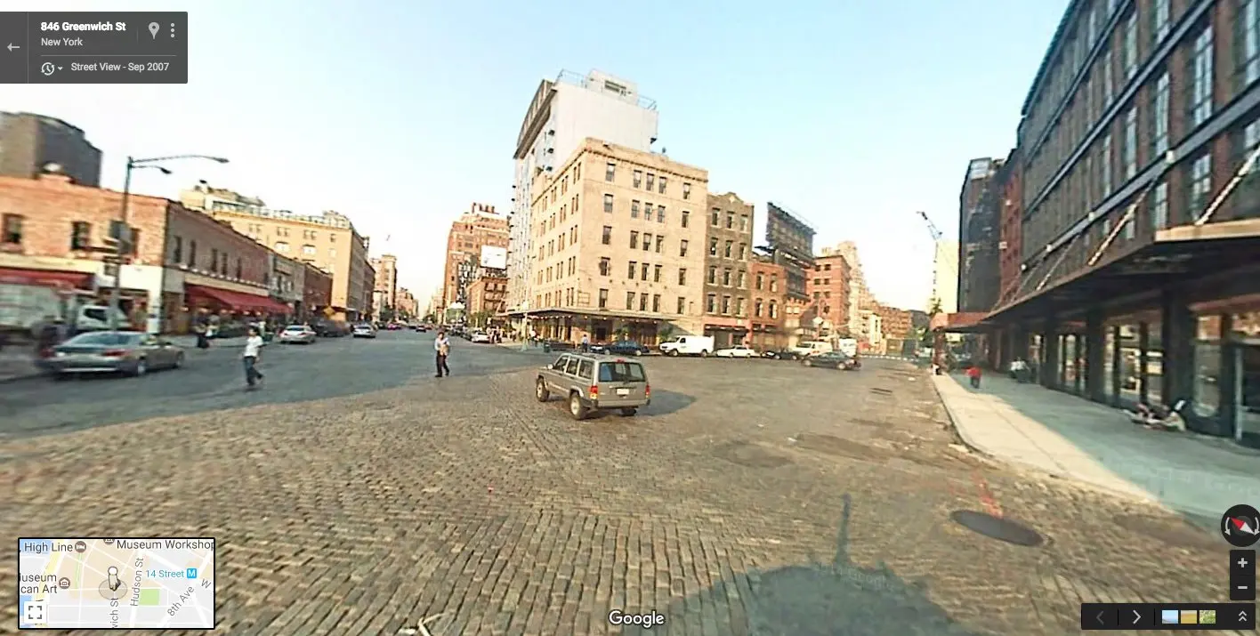
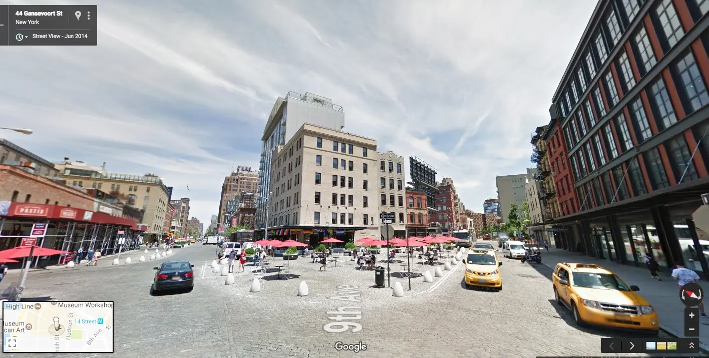
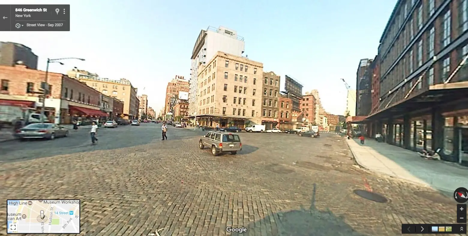
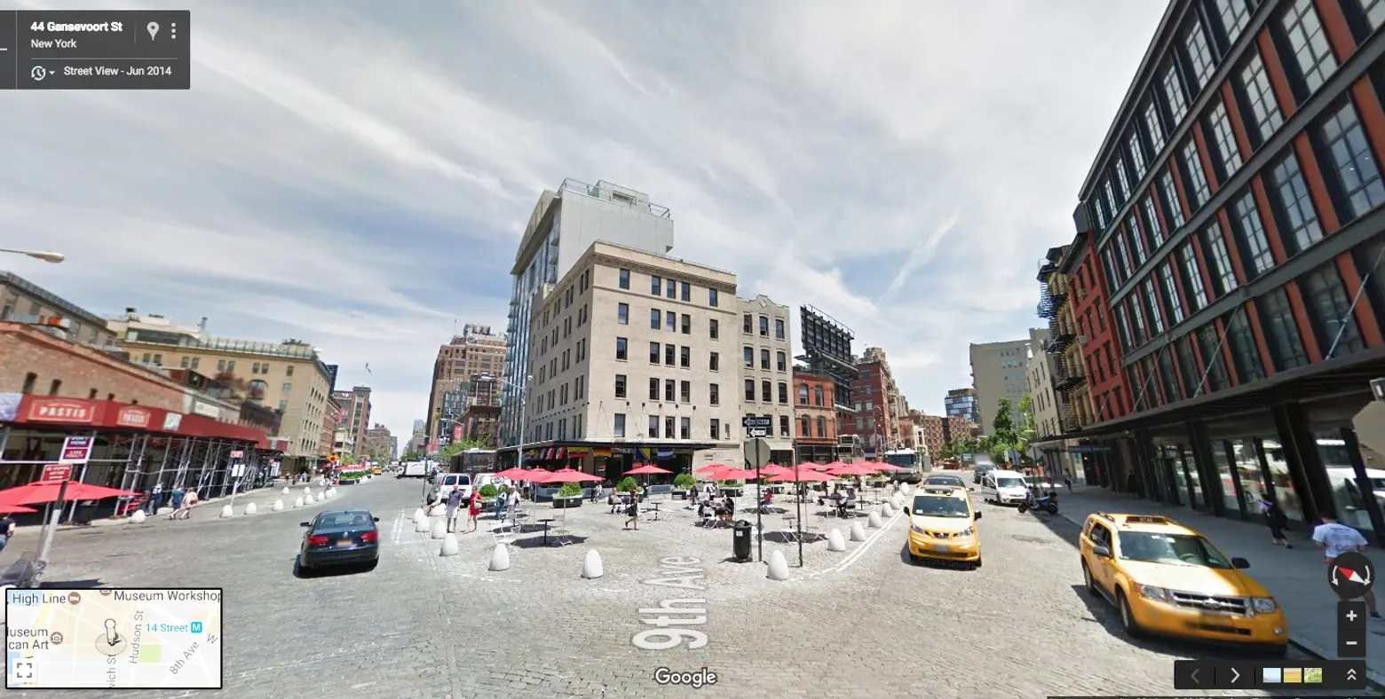
Gansevoort Plaza, Meatpacking District ↑
In 2008, seven pedestrian plaza areas were created along 9th Avenue from West 14th Street to Gansevoort Street as a way to calm traffic in the area. The car-free enclaves feature planters, concrete sculptures and seating, and the spaces spaces are often used to host like events like free yoga classes and art exhibits. Unfortunately the plazas, which together constitute Gansevoort Plaza, are currently closed as work is being done below-ground to update water mains and redesign the surrounding streets.
[twentytwenty]

[/twentytwenty]
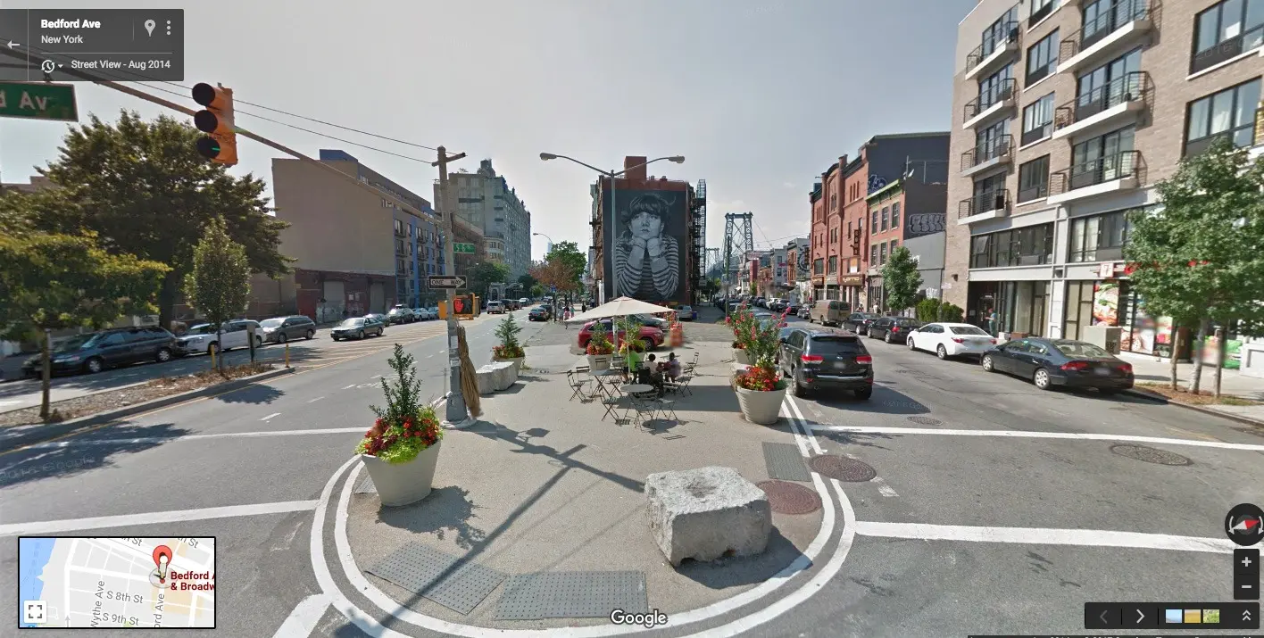
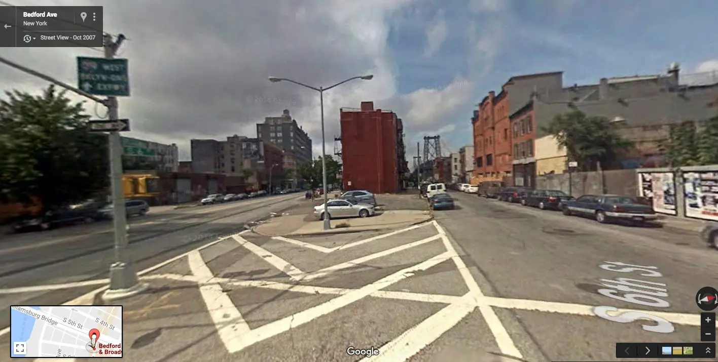
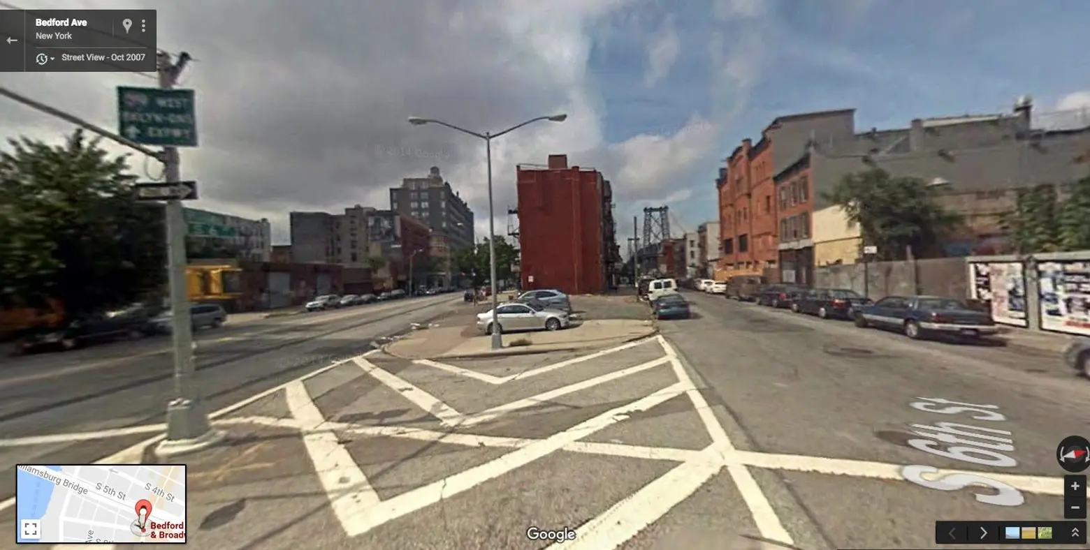
Broadway at Bedford Avenue, Brooklyn ↑
This project at the crossroads of Broadway and Bedford in South Williamsburg was another plan introduced to calm traffic in the area. Despite being located in a very pedestrian- and bike-centric neighborhood, the wide street was unattractive and proved unsafe for these users. Improvements included creating a dedicated cycling space, reconfiguring the scale of the street, creating landscaped medians and adding trees, art and seating.
[twentytwenty]

[/twentytwenty]
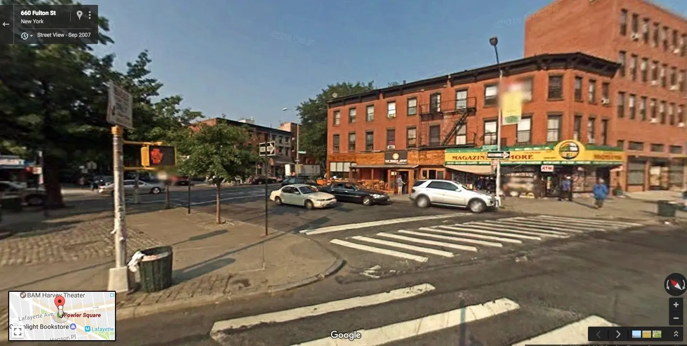
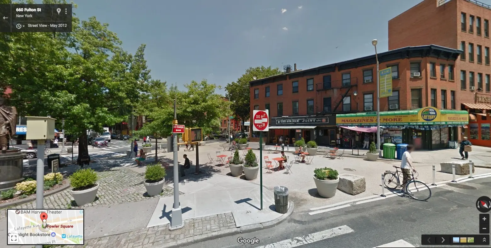
Fowler Square, Fort Greene, Brooklyn ↑
Tony Fort Greene has long been one of the more pedestrian-friendly neighborhoods of Brooklyn, and 2012, one of the neighborhood’s commercial stretches got a big boost when the city reclaimed a stretch of street between the sidewalk and an existing public triangle. Added were planters, granite blocks, folding tables and seating. The project took just a week to complete.
[twentytwenty]


[/twentytwenty]
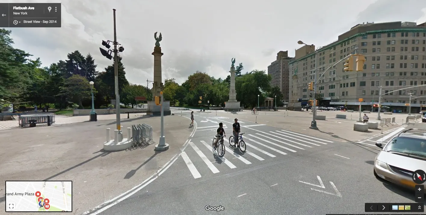
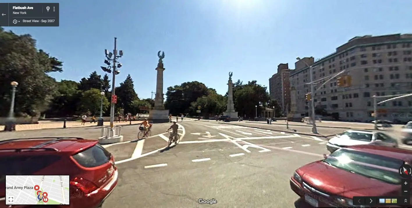
Grand Army Plaza, Brooklyn ↑
In 2011, the northern and southwest sections of Grand Army Plaza were redesigned to support more pedestrian-only areas and safer traffic conditions. Improvements included landscaped islands and crosswalks, improved bike access, and most notably enhanced plaza space at the entrance to Prospect Park and north of the arch—the former supports the expansive and very popular Grand Army Plaza Greenmarket that’s held every Saturday.
[twentytwenty]
[/twentytwenty]
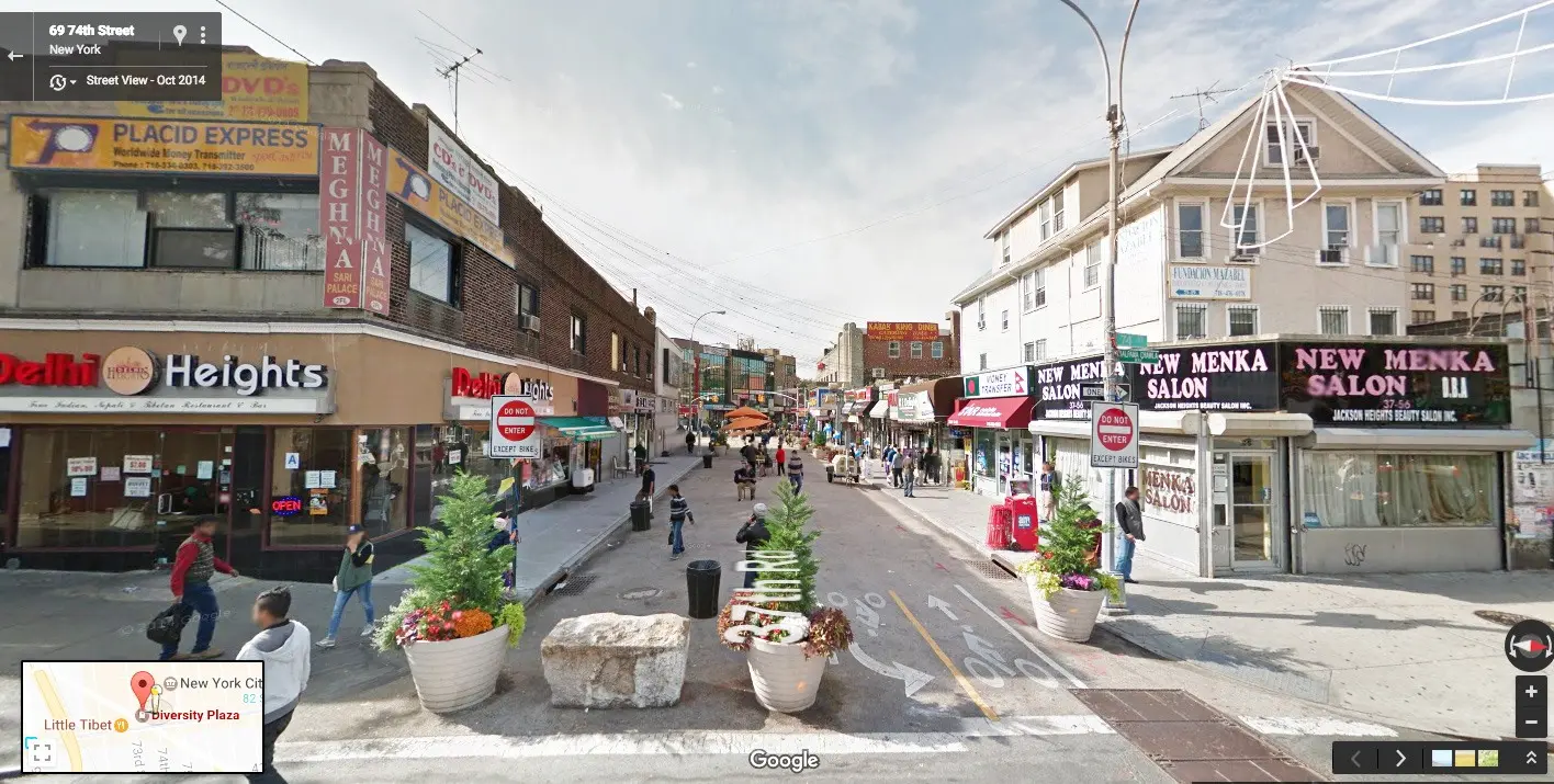
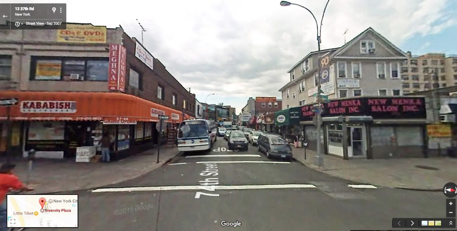
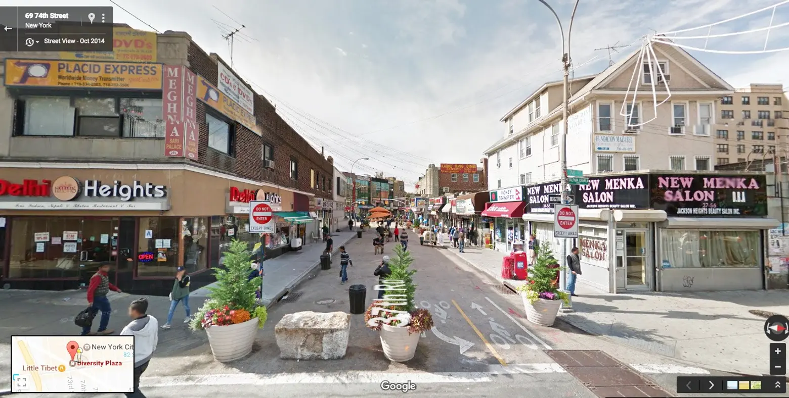
Diversity Plaza, Jackson Heights, Queens ↑
Located at 37th Road between 73rd and 74th Street, Diversity Plaza was first opposed by small business owners and many residents, but when it opened in 2011, it became a neighborhood centerpiece. The plaza today serves as a hub for many diverse organizations and is often part of the route for parades held in the area. “It really is the crossroad of the world,” City Council Member Daniel Dromm said. “As soon as the plaza was formed we began to see people from every nationality, every background, coming here to Diversity Plaza to celebrate themselves. We have a gay pride parade here, we have a south Asian community, we have a Latino community here…” The plaza was originally created to help calm traffic in Jackson Heights.
 Images via NYC Streetsblog
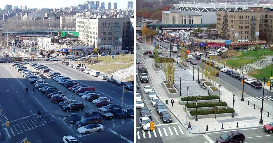
Grand Concourse at 161st Street, Bronx ↑
This project was launched in early 2006, and credit for its transformation goes to then-DOT commissioner Iris Weinshall. As Streetsblog points out, improvements included the creation of the ped-friendly Lou Gehrig Plaza (in front of the Bronx County Courthouse), wider medians and bike lanes along one section of the Concourse. Previously government employees used the space in front of the courthouse as free-for-all parking.
***
A fan of others? Share your favorites in the comments below.
RELATED: