‘Scratch Off’ This Map to Reveal Historic Aerial Imagery

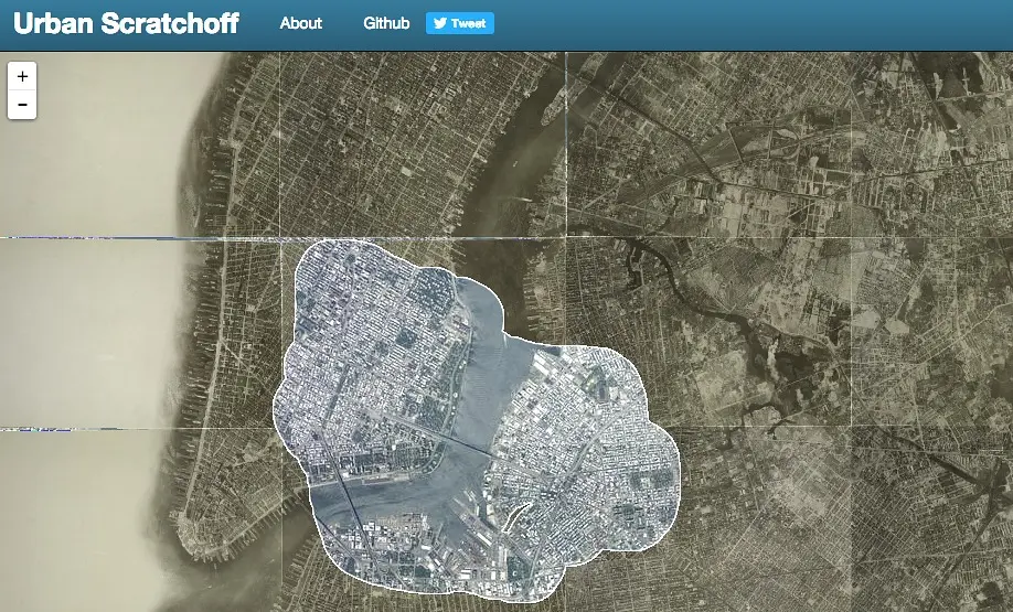
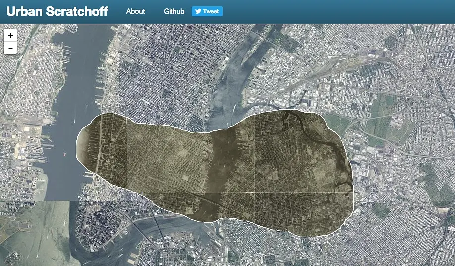
Had no luck scratching off those lottery tickets your grandma put in your holiday card? Then here’s a chance to scratch off something where everyone’s a winner (well, at least history and map buffs). Urban Scratchoff is a fun interactive map that overlays historic aerial imagery from 1924 atop the same location in current time. Simply drag the mouse over a portion of the map to “scratch off” the present aerial view. You also have the option to swap the layers and have the current view on top.

The map was created by urbanist, mapmaker, and data junkie Chris Whong. He was inspired by his routine drives on the BQE after learning about the huge number of buildings that were demolished under Robert Moses to make way for the highway. He says: “I wanted to allow the user to drag their mouse over the old buildings on a historical layer and “reveal” the highway beneath to get a better idea of the cost of progress. This was the original concept. After some hacking and getting a prototype working, scratching off parts of the city became downright addictive (especially waterfronts/docks, large construction projects, highways, etc.).”
Explore the full interactive map HERE >>
[Via Google Maps Mania]
RELATED: