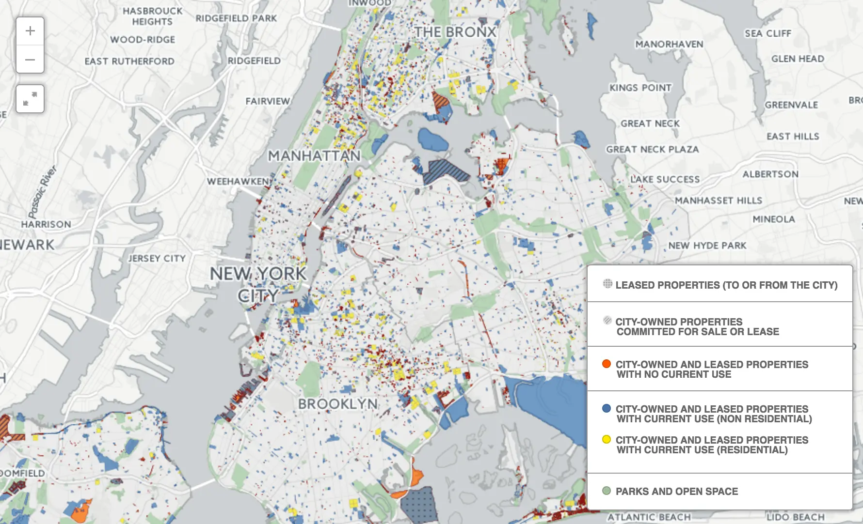
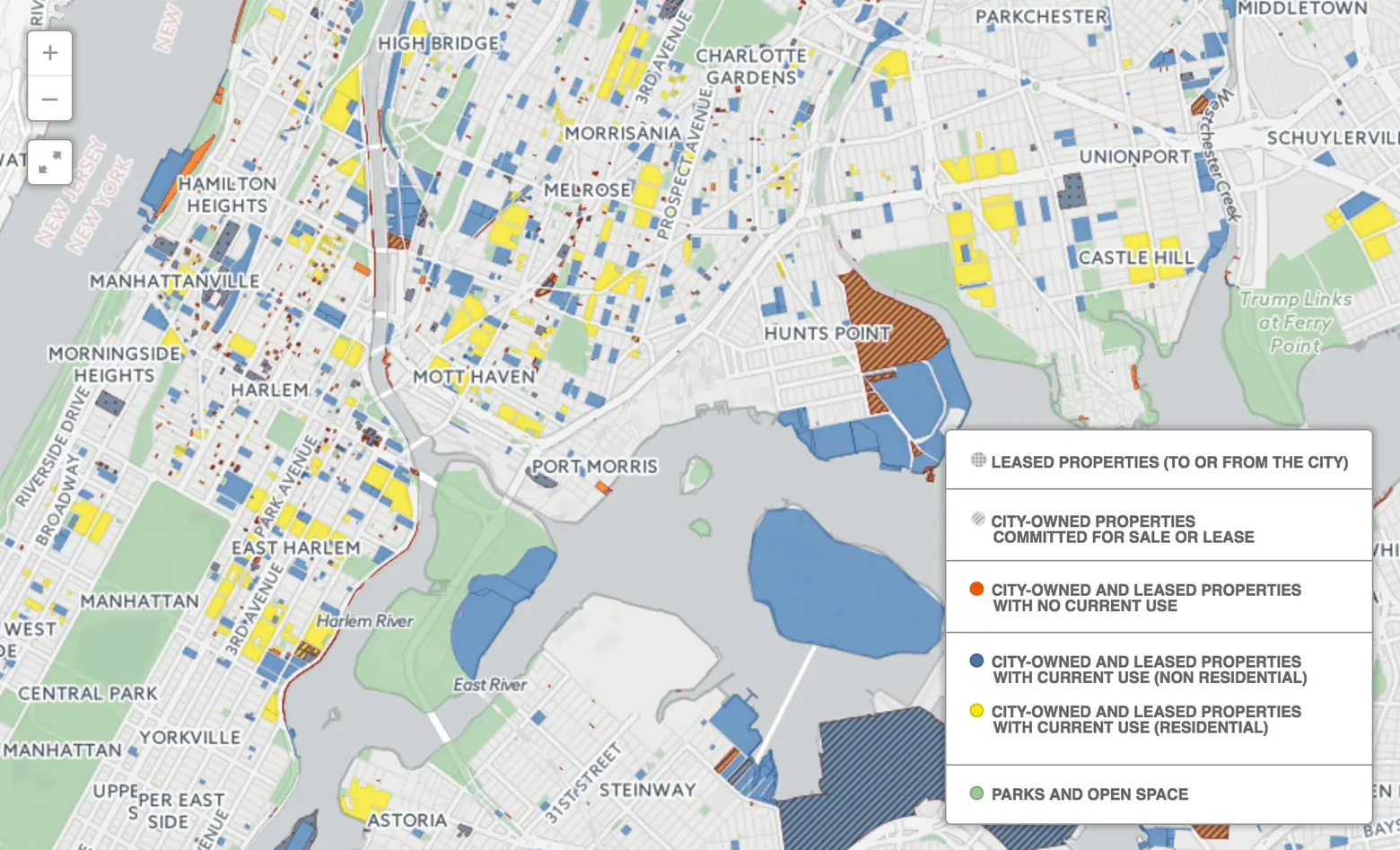
‘Sixth Borough’ map shows 14,000+ city-owned and leased properties that equal the size of Brooklyn

The Municipal Art Society of New York sent out a press release today that announces their new interactive map of the more than 14,000 city-owned and leased properties. Fittingly titled “The Sixth Borough,” it shows how these sites amount to 43,000 acres, a land area the size of Brooklyn or one-third of the city’s total land area, and the extent to which these public holdings–22 percent of which are listed as having no current use–affect the environment, infrastructure, landmarks, population, and neighborhood rezonings.
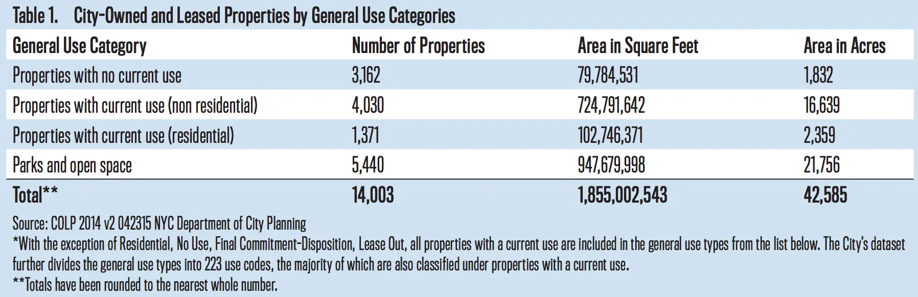
The Sixth Borough divides properties into four groups: properties with no current use (these total 1,800 acres, an area more than double the size of Central Park); those with a residential use; those with a current use that’s not residential; and property used for parks and open space. It’s part of MAS’s larger report “Public Assets: City-Owned and Leased Properties (Public Assets),” which found that:
- 64 percent are either completely or partially within the 100-year floodplain; 66 percent are at high risk for coastal flooding by 2050; and 75 percent are within the city- and state-regulated coastal flood zone
- 247 sites are full or partial New York State environmental remediation sites; 87 of these are enrolled in a Superfund or Brownfield Cleanup program
- 665 sites are city-designated landmarks; 47 of these have no current use
- 71 percent are in census tracts that are less dense than the citywide average; 6,969 sites are in tracts with low median household incomes
- Eight percent are in neighborhood rezoning areas
According to Gina Pollara, President of MAS, “These findings raise serious questions about whether our city’s available property is being appropriately leveraged for civic benefit. True equity in the city’s planning and land use decisions can only be achieved through an informed and engaged public… Examining these holdings and evaluating opportunities for their protection, enhancement, and development should be a priority of this and any future administration.” The organization’s recommendations for the city, therefore, are to:
- Prepare city-owned properties for high-risk flood events
- Take proper stewardship of landmark holdings
- Maximize assets for community benefit within low‐density, low‐income, and rezoning areas
You can explore the interactive map and read the full report HERE >>
RELATED: