Looking at NYC’s 10 Scenic Landmarks and What Sets Them Apart from Other Public Parks

Since 2015 marks the 50th anniversary of the New York City landmarks law, we’ve been talking a lot about historic buildings–those that have been saved, those that were destroyed, secrets of some of the city’s most famous spots. We even discovered that there are two landmarked individual trees. And starting tomorrow, the New York City Parks Department is hosting a new exhibit at the Arsenal in Central Park called Living Landmarks, which takes a look at nine of the city’s ten scenic landmarks, showcasing “their contributions to landscape design and to the dynamism of the city through historical and contemporary photography, renderings, maps, artifacts, and memorabilia.” Many of these, like Central Park, Prospect Park, and Bryant Park, are no brainers, while others like Verdi Square, Fort Tryon, and Ocean Parkway, are a little more under-the-radar.
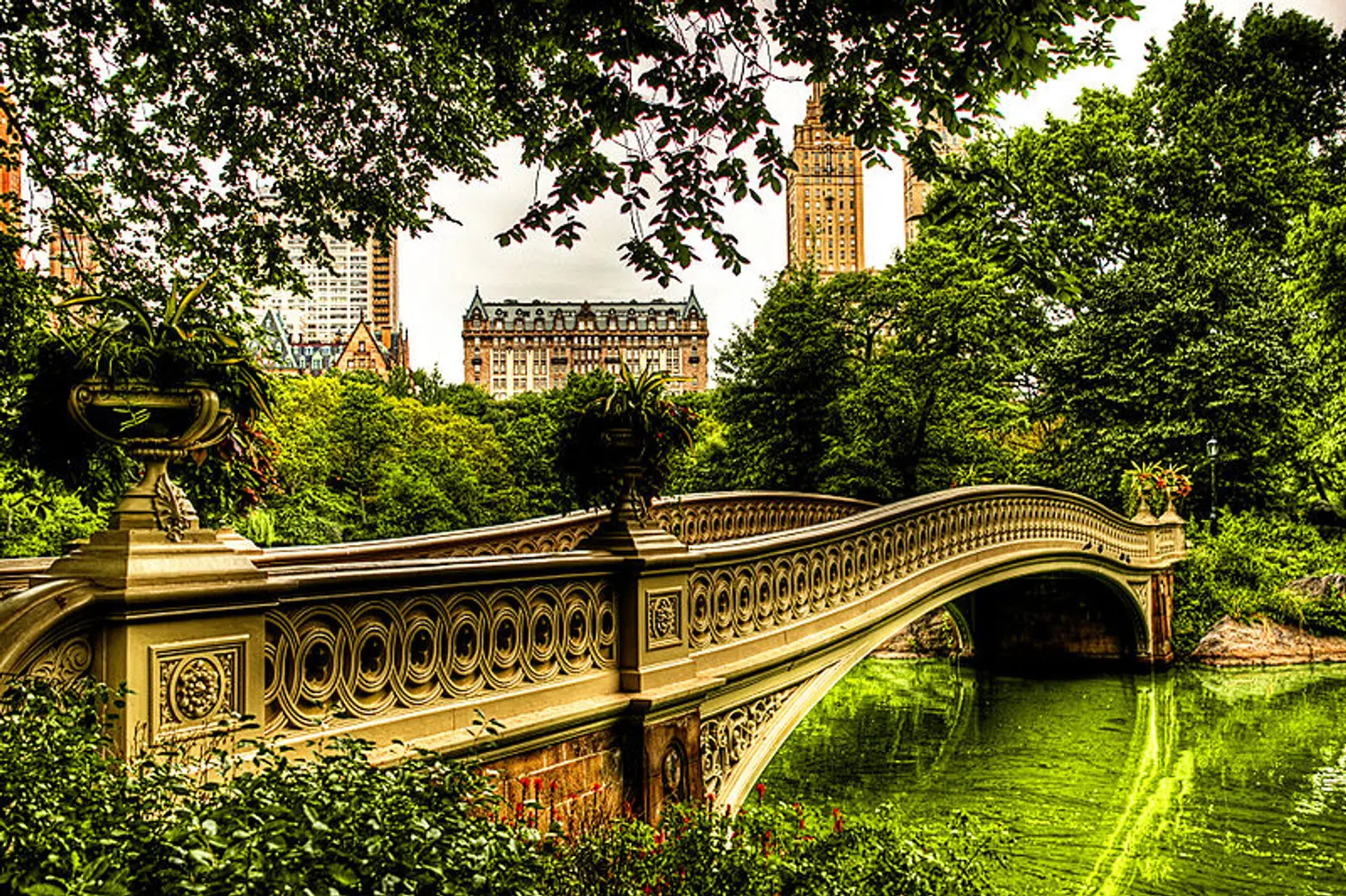
Bow Bridge in Central Park
Central Park
We’ll start with the most obvious, Central Park. The 778-acre oasis is not only the most visited urban park in the country, but it’s one of the most filmed locations in the world. We could go on for days about its history and design, but what really led to Central Park‘s landmarking in 1974 was the fact that it was “the first large-scale, public park in the nation that was designed and constructed according to a plan – a plan which reflected the aspirations of a people for their city,” according to the designation report. Up until Frederick Law Olmsted and Calvert Vaux won the design competition in 1858, city parks had been created as private spaces like Gramercy Park and St. Johns Park or were cemeteries and converted burial grounds like Washington Square Park.
Prospect Park
Though Central Park usually gets all the glory, it should be noted that Prospect Park was also designed by Vaux and Olmsted, and it’s often described as even more of a masterpiece since the designers learned from any previous mistakes. The 526-acre park was to Brooklyn what Central Park was to Manhattan, and the decision to build it came from the borough’s emergence as the world’s first commuter suburb. The designation report states, “Naturally, there was the desire to compete with New York as well as to attract more people to the advantages of Brooklyn living. But a more altruistic and democratic conception was also present: such a park was perceived as vitally necessary to bring relief from the urban environment for many city dwellers.”
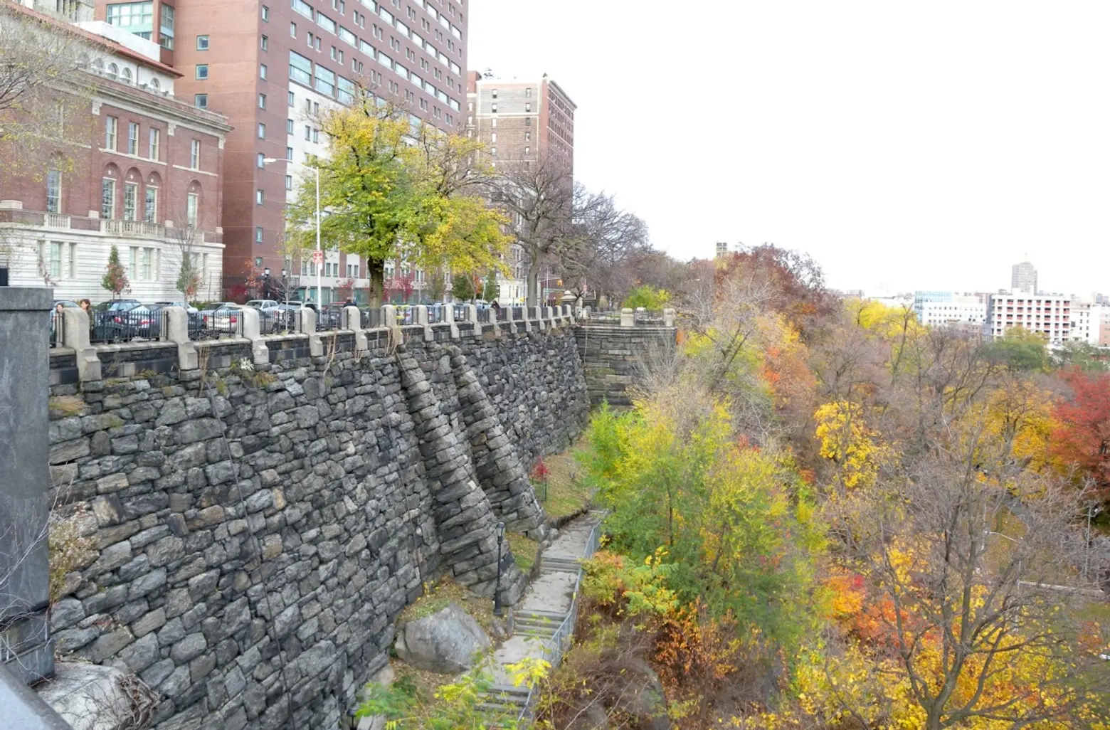
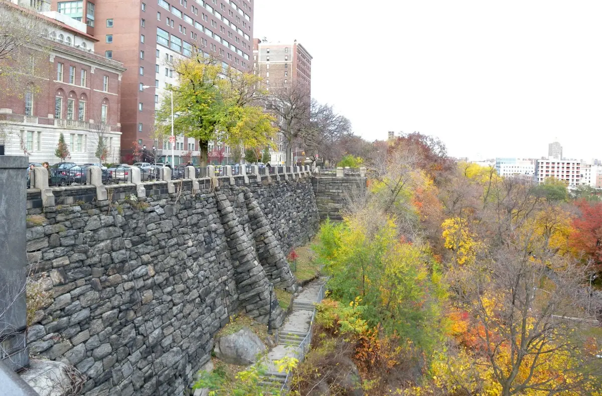
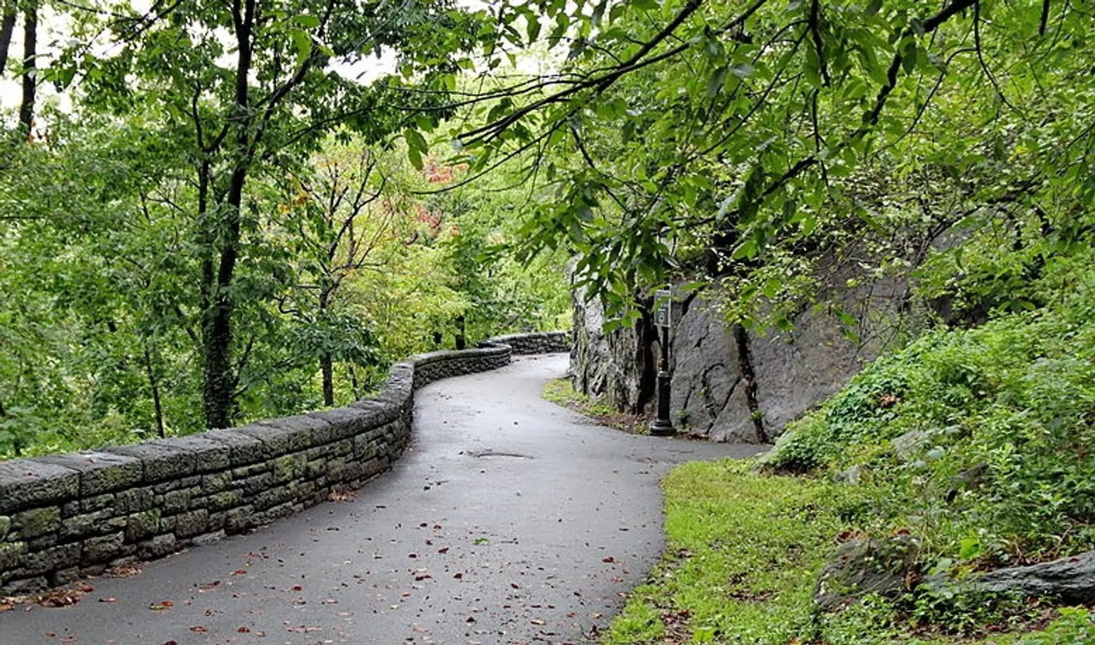
The Morningside Park retaining wall
Morningside Park
Morningside Park is a recent landmark, designated in 2008, but it too was designed by Vaux and Olmsted. The LPC explains: “Originally, the site was a rugged rocky ledge separating Morningside Heights from the Harlem Plain, and because of the terrain, Andrew Haswell Green in 1867 proposed that it be excluded from the Commissioner’s Plan street grid.” This unique character and topography set the site apart from Central Park and Prospect Park, as do its high rock outcroppings and “massive buttressed masonry retaining wall with parapet, overlook bays, and entrance stairways.”
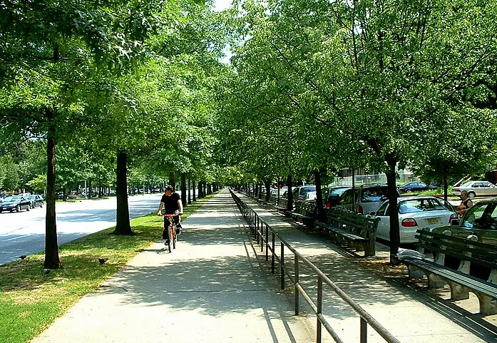
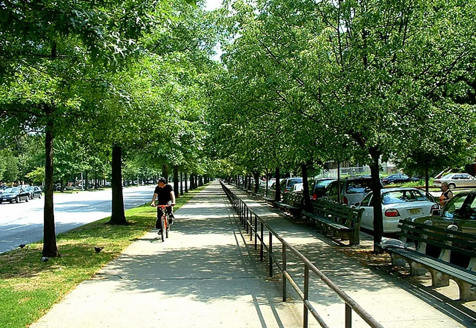
Riverside Park and Riverside Drive
The landmarked portion of Riverside Park and the parallel Riverside Drive begins at 72nd Street and continues north to 129th Street. Other than its extraordinary Hudson River views, this area is unique for its four-level design. “Each register has particular activities associated with it, and these are repeated along its length,” writes the LPC. The highest level is the drive itself, lined with apartment buildings, cultural institutions, and religious sites. Along the street’s western border is a paved promenade lined with trees and benches against the retaining wall. The level down from this wall is “the steep, sloping hill planted with grass and trees which one descends by steps, ramps and meandering walks.” Until the 1930s, this is where Riverside Park ended, but when train tracks were extended, a plateau was built over them. This third level is a tree-lined promenade for pedestrians and bicyclists. Finally, the lowest level is “where massive arches incorporating ramps and stairs provide access for people and ventilation for the railroad. The parapet formed by the railroad wall also provides additional areas for recreational facilities.”
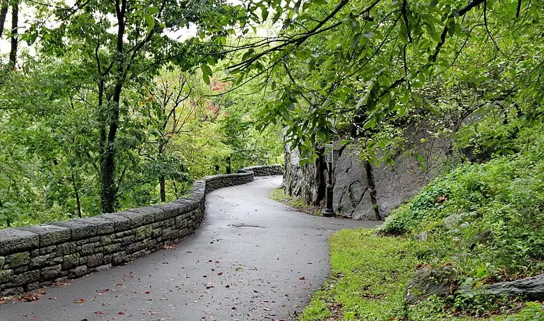
A pathway in Fort Tryon Park
Fort Tryon Park
Fort Tryon Park is another Olmsted work, but in this case the famous surname refers to the designer’s sons. Step-brothers John Charles Olmsted and Frederick Law Olmsted Jr. made up the firm Olmsted Brothers. In 1917, they were hired by John D. Rockefeller Jr. to create a public park to be gifted to the city. Aside from being home to the famous Cloisters museum, Fort Tryon Park is noteworthy for its unusual landscape on one of the highest public spots in Manhattan. The LPC explains that “36,000 cubic yards of gray Manhattan schist that were removed were employed in the construction of the architectural elements of the park.” Further, the land contains Inwood marble and glacial striations from the last Ice Age.
Eastern Parkway
This is not a park in the traditional sense, but rather a major thoroughfare conceived by Vaux and Olmsted as part of their overall Prospect Park plan. Eastern Parkway was the world’s first parkway; the designers coined the term in reference to the scenic drives to and from the park. The road begins at Grand Army Plaza and heads east, terminating at Evergreen Cemetery. By incorporating central malls with trees and walkways, they were extending the beauty of the park throughout Brooklyn. And as the LPC points out, “The formal elegance of the parkway attracted such prestigious cultural institutions as the Brooklyn Museum, the Brooklyn Botanical Garden and the Brooklyn Public Library.”
View of the median at Ocean Parkway
Ocean Parkway
Like Eastern Parkway, Ocean Parkway was part of Vaux and Olmsted’s plan for Prospect Park, so that Brooklynites could take pleasure drives from the park to the ocean. The six-mile long road was completed in 1876 and stretches from Coney Island to the park. According to the designation report, Ocean Parkway “established a new concept in road building.” Two medians feature trees, benches, and pedestrian paths, and still today, this is some of the only green space for local residents.
Verdi Square
There are plenty of triangular plots of land used as parks throughout the city, so what makes Verdi Square special? The answer has to do with the small area’s central location through many eras. Bloomingdale Road (present-day Broadway) was laid out in 1703, and when the Commissioner’s Plan of 1811 instituted the city’s street grid, Amsterdam Avenue and 73rd Street intersected with the historic road to create this triangular plot of land. In the late 18th and early 19th centuries, this area was known as Harsenville and was “the site of a number of country seats and of the summer villas of wealthy New Yorkers who were attracted to it because of its rustic charm and its view of the Hudson River,” notes the LPC. Later, in the early 20th century, Verdi Square was a popular hangout for musicians, including Enrico Caruso and Arturo Toscanini.
Grand Army plaza, via Bridge and Tunnel Club
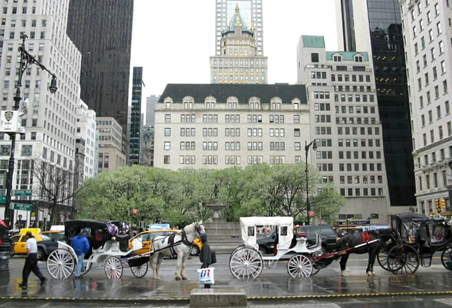
Grand Army Plaza
There are two Grand Army Plazas in NYC (both of which vie for the title of world’s largest menorah), but the landmarked site is in Manhattan at 5th Avenue and 59th Street at the corner of Central Park. Among the reasons for its designation are that “Grand Army Plaza was laid out in accordance with a carefully prepared plan that it is an excellent example of the influence of the City Beautiful movement… it contains two of the finest works by the notable American sculptors Augustus Saint-Gaudens and Karl Bitter… and it is a tastefully restrained entrance to Central Park” says the designation report.
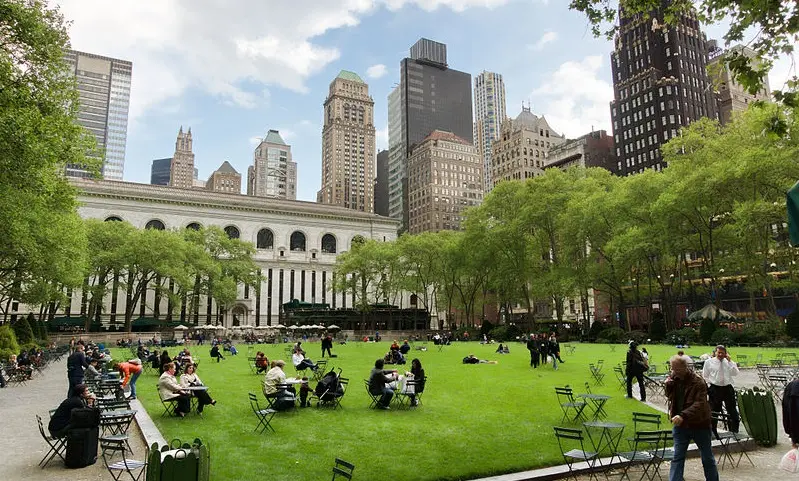
Bryant Park
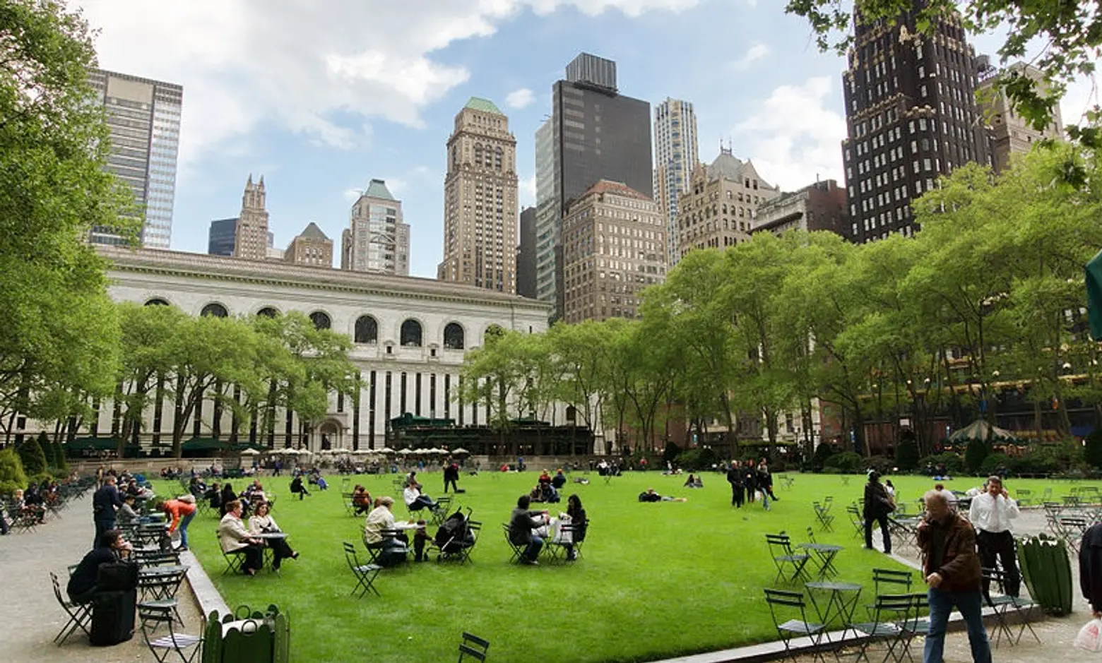
Bryant Park
Bryant Park may be smaller than most of its fellow scenic landmarks, but it has perhaps the most varied and interesting history. The land first made headlines in 1776 when George Washington’s troops defended themselves against the British there during the battle of Long Island. Then, from 1823 to 1840, it was used as a potter’s field (burial ground for the poor). In 1847, the first park opened on the site. It was known as Reservoir Square, named for the neighboring Croton Distributing Reservoir. But it was in 1853, during the Exhibition of the Industry of All Nations, that this location rose to international fame. It was the site of the Crystal Palace, a massive iron and glass exhibition building that resembled the structure of the same name that had been built in London’s Hyde Park. It burned down in 1858, and the land was used for drills during the Civil War. In 1884, it was officially named Bryant Park in honor of William Cullen Bryant, and in 1899, construction began on the main branch of the New York Public Library, a landmark now intrinsically connected to the bustling park.
***
The opening reception for Living Landmarks is tonight from 6:00 to 8:00pm, and the exhibit will run daily through August 28th. More information is available here.
RELATED: