Living Lots map helps New Yorkers transform vacant land into community spaces

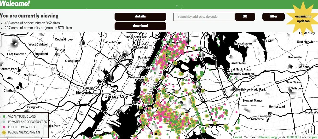
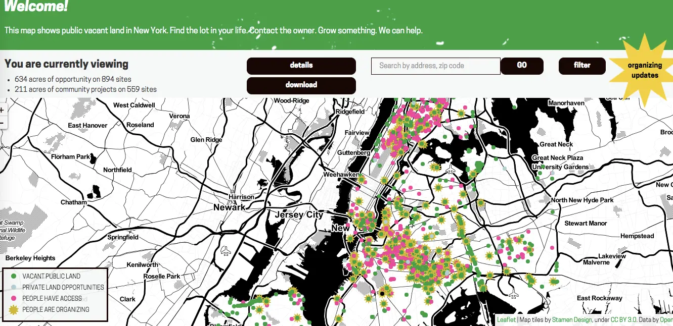
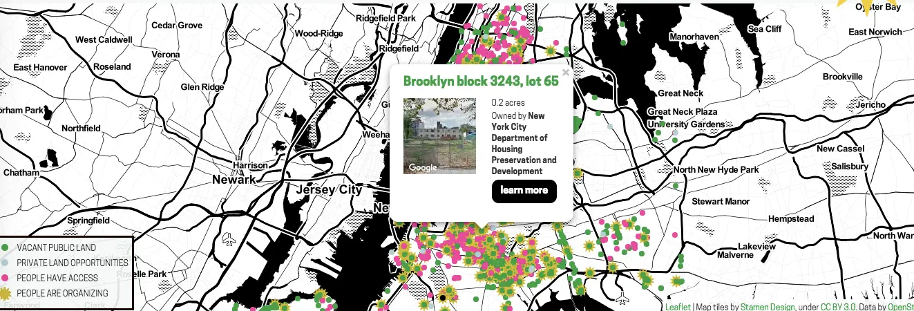
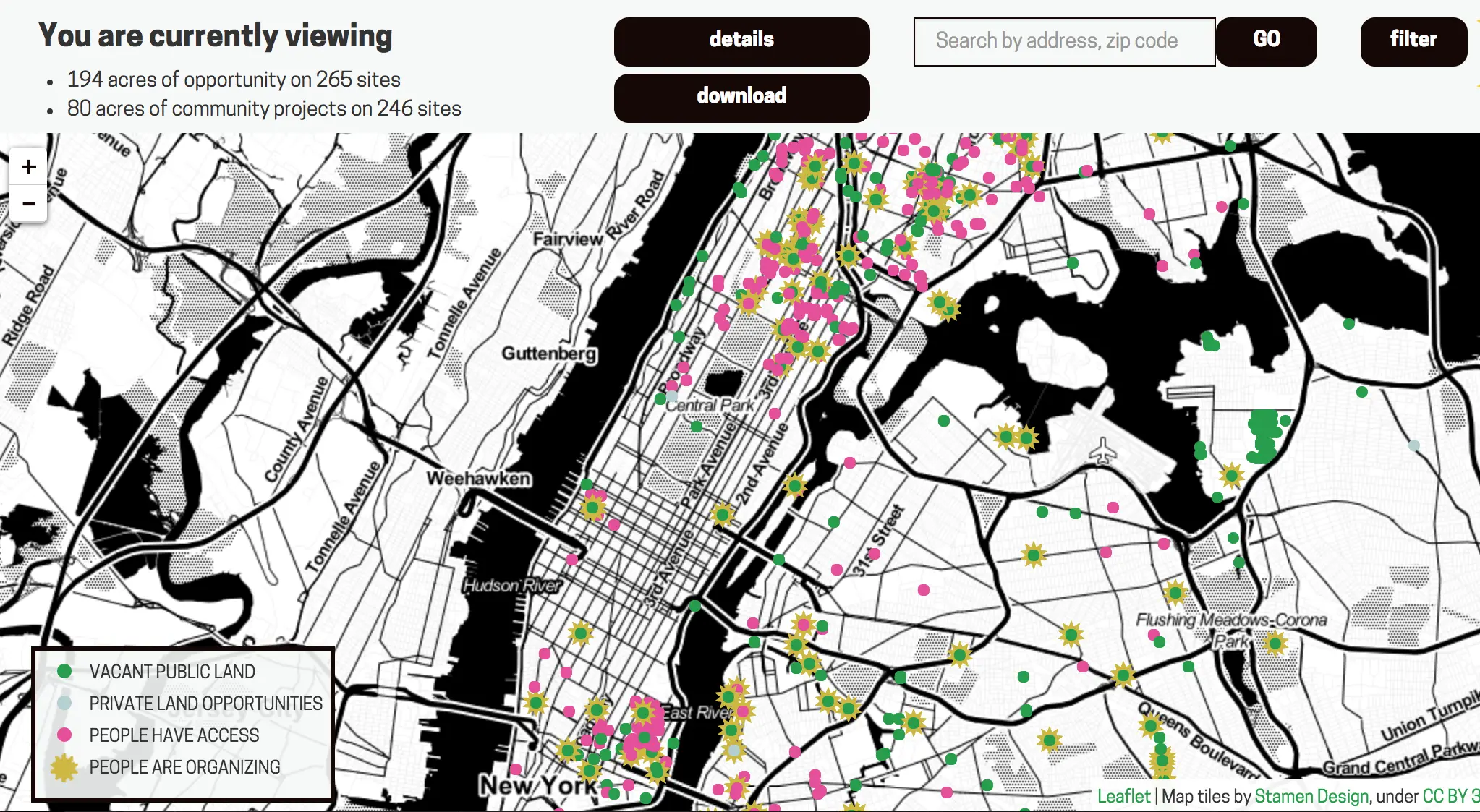
It’s time to think about gardening–a seasonal rite that’s something of a challenge for most city-dwellers. Living Lots NYC is a clearinghouse of information that New Yorkers can use to turn vacant land into community spaces. Begun as a pilot project that ran from 2011 to 2015, which led to the to the official transformation of 32 vacant lots, Living Lots NYC was created by community organization 596 Acres as a database that New Yorkers can use to find, unlock, and protect the shared resource of the city’s vacant lots. According to the map, at this particular moment, there are 877 sites throughout 626 acres of vacant public land, 18 sites on 8 acres of private land opportunities, and 559 sites on 211 acres to which people have access.

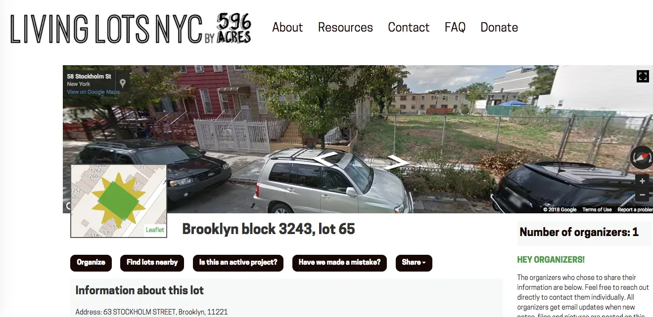
Once you find a spot on the map–which also notes land that people are already organizing so you can get connected–you can click to find out who owns the land and why it might be vacant, learn more about the possibilities, and check out the spot via Google Maps. You’ll also find suggestions on the best ways to go about getting involved in community development on that particular lot.

Designed to help people find one another on a property-by-property basis, 596 Acres also welcomes institutional partners who want to facilitate access to other types of spaces through information and advocacy; other spaces include lawns of public housing campuses, closed-off municipal observation decks, post offices, libraries and every type of public space in between.
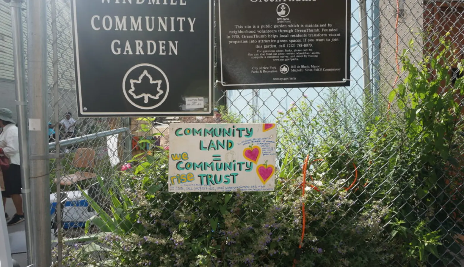
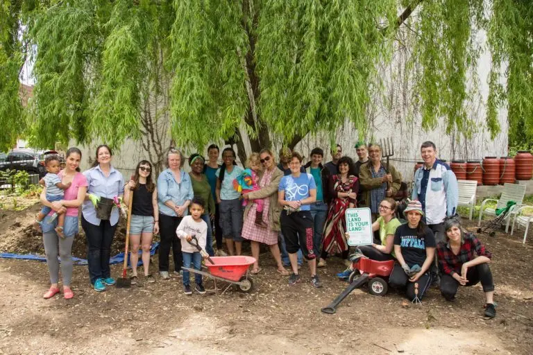
Photo courtesy of 596 Acres.
As an example, if the lot you’ve found is managed by HPD, you may still be able to advocate to have the property transferred to the Parks Department or the Department of Cultural Affairs to create a permanent community garden or park; a transfer is very likely if land is planned “open space” under an Urban Renewal Area Plan.
Housing Preservation and Development (HPD) controls the majority of the city’s vacant, public land. HPD used to license land for community gardens on an interim basis through GreenThumb. They have recently stopped agreeing to grant these licenses, but there are still dozens of active gardens around the city with these types of licenses.
Find out more, and read up on past success stories here.
RELATED: