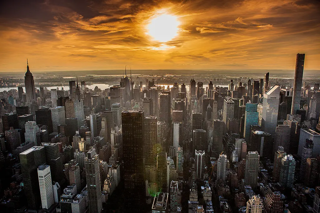
Find out just how much sunlight any building in NYC gets

Natural light is at the top of the list when New Yorkers think about a building’s livability. Recently at the Municipal Art Society Summit for New York City, Localize.city, an AI powered website that provides insights about every address in New York City, unveiled a shade analysis for every building in the five boroughs. The site’s creators say the analysis gives NYC home hunters a way to really determine just how much light any given address gets.
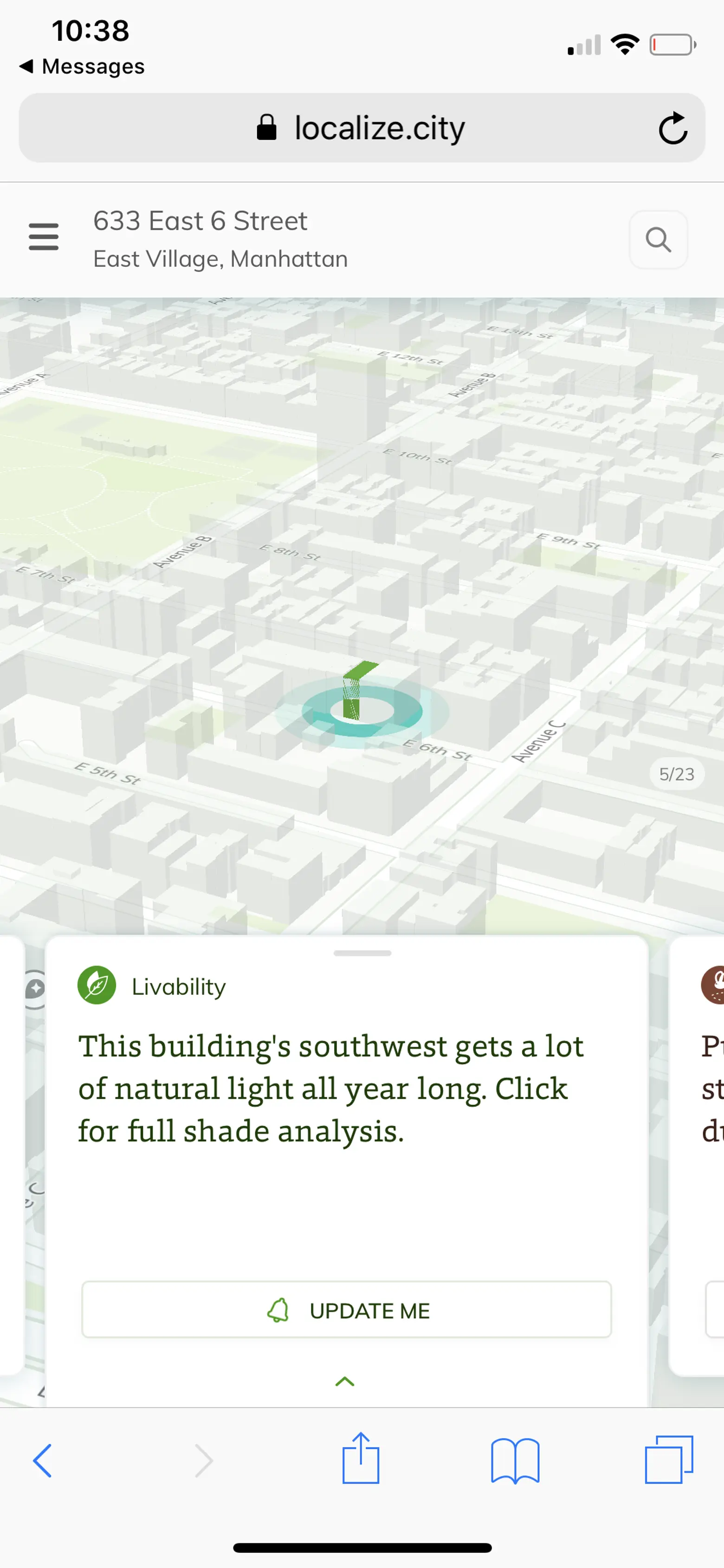
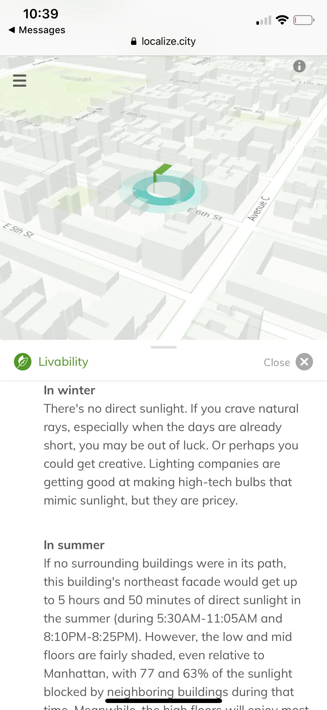
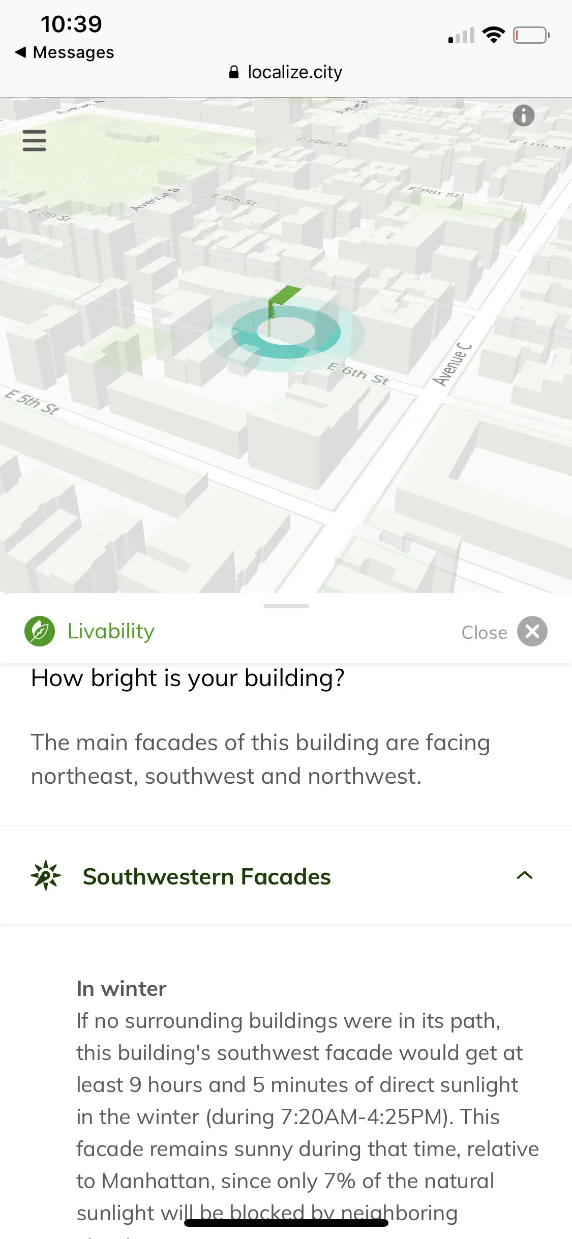
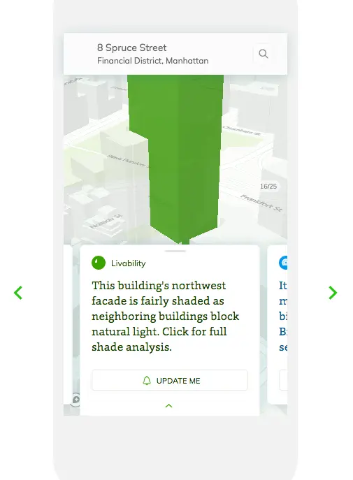
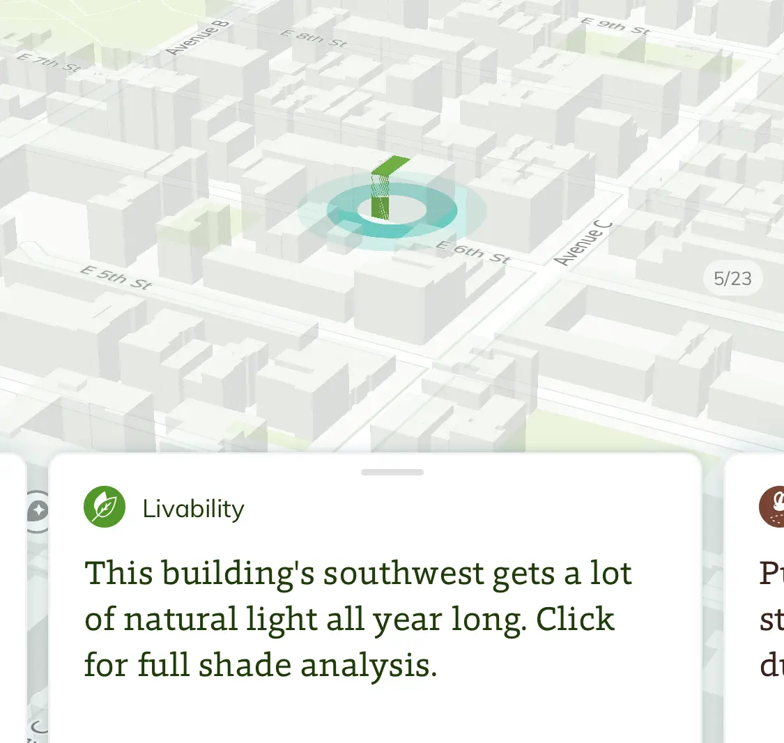
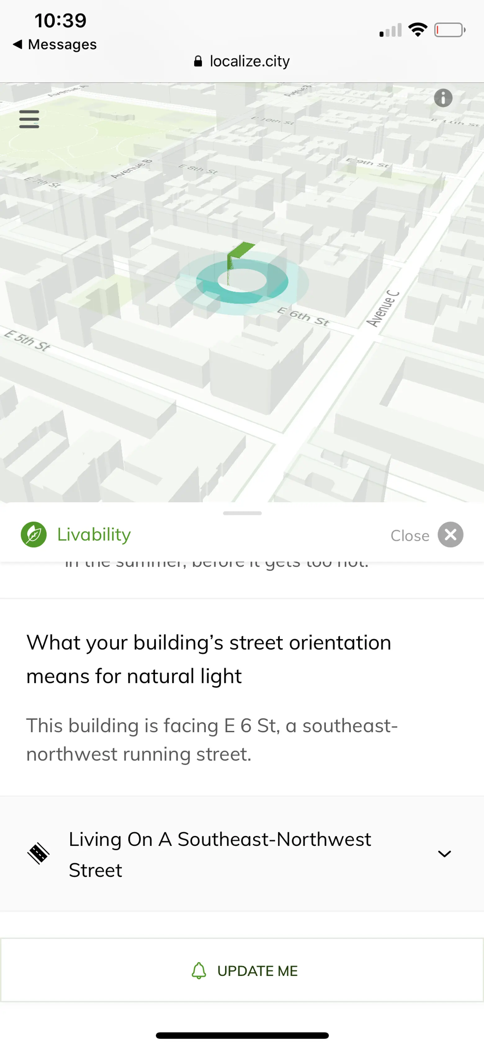
Having good sunlight at home is regularly a “must-have” for New Yorkers, yet it’s one of the most difficult things to verify and you can’t really tell by browsing apartments online. What’s more, if you see a place on a summer day, you can’t really tell what it will be like in winter. Localize.city has solved this problem by allowing visitors to search the address of any building and providing a description of the sunlight on every side of the building throughout the year, including hours of the day when it will be brightest along with how different floors are affected by shadows cast from surrounding buildings.


“It was overwhelming to hear how many New Yorkers regretted choosing their apartment because it had less sunlight than they expected,” said Localize.city President Steve Kalifowitz. “Our data scientists and GIS experts spent many months creating an algorithmic model of New York City that analyzes the amount and quality of sunlight you can expect in your home. This analysis has never been done at this scale and released freely to the public.”
Localize.city calculated the azimuth (arc of horizon) of every outward-facing facade in New York City to determine how much direct sunlight exposure there was throughout the year. To do this, data scientists and GIS experts took complex, three-dimensional out-facing geometrical shapes of every building in New York City and measured the amount of sunlight exposure they could potentially receive.
To simulate the shading over the walls of the entire city, Localize.city used detailed three-dimensional building models of the five boroughs. The team overlaid a shadow map on an area and recorded whether a three-dimensional location on a wall was inside a shaded area or not. Those measurements were aggregated for each point in space and time. This enabled the team to analyze the amount of direct sunlight that is blocked by shadows cast from neighboring structures.
Find out how much sunlight your building–or any building–gets, here.
RELATED:
- Central Park Sunshine Task Force Meets to Speak Out Against Supertall Shadows
- Time Lapse Video Shows How Midtown’s Tall Towers Will Cast Dark Shadows on the Park
- Nordstrom Tower Adds 20 Feet to Become the Tallest Building in NYC and Western Hemisphere
- Infographic: How NYC’s Supertalls Compare in Height and Girth to Global Towers