City reveals maps of proposed routes for Brooklyn-Queen streetcar

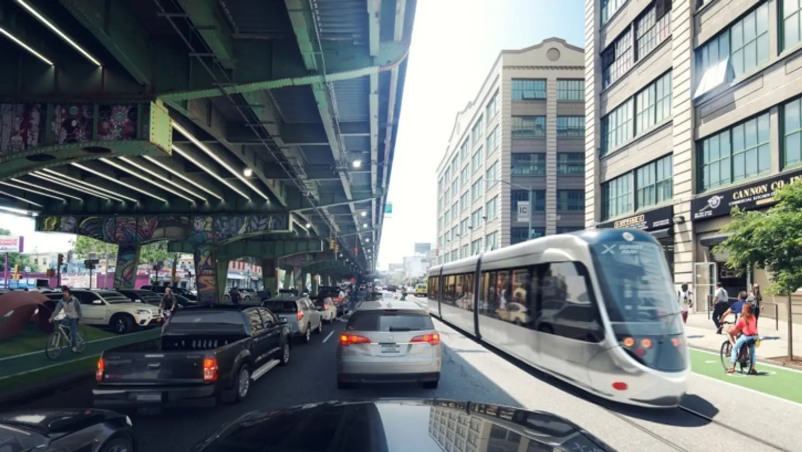
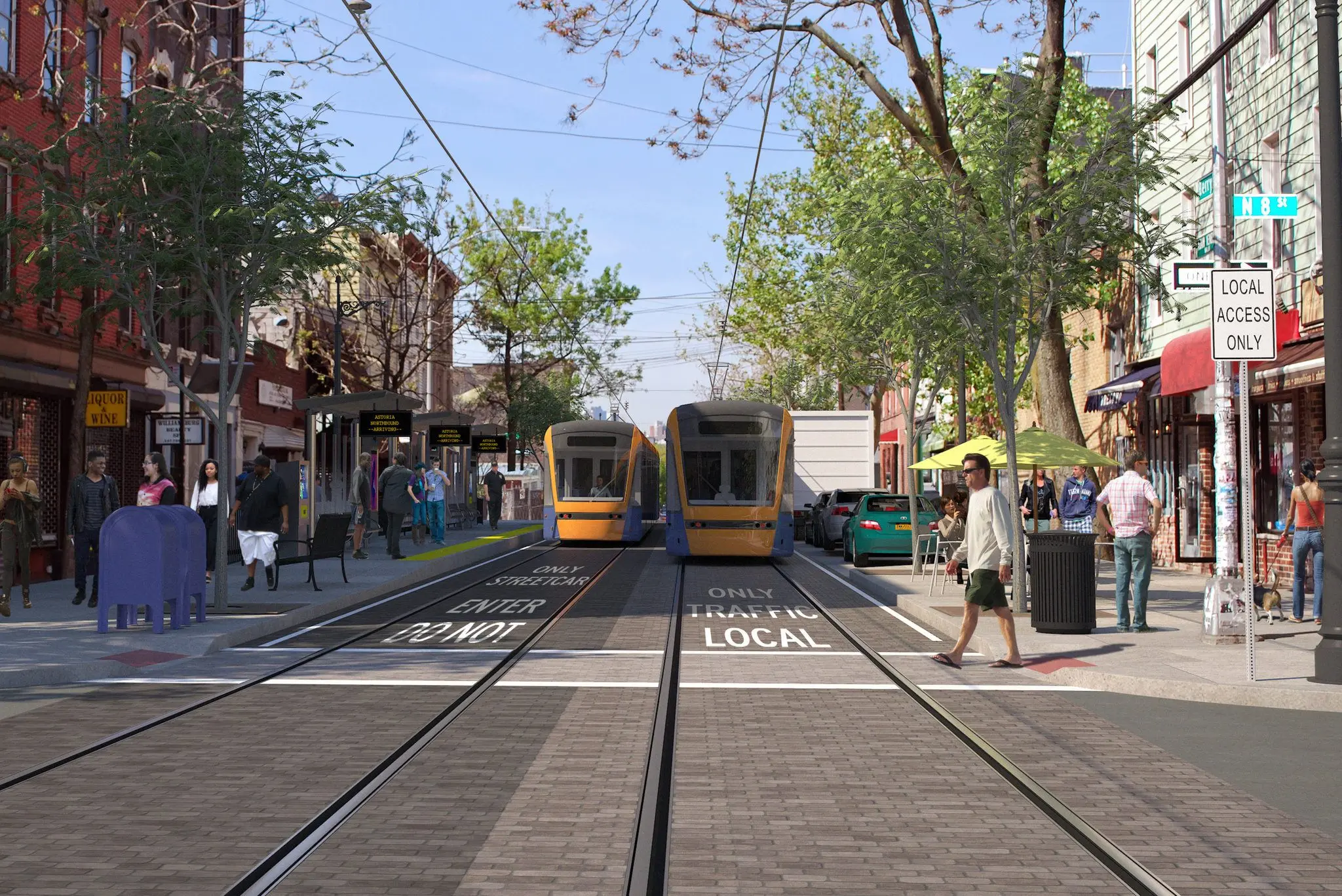
Rendering of the streetcar on Berry Street in Williamsburg
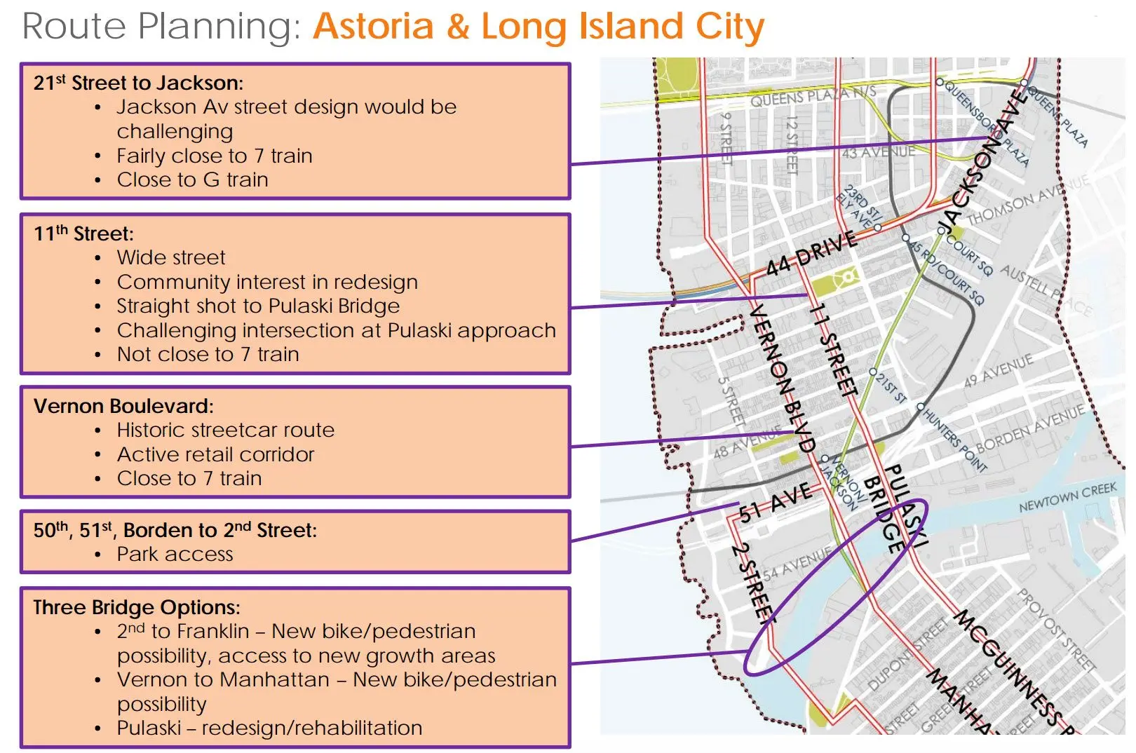
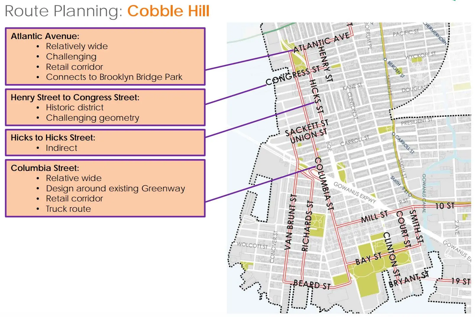
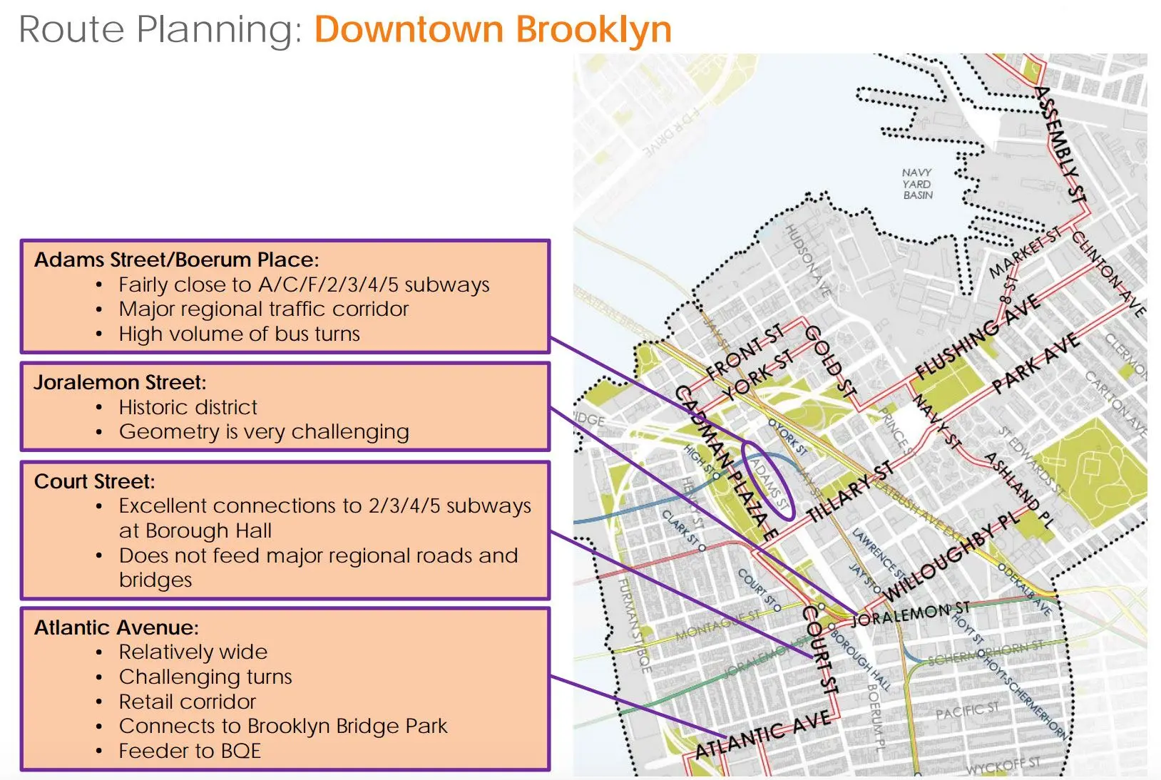
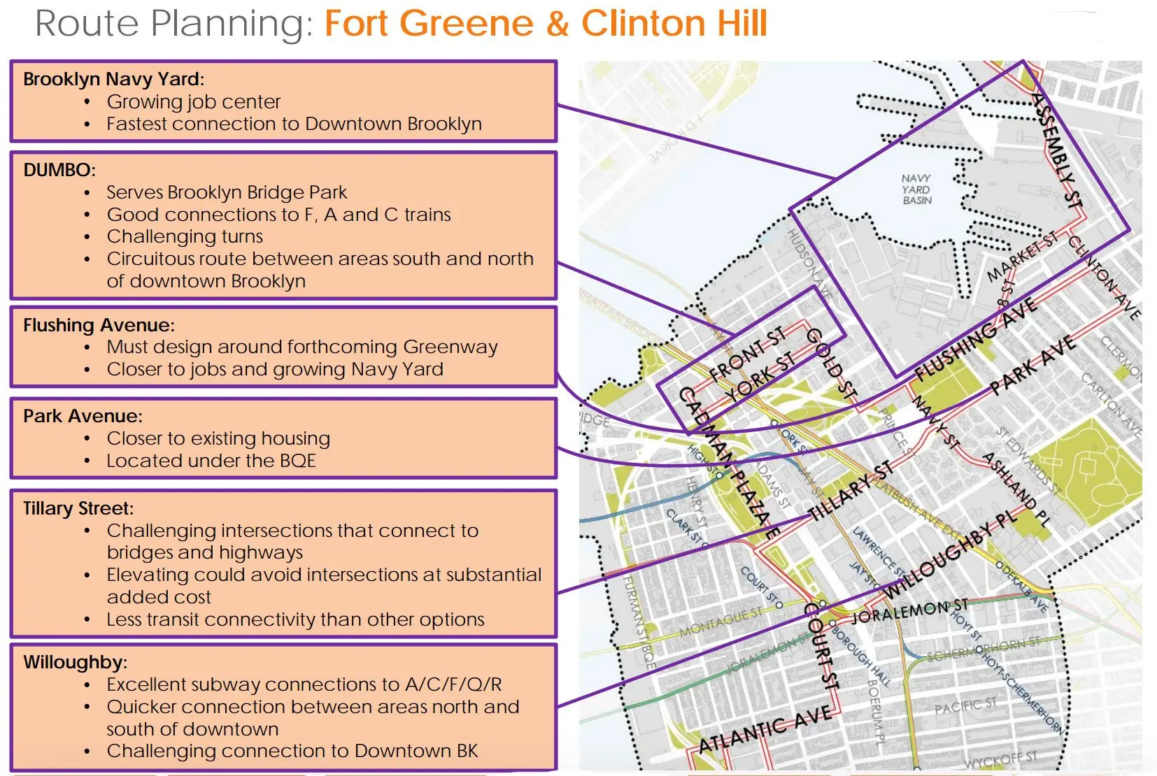
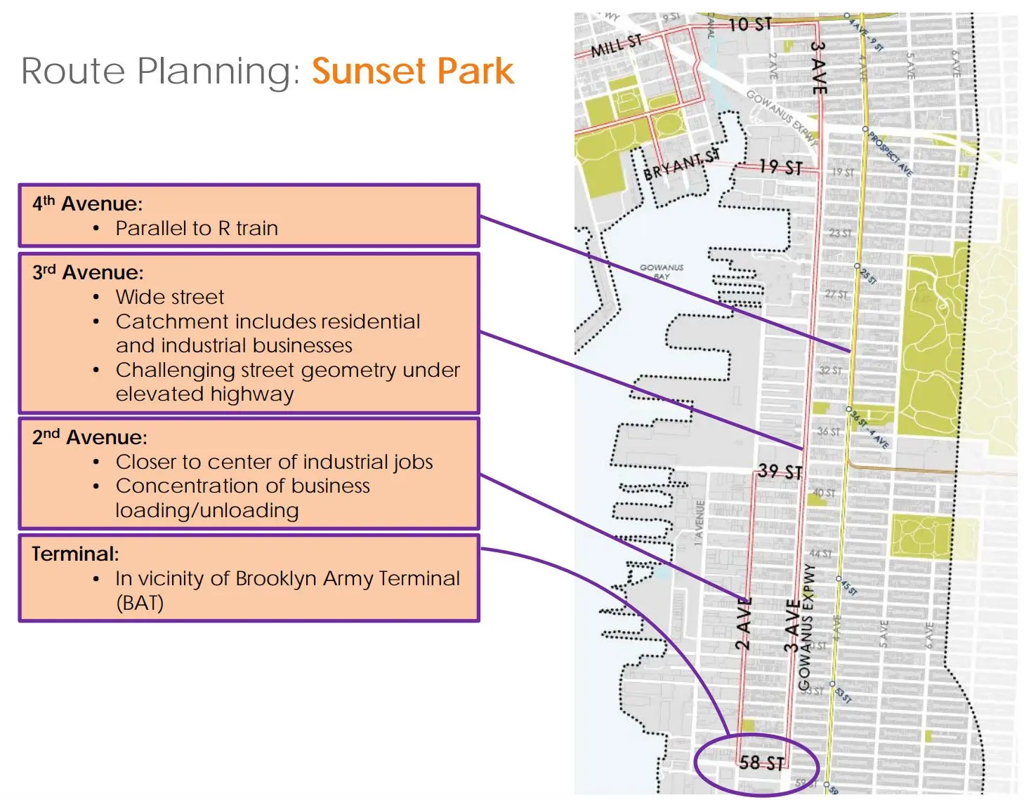
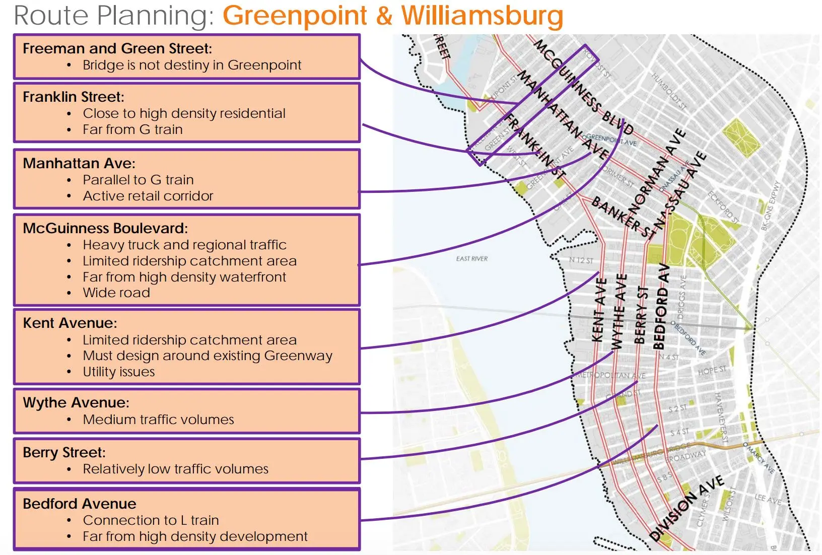
When the plan for a streetcar from Brooklyn to Queens was officially announced by the city in February, we knew that the $2.5 billion line would run 16 miles along the East River, from Astoria to Sunset Park, but the exact routes have remained a mystery, up until now. The Times reports that yesterday the city released a 25-page report that outlines these key details, as well as how the streetcar would traverse bridges to cross Newtown Creek and the Gowanus Canal and more logistical details. It also includes maps for the various routes through each neighborhood with a list of pros and cons (road width, proximity to existing subway stations, street and pedestrian traffic) for each possible street.

In all, the city expects to have 30+ stops along the route, approximately a half mile apart. They’ll be located at the center of the road, but the streetcars will interact with vehicular traffic only at intersections. During peak hours, cars will arrive every five to 10 minutes. Some streets, such as Berry Street in Williamsburg as seen above, will become “transitways” used only by the streetcars and pedestrians. It would have expanded sidewalks, but allow some street parking.
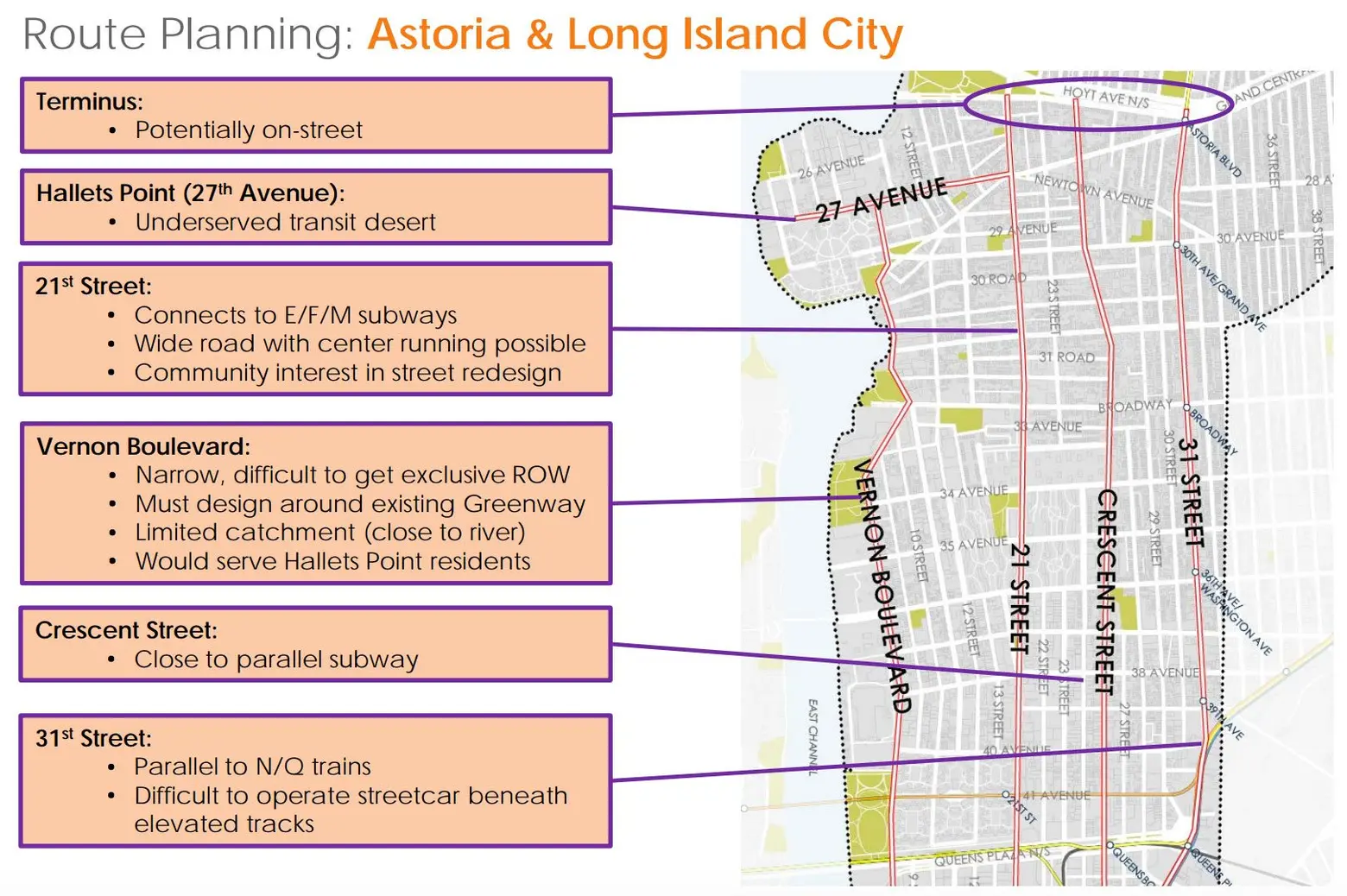
In some areas, the routes may be moved farther away from the waterfront than originally conceived, based on studies of housing, public utilities, and subway connections. But in Astoria, for example, there’s a concern that this would leave out “transit deserts” near the East River such as public housing development the Astoria Houses. Councilman Costa Constantinides who represents Astoria said, “In the western part of my district, they can see Manhattan from their homes and yet it’s one of the longest commutes in the city, and into Brooklyn it’s even longer… We’re going to make sure our community has a voice.”
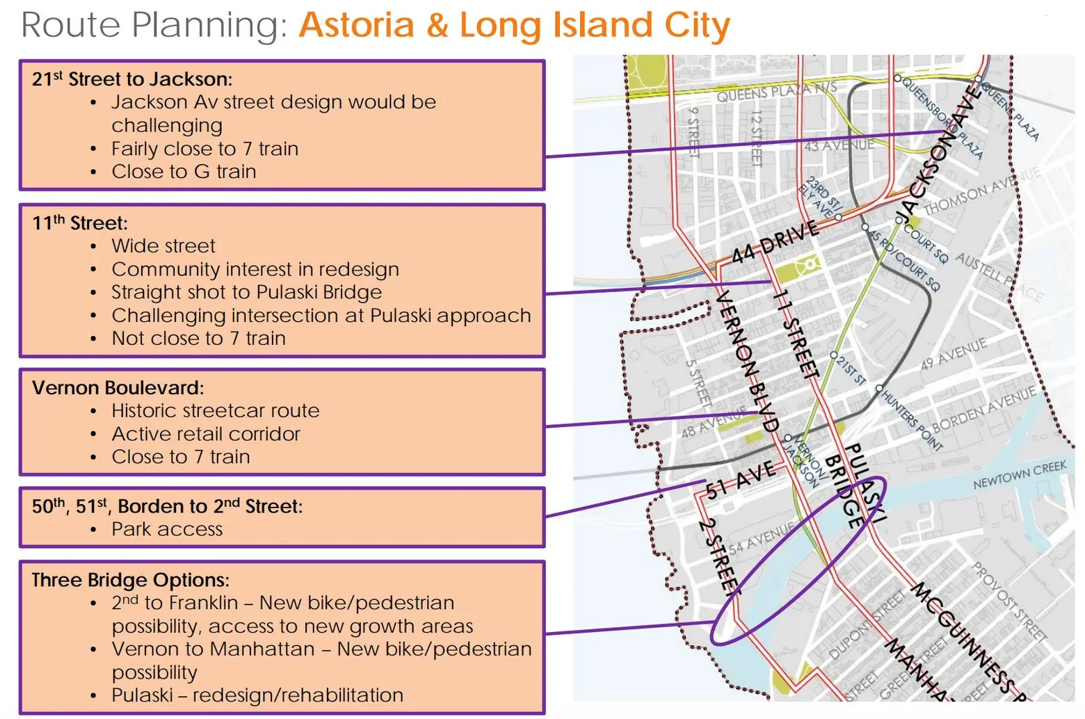
To cross Newtown Creek, there are three possible bridge options–a redesign of the Pulaski Bridge or new infrastructure at either 2nd to Franklin Street or Vernon to Manhattan Boulevards, both of which would include new bike and pedestrian paths.
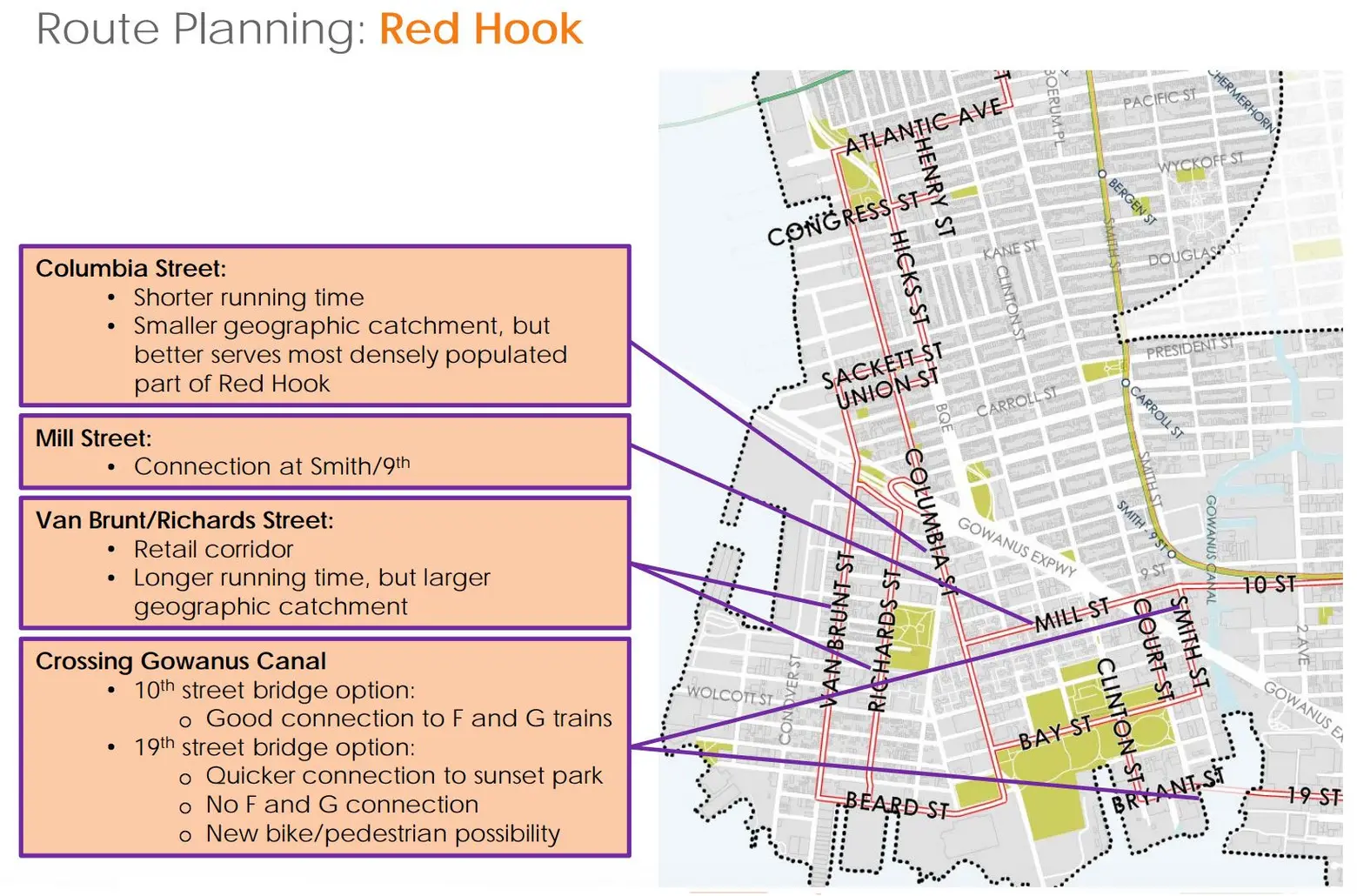
To cross the Gowanus Canal in Red Hook, there could either be a 10th Street bridge that would connect to the F and G trains or a 19th Street bridge that would lack a subway connection, but provide quicker access to Sunset Park and a new bike/pedestrian path.
Fares will cost $2.75, the same as a subway ride, but it’s still unclear whether there will be free transfers to other modes of MTA transit. The city will begin meeting with local community groups this month to discuss the possible routes. They’ll then start the environmental review next year and construction in 2019. Completion is planned for 2024. You can read the Economic Development Corporation’s full report here, and view all the route maps in our gallery below.
[Via NYT]
RELATED:


Get Inspired by NYC.
Leave a reply
Your email address will not be published.


This looks and sounds amazing . However I am skeptical and wonder how it can only cost 2.75 a ride? same as the ferries that they are launching, economists say it will cost the city 7.00 dollars a ride and they will charge 2.75 and the city will subsidize the difference.
Why does it not go anywhere near Atlantic Terminal? That is a central point in Brooklyn. Lots of people going to LIC do NOT live on the waterfront.