Chimneys and reindeer food: These maps optimize Santa’s Christmas Eve efficiency

Santa may not have an engineering background, but he certainly knows his location intelligence, considering he’s long been able to deliver billions of gifts around the world in just one night. But with population growing and delivery becoming faster and faster (ahem, Amazon), the team at Datastory decided to help him out and optimize his Christmas Eve travel. Using the metrics of population, fly times, fireplaces, cookies, milk, and reindeer food (aka grassy areas), they’ve suggested “distribution points that maximize access to everyone on the nice list,” so that, in theory, “his elves could stage the gifts in just the right places, helping Santa complete the job in time.”
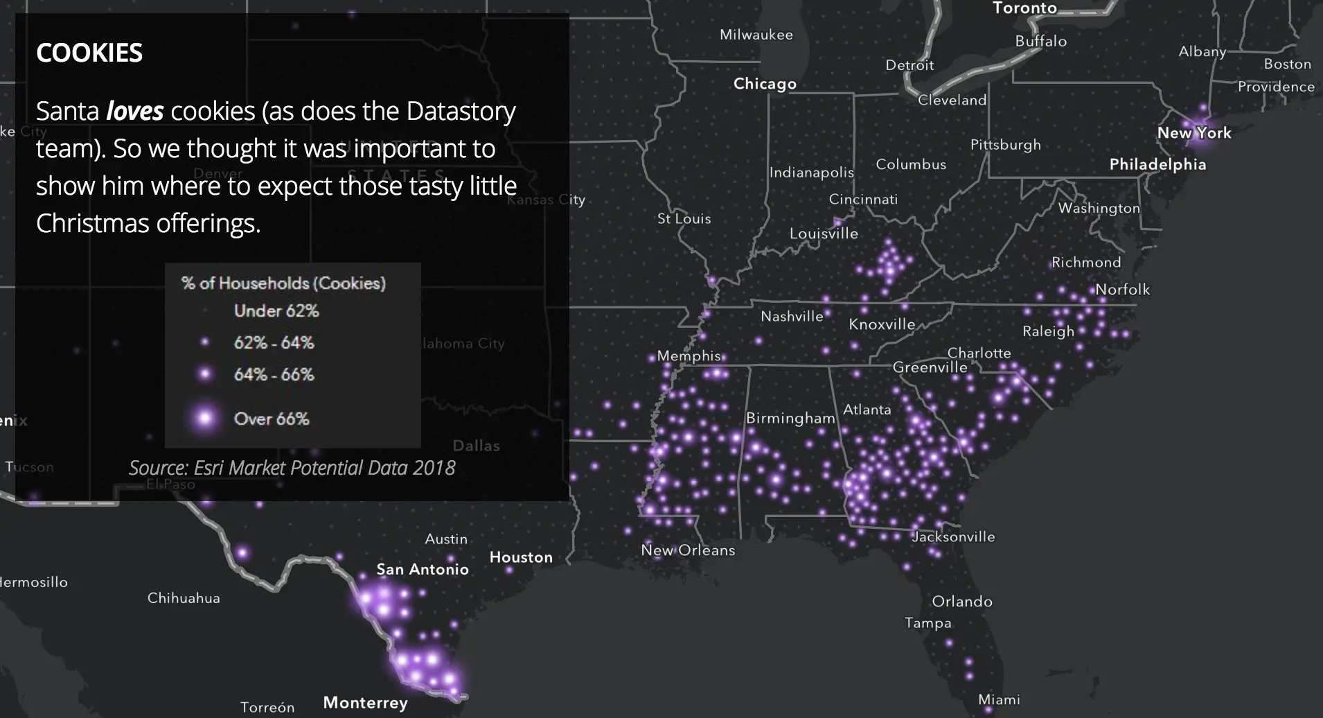
 Apparently, New Yorkers are skimping on cookies!
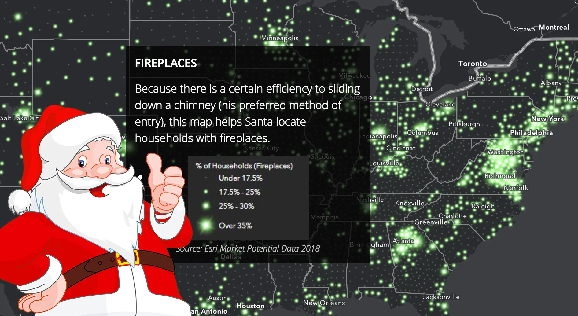
Datastory first mapped county population to predict the demand for gifts and give Santa an idea of how many families he’ll need to visit. They then mapped fireplaces (“because there is a certain efficiency to sliding down a chimney”), cookies, milk, and reindeer food (“grassy areas to keep his team well fueled for the night”). They then compared population with flight times to see which areas give Santa access to the greatest number of people.

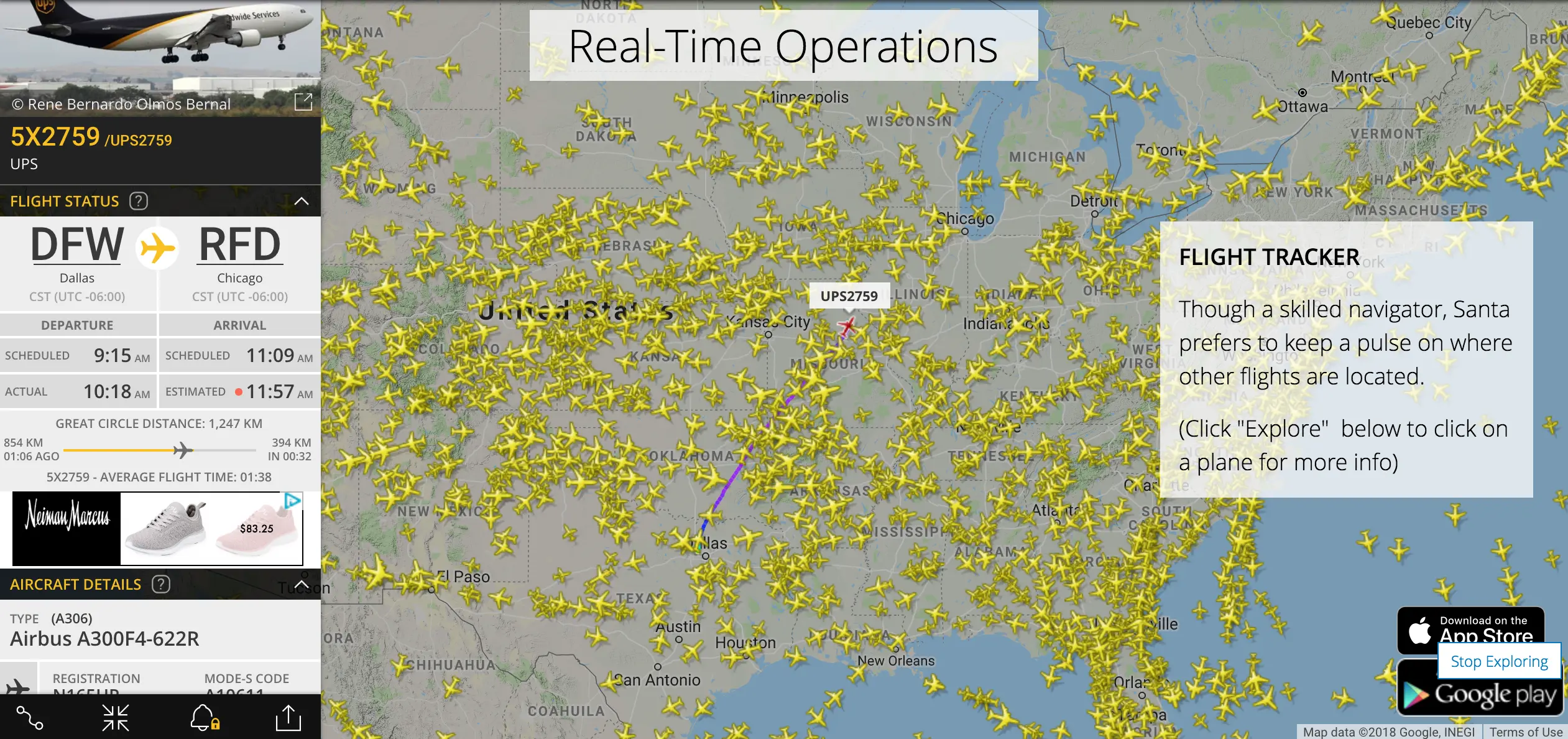
They’ve also mapped out real-time operations so that while in flight Santa can check out no-fly zones, snowfall and other extreme weather, and other flight traffic.
Of course, however, Datastory is certain to let us know that they can’t give away all their secrets, as they’re “under an NDA” with Santa. Explore all the maps here >>
RELATED:
- See this year’s completely outrageous Dyker Heights Christmas lights
- On Long Island, Santa’s Christmas Tree Farm is for sale for $2.5M (lights included)
- In the 1800s, a group of NYC artists and writers created the modern-day Santa Claus
Image of Santa via imgpng.com