The American Panorama Uses Modern Maps to Create an Historic Atlas of the U.S.

Well ahead of his time, naval historian Charles Paullin created the Atlas of the Historical Geography of the United States in 1932. Its 700 maps covered all sectors of American life, from geographic boundaries to topography and European settlement to the development of railroads. Last year, the University of Richmond digitized these maps, and they’ve now taken inspiration from the catalogue to create a modern version of the project.
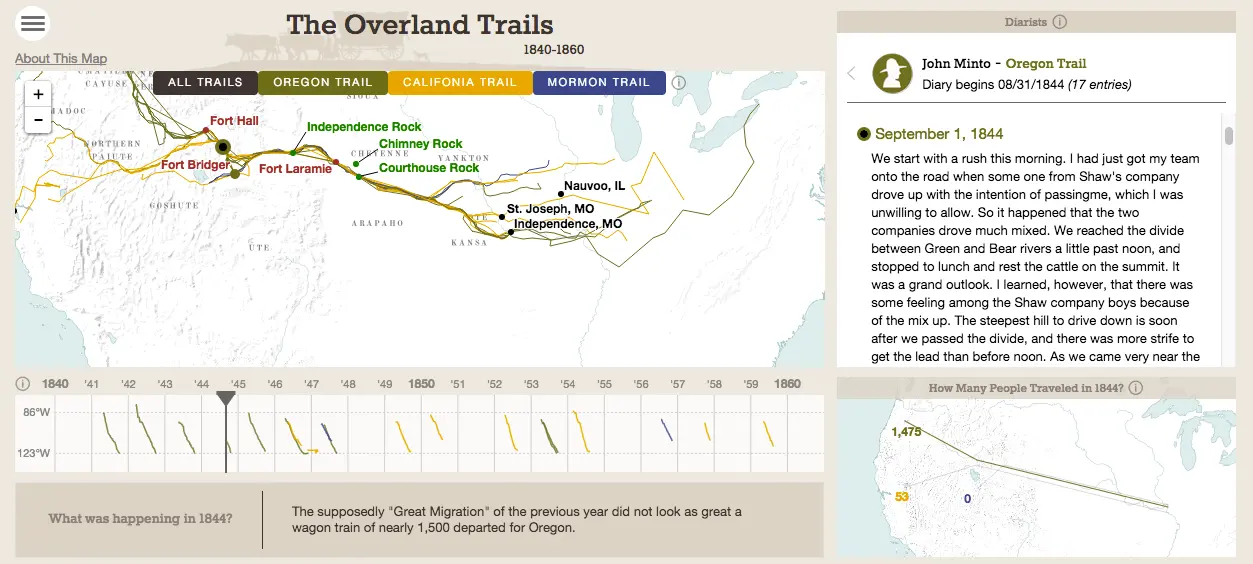
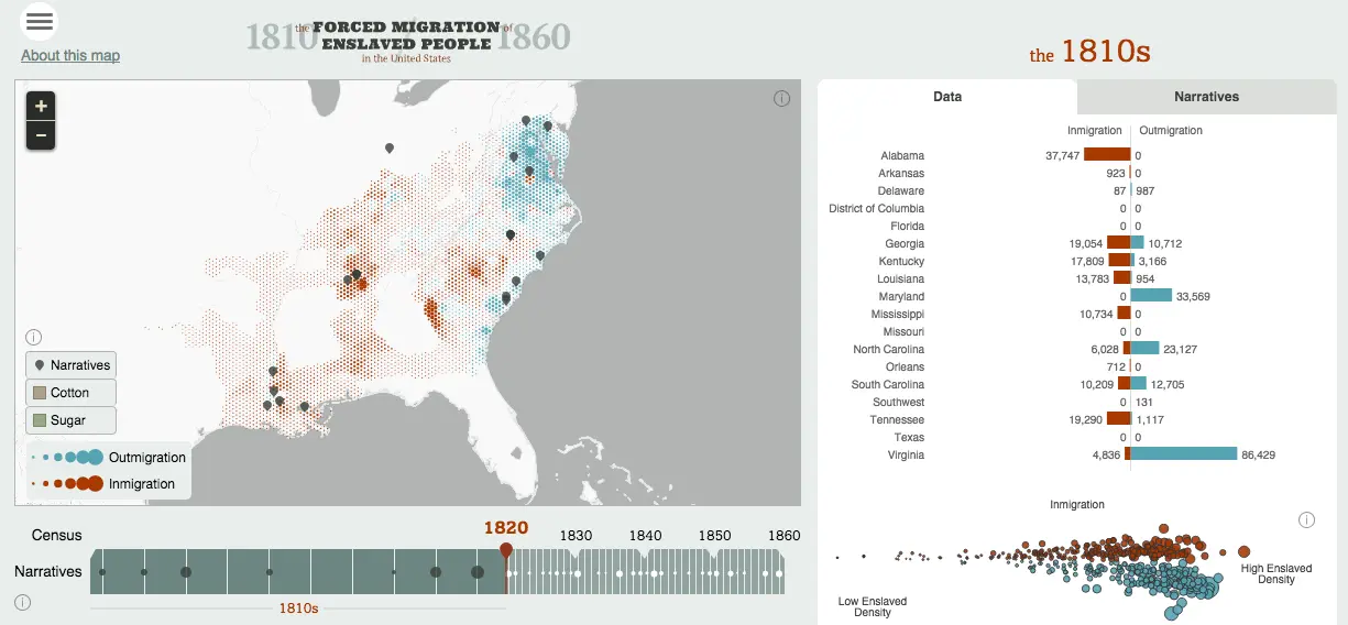
Called American Panorama, the platform aims to be an “historical atlas for the online era,” according to CityLab. The four interactive maps currently on the site are: The Forced Migration of Enslaved People; The Overland Trails; Foreign-Born Population; and Canals.
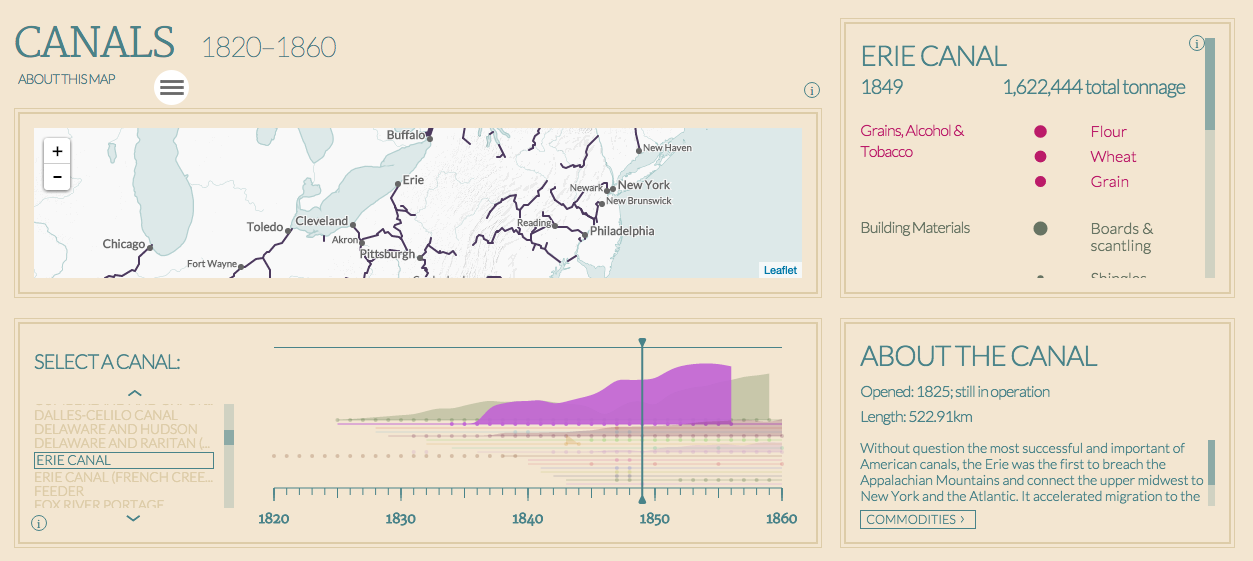
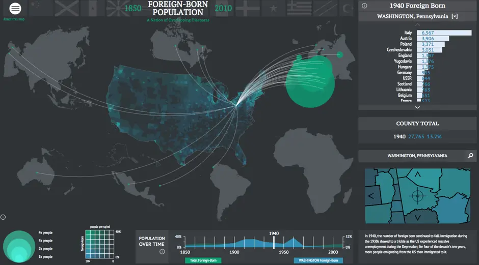
The Panorama is a collaboration between the University of Richmond’s Digital Scholarship Lab and cartography firm Stamen. They’ve created much more than your typical hover-over digitizations. For example, Foreign-Born Population, which spans all the way from 1850 to 2010, includes an interactive timeline that corresponds with a selectable list of foreign locations. And Canals (1820-1860) can be broken down by year and/or specific canal with additional data regarding agricultural products and building materials.
The Forced Migration of Enslaved People once again works with time and location, but it also provides narratives of actual people involved in slavery. Similarly, Overland Trails offers 19th century diary entries from those who were on the “Great Migration.”
Robert K. Nelson, director of the Digital Scholarship Lab, said to CityLab: “The maps should communicate something that doesn’t require tons of time and effort. But they should also be deep enough that they reward explorations that take more time.” He expects dozens more maps to become available in the near future.
Explore American Panorama HERE >>
[Via CityLab]
RELATED: