Map Lets Users Draw Where They Think Their Neighborhood Borders Are

Back in the day, there was no East Village; it was all the Lower East Side. The Upper West Side was one big neighborhood; there weren’t subdivisions like Broadway Corridor or Riverside. Brokers didn’t invent acronyms like NoMad and DoBro. As time goes on, areas in New York City seem to multiply, but this really all depends on who you’re talking to. Since the city has no actual neighborhood boundaries (they divide the city by much larger community districts), everyone has their own idea of where one neighborhood ends and the other begins. And a new interactive map from DNAinfo allows New Yorkers to draw what they think their neighborhood borders are and see how their approximations compare to others.’
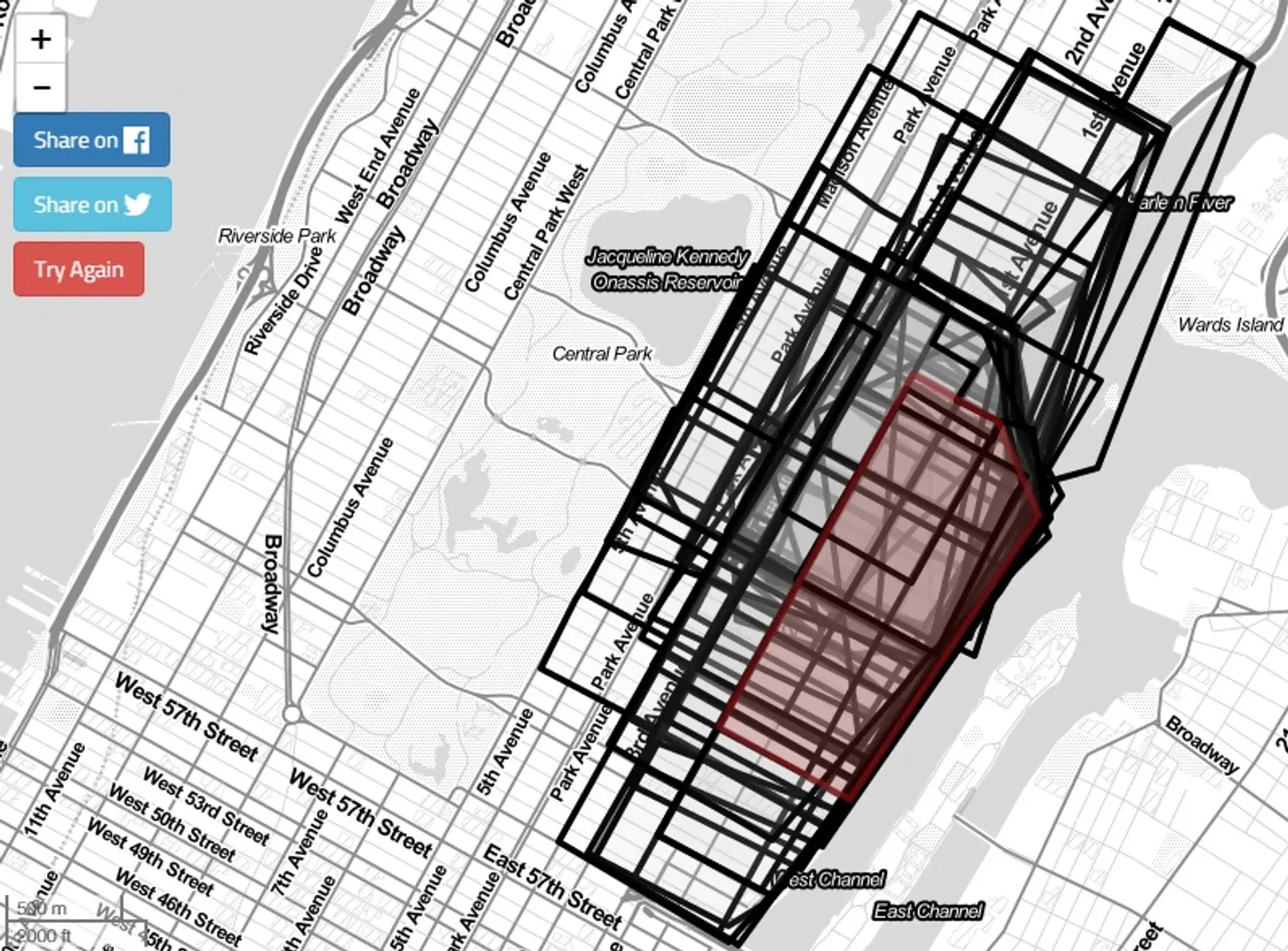
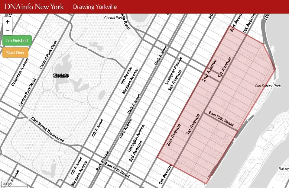
To begin, simply select your neighborhood and how long you’ve lived there. We chose Yorkville, where one of us has lived for 3 years. After drawing our borders–92nd Street to the north (where York Avenue terminates), 70th Street to the south, the East River to the east, and Second Avenue to the west–we selected “I’m finished” and got a map overlay of all the other users’ borders compared with ours. And as you can see above, the results are quite spread out.
Draw your neighborhood borders right here >>
RELATED: