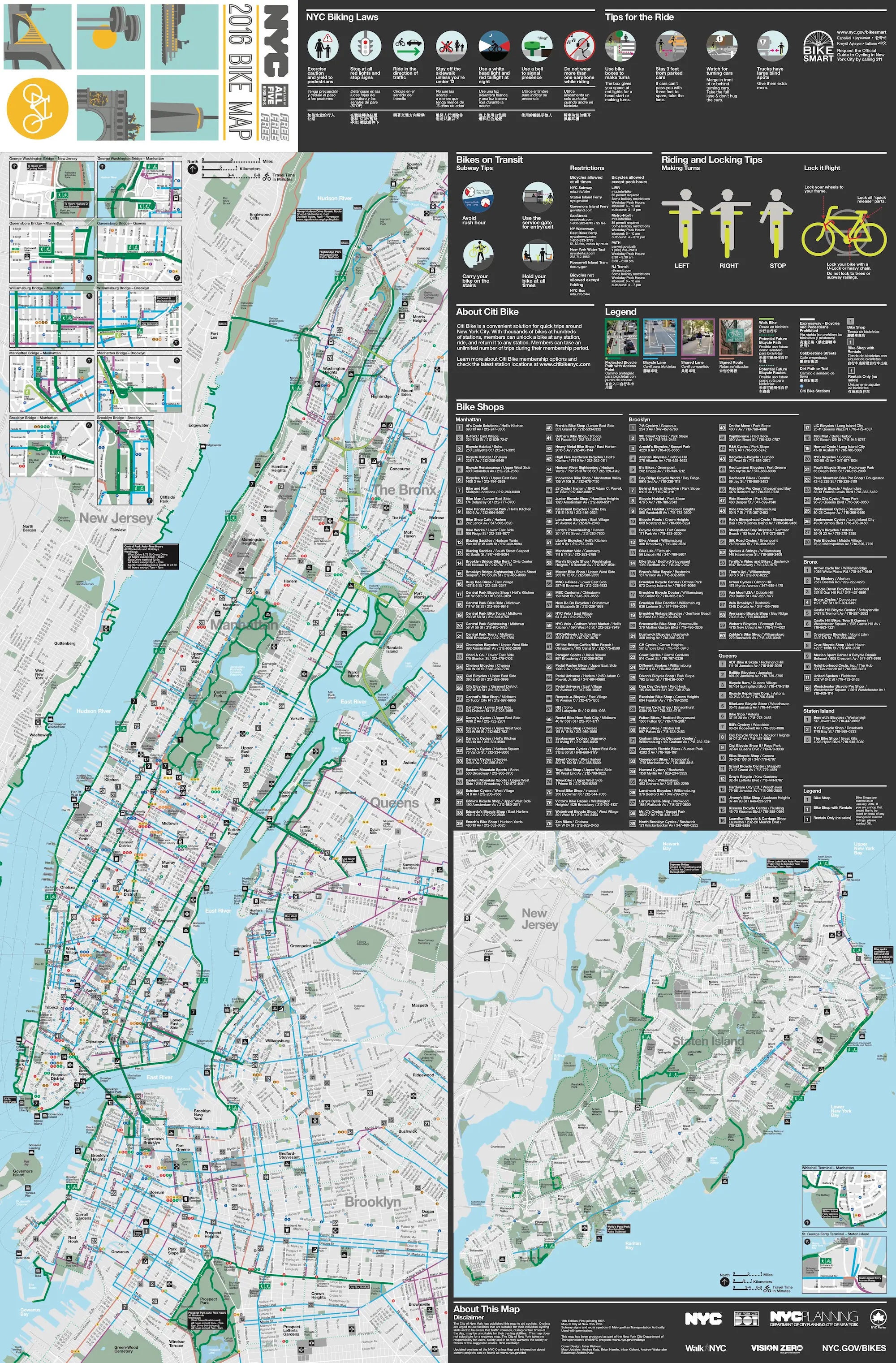
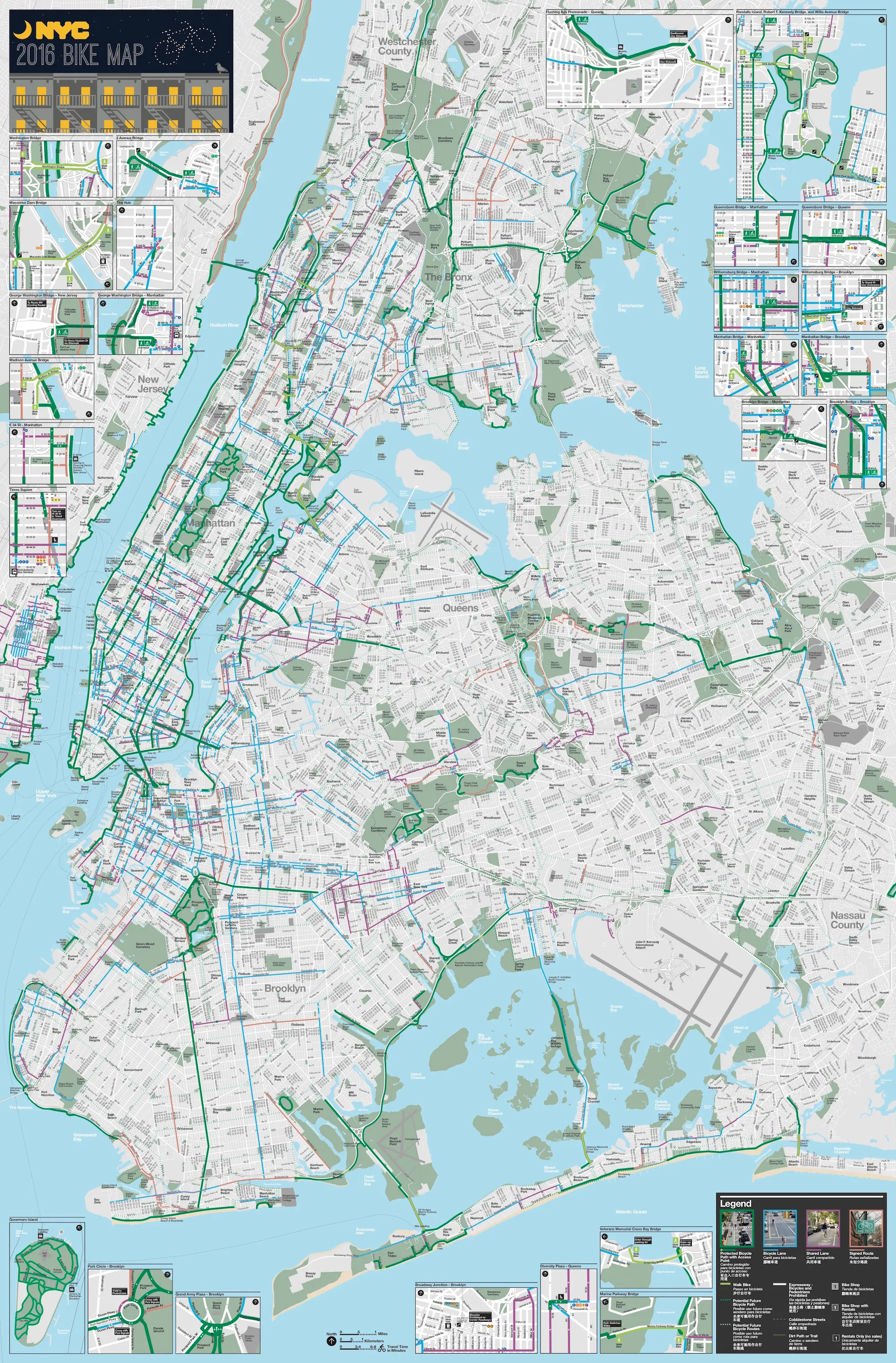
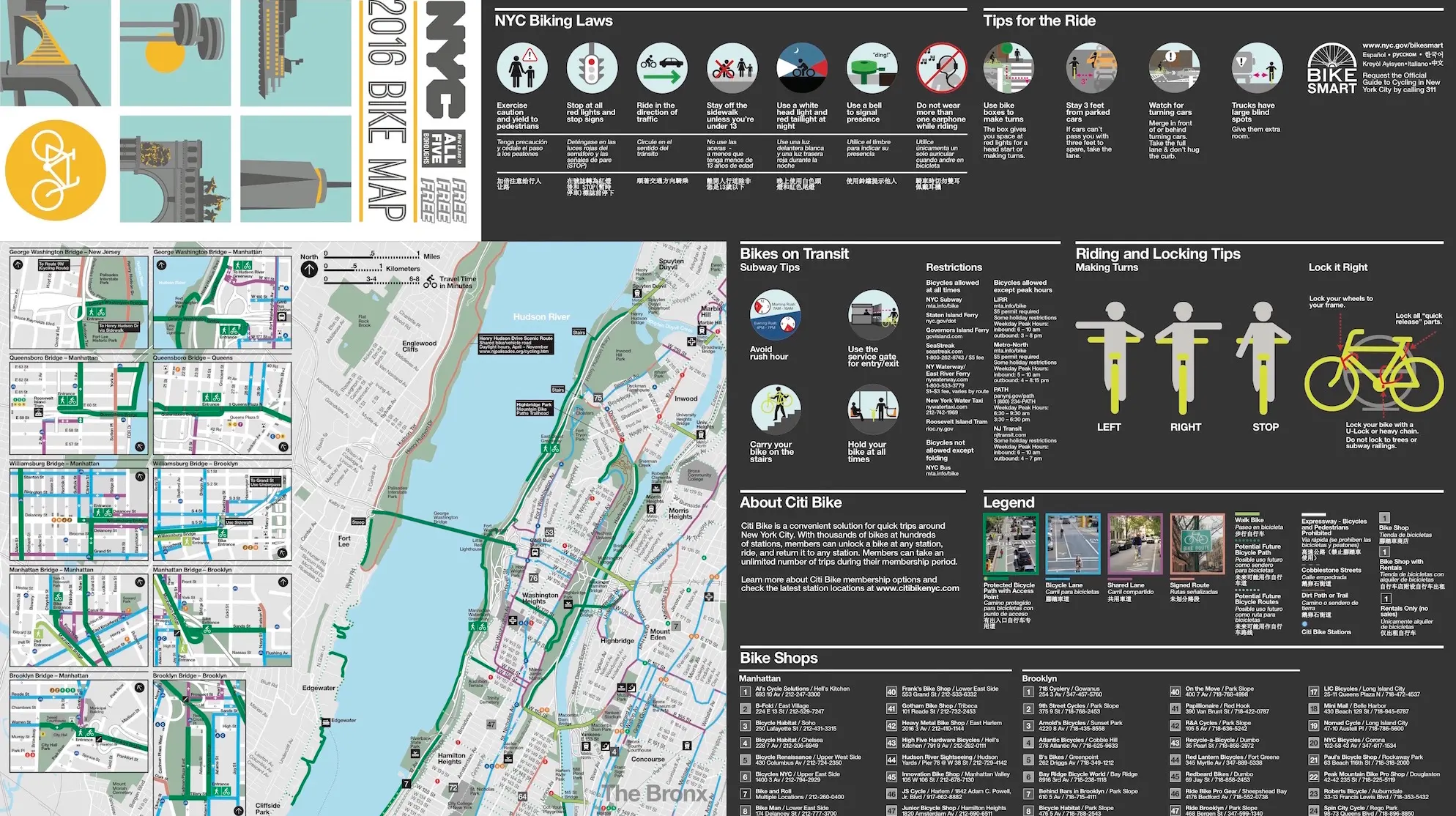
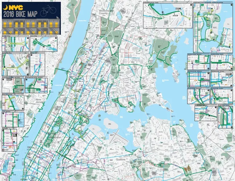
The Official 2016 NYC Bike Map Has Arrived

The Department of Transportation just released the downloadable 2016 New York City Bike Map ahead of a paper version due next month. This year’s map shows 70 miles of new or “upgraded” bike-specific lanes, twelve of which are protected (physically separated from auto traffic). Also on the map are seven miles of newly-created off-street bike lanes.
Map: DOT. Click to enlarge >>
The DOT has promised to add 15 new miles of protected bike lanes in the coming year, including Amsterdam Avenue and Chrystie Street in Manhattan. And DOT efforts to connect bike lanes in a logical, commuter-friendly fashion has resulted in a proposal (PDF) for protected bike lanes on Jay Street in Downtown Brooklyn, working toward a safe commute to Midtown from Brooklyn across the Manhattan Bridge.
City officials being the fallible humans they are, some errors have been spotted on the map, but the DOT is reportedly on the case.
RELATED: