A Subjective Map of New York City: Dutch Graphic Artist Takes Virtual Check-Ins to a New Level

Social media has certainly made it easier to take a nostalgic look back in time; a quick perusal of one’s past Facebook statuses or Twitter feeds is all it takes to remind us of what we were doing last week, month, or even last year. (Yes, we know some of those photos are cringe-worthy; we have them too.) Consider all of the different places those statuses and tweets were generated from, and imagine what it might look like if you tracked all of those locations on a map of the city – a literal “walk” down memory lane, if you will.
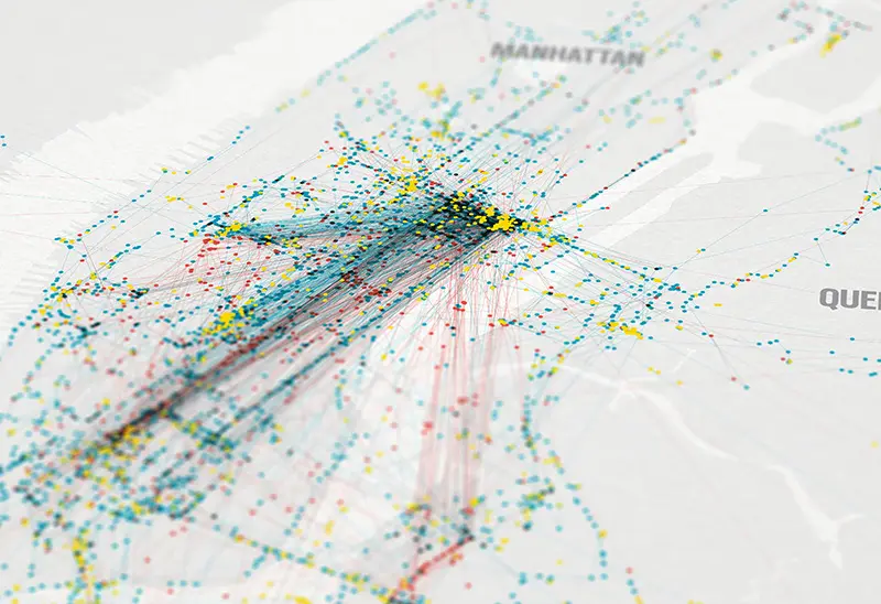
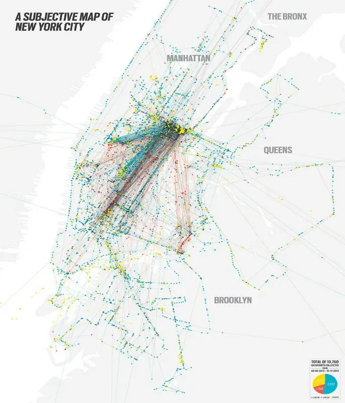
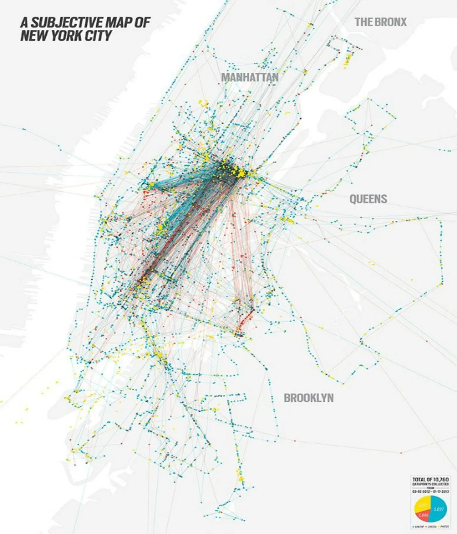
That’s exactly what Dutch graphic designer Vincent Meertens and his girlfriend did between March 2012 and January 2013, using an application called OpenPaths. The result? An intricate series of dots and lines (10,760 data points in all) representing all of their movements through New York City.
Vincent’s check-ins are notated on the map with blue dots, his girlfriend’s are red, and the yellow dots show where they took photos – all neatly tied together with lines to mark the route. Meerteens considers this one-of-a-kind map of New York City a diary of sorts, saying “there is a memory and a story” attached to every dot or route.
While it’s true this type of data in aggregate might certainly be interesting from an urban planning perspective, we think the end result also makes a fascinating and uniquely personal piece of art – one that is much more attractive than a year’s worth of status updates.
What would your “walk” down memory lane look like?
[via Business Insider]
Images courtesy of Vincent Meertens Graphic Design