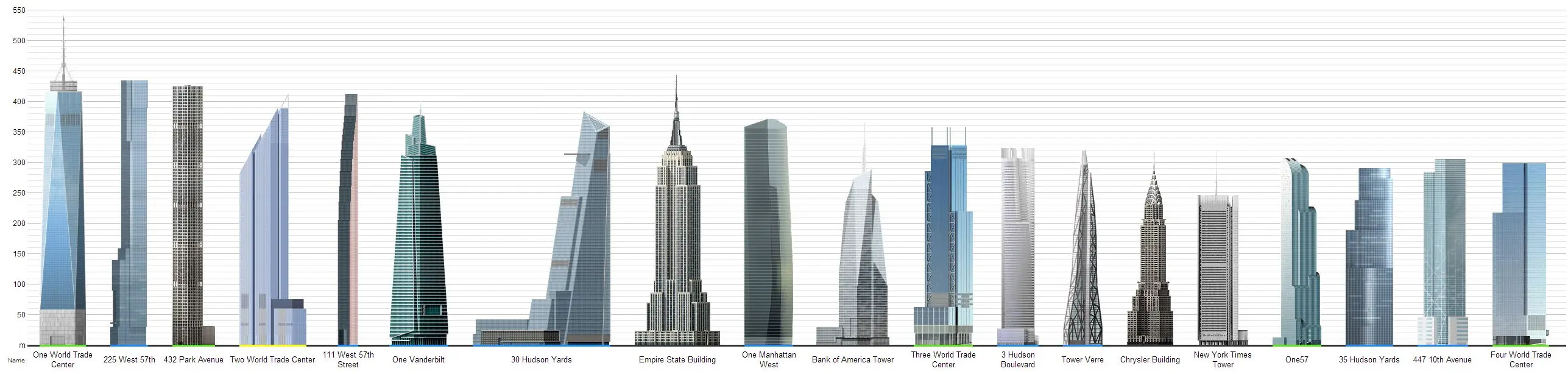
NYC’s Threat of Earthquakes on the Rise, But Tall Towers Have a Lower Risk of Being Affected

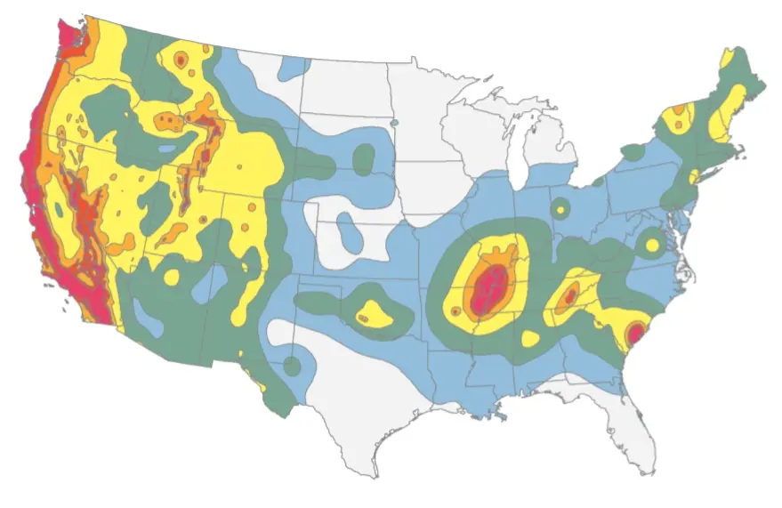
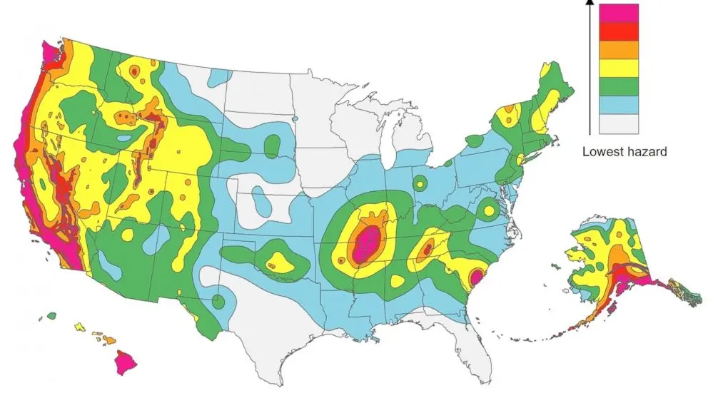
You read it right, tall towers in New York City actually have a lower risk of being affected by an earthquake. The U.S. Geological Survey, the federal agency responsible for reporting and recording earthquake activity, recently updated their National Seismic Hazard Maps, which “reflect the best and most current understanding of where future earthquakes will occur, how often they will occur, and how hard the ground will likely shake as a result.” One change to the maps since they was last updated in 2008 is that the east coast has the potential for larger quakes than previously outlined, but residents of NYC high rises are in a slightly lower risk bracket.
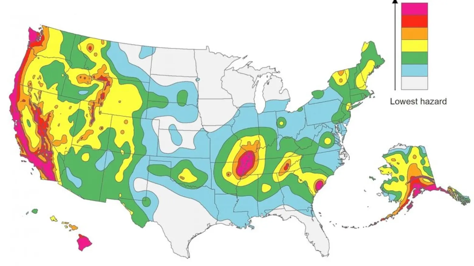
The magnitude 5.8 earthquake that struck Virginia in 2011 showed scientists a lot about future east coast trends, as it was the largest quake in the area in the last century. But the New York City map indicates a lower hazard for tall buildings, since “slow shaking” is less likely near the city, and this is what usually damages tall structures the most, as opposed to “fast shaking,” which is more harmful to shorter buildings.
Faults near New York are more random and move slower than those in California, but the city did establish an earthquake building code in 1996, which applies mostly to new construction. It will be interesting to see if these codes are updated based on the new data and maps.
Read the full report from the U.S. Geological Survey here.
[Via New York Times]
Lead image via Skyscraper City; Map image courtesy of U.S. Geological Survey