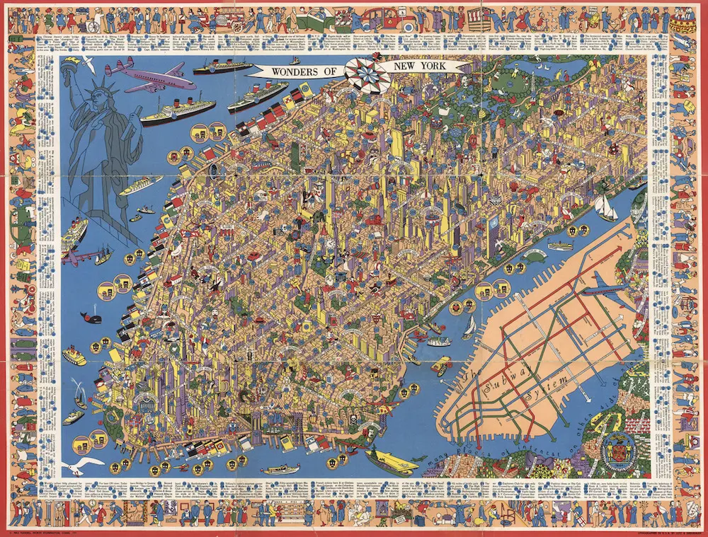
Amazing Detailed Map from the 1950s Shows 300+ ‘Wonders of New York’

Historical Map: “Wonders of New York” by Nils Hansell, c. 1953-1955; courtesy of Transit Maps.
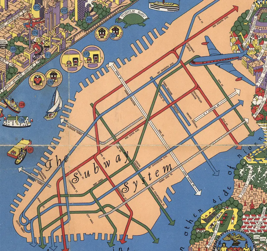
One of a growing collection of transit maps, this cool detailed New York City map, designed by graphic designer/sailing enthusiast/IBM employee Nils Hansell sometime around 1953-1955, offers a mind boggling tableau of (mostly) Manhattan’s points of interest, numbered, with a corresponding key. There’s also a color-coded schematic to the subway system, which was at the time divided up by its operators, BMT, IND and IRT; the map also shows a remaining few of the city’s elevated railway systems, the last of which was ended in 1955.
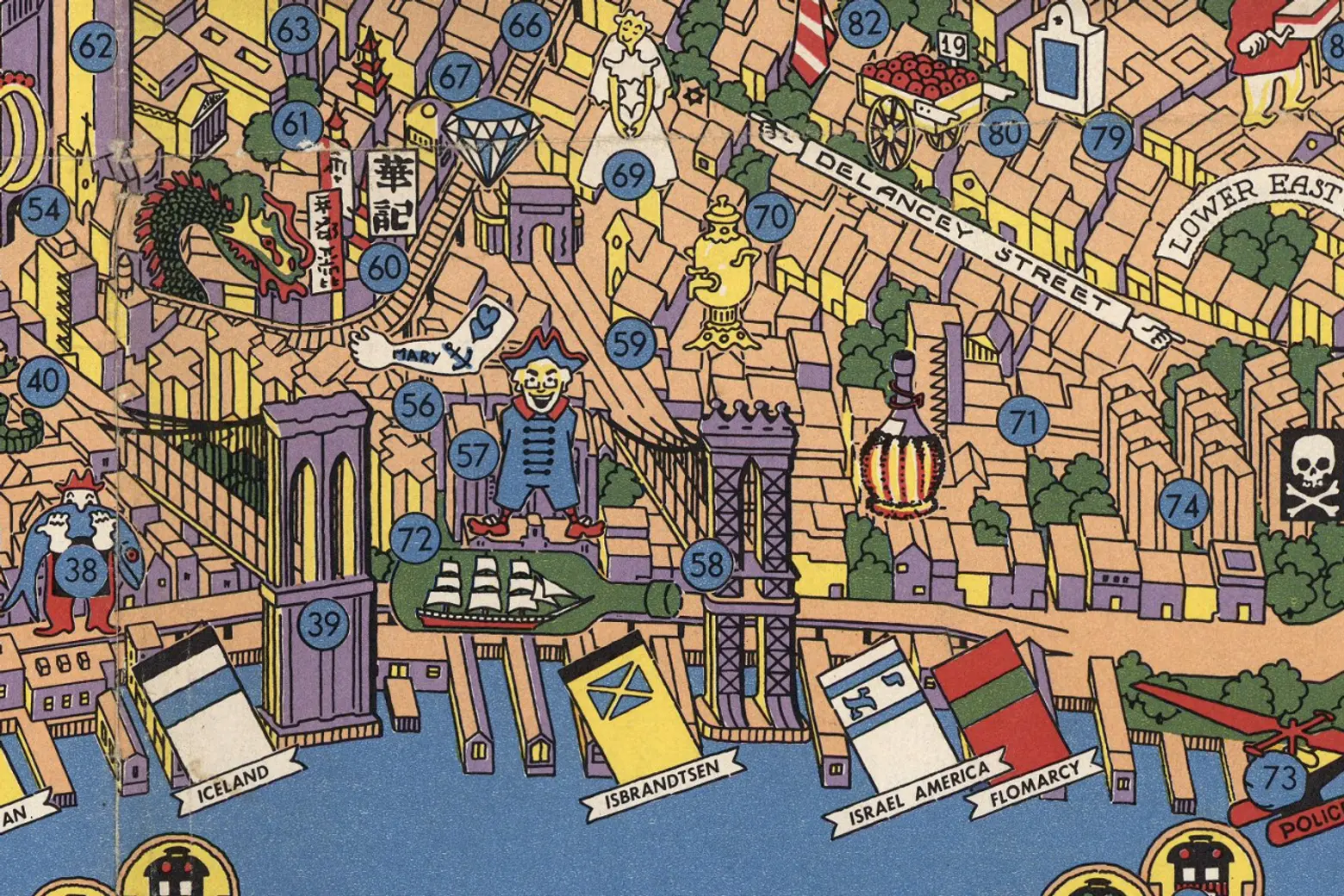
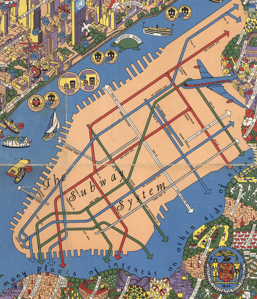 Historical Map: “Wonders of New York” by Nils Hansell, c. 1953-1955.
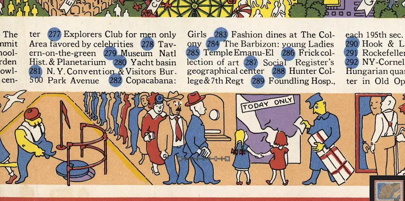
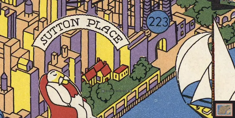
You can see more detail in the close-ups, and get a (much) closer look at the high-resolution source, or order a print, here.
 Historical Map: “Wonders of New York” by Nils Hansell, c. 1953-1955.
 Historical Map: “Wonders of New York” by Nils Hansell, c. 1953-1955.
[via Transit Maps]
RELATED:
- The NYPL Is Mapping Books About NYC Neighborhoods—Add Your Favorites!
- What’s Your Subway Cred? New Game Judges You Based on the Number of Stations You’ve Visited
- 1970s Map Reveals Worldview According to New Yorkers
- 1920s Popular Science Illustration Stacks the Future American City Like a Layered Cake